ORH_wxman
-
Posts
93,092 -
Joined
-
Last visited
Content Type
Profiles
Blogs
Forums
American Weather
Media Demo
Store
Gallery
Everything posted by ORH_wxman
-
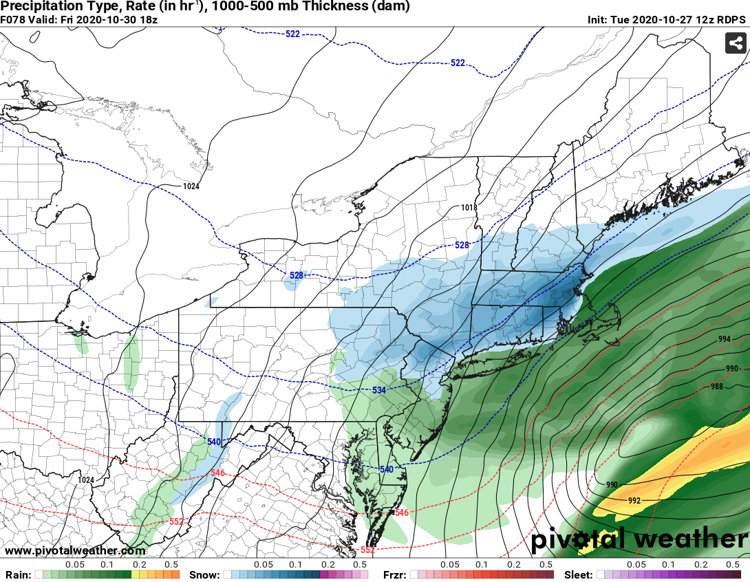
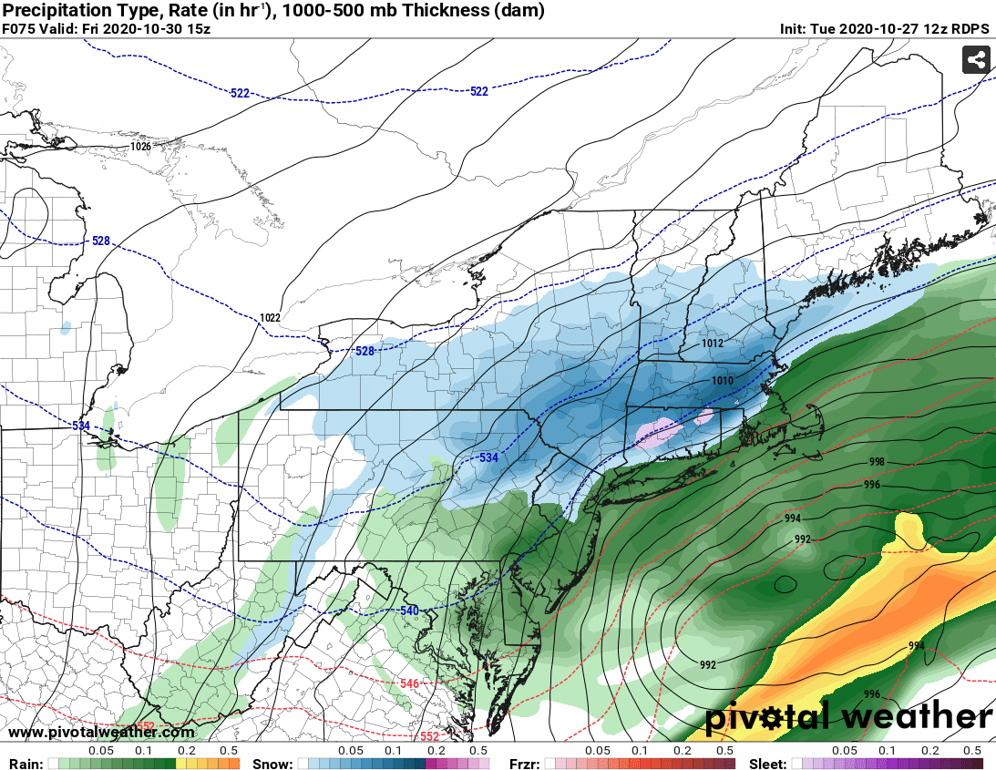
GGEM is actually a bit more amped than Reggie...not very common to see that. It really hits CNE hard, but it even gets warning snows down to the pike region. 2-4" type event south of that.
-
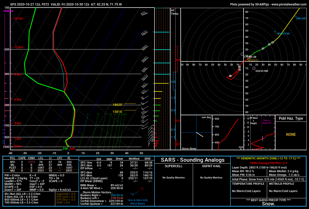
The soundings look good on GFS for Friday morning. Good saturation through SGZ. Best lift is actually like 550-600mb there...thats prob midlevel magic going on.

-
Yeah you'd be close, but prob pick up a couple inches there. RGEM is kind of the "compromise" solution I was talking about with Kevin....in between some of the zonked solutions yesterday and the flatter ones overnight. It's not going to give anyone 18", but you could realistically see some low end warning snow amounts in an RGEM type evolution....esp over interior elevated areas.
-
RGEM even smokes Scooter later on, lol

-
Reggie gone wild
-
Yes...that is the band most folks will want to focus on...if you are way up north like where Phin and powderfreak are, you probably hope some of the Zeta front end stuff hits you for best shot at snow....seems like the backside fronto-band snows are going to be more of a CNE/SNE deal if current trends hold.
-
See above post...
-
It did chew some of the northern precip extent up in NNE....though it was stronger with the CCB down south. Seems like the front side got slightly squished while the backside CCB got a bit better.
-
GFS looks slightly more amped than 06z, but it's pretty similar overall. I think it's a bit snowier than the 06z....slightly better dynamics.
-
Yeah it could be....models never seem to handle super fast flow very well. Esp when critical piece of energy are out over the N PAC or up in blackout land in the arctic where even satellite data gets distorted.
-
The amped runs yesterday gave me more snow than the flatter stuff today. If you are way south in CT/RI then maybe the flatter ones give best chances of flakes and perhaps some light accumulations, but I think even you would want something more amped than the NAM because it will give a heavier burst before exiting....it doesn't need to be like the Euro yesterday, but something in between.
-
I'd sell the NAM clown maps that show 6-8....prob more like 3-6"....still impressive for October no doubt. But this is definitely much weaker dynamics than we saw on yesterday's runs.
-
Yeah, it's a crazy cold airmass lurking for this time of the year. Even though there's potential for higher amounts if this weren't flat, even 1-3" would be pretty amazing.
-
Training camp is over and your metamorphosis is complete....we're deleting irrelevant banter. This is a storm threat thread.
-
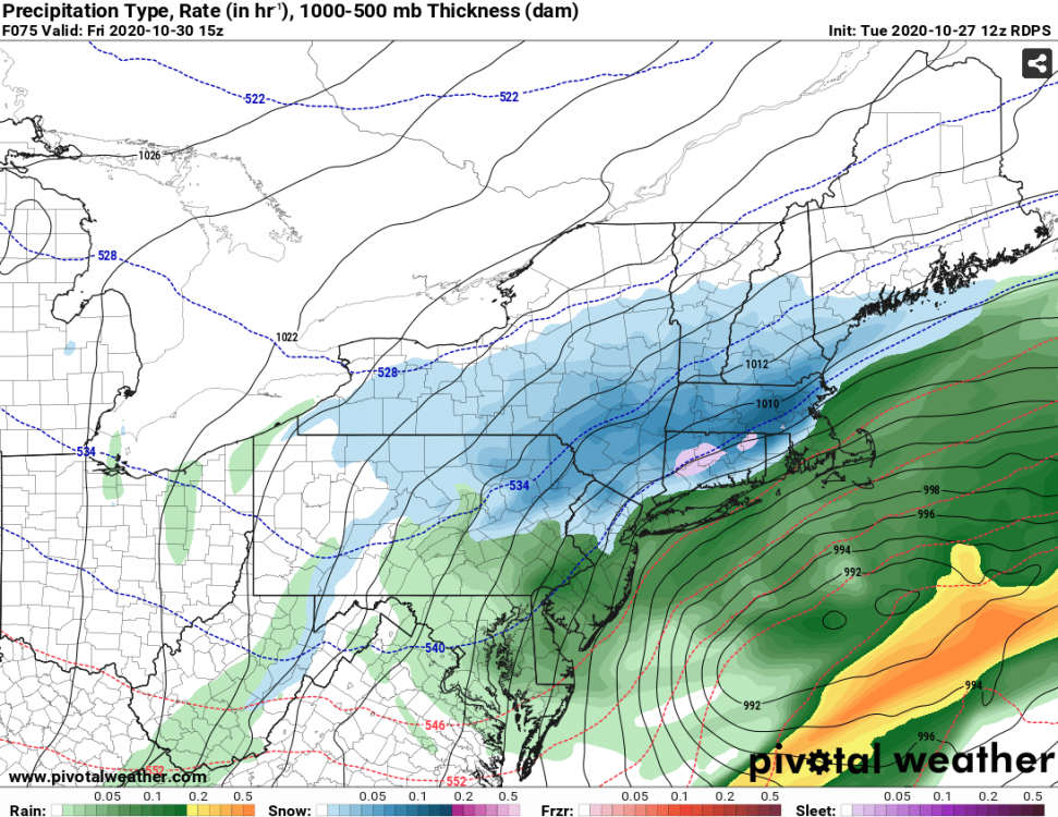
Yep...pretty weak sauce. But damn, that's cold at the end. Look at this sounding Friday morning.....

-
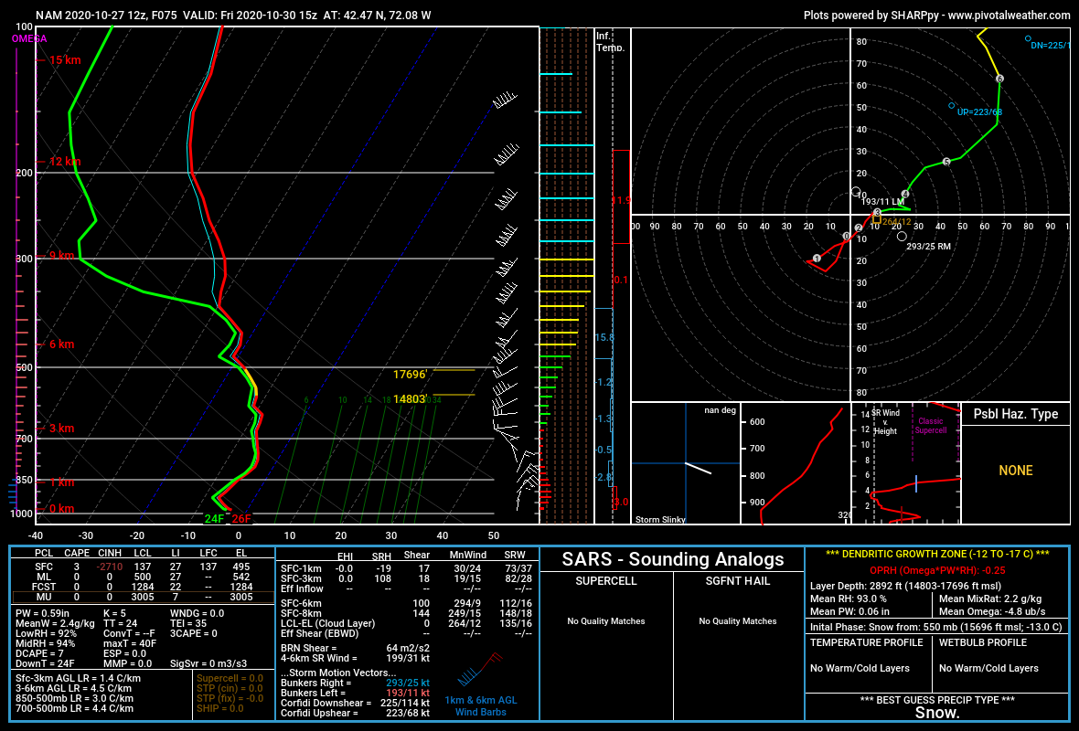
12z NAM coming in flatter than 06z. Though the shortwave in MN at 48h looks a bit more potent, so maybe it can pop late.
-
Yep....piggy has disappeared on guidance so fingers crossed that holds. Look more -PNA like Scott said but there's actually some weak ridging up in AK/EPO region. Weeklies look like they may cool down late month into early December with western CONUS ridging, but that is out in clown range.
-
Still some time for it. Though this pattern has some things working against it too. Zeta makes landfall in about 36 hours....which means that in probably 24 hours, models will be able to handle it better. It should influence the downstream ridging/phasing potential. If it runs too far ahead of the bowling ball currently in the southwest, then it will likely produce a flatter solution, if it is closer, then we'll probably see a more amped solution.
-
Yeah this is getting pinched pretty quickly...I mentioned yesterday that I was kind of worried about a sheared storm more than one that was too amped. The pattern is screaming. A bit more of a trend and this goes into a non-event....maybe a few flakes or coating.
-
That algorithm looks pretty optimistic based on what I saw....but it would definitely still be solid advisory snows over the interior....maybe NW Berks and S VT/Monads could squeeze 6.
-
06z Euro looks like it's going to be flatter than 00z.
-
The sheared monster coming to get us last night. This fast flow is relentless. Definitely a flatter theme in the overnight runs. Hopefully we can slow things down just a smidge on today’s runs. That said, obviously still a decent shot at first flakes and maybe some accumulation.
-
Yeah it’s going to move. But it will max out too and then start weakening. Where the convergence of it maxing out and residence time is the highest is where someone will get smoked. Like for example, most everyone is getting moderate rain and then as that vort swings up the precip starts intensifying and it flips to snow at Mitch’s in S VT....and the band really starts going to town big time...then it maxes out over SW NH and N MA and then collapses SE slowly weakening (but still intense). In that scenario we’d prob see the highest snows from near Mitch (who was snow the longest but maybe not quite where the band reached peak intensity) to SW NH (which was snow the 2nd longest but saw the most intense period of the band)...and then the amounts would be less to the southeast but still mostly everyone sees at least some period of snow.
-
Yeah that has the look of cold rain to hearing pellets hammering the skylights and windshields for maybe an hour or two and then flashing to heavy snow. Some impressive dynamics on this whole setup. As long as the southern vort can maintain its integrity long enough, I think someone will see a really intense period of snow...location TBD as we get closer.
-
Yeah the NAM was about to hammer interior SNE if we had another frame. That cold was collapsing SE really quickly with a shortwave that was still pretty deep.