

ORH_wxman
-
Posts
93,092 -
Joined
-
Last visited
Content Type
Profiles
Blogs
Forums
American Weather
Media Demo
Store
Gallery
Everything posted by ORH_wxman
-
Some nice bands. 925mb is getting very cold. Into the DGZ so these might be producing some nice dendrites
-
26th-27th event, coming at us like a wounded duck.
ORH_wxman replied to Go Kart Mozart's topic in New England
Man, what a tough forecast. At least around here. I think it’s pretty easy to go 5-8” or so for most of CT. Maybe a stripe of higher if we can pin down where that max forcing ends up. But further northeast this could plausibly be 4-5” or a coating of sand. The fronto gets pretty strong even into MA. If that lowest level of dry air can be overcome then you could still get a surprise band that produces north. -
26th-27th event, coming at us like a wounded duck.
ORH_wxman replied to Go Kart Mozart's topic in New England
Top analog for this system is 12/14/95 but this is def a further south version of that. -
26th-27th event, coming at us like a wounded duck.
ORH_wxman replied to Go Kart Mozart's topic in New England
What was wrong with the euro there? -
26th-27th event, coming at us like a wounded duck.
ORH_wxman replied to Go Kart Mozart's topic in New England
Euro went NE a bit. Prob gets almost all of CT into 4”+ now. Except maybe extreme E or NE zones. -
26th-27th event, coming at us like a wounded duck.
ORH_wxman replied to Go Kart Mozart's topic in New England
18z GFS looks a hair SW of 12z. -
26th-27th event, coming at us like a wounded duck.
ORH_wxman replied to Go Kart Mozart's topic in New England
It’s probably true. Heavy snow for 3 hours is going to give you like a quick 4-5” and then you grab a couple on either side of it, there’s your warning event. People shouldn’t be expecting double digits in this. They might happen, but probably because banding was even stronger than anticipated and you never know quite where the best bands will set up. -
26th-27th event, coming at us like a wounded duck.
ORH_wxman replied to Go Kart Mozart's topic in New England
This is gonna be a crazy battle between the mid and upper level support for heavy snow and the obscene dry arctic air to the northeast. I’m looking at several different models right now and almost all of them are punching some serious lift, fronto, and dPVA well into SNE, but the further northeast you go, it just fights that ridiculous low level arctic air. There’s gonna be crazy Virga on the northeast side. Prob the type of system where you have Virga under 15-20 dbz returns. -
26th-27th event, coming at us like a wounded duck.
ORH_wxman replied to Go Kart Mozart's topic in New England
Icon and Rgem look very similar to 12z. Rgem might have been a hair NE with the heaviest stuff and icon a hair SW. -
26th-27th event, coming at us like a wounded duck.
ORH_wxman replied to Go Kart Mozart's topic in New England
SREFS look like they went north a bit too. We’ll see what the 18z globals do but this trend doesn’t feel like it’s stabilized yet. -
26th-27th event, coming at us like a wounded duck.
ORH_wxman replied to Go Kart Mozart's topic in New England
You may have a watch there if euro ticks NE again . You’re pretty far west and longitude is the key. -
26th-27th event, coming at us like a wounded duck.
ORH_wxman replied to Go Kart Mozart's topic in New England
They’ll update in afternoon package most likely. -
26th-27th event, coming at us like a wounded duck.
ORH_wxman replied to Go Kart Mozart's topic in New England
Jan 4, 2018 was pretty cold too over interior. Maybe not teens (except part of it but def low 20s for a long stretch) -
26th-27th event, coming at us like a wounded duck.
ORH_wxman replied to Go Kart Mozart's topic in New England
2015 had several. -
26th-27th event, coming at us like a wounded duck.
ORH_wxman replied to Go Kart Mozart's topic in New England
Yeah I was looking at mid levels and there’s an area that looks like it would be pounding but it’s north of the good QPF. Wonder if there is an undermodeled death band for a few hours near that northern line. -
26th-27th event, coming at us like a wounded duck.
ORH_wxman replied to Go Kart Mozart's topic in New England
Yeah GGEM shifted north too. You get a couple more of those and then you’re getting serious snow into pike region. -
White Christmas Miracle? December 23-24th
ORH_wxman replied to Baroclinic Zone's topic in New England
Dec 2013 is an underrated really good month that just got really spoiled by the grinch storm. -
White Christmas Miracle? December 23-24th
ORH_wxman replied to Baroclinic Zone's topic in New England
2013 had a huge cutter type system that CAD’d in NNE and caused a decent ice storm there. Torched into the 50s in SNE though the CAD did back door into SNE eventually. N ORH county over to Ray’s hood kept enough pack though for a white Xmas. -
26th-27th event, coming at us like a wounded duck.
ORH_wxman replied to Go Kart Mozart's topic in New England
Starting to get a little bit interesting with these 00z trends. Need to see the globals though. -
26th-27th event, coming at us like a wounded duck.
ORH_wxman replied to Go Kart Mozart's topic in New England
Won’t really buy it until a lot of 00z guidance comes further north. -
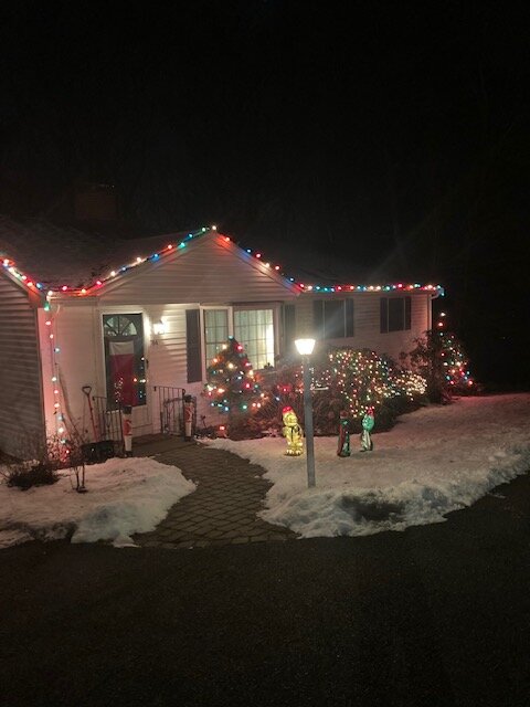
Not like the norlun winners in Maine, but we’ll take it…festive enough for Xmas Eve
-
White Christmas Miracle? December 23-24th
ORH_wxman replied to Baroclinic Zone's topic in New England
Actually have CAA right now. Temps not dropping much with daylight yet but dews def are dropping. -
White Christmas Miracle? December 23-24th
ORH_wxman replied to Baroclinic Zone's topic in New England
About 2” on winter hill.
-
White Christmas Miracle? December 23-24th
ORH_wxman replied to Baroclinic Zone's topic in New England
Very dense snow but it looks nice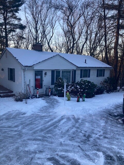
-
White Christmas Miracle? December 23-24th
ORH_wxman replied to Baroclinic Zone's topic in New England
One of the rare 11th hour breaks we’ve gotten in the last few years. Event somehow got its act together just enough this evening to make it pretty nice. Would be nice if we could get a region-wide good break soon.


