

ORH_wxman
-
Posts
93,099 -
Joined
-
Last visited
Content Type
Profiles
Blogs
Forums
American Weather
Media Demo
Store
Gallery
Everything posted by ORH_wxman
-
January 2026 regional war/obs/disco thread
ORH_wxman replied to Baroclinic Zone's topic in New England
Lock in big miller B for that 1/5-1/6 signal. -
January 2026 regional war/obs/disco thread
ORH_wxman replied to Baroclinic Zone's topic in New England
Where you going? -
January 2026 regional war/obs/disco thread
ORH_wxman replied to Baroclinic Zone's topic in New England
That’s not a particularly cold pattern shown with the lower heights over AK but it’s not a torch for us either because of NAO blocking. It’s occurring during a favorable climatological period too where the averages are already pretty cold. Weeklies have been rebuilding the WPO/EPO ridge after that though which would bring more reinforcing cold air if it verified. -
January 2026 regional war/obs/disco thread
ORH_wxman replied to Baroclinic Zone's topic in New England
Pretty decent pattern as we go into early January. This is a 5 day mean from EPS….note how all the lower heights are now down south. Going to be more receptive to potential coastal storms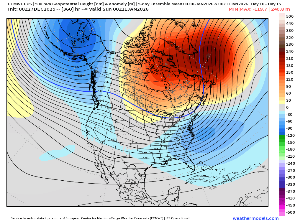
-
Wounded Duck Strikes Back: Dec 26 & 27th Winter Storm Obs
ORH_wxman replied to WxWatcher007's topic in New England
Actually not in Holliston right now, lol. But it looked pretty good there on radar for a while so I’m guessing 4-5”? -
Wounded Duck Strikes Back: Dec 26 & 27th Winter Storm Obs
ORH_wxman replied to WxWatcher007's topic in New England
They managed to slowly claw their way to 4”+ with additional redevelopment late evening….wasnt pretty and the best was north, but that allowed the event to still be decent there. -
Wounded Duck Strikes Back: Dec 26 & 27th Winter Storm Obs
ORH_wxman replied to WxWatcher007's topic in New England
Def starting to lose the really dynamic lift from earlier. Radar becoming more banded/less organized. Still snowing well with good ratios but not the heavy stuff from earlier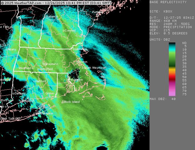
-
As currently shown it is NY day into that evening.
-
00z GFS trying to redevelop a little clipper to out south for New Years. Would be a nice little advisory type event. Well see if other guidance starts latching on. 18z euro was kind of close but not quite able to turn that vort around the base of trough.
-
Wounded Duck Strikes Back: Dec 26 & 27th Winter Storm Obs
ORH_wxman replied to WxWatcher007's topic in New England
Incoming for you…band in metrowest is strengthening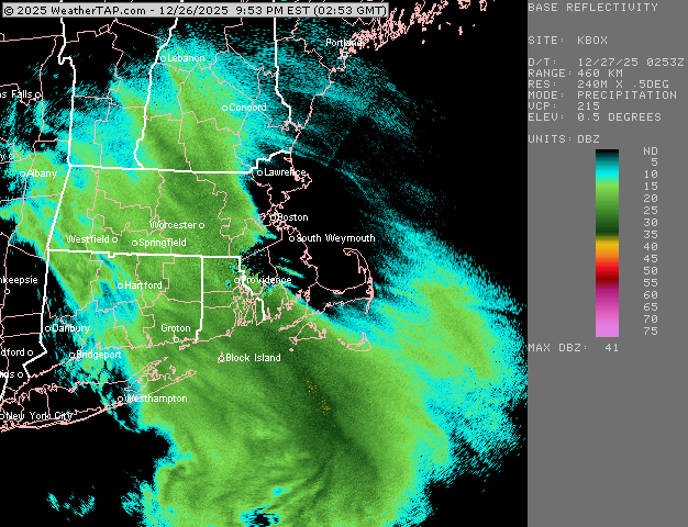
-
Wounded Duck Strikes Back: Dec 26 & 27th Winter Storm Obs
ORH_wxman replied to WxWatcher007's topic in New England
It’s also weenie kuchera ratios. Post liquid equivalent instead. It’s all snow everywhere in SNE so we don’t need clown maps. -
Wounded Duck Strikes Back: Dec 26 & 27th Winter Storm Obs
ORH_wxman replied to WxWatcher007's topic in New England
ORH now at 1/4 heavy snow. These bands aren’t as crazy as the CT stuff but they are still pretty solid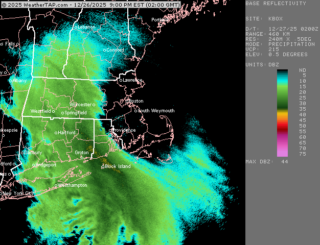
-
Wounded Duck Strikes Back: Dec 26 & 27th Winter Storm Obs
ORH_wxman replied to WxWatcher007's topic in New England
BID reporting thunder- 632 replies
-
- 10
-

-

-
Wounded Duck Strikes Back: Dec 26 & 27th Winter Storm Obs
ORH_wxman replied to WxWatcher007's topic in New England
Incoming for @Ginx snewx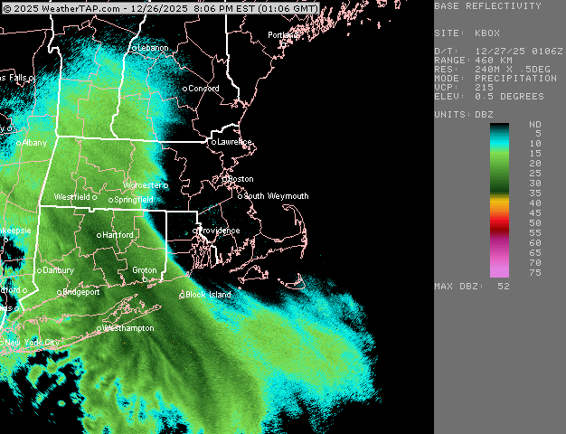
-
Wounded Duck Strikes Back: Dec 26 & 27th Winter Storm Obs
ORH_wxman replied to WxWatcher007's topic in New England
Incoming for Kevin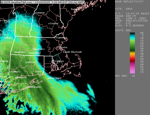
-
Wounded Duck Strikes Back: Dec 26 & 27th Winter Storm Obs
ORH_wxman replied to WxWatcher007's topic in New England
2015 too. Haven’t had many in the teens since. Jan 4, 2018 was pretty cold too but not in the teens the entire time. But that’s not surprising considering how warm the last 5 winters have been. -
Wounded Duck Strikes Back: Dec 26 & 27th Winter Storm Obs
ORH_wxman replied to WxWatcher007's topic in New England
Been awhile since I’ve seen such a cold storm on the south coast. -
Wounded Duck Strikes Back: Dec 26 & 27th Winter Storm Obs
ORH_wxman replied to WxWatcher007's topic in New England
Can’t be too long for Kevin if he hasn’t started already. Brainard at HFD quickly went to 1/2 mile moderate. -
Wounded Duck Strikes Back: Dec 26 & 27th Winter Storm Obs
ORH_wxman replied to WxWatcher007's topic in New England
Yep. Lots of icy/rimey sleet mixed in near NYC and the most organized bands are a bit north (or even east on LI)…11th hour rug pulls are the worst. But their loss is your gain and many others to the north. -
Wounded Duck Strikes Back: Dec 26 & 27th Winter Storm Obs
ORH_wxman replied to WxWatcher007's topic in New England
Absolute poundage in New Haven county and prob into Litchfield county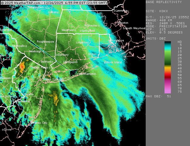
-
Wounded Duck Strikes Back: Dec 26 & 27th Winter Storm Obs
ORH_wxman replied to WxWatcher007's topic in New England
Yeah there’s a lot of resistance as it tries to go east but it will start there soon. Prob by 745-8 -
26th-27th event, coming at us like a wounded duck.
ORH_wxman replied to Go Kart Mozart's topic in New England
Gotta love seeing that much rotation with the echoes near BGM shows there’s some pretty dynamic bending of the midlevel height field there which is what we want to see if you want the strong dynamics to last further east before they weaken too much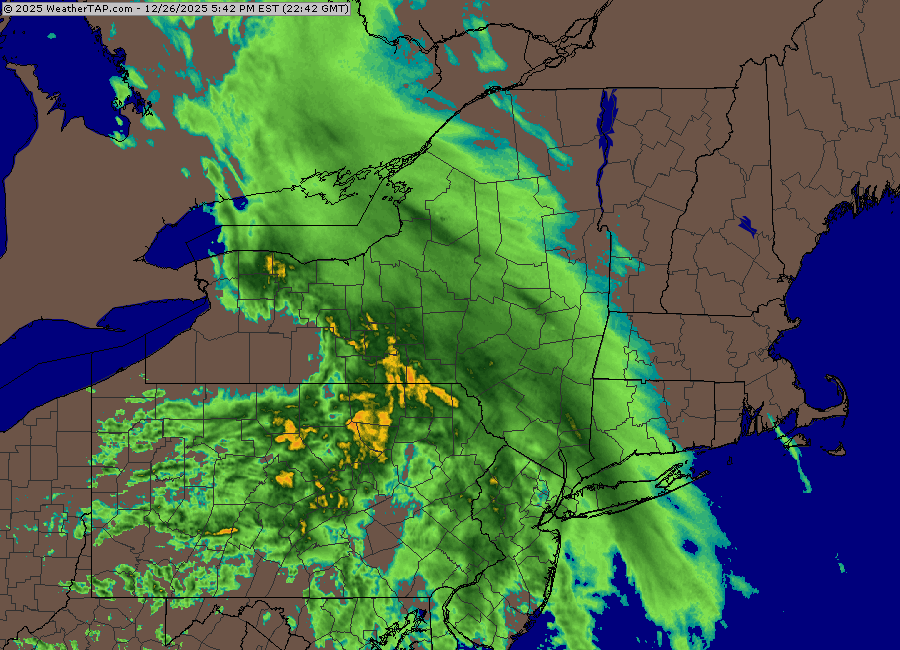
-
26th-27th event, coming at us like a wounded duck.
ORH_wxman replied to Go Kart Mozart's topic in New England
Nice CJ showing up for scooter -
26th-27th event, coming at us like a wounded duck.
ORH_wxman replied to Go Kart Mozart's topic in New England
Great post. I mentioned yesterday that 12/14/95 was the top analog on CIPS (at least it was yesterday)…similar setup with a very mild center of the country and a weakish disturbance running into a cold dome over New England. That one was a bit further north but same idea. -
Wounded Duck Strikes Back: Dec 26 & 27th Winter Storm Obs
ORH_wxman replied to WxWatcher007's topic in New England
Much of CT could outperform Boxing Day 2010….there was a big sucker hole in that one that also extended up into chunks of MA where totals were like 5-8”.


