

ORH_wxman
-
Posts
93,099 -
Joined
-
Last visited
Content Type
Profiles
Blogs
Forums
American Weather
Media Demo
Store
Gallery
Everything posted by ORH_wxman
-
26th-27th event, coming at us like a wounded duck.
ORH_wxman replied to Go Kart Mozart's topic in New England
Starting to get a little bit interesting with these 00z trends. Need to see the globals though. -
26th-27th event, coming at us like a wounded duck.
ORH_wxman replied to Go Kart Mozart's topic in New England
Won’t really buy it until a lot of 00z guidance comes further north. -
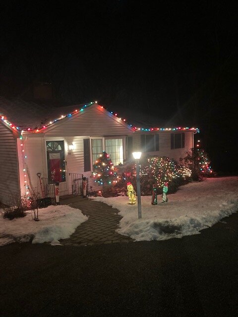
Not like the norlun winners in Maine, but we’ll take it…festive enough for Xmas Eve
-
White Christmas Miracle? December 23-24th
ORH_wxman replied to Baroclinic Zone's topic in New England
Actually have CAA right now. Temps not dropping much with daylight yet but dews def are dropping. -
White Christmas Miracle? December 23-24th
ORH_wxman replied to Baroclinic Zone's topic in New England
About 2” on winter hill.
-
White Christmas Miracle? December 23-24th
ORH_wxman replied to Baroclinic Zone's topic in New England
Very dense snow but it looks nice
-
White Christmas Miracle? December 23-24th
ORH_wxman replied to Baroclinic Zone's topic in New England
One of the rare 11th hour breaks we’ve gotten in the last few years. Event somehow got its act together just enough this evening to make it pretty nice. Would be nice if we could get a region-wide good break soon. -
White Christmas Miracle? December 23-24th
ORH_wxman replied to Baroclinic Zone's topic in New England
We pray for dongs out east tomorrow. Still one more shot at a Christmas miracle there. -
White Christmas Miracle? December 23-24th
ORH_wxman replied to Baroclinic Zone's topic in New England
If the northern side of the band currently hitting me gets you, it’ll be worth another snow walk. Nuking in this band. Enjoy the little victories. -
White Christmas Miracle? December 23-24th
ORH_wxman replied to Baroclinic Zone's topic in New England
Solid event. Locks in white Christmas. We’re pushing about half that here, but it just might be enough. Esp with CAA during the afternoon. We’ll see. Still trying to add a little more...still ripping outside. -
White Christmas Miracle? December 23-24th
ORH_wxman replied to Baroclinic Zone's topic in New England
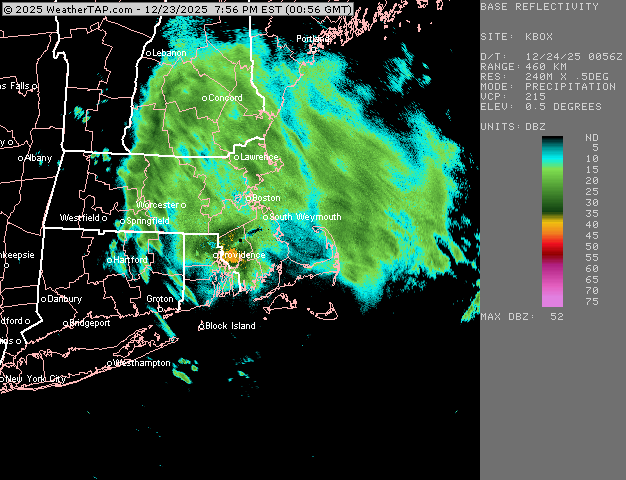
Nuking in this band right now. Piling up quick. Too bad it’s not gonna last too much longer.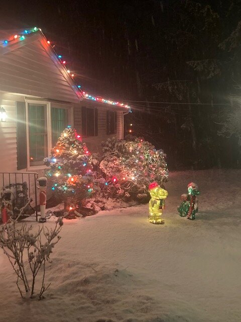
-
White Christmas Miracle? December 23-24th
ORH_wxman replied to Baroclinic Zone's topic in New England
Looks like one more round to go through and then we’re prob done.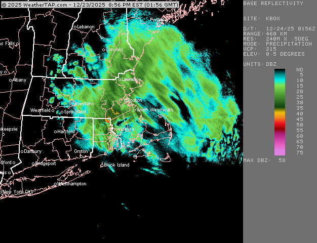
-
White Christmas Miracle? December 23-24th
ORH_wxman replied to Baroclinic Zone's topic in New England
IMG_4248-ezgif.com-gif-maker 3.mp4 -
White Christmas Miracle? December 23-24th
ORH_wxman replied to Baroclinic Zone's topic in New England
-
White Christmas Miracle? December 23-24th
ORH_wxman replied to Baroclinic Zone's topic in New England
These are massive aggregates now. Lots of nickels and quarters falling in this band. If this intensity kept up even for an hour (it won’t), I’d would be a quick 1.5-2” easy. -
White Christmas Miracle? December 23-24th
ORH_wxman replied to Baroclinic Zone's topic in New England
Yeah I’ve got iPhone SE. Not paying for a good one, lol. I also reduce the size of the photos before I upload them so that makes them crappier too. -
White Christmas Miracle? December 23-24th
ORH_wxman replied to Baroclinic Zone's topic in New England
Incoming now -
White Christmas Miracle? December 23-24th
ORH_wxman replied to Baroclinic Zone's topic in New England
A few tenths now. Best bands are just west so hoping to nuke for the next hour or two.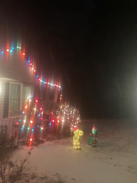
-
White Christmas Miracle? December 23-24th
ORH_wxman replied to Baroclinic Zone's topic in New England
Pounding aggregates right now. Everything covered including pavement. It’s now or never down here over next 2-3 hours. -
White Christmas Miracle? December 23-24th
ORH_wxman replied to Baroclinic Zone's topic in New England
Actually getting some good flakes now here. 33F Not gonna last though. Gotta wait until after 00z here. Up by Ray could get some accumulation from this batch. -
The medium range guidance for post-Christmas is some of the worst I’ve seen in a while. I mean, some of these runs were giving us pretty damned mild weather for several days in a row just a few cycles ago and it’s completely flipped. They weren’t able to handle the blocking in the Atlantic with much skill.
-
White Christmas Miracle? December 23-24th
ORH_wxman replied to Baroclinic Zone's topic in New England
I mean this basically is the thread for this event. There isn’t much to talk about down here except maybe a quick burst this evening and a chance at a little IVT clipping the coast tomorrow. -
Yeah northern outlier. If it’s gonna come back, we need the big boy models to start making a move at 00z
-
White Christmas Miracle? December 23-24th
ORH_wxman replied to Baroclinic Zone's topic in New England
Last chance will be that stuff coming down from near ART and Lake Ontario. Some guidance kind of blows it up for a good 3 hour burst….I’m remaining skeptical but if it happens then we could pick up a quick inch or two.
-
White Christmas Miracle? December 23-24th
ORH_wxman replied to Baroclinic Zone's topic in New England
Gonna be like a -4 or -5 December with little snow to show for it.


