ORH_wxman
-
Posts
93,092 -
Joined
-
Last visited
Content Type
Profiles
Blogs
Forums
American Weather
Media Demo
Store
Gallery
Everything posted by ORH_wxman
-
12z Ukie is a Randolph Roof Collapser. Not quite enough for interior SNE.
-
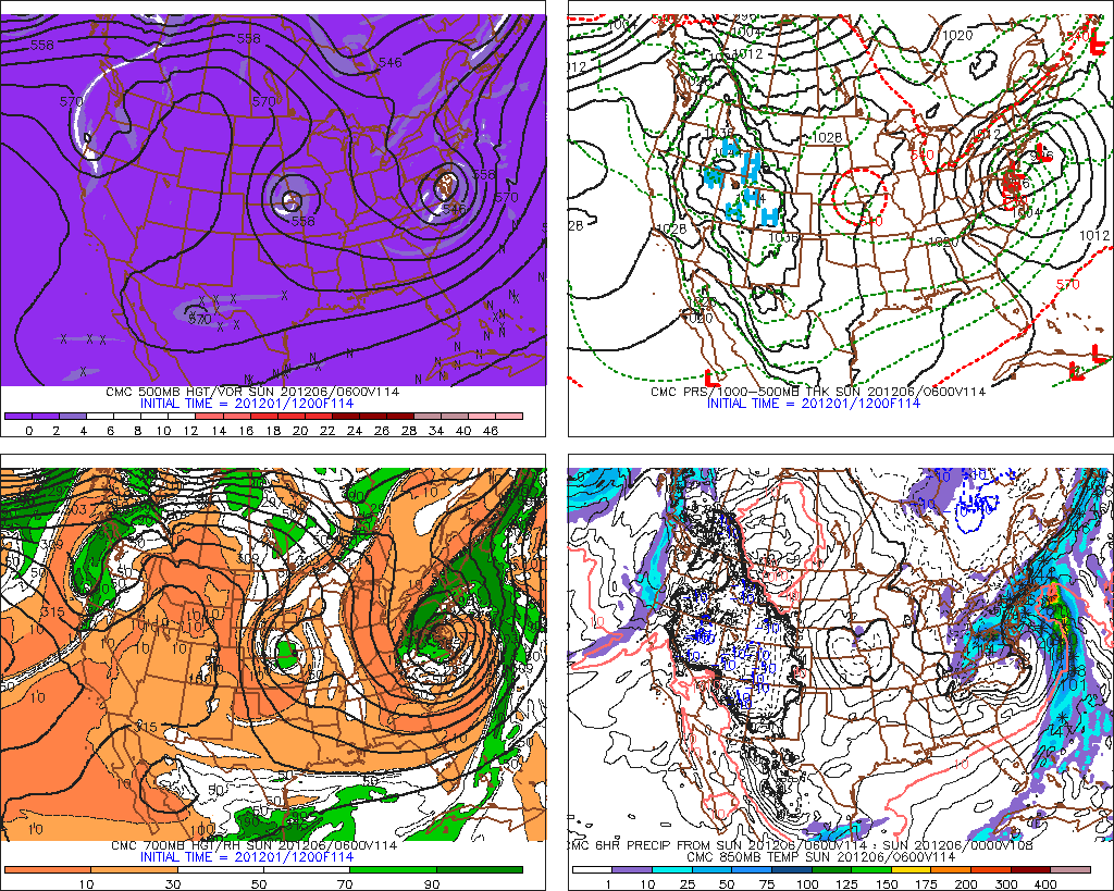
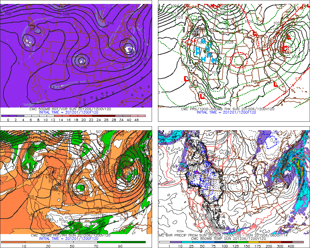
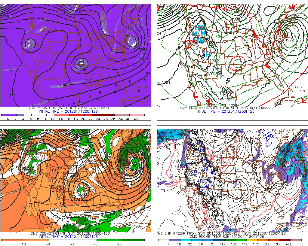
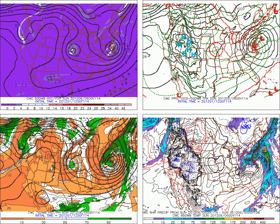
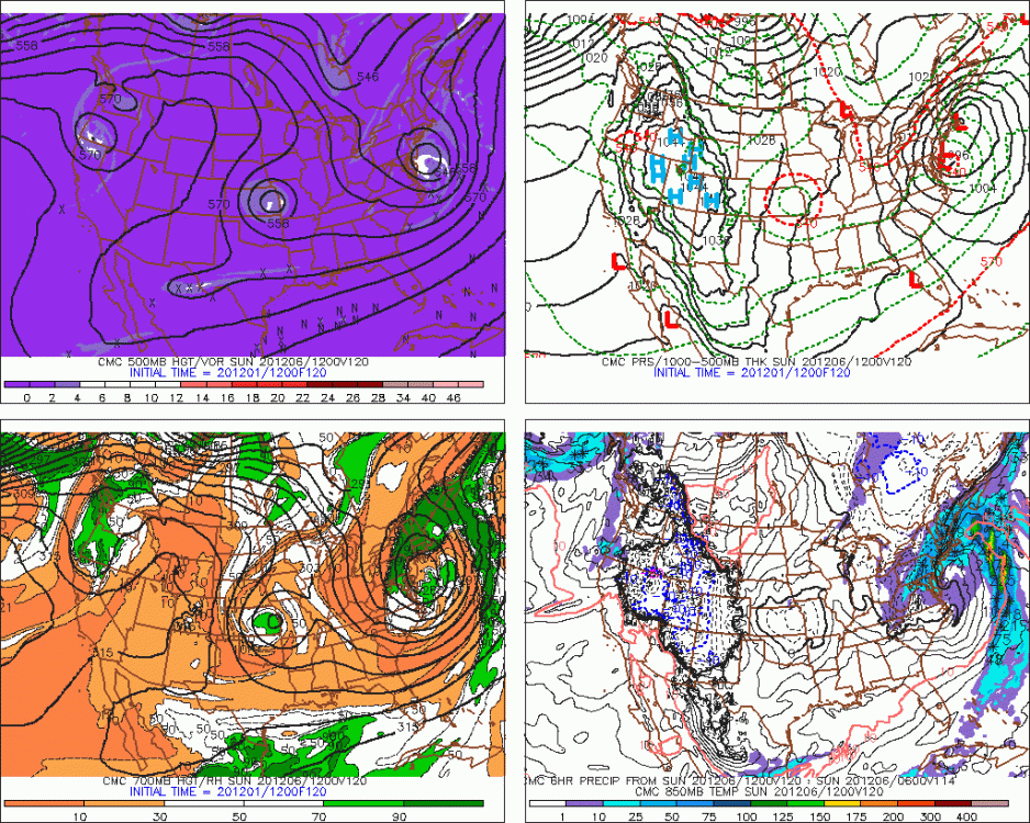
You can see the GGEM has a little bit of a better synoptic setup than the GFS up in Quebec....little high trying to feed down and entrained just enough cold air.
-
It's too bad the southern stream is ejecting now rather than getting buried in the southwest. That northern stream shortwave is diving like crazy on today's runs for Dec 7-8, but it can't produce with the wave interference from 12/5-6.
-
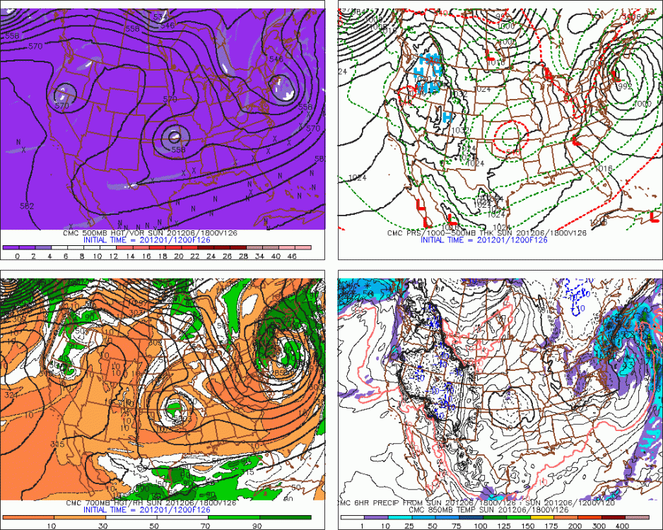
GGEM is more interesting for the interior on Sat night/Sunday.
-
Ugh....I wouldn't forgive him either for missing that storm. That was one of the all timers.
-
Well the GFS gets it done for St Agatha.
-
Yeah RE: the bolded.....we need to infuse northern stream into this in order to crash the thicknesses enough to make this matter for snow. So it's definitely a "thread-the-needle" system. Leaving the southern stream behind in the southwest and focusing on the 2nd northern stream shortwave for 12/7-8 turned out to be more useful like yesterday's 12z Euro....but it seems we're trending away from that now as the southern stream is ejecting and we're back to the 12/5 system which is tougher and probably causes too much interference for 12/7-8 should that shortwave even try to dig enough. So we're left with trying to phase the first northern stream shortwave with the southern stream for 12/5....all while not "accidentally" tracking this too far west at the same time.
-
12/5-12/6 is a hail mary. Absolutely putrid airmass.
-
You'll have to post pics of your sheltered side of the house later in winter. I bet in late winter/earl spring (like March/April) you have situations where there's like 3-4 feet on one side of the house and that open field with southern exposure is already getting some holes in it.
-
Lol...he knows what I said was true.
-
Welcome back to La Nina model performance.
-
The Dec 10-20 period definitely has some potential. Keep that PNA ridging more stout like on the 12z ensemble runs today and it will give a better shot at a legit coastal vs overrunning/SWFEs/clipper redevelopers.
-
It’s all good. I have a sickness in remembering storm dates like one would remember birthdays of loved ones.
-
The end of January storm was garbage northeast of about a BDL-PVD line. Storm ran into a brick wall. I think we had about 3-4” of arctic sand from it. Ditto PVD and BOS did even worse. It was a good storm though for the south coast and the southwest half of CT where they cleaned up.
-
With the caveat that the weeklies have been almost clueless so far this cold season.....it looks like they are pretty solid through week 3 with a colder pattern....then they break things down to a more classical La Nina look with eastern ridging. Though my guess is that if the EPS trends today are real, then Thursday's weeklies will show a more amplified pattern lasting longer.
-
46 knots at that pit in OWD is pretty impressive.
-
No, that was Feb 7, 2003....one year earlier. The '03-'04 winter was more frustration than anything for snow outside of the 12/5-7/03 event (even where I was, it was frustrating, lol), but it definitely had the epic January 2004 cold. The winter before in 2002-2003 seemed to go right every time there was a chance. That was also a brutally cold winter, but didn't quite have the peak cold that 2004 did.
-
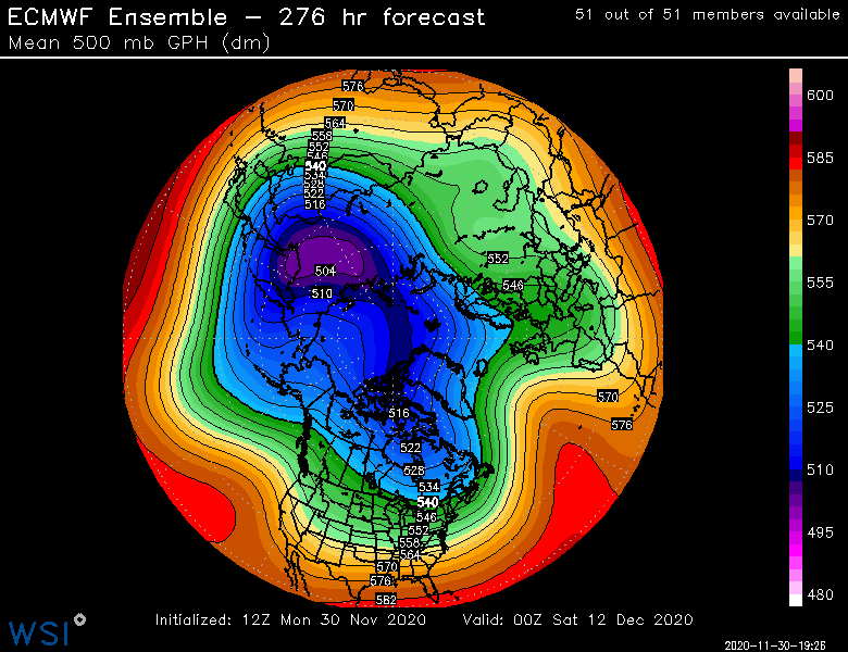
Pretty hard to dunk on this look right now on the EPS. This is the evolution after the 12/7-8 threat.
-
Funny thing is I learned to ski in the 1990-1991 and 1991-1992 winters. Those were horrendous winters but I didn't know any better other than "it normally is a bit snowier than this" adults would tell me. But your post reminds me of my first trip to Killington in that 1990-1991 winter. The 1st two days were actually pretty wintry and there had been recent snow. But then the 3rd day was like this. Pouring rain and temps in the 40s. Funny this is it happened again the next time we went a year later. I thought it was normal to get pouring rain and 40s with bare spots on the steepest trails roped off. Only after skiing all the years after that did I realize in retrospect how pathetic it was.
-
It's really a different shortwave that produces the 12/7-8 storm than produces 12/5 (or formerly produced it if we're talking Euro/GFS)
-
Really nice dprog/dT again on the heights in the Yukon/AK region. Looks like the 12z GEFS was real...at leats real enough for other guidance to see it. We'll see if it actually continues on future runs. Good trend today though at 12z.
-
Killington always had the deal (I think it's still there amazingly) where each kid 12 and under skis for free with the purchase of a 5 day adult lift ticket. That's prob one reason we went there a lot. Several resorts still have young kids ski for free any time (usually 6 and under or 5 and under) or reduced prices for older kids. I got some sticker shock on the day passes too a few years ago when I started skiing more again...but I actually did the math in my head and realized that it was pretty much in line with inflation since the 1990s.
-
I have a feeling you might be breaking out in a cold sweat if it evolved like that....watching cars with blocks of snow on them driving east on 93 past Blue Hill while the cars driving west are bare.
-
Yeah, to really make it affordable for a lower income person...you typically have to be in these bins: 1. Single or at least no family to support...pretty hard for a middle-low or lower income person to pony up the up-front cash for a season pass otherwise. 2. Live close enough to a ski hill to have a season pass. 3. Relatively flexible job where you can get out and ski some mornings or afternoons during the weekdays. A lot of people in their 20s up there fit all these requirements so they can ski for pretty cheap.
-
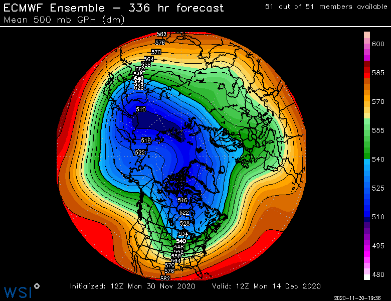
I wouldn't say it is splitting there...more like taking some punches. Getting elongated a little bit and also displaced. That's good enough though to get some good blocking/ridging into the AK region and north of there if it holds.