ORH_wxman
-
Posts
93,092 -
Joined
-
Last visited
Content Type
Profiles
Blogs
Forums
American Weather
Media Demo
Store
Gallery
Everything posted by ORH_wxman
-
-
Good 00z suite. Nothing fundamentally changed on the longwave scale.
-
You’re up...there’s some ducks on the pond too. Knock ‘em in.
-
That was still a great storm at least here. Had about 13 inches and then some sleet/freezing drizzle. The WCB in that was pretty awesome. Obviously it would have been nice to get the 87 inches that fell in Stowe, but I’d sign on the dotted like for another one right now if offered.
-
We’ve done threads at 5 days out. Especially if there is strong support for the system. 6+ is kind of unofficially frowned upon.
-
Yeah if it actually happened and ORH got like a foot, they’d be pretty high on the historical list through Dec 17. Might only trail 1992 if that happened. Of course, 2019 was at like 25” by that point and that went to shit. Lol.
-
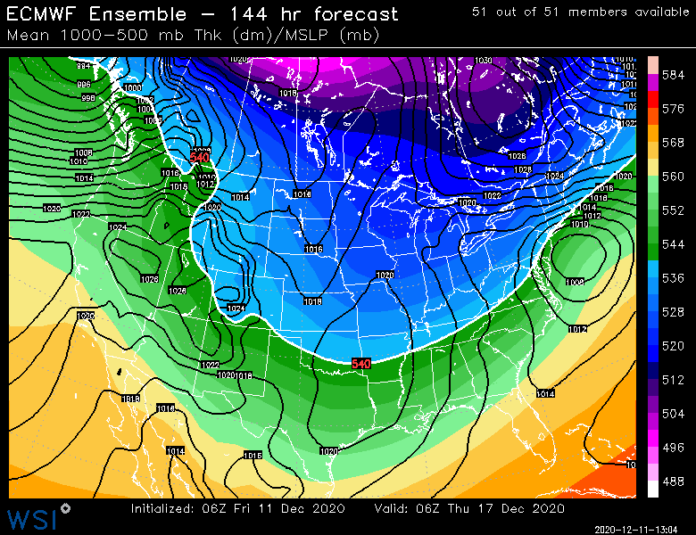
18z EPS goes out to 144 but it looks solid. Transfer occurring off VA/NC
-
Kind of a bummer that NNE won’t get much snow out of this (CAD region of W Maine might see a little) ...I was thinking that they probably would once it started trending but then it kind of stalled and trended a slight bit back NW. At least the sfc wedge is happening so very little snowpack loss up there. 4 days ago it was a 55F cutter.
-
The grinch storm is a given. Only question is whether the low tracks through Milwaukee or whether it tracks through Buffalo.
-

-
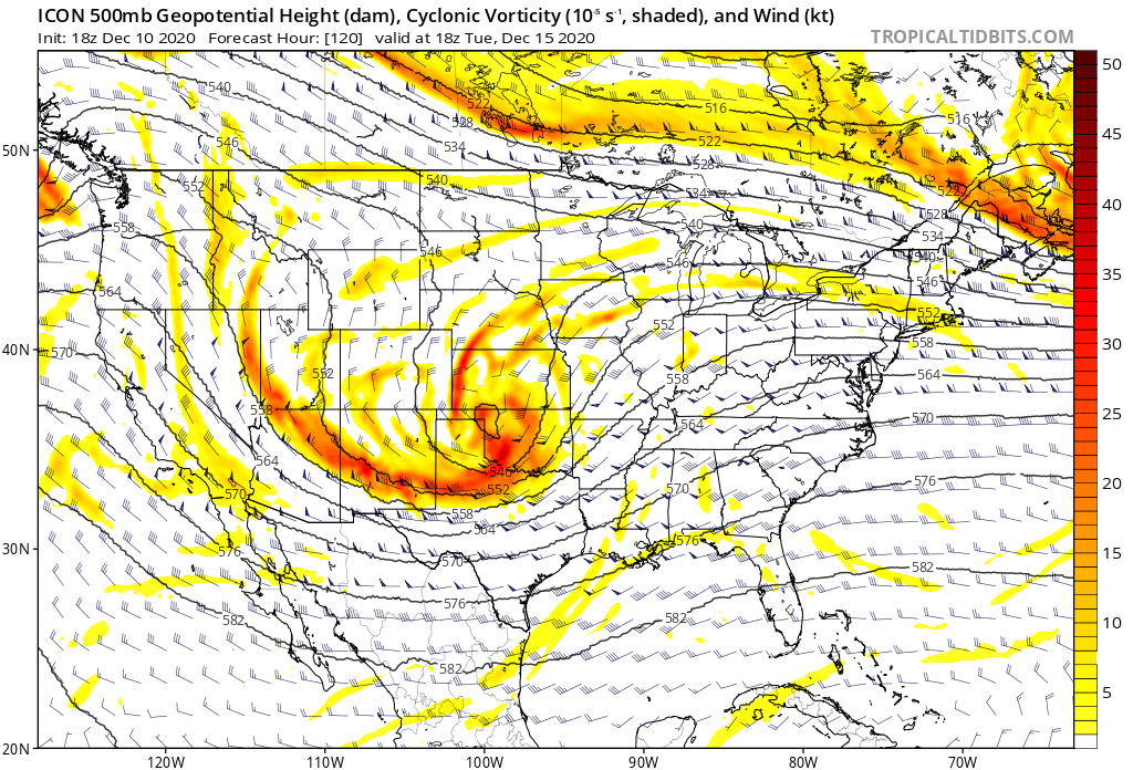
Thought it would be better based on upper air at 120-132. Either way, very strong setup. These wiggles will happen.
-
GFS will come in good again. Prob not HECS this time but that look is just classic. Nice to have longwave features in place because it provides more wiggle room.
-
This is a miller B setup, so you'd sell big snows for MD, even with the -NAO. Doesn't mean it can't happen (see 2/9/10), but it takes some pretty anomalous features to slam that far south with a Miller B and whiff your NH area.
-
http://www.eas.slu.edu/CIPS/ANALOG/DFHR.php?reg=EC&fhr=F132&rundt=2020121012 12/16/07 is the top analog at the moment....which makes sense. This one really looks like that storm except the NAO is negative (which the analog table can't see since it only goes on a smaller domain) so this one would likely end up getting more resistance to hugging the coast/inland running than that one did.
-
http://www.meteo.psu.edu/fxg1/NARR/2003/us1205.php http://www.meteo.psu.edu/fxg1/NARR/2003/us1206.php
-
With that high placement, I'd take the under on the CF making it that far inland.
-
mid-levels are way colder...so the only thing looking at soundings will matter for is whether the ratios are like 10 to 1 or 18 to 1....like a normal snowstorm. Tha is assuming of course that something like the Euro/GFS are semi-close to reality.
-
This type of evolution is a great example how the Atlantic being favorable prevents a cutter or inland runner.
-
Yeah less likely to have this go full zonked out west....still possible, but less likely with the NAO the way it is and the 50/50 low. This is still 6 days out though, so we're going to see some big changes run to run.
-
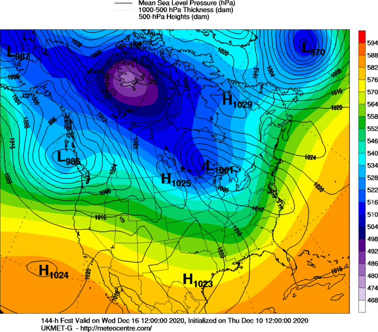
Ukie looks like a late developer based on 144.
-
GFS at 132 looks quite classic for Miller B.
-
Dr No is more like waking from the post-lunch coma with a ripping hangover. You're reading the stingy Eurowx snow maps with a pot of coffee in front of you.
-
When that's not doing it, you can break out the secret stash and fire up the JMA.
-
The PV just kind of sits there in the same spot and spins for days on end....good environment to just keep cooling down with almost no solar insolation now up there.
-