ORH_wxman
-
Posts
93,092 -
Joined
-
Last visited
Content Type
Profiles
Blogs
Forums
American Weather
Media Demo
Store
Gallery
Everything posted by ORH_wxman
-
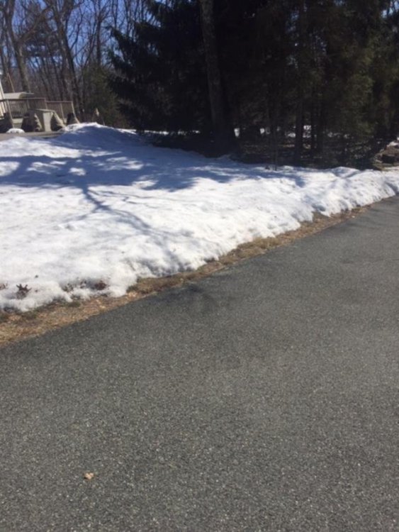
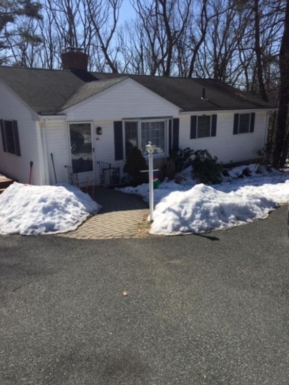
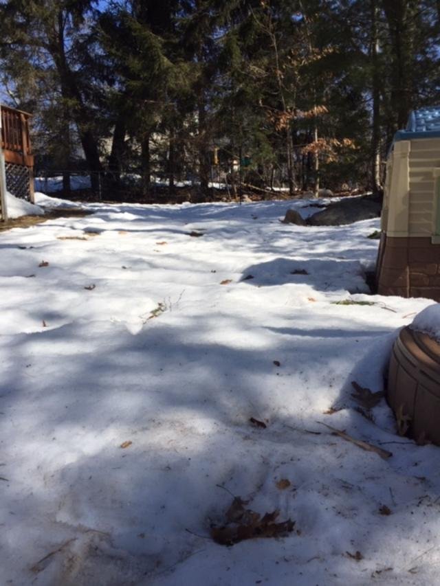
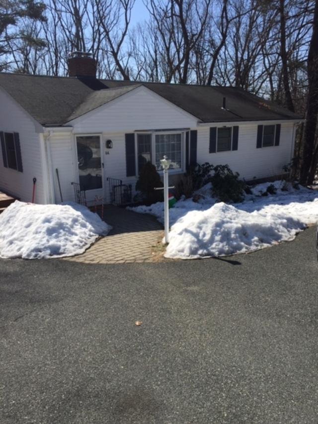
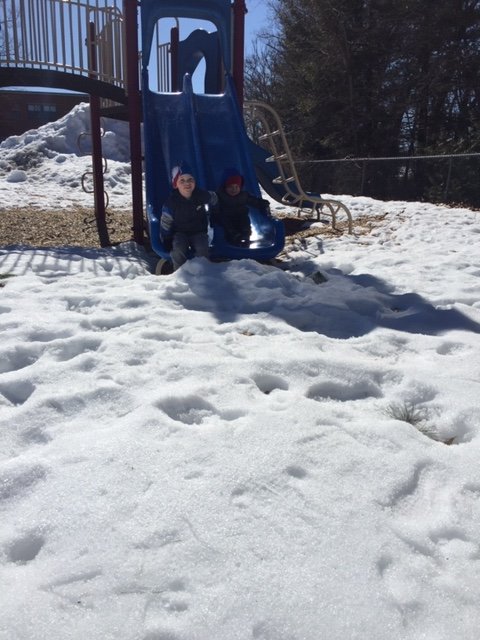
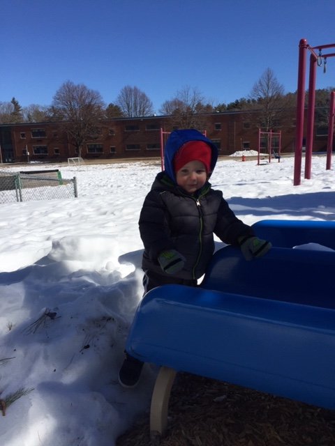
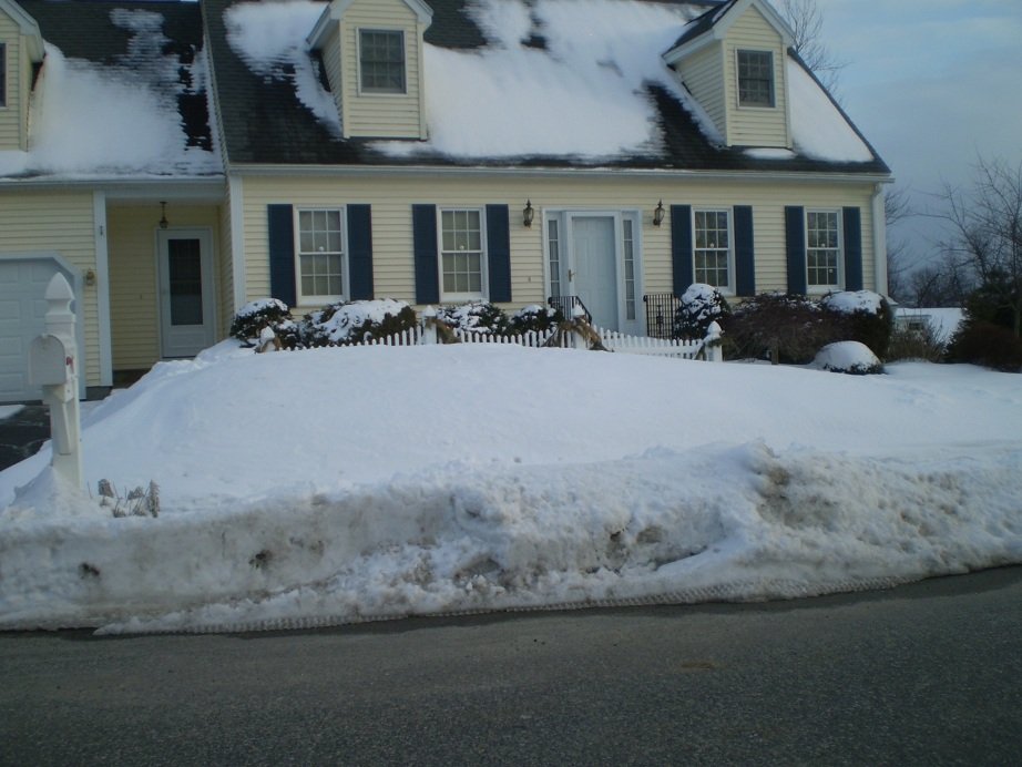
This decaying snow pack is useless now. At least the torch areas are opening up. Took the boys out to the local elementary school playground. Snow was actually pretty blinding in the March sun The backyard is getting there. Should be gone in the next few days
-
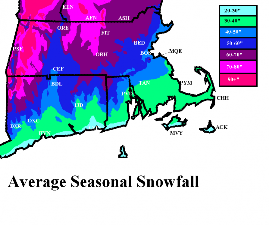
My map has BOX right about 40” for average. Granted, I made the map like over a decade ago. You could probably add a couple inches to the long term average there given how ridiculous the 2010s were there. I’d probably drag that 40” contour a solid 10-15 miles southeast if I included the 2010s
-
Feb 1-2 is pretty obvious on that map. Look just west of BOS where the positive departures are. Also, the fact that they are still below climo snow despite those other storms like 2/7 and 2/19 means their “climo” is actually the opposite of hostile...it’s because it’s a 12 year mean on that map....2009-2020. Those were very kind years to SE MA. They prob averaged over 20” for February during that stretch. If that map was based on like 1981-2010, they prob wouldn’t have negative departures. Yep, the 128 belt back to ORH had 30”+ for the month of February.
-
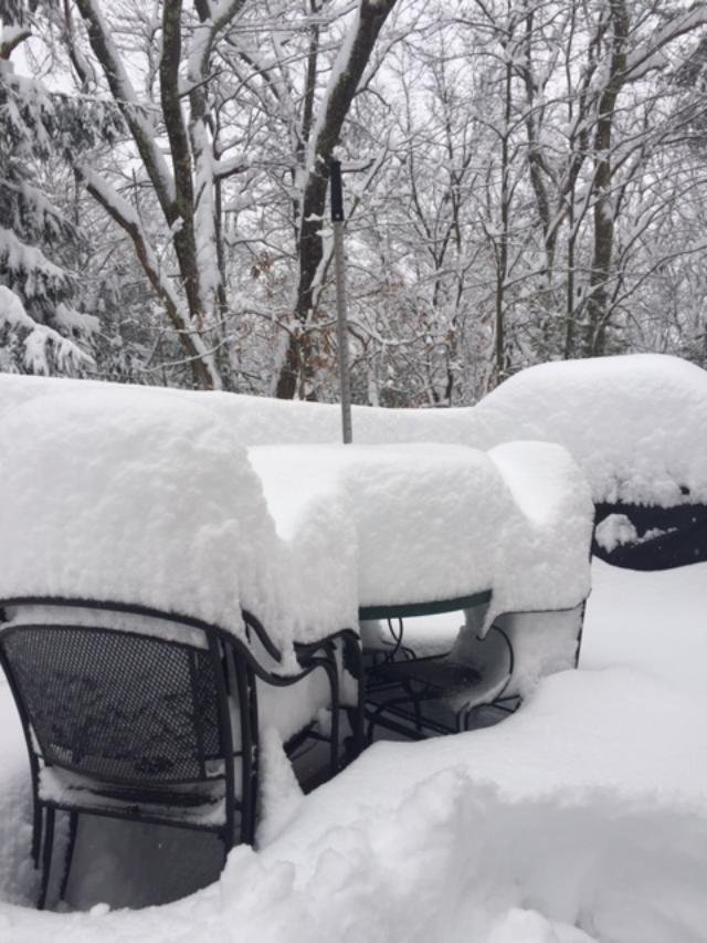
1996 mostly melted out in mid March....there was a pretty good warm spell the week after the big snows in the 3/2-3/8 period before it got chillier again. Even 2007 was mostly gone IIRC going into April but it was still present in the typical shaded spots. 2005 def had pack going into April but it was on its last legs and didn't last long. But I remember it still pretty impressive like on March 29-30ish and then it started going pretty quick. 2018 had some leftover pack too but it was pretty mangled because that final few days of March torched pretty good. 2017 was also trying to hold on too and even got an event on 3/31-4/1 to reinforce it. 2013 was trying to hold on but it went really fast in the first 3-4 days of April. I do have a pic of what it looked like on Mar 22nd that year: Nothing rivals 2001 though because it was like legit pack everywhere (not just shaded spots) going into April. Though I will say that ORH was literally the line for that....you went to southern and lower parts of the town and it didn't look nearly as uniformly covered. But my area up into Holden and those areas was like 18+ even in open fields and because the first week of April was pretty cold, the pack was taking a while to melt out so you had like full pack everywhere still on like 4/9 or 4/10. Part of the reason for that too was the 3/30/01 storm. That storm literally sliced the city in half....even the airport had some trouble because they are kind of south. Up by the north side on the Holden line we had like 8-10" of paste but the airport was like 4" with a ton of sleet and marginal ZR contamination. It was a sick gradient. I think they basically got almost shut out down around Auburn/Millbury. The only year that probably rivals 2001 for continuous pack into April around here was 1956. The difference is that 1956 was probably much more impressive than 2001 southeast of ORH...like my current area back toward Auburn/your old stomping grounds in Shrewsbury and then south into N RI....they got destroyed/jackpotted in multiple late March storms worse than ORH did surprisingly whereas 2001 was mostly N ORH county for the obscene pack durability into April. 1984 went into April with a stout pack, but it wasn't super durable since the winter pack had already mostly melted out before the big 3/29-30/84 storm. Ditto 1997 of course...ton's of pack on 4.1 but it was all from one storm, so the liquid equivalent was no more than 2-3" maybe. Still impressive, but you usually want like 5-6+ inches of water in that sucker late in the year from the winter pack that has absorbed all those ZR/sleet/cold rain events....it makes it harder to melt out fast. We really squandered 1993 badly....had a massive pack after the superstorm and then even added to it (or at least slowed the melting/compaction) with a couple of events over the next 10 days. That pack had a lot of water in too from all the events (including a juicy snow to sleet SWFE) in Feb '93 and pre-superstorm Mar '93 and virtually zero rain at all during that time....but then we absolutely furnaced the final week or so of the month. We had multiple days near 70F IIRC and then a massive rainstorm and that was all she wrote. The piles lasted until May, but dreams of full pack into April were dashed with that final week of March which was a bloodbath. If you had shown someone a pic of the snow on like St. Patty's day or the equinox that year, you would have never guessed it would mostly melt out by 4/1.
-
Not sure I follow...you saying you don't believe the cold dump because of the background La Nina? I suppose it could fail...it's not an overwhelming signal yet though it has been trending more pronounced each run. I don't know how "wintry" it would be anyway unless we get a precip event out of it. As you know, this time of the year you can be 44F under clear skies despite 522 thicknesses. The sun is just too strong....but if you have precip falling in the same column, it's 21F blowing snow off your roof.
-
The EPS are def going with that transient EPO dump of cold air....way more than even a few cycles ago....so there's a window there first when that happens....and then likely another window of opportunity several days later as it morphs more into a western ridge
-
Then of course, winter hill after Mar 4-6, 2001....the snow got even deeper too after that, LOL
-
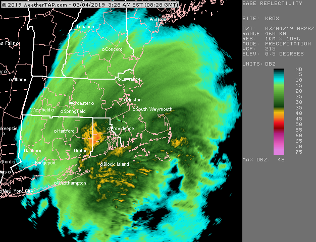
3/4/19 was a great one here...right near the jackpot with just under 17"

-
Usually Bethel is a great spot but the last month-plus has sucked up there. So many of my March trips will have a big snow pack increase between about Windham and North Waterford/Stoneham and then it usually levels off with maybe a small increase toward Bethel and SR.
-
Yeah there might be a solid 8-10 day window there. EPS still has a decent look at the end of the run that looked like it would go for a few more days. Lets get a 70F Tip Tulip day and then a 18F powder job for St Patty’s day.
-
Yes. He’s the crazy good skier sometimes people reference (name is pete) on here when discussing past ski GTGs. He sometimes goes up to alaska and jumps out of helicopters to ski.
-
Yeah the historical snow climo shows this too...there tends to be a pretty sharp dropoff in snow climo though once into the final week of March but that 3/14-3/22 period or so is not too difficult. Then there is another pretty sharp dropoff in snow climo after about 4/12-4/13 in the historical record.
-
I remember a couple events close together in Mar 2002...around 2-3" on 3/18 or so and then we had 7" on 3/20
-
Bored is a relative term in the context I used it. I’d rather get “bored” skiing a mountain than most other activities. I’d still be happy as a pig in shit.
-
BW has a few decent pitches, but yeah, I’d get bored there probably if I skied it several days in a row....esp if it’s a cloudy/low ceiling day where you lose the spectacular views that mountain gives. But I love doing the occasional cruiser day up there. I’ll go there anytime on one of those March/April corn snow days where you get snow-blinded if you take your goggles off. I love those days. MWN looks like this bright white menace against the blue sky on those types of days. Cannon/Wildcat are def way gnarlier. They have some sick terrain. Ill eventually get over to powderfreak’s mountain. I just haven’t done Stowe yet for whatever reason over the years. By far the biggest name mountain I haven’t done in New England. I’ve done Bolton valley nearby and then Jay Peak a few times.
-
Ive always loved BW for the cruisers. Prob best mountain in New England if you want well-groomed cruisers with stunning views. A couple of my best ski days were March/April days just cruising corn snow on one of their 25 or 30 dollar late-season specials. If you are looking for super gnarly stuff, def better to head to Cannon or Wildcat in your area which I’m sure you’ve figured out by now after nearly a full season there.
-
We actually had some pretty good icing for a time during that storm in the ORH hills. It was well into the event that the cold air drain came south enough to flip our area to ZR. Esp above about 700 feet. I recall above 1000 feet having some pretty decent damage and some power outages, though not like the 2008 ice storm here.
-
Yep. I believe BOS went into that storm with like 7 or 8 inches total on the season. But then that storm turned what could’ve been futility into a more mundane 17-18” dead-ratter season.
-
No. It was pretty cold for several days afterward, highs in the 30s. I think we had a refresher of about an inch too overnight on Mar 19-20.
-
Yep, I had 13" and that included some sleet on top. Pretty solid storm....cold too. Spent most of it barely above 20F.
-
Lets get a 2007 St. Pattys redux.
-
No, that will start showing up on the 84 hour NAM when it gets in range, and we'll all dismiss it as the NAM being the NAM and when it stills shows 38F with Tip's northeast-facing screen door slamming shut at 48 hours out, other guidance will start coming on board.
-
Last a solid 3+ days it looks like. Hopefully it is correct....pretty good multi-guidance support today anyway.
-
I almost always agree, but in this case I'm kind of 50/50 on it. It's become pretty ugly and not conductive for the kids to do anything with.
-
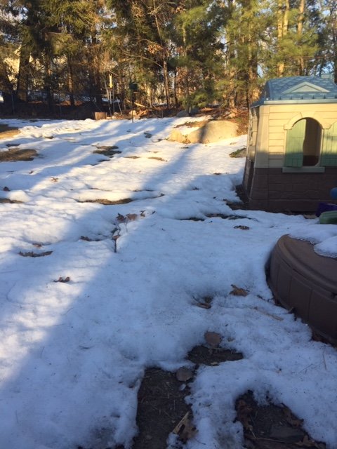
Snowpack absolutely rotting/decaying/sublimating under the March sun. It's useless when it gets this bad. I can walk on top of it without sinking in. It had become littered with debris too after the big wind a couple nights ago/yesterday. The playhouse in the back yard was once buried above the color demarcation from dark brown to tan.