ORH_wxman
-
Posts
93,099 -
Joined
-
Last visited
Content Type
Profiles
Blogs
Forums
American Weather
Media Demo
Store
Gallery
Everything posted by ORH_wxman
-
No. It was pretty cold for several days afterward, highs in the 30s. I think we had a refresher of about an inch too overnight on Mar 19-20.
-
Yep, I had 13" and that included some sleet on top. Pretty solid storm....cold too. Spent most of it barely above 20F.
-
Lets get a 2007 St. Pattys redux.
-
No, that will start showing up on the 84 hour NAM when it gets in range, and we'll all dismiss it as the NAM being the NAM and when it stills shows 38F with Tip's northeast-facing screen door slamming shut at 48 hours out, other guidance will start coming on board.
-
Last a solid 3+ days it looks like. Hopefully it is correct....pretty good multi-guidance support today anyway.
-
I almost always agree, but in this case I'm kind of 50/50 on it. It's become pretty ugly and not conductive for the kids to do anything with.
-
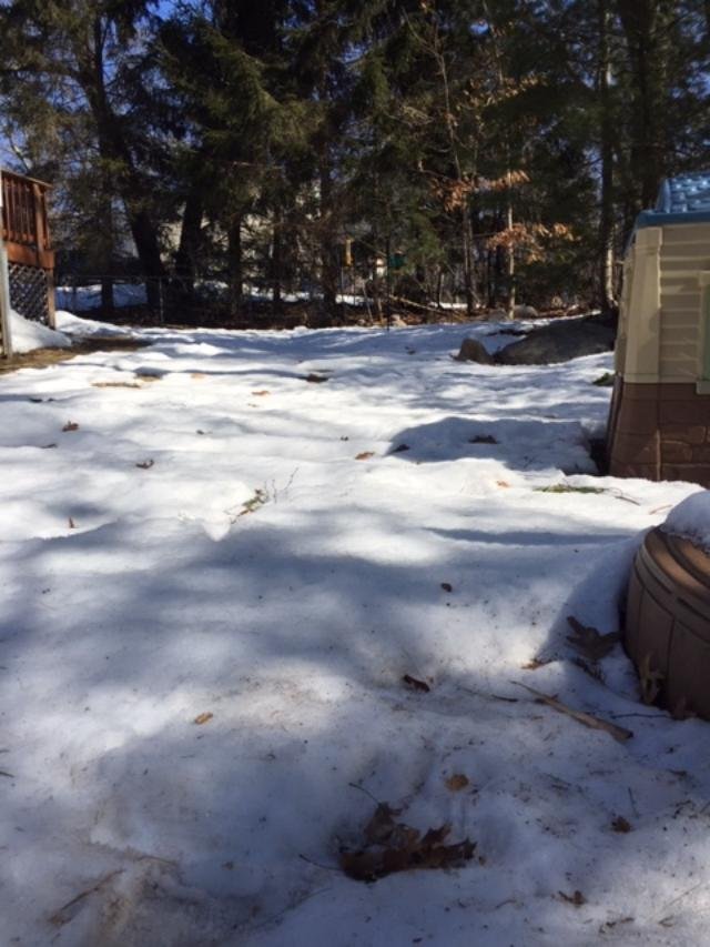
Snowpack absolutely rotting/decaying/sublimating under the March sun. It's useless when it gets this bad. I can walk on top of it without sinking in. It had become littered with debris too after the big wind a couple nights ago/yesterday. The playhouse in the back yard was once buried above the color demarcation from dark brown to tan.

-
Yep, I had about 7.5" in ORH and when I got into BOS that morning for work, I couldn't believe how much they had. It was like a solid 10"+, lol. The band had just missed me to the northeast. I had a really good pack after that one though....the firehose storm had torched/compacted down a lot in the week after it, but we still had about 8-10" OTG before the 3/19/13 event. Took until early April to melt out.
-
It does look like there could be some shenanigans mid month or a little after....pattern become a bit more favorable for a winter threat.
-
I'll believe 70F if we can get it inside of day 4.
-
Post-Ides of March though might bring a last hurrah chance for a winter storm. That's probably our chance if we're trying to squeeze one more into the stat column. Pattern isn't exceptionally good, but there's a pretty decent cold supply lurking and some western/Rockies ridging tries to pop
-
I'm planning it being more like the OP run where we get CAD'd with 39F rain/drizzle.
-
Wow I still had like 6-8” glacier that year. There was a little bit of CAD on the front side of that cutter...you must have warm sectored a lot earlier.
-
Yep. I prob had over 1.5” of qpf in that storm. Too bad it doesn’t really matter at this point. It will melt out soon with no other snow threats imminent. I was hoping we’d start March on a solid note to add to the pack and seasonal totals but doesn’t look good now. At this point I’m just hoping for some stat-padders mid-month and beyond since it’s prob not going to be nice. The alternative is usually garbage.
-
Yeah I PM’d him some prime spots within ORH (north or northwest side mostly) and then told him if he was ok being one town outside then pick Holden or Paxton. Best looks north but it’s possible.
-
There’s def a few south facing areas opening up. Your area has less though. Feb 1-2 is prob the reason. We got a much bigger QPF dump in that.
-
Paxton is a great spot. So high up. Town center there is over 1200 feet. Prob the best spot in central MA until you get further north into Princeton center.
-
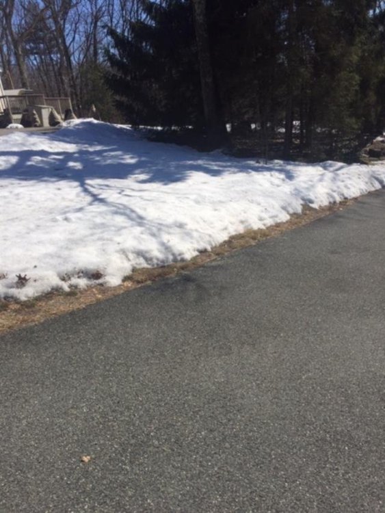
Wow Kevin’s pack turning to Swiss cheese.
-
We'll usually do well when northern NJ does and DC doesn't (see 2000-2001, 2004-2005, 2010-2011, etc). You need something more M.A.-centric like 2009-2010 or '78-'79 to screw us when N NJ gets it. We do get the occasional dud when they do well and DC doesn't....2003-2004 comes to mind. This year for you as well, but not for just south of you. ORH is solidly above normal and so am I. BOS is doing ok, but them getting skunked in 2/1 is hurting their overall numbers. 128 belt has done well.
-
Final ORH February numbers: Temps: 0.7F above normal (tied for 41st warmest Feb....warmest 1984, coldest 2015) Snowfall: 31.8" (15th snowiest February on record, snowiest 2015 at 53.4", Least snowy 1937 with a trace) Depth was pretty solid as the month basically went wire to wire with double digits.
-
The ridge isn't in a terrible spot. It's a little bit east, but nothing crazy....over the Dakotas or so. The bigger problem is you have a negatively tilted trough over Quebec/NE made up of a massive PV lobe....so you need something to amplify underneath that which is really hard. Not impossible, if you can phase a spoke of PV energy with the southern stream, it's possible. But you can start to envision how much has to go right.
-
And even if it does, I'd probably not be very interested if I was in the western half of New England. You'd want to be in downeast maine first and then maybe E MA.
-
There is almost no room for the storm to get far enough west in the longwave pattern. Everything would have to break right.....plausible? Sure. Extremely unlikely? Also true.
-
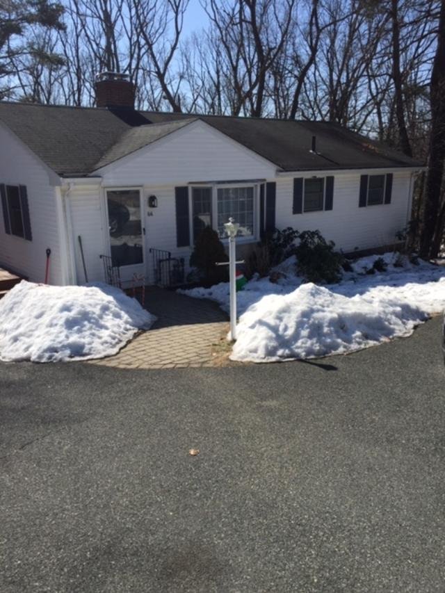
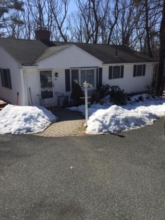
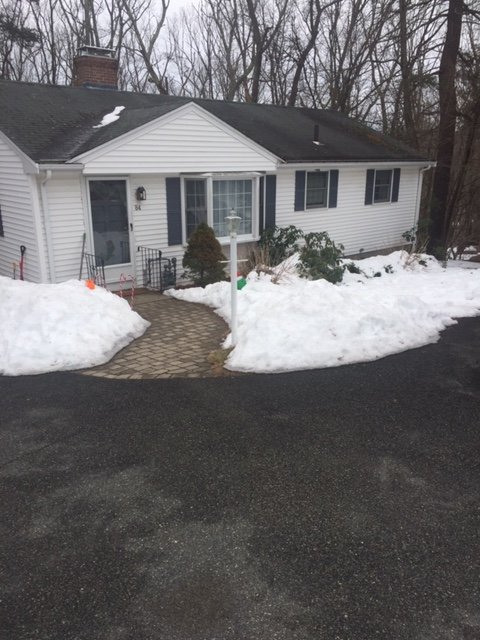
Roof finally melted out. Last little patch about to go. The pile next to the light post was almost as tall as the post itself at its peak...maybe a little shorter.
-
Yeah deep winter is over but snow chances probably aren’t. Another warning criteria storm could change the grade for many.