ORH_wxman
-
Posts
93,099 -
Joined
-
Last visited
Content Type
Profiles
Blogs
Forums
American Weather
Media Demo
Store
Gallery
Everything posted by ORH_wxman
-
January 2026 regional war/obs/disco thread
ORH_wxman replied to Baroclinic Zone's topic in New England
Need that vort energy in Wisconsin/Iowa to phase a little more with the southwest stuff before it moves east. Started doing that this run but not enough except for very light stuff into SNE. -
January 2026 regional war/obs/disco thread
ORH_wxman replied to Baroclinic Zone's topic in New England
Tick tick tick on the OP Euro. -
January 2026 regional war/obs/disco thread
ORH_wxman replied to Baroclinic Zone's topic in New England
GEFS def came north a bit from 06z. There’s some hits in there now while 06z had almost unanimous whiffs. The risk is obviously suppression on this but it’s far from a done deal. PV is crazy cold with the press but it’s also moving NE with time and we don’t have quite the crazy exotic west based block like a Feb 2010…EPS is more bullish on the blocking which has kind of been a theme this winter -
January 2026 regional war/obs/disco thread
ORH_wxman replied to Baroclinic Zone's topic in New England
Next weekend is a great setup for Scooter down to @amarshall to get Coke line steamers from frigid onshore flow. -
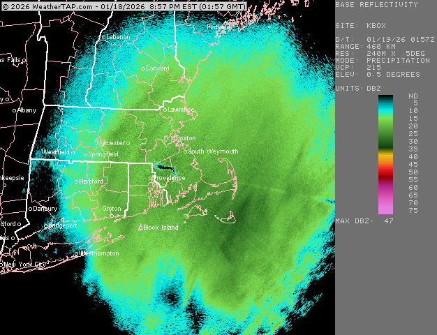
Rise of the Machines: January 18-19 Winter Storm Obs Thread
ORH_wxman replied to WxWatcher007's topic in New England
We def beat 10 to 1 ratios too. So I doubt there was a QPF bust. If I melted it down I’m guessing 4 tenths or maybe a bit more. -
Rise of the Machines: January 18-19 Winter Storm Obs Thread
ORH_wxman replied to WxWatcher007's topic in New England
Looks like our nice IVT stuff is ending. Just some flurries out there now. 6.2 will do it I think for the storm total. -
Rise of the Machines: January 18-19 Winter Storm Obs Thread
ORH_wxman replied to WxWatcher007's topic in New England
Ripping fatties here in this stuff.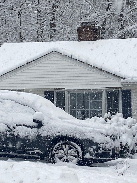
-
Rise of the Machines: January 18-19 Winter Storm Obs Thread
ORH_wxman replied to WxWatcher007's topic in New England
Just over 6” here. Just measured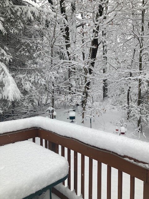
- 851 replies
-
- 10
-

-

-
Rise of the Machines: January 18-19 Winter Storm Obs Thread
ORH_wxman replied to WxWatcher007's topic in New England
Nickels and quarters falling here. This is that good growth IVT stuff. Can get some sneaky additional accumulation. -
January 2026 regional war/obs/disco thread
ORH_wxman replied to Baroclinic Zone's topic in New England
Yeah I was looking at 06z which was pretty ugly. Obviously that doesn’t mean the threat is gone but it truly is basically AI and Ukie versus other guidance right now. -
January 2026 regional war/obs/disco thread
ORH_wxman replied to Baroclinic Zone's topic in New England
GEFS didn’t show anything for the overrunning setup. They were suppressed. -
Rise of the Machines: January 18-19 Winter Storm Obs Thread
ORH_wxman replied to WxWatcher007's topic in New England
Eyeballing 6” here but will measure in a bit. What a scene. Coming down pretty good in this IVT stuff.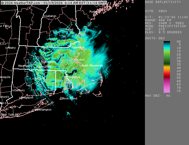
-
Rise of the Machines: January 18-19 Winter Storm Obs Thread
ORH_wxman replied to WxWatcher007's topic in New England
Band regenerating right over head.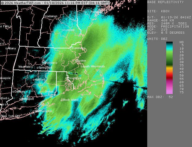
-
Rise of the Machines: January 18-19 Winter Storm Obs Thread
ORH_wxman replied to WxWatcher007's topic in New England
Yeah at least everywhere had some success this weekend out of all the waves. CT and C/W MA really cashed in yesterday and today the eastern folks are overperforming relative to expectations 12 hours ago. -
Rise of the Machines: January 18-19 Winter Storm Obs Thread
ORH_wxman replied to WxWatcher007's topic in New England
There’s more back building over the interior now…it won’t be as intense as the stuff in the last 2 hours, but it’s that high ratio fluff that can add a sneaky inch or two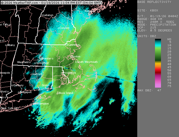
-
Rise of the Machines: January 18-19 Winter Storm Obs Thread
ORH_wxman replied to WxWatcher007's topic in New England
Some of those soundings showing awesome growth at times late this evening seemed to be correct. Definitely getting really efficient stacking for a while now. Snow is slowly getting drier too so that helps. Just creeped below 30F.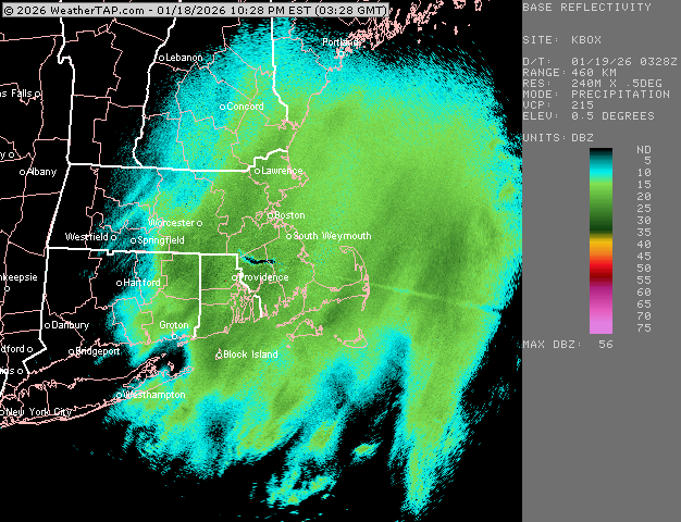
-
Rise of the Machines: January 18-19 Winter Storm Obs Thread
ORH_wxman replied to WxWatcher007's topic in New England
Go wake your dad up and tell him he’s missing the best band of the winter, lol Pretty solid here so far. Passed 4”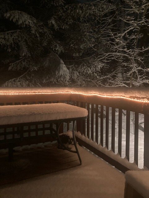
-
January 2026 regional war/obs/disco thread
ORH_wxman replied to Baroclinic Zone's topic in New England
Yeah Cape getting slugged with a good paste storm will lock in a pack even down there. -
Rise of the Machines: January 18-19 Winter Storm Obs Thread
ORH_wxman replied to WxWatcher007's topic in New England
Getting nuked in this. Easily 4”+ now. Lots of nickels falling in this band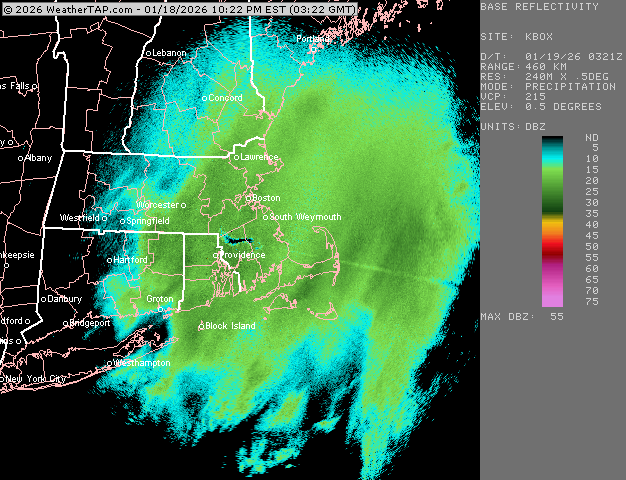
-
Rise of the Machines: January 18-19 Winter Storm Obs Thread
ORH_wxman replied to WxWatcher007's topic in New England
Wow just did a check and we’re almost 4” now. Really stacked up good in the last hour. Growth is excellent right now in this band. Temp down to 30F -
Rise of the Machines: January 18-19 Winter Storm Obs Thread
ORH_wxman replied to WxWatcher007's topic in New England
Bands still intensifying.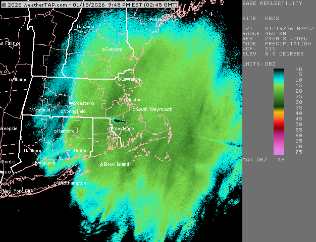
-
Rise of the Machines: January 18-19 Winter Storm Obs Thread
ORH_wxman replied to WxWatcher007's topic in New England
Still some bands back building around ORH. But it prob starts to weaken by midnight. There could be some higher ratio fluff in the IVT hangback stuff later tonight.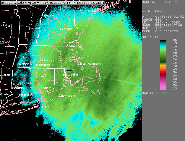
-
Rise of the Machines: January 18-19 Winter Storm Obs Thread
ORH_wxman replied to WxWatcher007's topic in New England
It’s gotten very good in these bands to your west. Stacking quick. -
Rise of the Machines: January 18-19 Winter Storm Obs Thread
ORH_wxman replied to WxWatcher007's topic in New England
Growth has increased remarkably over the last 30 min. -
Rise of the Machines: January 18-19 Winter Storm Obs Thread
ORH_wxman replied to WxWatcher007's topic in New England
More bands forming over interior