

ORH_wxman
-
Posts
93,095 -
Joined
-
Last visited
Content Type
Profiles
Blogs
Forums
American Weather
Media Demo
Store
Gallery
Everything posted by ORH_wxman
-
The last hurrah? Putting all the eggs in the Tuesday 3/14 basket
ORH_wxman replied to Ginx snewx's topic in New England
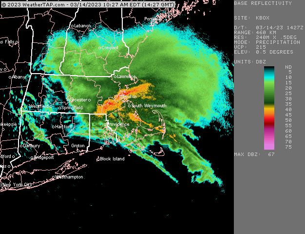
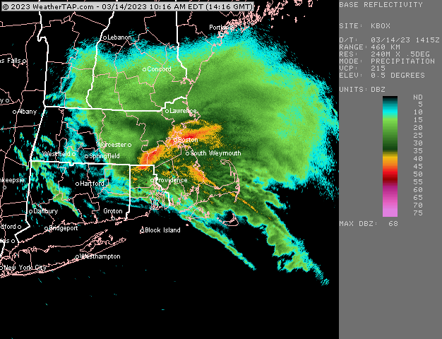
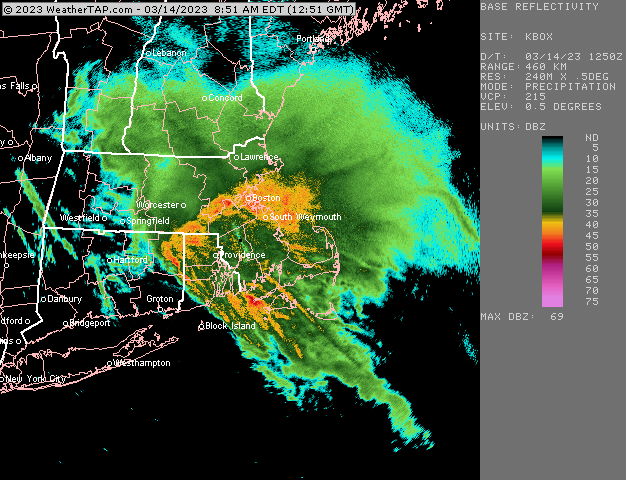
Gives another inch of QPF after 11am for ORH eastward down into N half of RI. Southern part gets over a half inch but has to wait for dryslot to sink south. -
495 belt is playing catch-up right now with this stuff. That is just a firehose of poundage
-
Yeah you can see the dryslot pivoting in RI now
-
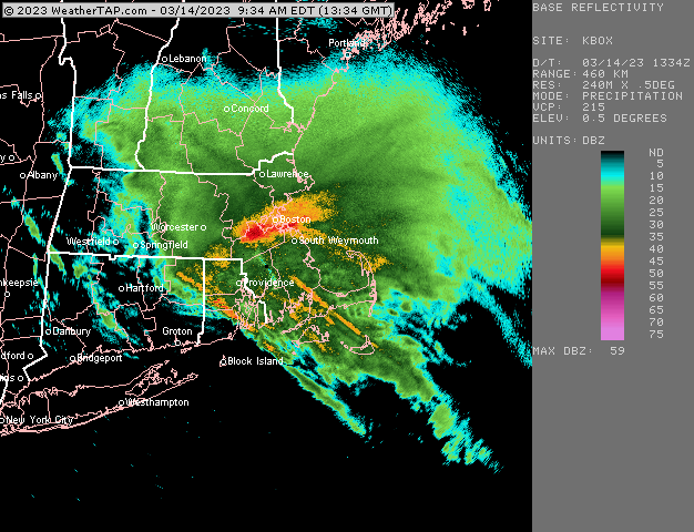
Yep…7.5” now on winter hill btw. Absolutely pounded this morning…3” on the clear area from 8am
-
What a firehose
-
Yeah and it’s prob really notable down in ORH where the snow was really marginal for much of overnight.
-
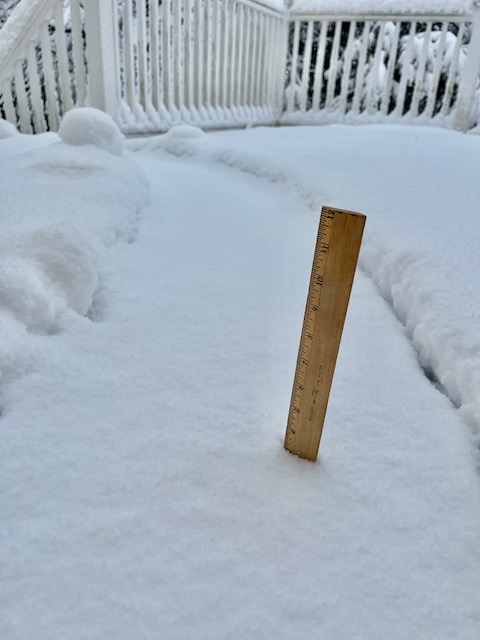
What’s your elevation? There’s about 4.5” on top of winter hill.
-
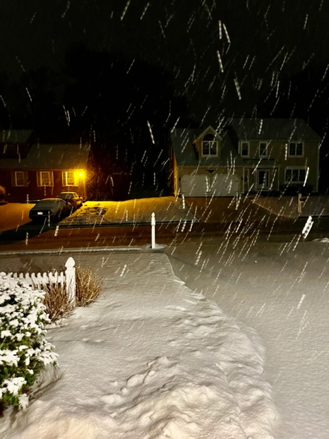
Pounding fatties on winter hill in ORH.
-
You may be as close to a lock for a 30 burger as one can get in a storm. At least 2 feet anyway.
-
About an inch down on winter hill
-
The last hurrah? Putting all the eggs in the Tuesday 3/14 basket
ORH_wxman replied to Ginx snewx's topic in New England
Scooters roof getting blown off with 10” of paste? -
The last hurrah? Putting all the eggs in the Tuesday 3/14 basket
ORH_wxman replied to Ginx snewx's topic in New England
NAM doesn’t shut the snow off in eastern areas until Wednesday morning. -
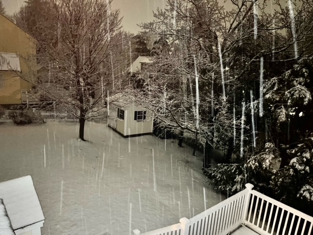
Def catpaws and mangled flakes mixing in Holliston. Temp is still pretty high though at 37.2.
-
The last hurrah? Putting all the eggs in the Tuesday 3/14 basket
ORH_wxman replied to Ginx snewx's topic in New England
3k slays too. -
The last hurrah? Putting all the eggs in the Tuesday 3/14 basket
ORH_wxman replied to Ginx snewx's topic in New England
Might end up historic there if they can stay snow. -
The last hurrah? Putting all the eggs in the Tuesday 3/14 basket
ORH_wxman replied to Ginx snewx's topic in New England
ORH snowing now too. (Airport says 36 but it’s actually about 34 with their warm bias and all the mesonets around them are 33-34) -
The last hurrah? Putting all the eggs in the Tuesday 3/14 basket
ORH_wxman replied to Ginx snewx's topic in New England
I don’t think that is an elevation gradient on the herpes…it’s where the 925 layer warmed enough. ORH airpor and adjacent Paxton (1200+ feet) are pretty high in elevation and they both get porked that run. -
The last hurrah? Putting all the eggs in the Tuesday 3/14 basket
ORH_wxman replied to Ginx snewx's topic in New England
The cluelessness of the models for tomorrow morning is going to be fun. Hopefully it breaks right for most. It's too bad that IVT is probably real....really kept this from being a higher end storm for a much larger area. Still hoping it comes in a little weaker which could make a big difference vs trending even stronger. -
The last hurrah? Putting all the eggs in the Tuesday 3/14 basket
ORH_wxman replied to Ginx snewx's topic in New England
Yeah it's probably the worst spot you can pick....maybe Bennington is worse on the other side of the mountains in the nor easter, but both are awful in this type of storm. -
The last hurrah? Putting all the eggs in the Tuesday 3/14 basket
ORH_wxman replied to Ginx snewx's topic in New England
Ray with the local jackpot on the 3k -
The last hurrah? Putting all the eggs in the Tuesday 3/14 basket
ORH_wxman replied to Ginx snewx's topic in New England
Even Kuchera map is trying to give you like 10" in 6 hours, lol -
The last hurrah? Putting all the eggs in the Tuesday 3/14 basket
ORH_wxman replied to Ginx snewx's topic in New England
18z NAM is a furnace at 925 tonight....no snow even in N ORH county until prob 09z. -
The last hurrah? Putting all the eggs in the Tuesday 3/14 basket
ORH_wxman replied to Ginx snewx's topic in New England
I'll be really interested in seeing how the R/S line responds to heavier precip later. A lot of these models have a very good cross hair sig over the interior with marginal BL overnight....typically, if you're trying to overcome a marginal BL, you want to see big lift in the DGZ which will make latent cooling more efficient as those dendrites fall into the above freezing BL. It won't make a difference if you're like +3C at 925, but in those areas that are around 1C, that's where things can bust. -
The last hurrah? Putting all the eggs in the Tuesday 3/14 basket
ORH_wxman replied to Ginx snewx's topic in New England
Until 00z, and then until 06z. -
The last hurrah? Putting all the eggs in the Tuesday 3/14 basket
ORH_wxman replied to Ginx snewx's topic in New England
Actually retros into Hubbdave, lol These hi res mesos are pretty much useless after 6 hours....we can't even trust the Euro right now at 24h.


