ORH_wxman
-
Posts
93,095 -
Joined
-
Last visited
Content Type
Profiles
Blogs
Forums
American Weather
Media Demo
Store
Gallery
Everything posted by ORH_wxman
-
In larger events, I've noticed they'll usually not issue a final map until at least 12 hours after it's over. So I'd think by later this afternoon or evening theyll have a final map.
-
Oh yeah, I was thinking around a foot when I went, so 14" was actually exceeding expectations, lol. It's def a bummer to miss another foot by a few miles, but at least most of the part that we were getting screwed on was overnight....during waking hours, it absolutely pounded. It's better than watching mostly rain.
-
Not sure what you mean? Was what worth it?
-
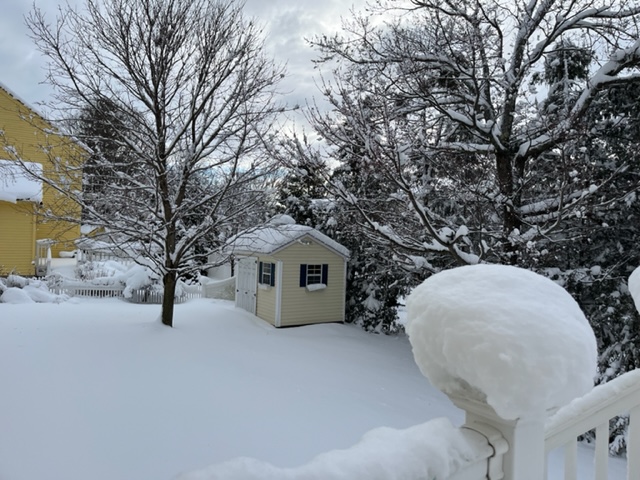
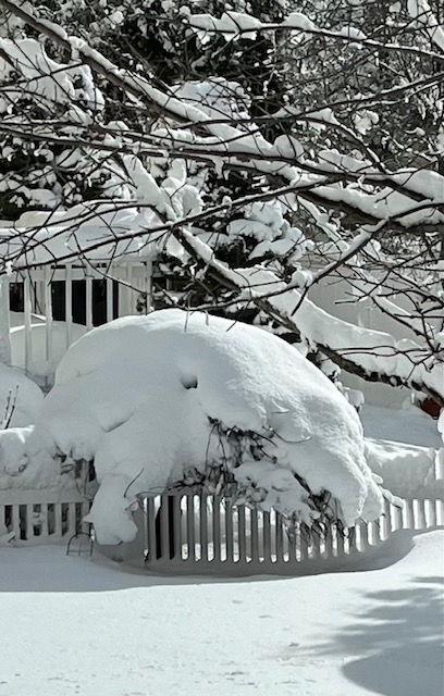
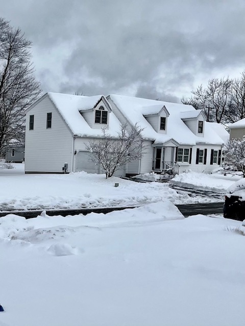
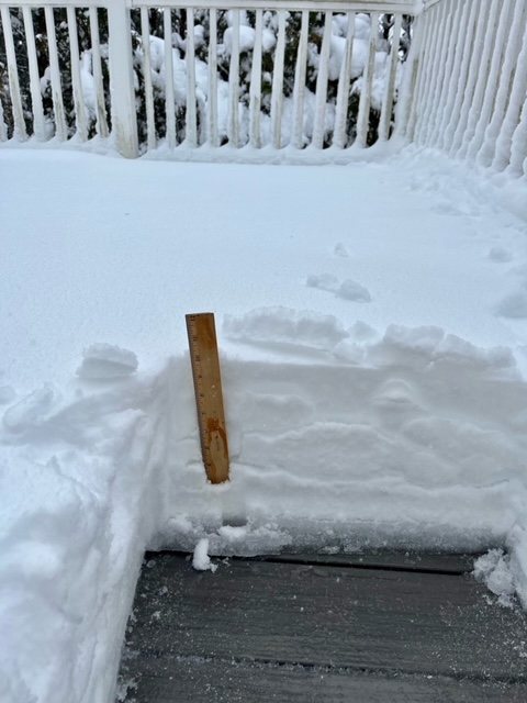
Some pics from ORH on winter hill. Just over 14”…amazingly less than 5 miles way at similar elevation had over 2 feet…the 900-925 warmth overnight prior to about 7am was most of the difference (about 13-17” vs 4” at 7am yesterday…beyond 7am, snow accumulated roughly at similar rates/amounts)
-
Even back home in Holliston, we have about 3.5" on top of the hill here and literally half a mile away and 150-200 feet lower has a maybe an inch, if that.
-
But if you spend any time in here you must have known 2 feet was a legit possibility.
-
That area is sneaky awesome for big storms. They average a ton of snow anyway, but they can go for the stars on these easterly flow events.
-
Used to live there. My parents house. I had my own place down the hill about a mile away for a few years too before I was married. And yes, it’s on the northern edge of the city right near the holden line at about 900 feet elevation.
-
He posts in here as @wxmanmitch He’s at like 2200+ feet there.
-
About 14” on winter hill so far. But man, literally about 5 miles northwest where they weren’t flirting as close with the 0C line at 925 overnight, they have 20-24” (and then another 10 miles further north is where the 30 burgers might happen) There was both an elevation gradient and a geographical one around the city of Worcester because that 925-950 0C line was almost overhead for about 6-8 straight hours last night.
-
Well I can sympathize with Don…tracking is fun so far as you actually cash in on a couple of them. You expect many to miss…that’s fine, but you except at least one or two to get you This winter has just been like a baseball player in a 0 for 33 slump or something. You expect at least a few hits to drop in out of shear luck when you are in interior CT, even in the valley. There’s a reason the average is almost 50” there. So when you reach a point where you have tracked your 15th failure in a row, it can start wearing on you. That said, we all know if the threat starts looking really nice inside of 4 days, we can’t resist. It’s why we are here. We all have a sickness for this.
-
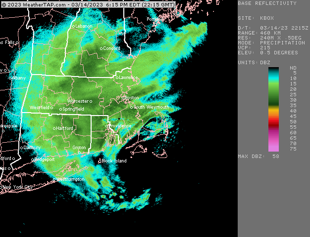
Incoming for ORH county (and metro west)
-
Closer to BOS should start finally getting some measurable over the next few hours
-
Stuff getting more organized now. Hopefully we can rip for a few hours
-
Yes. Esp in lower elevations. They would’ve been horrible though in the hills and mountains. I think a lot of them had like 8-12” in N ORH hills and many of them pushing 2+ feet.
-
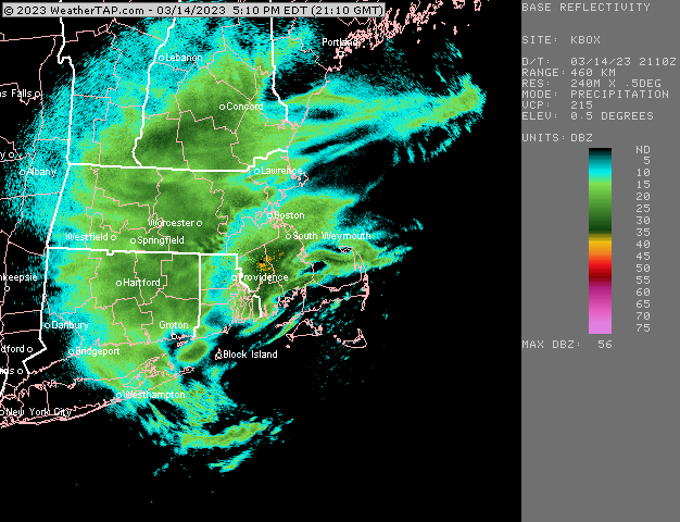
Things starting to fill in again
-
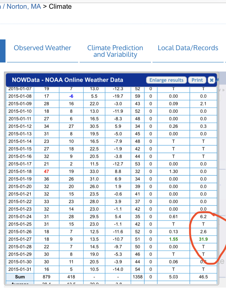
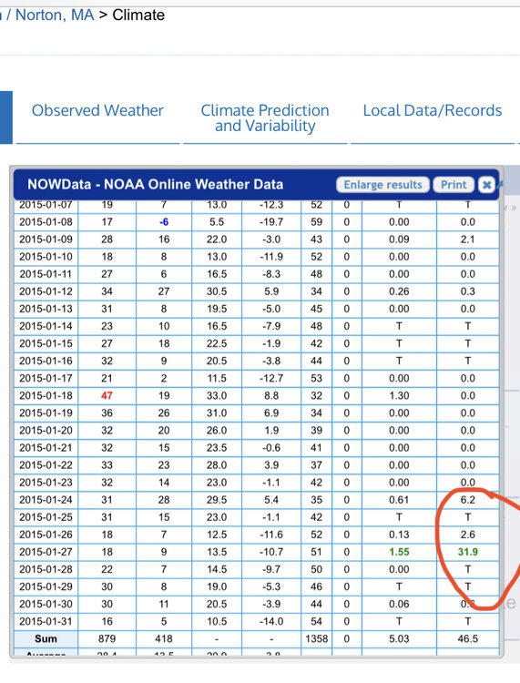
ORH already beat that in 2015 too. Not sure why that isn’t in the NCEI database. What a disaster that data set is.
-
Yeah something’s weird with that number. I know for a fact that ORH had 31.9” on January 27, 2015 alone (34.5” storm total)
-
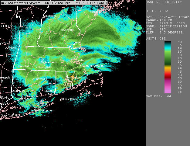
There will be some accumulating snow into BOS later imho. It won’t be 6” but sun is going down when that stuff rotates down and it could be moderate to b briefly heavy. Could be a couple inches from that.
-
Should start filling in over the next 60-90 minutes if the short term mesos have any clue (and to be fair, they’ve been pretty bad).
-
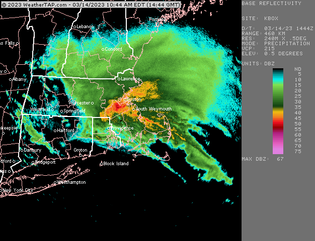
Firehose out of east will def cease pretty soon and we’ll see more ML type stuff fill in. I think we’ll see some pretty good bands redevelop.
-
Pure grease on winter hill
-
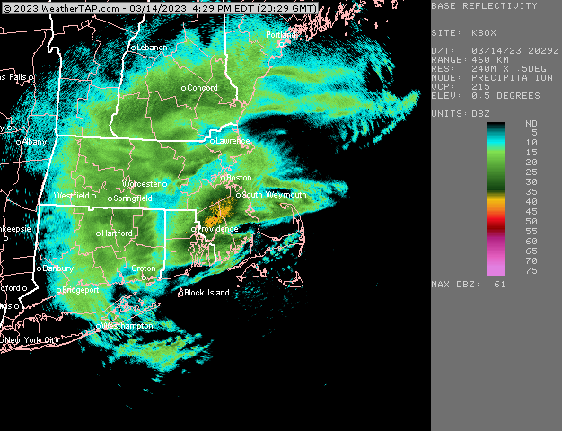
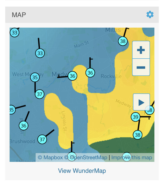
Yes it is all snow in Holliston. Snow line is clearly down to about Medway right now where those 33s meet the 36s and 37s
-
Prob not too much further north for dryslot as it is pivoting. Just a firehose for metrowest right now and up into Ray’s hood
-
I wonder if we can get a clap of thunder for metrowest given that they flirt with the edge of the dryslot. More unstable near the edge there.