tiger_deF
-
Posts
615 -
Joined
-
Last visited
Content Type
Profiles
Blogs
Forums
American Weather
Media Demo
Store
Gallery
Everything posted by tiger_deF
-
2023 Atlantic Hurricane season
tiger_deF replied to Stormchaserchuck1's topic in Tropical Headquarters
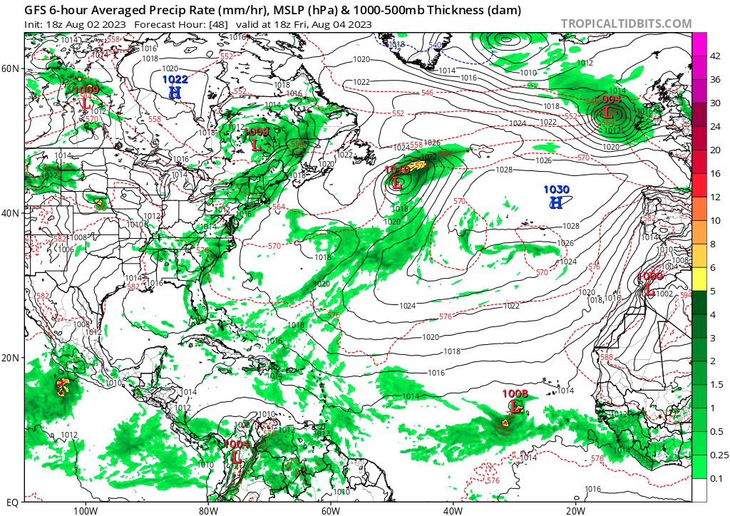
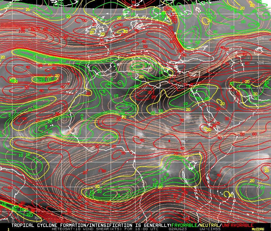
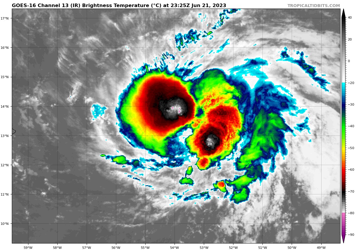
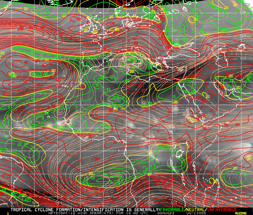
18z GFS develops the pictured wave into a tropical storm, which crosses the Atlantic and degenerates into an open wave in 3-4 days after formation. Shear values are quite low in the area, and vorticity has been increasing on all levels over the past several hours.

-
2023 Atlantic Hurricane season
tiger_deF replied to Stormchaserchuck1's topic in Tropical Headquarters
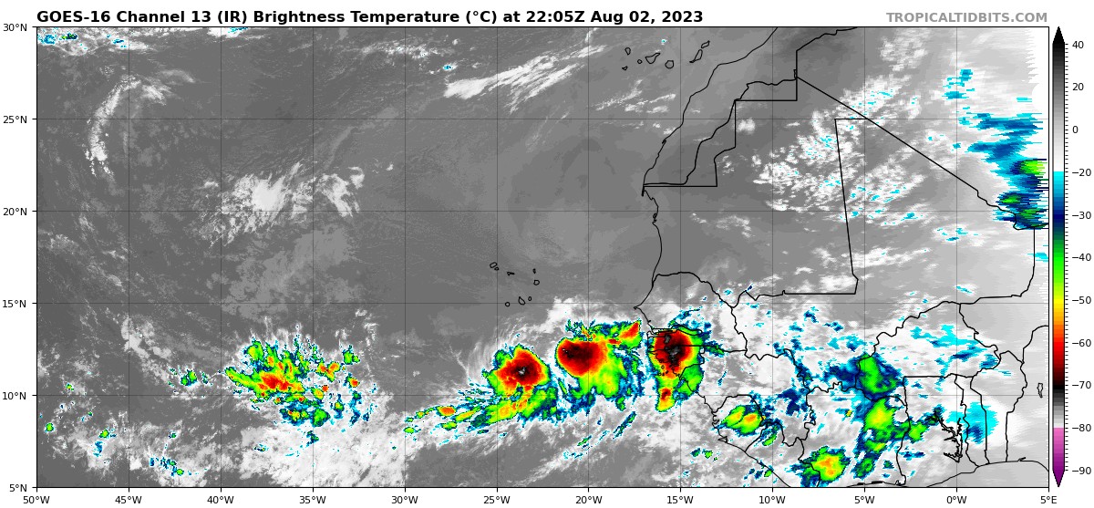
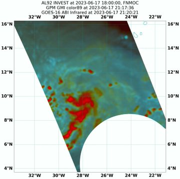
The TW that just exited Africa is looking interesting..gif.2d6b7cde1d0b822df805150848d35fee.gif)
-
2023 Atlantic Hurricane season
tiger_deF replied to Stormchaserchuck1's topic in Tropical Headquarters
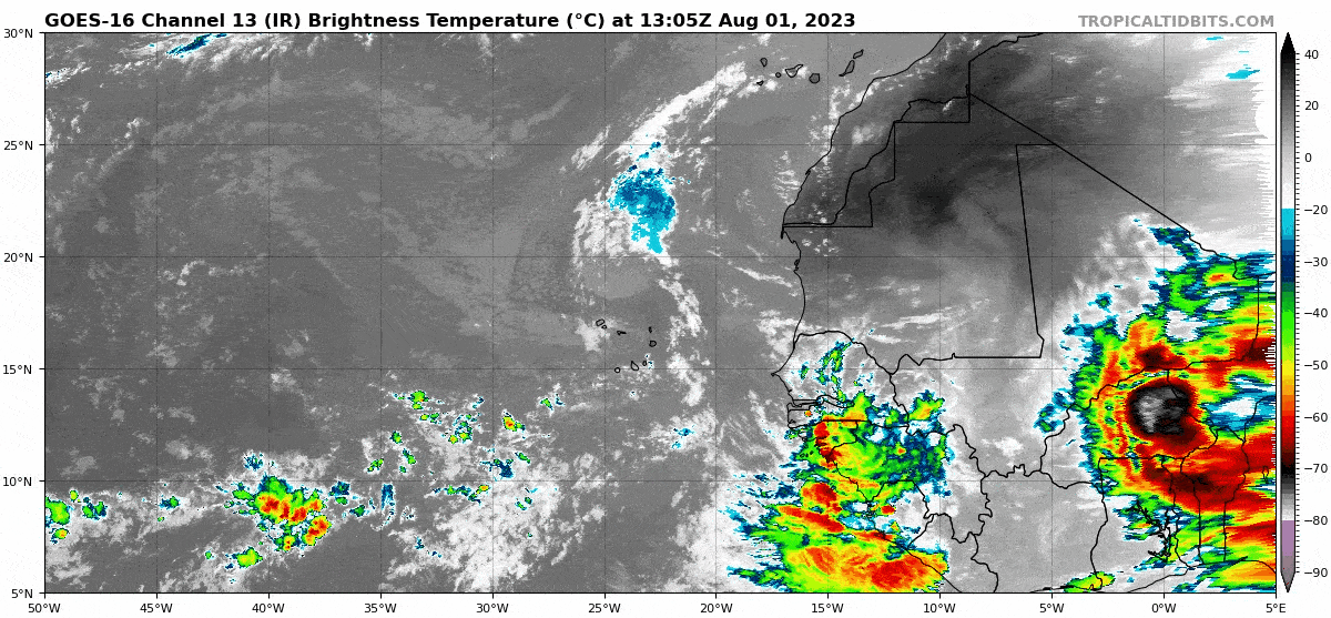
While these waves aren't forecasted to develop until potentially much later, they sure look impressive.
-
Thursday, July 27, 2023 Severe Weather Potential
tiger_deF replied to weatherwiz's topic in New England
I still have hope for the southern and western trail of storms, but the current line in central mass looks like crumbling garbage. -
Bret is looking pretty good right now. Outflow is limited, but it this convective burst is the coldest and longest-lasting for the past few days. A broad feeder band has been developing as well.

-
We're on the cusp
-
2023 Atlantic Hurricane season
tiger_deF replied to Stormchaserchuck1's topic in Tropical Headquarters

-
2023 Atlantic Hurricane season
tiger_deF replied to Stormchaserchuck1's topic in Tropical Headquarters
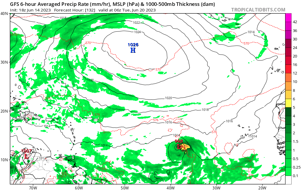
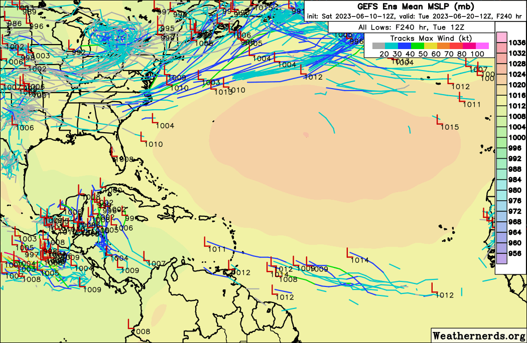
In addition GEFS ensembles are increasingly showing potential early-season activity. The MDR feature is also seeing support from the Euro.
-
2023 Atlantic Hurricane season
tiger_deF replied to Stormchaserchuck1's topic in Tropical Headquarters
Speaks for itself.
-
Our first phantom hit of the year!

-
Already looking meaty and the event is only just beginning. Discrete signatures up and down the breadth of the system.
-
From someone relatively new to tracking severe weather, would an extremely severe event/positive bust in the midwest/TV increase the chances for strong thunderstorms or potential tornadic activity here?
-
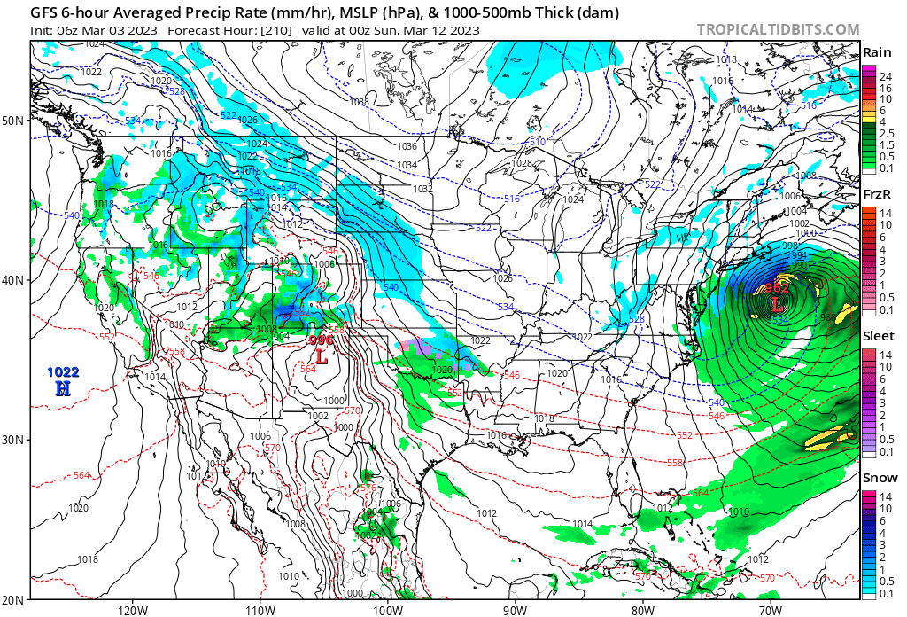
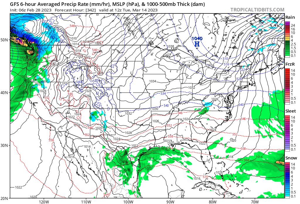
The last hurrah? Putting all the eggs in the Tuesday 3/14 basket
tiger_deF replied to Ginx snewx's topic in New England
Unfortunately (or fortunately) daylight savings time is done. We're not getting back the early European again. -
Here in Boston I'd be thrilled if we get over two inches of accumulation. This entire winter has had snow gone in a couple days thanks to back-end rain or sleet. I'm already onto the next system. If the EPS is any indication, this could be the strongest system since Jan 2022 of last year (with a 1993 or 1978 ceiling).
-
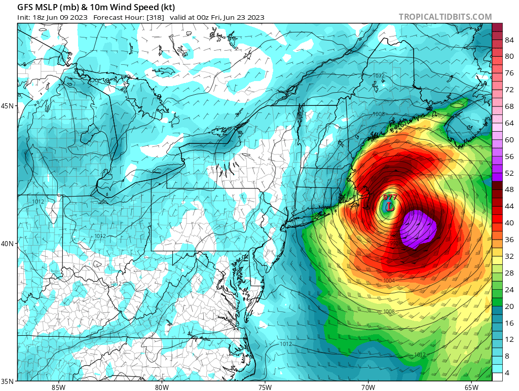
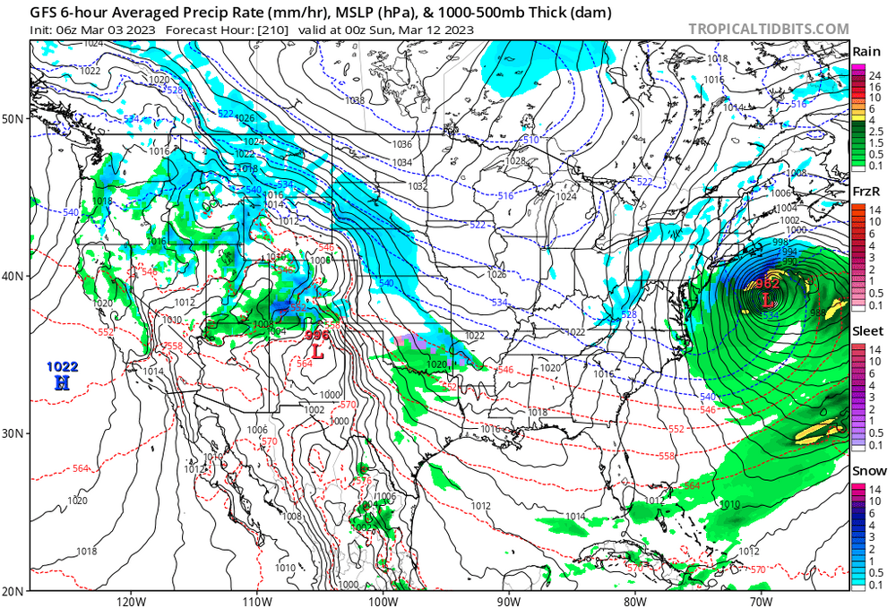
GFS has a system, just at a slightly later time frame and offshore. Regardless, there's huge potential with this pattern, and the models are clearly reflecting that
-
Long range GFS is showing a classic setup.

-
Julia | 85 mph 982 mb peak | EPAC Crossover #2
tiger_deF replied to Iceresistance's topic in Tropical Headquarters
- 133 replies
-
- 15
-

-

-

-
2022 Atlantic Hurricane season
tiger_deF replied to StormchaserChuck!'s topic in Tropical Headquarters
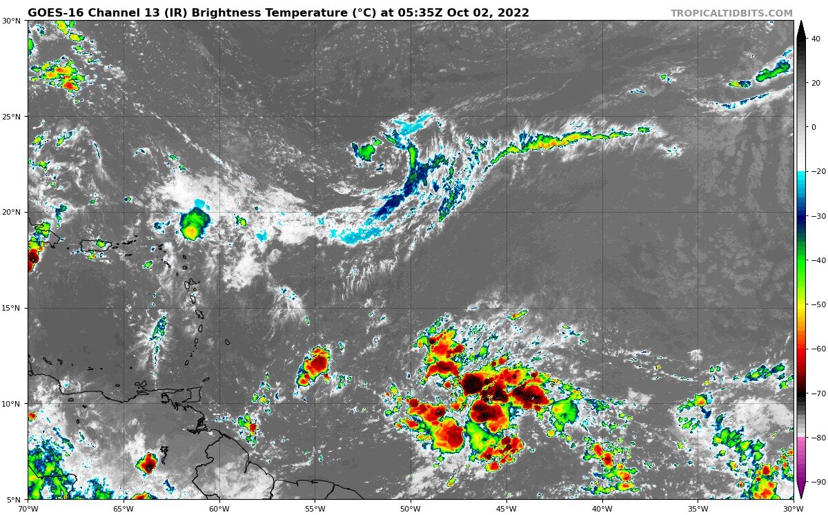
In the past day this wave has blossomed into one of the better looking ones this season, with lots of convection, a relatively moist environment, and growing vorticity. Early October can often signal an end to threats from the deep tropical Atlantic, but the delayed nature of this season could mean a later end to CV season as well. The UL to the left will provide some short-term barriers to intensification, but I would not be surprised to see a tropical system developing before it reaches the Caribbean.
-
Really serious situation with my extended family... last I heard from them 20 minutes ago the water was up to their necks in their house in the Royal Woods neighborhood of Ft. Myers, and they are too old and weak to swim for a higher building. How much more is the water expected to rise? The eye should be over them now based on radar, how long before Ft. Meyers gets the backside of the storm? If they have some time maybe they could float to somewhere more elevated... Any information would be really appreciated, I am extremely worried and my stepfather is in hysterics.
-
I have elderly family living in Fort Meyers near Estero that refused to evacuate... their house is only 1 story, and they've already lost power. Really hoping they come through ok...
-
Eye looks to be coming back out soon, the inner eyewall seems to have almost completely merged with the Northern eyewall
-
And both recon planes have turned around, with a single center pass to show for it...
-
18z ICON re-intensifies Ian into a major after leaving FL, and makes landfall in Charleston
-
This may be due to the recent hot towers popping in the eyewall, but the eye has clearly been contracting for the past several hours. Unless the inner eyewall dramatically weakens I think recon will find mid-cat 4 FL winds somewhere in the eyewall