cptcatz
-
Posts
1,109 -
Joined
-
Last visited
Content Type
Profiles
Blogs
Forums
American Weather
Media Demo
Store
Gallery
Everything posted by cptcatz
-
Euro showing another low rider heading into the Caribbean, I assume would be Vicky.
-
It looks like there's an area of convection out ahead of 95L around 50W. Any chance this can spin up?
-
What good is it when half the ensembles show a recurve in the middle of the Atlantic and half show a monster storm in the Caribbean heading to Florida?
-
6z GFS taking an Irma route across the Keys and up the west coast of Florida
-
Happy peak of hurricane season day to all!
-
Probably this one? Looks like a bad surge event for Tampa Bay...
-
Where are you seeing this? The GFS is loading super slow for me.
-
12z GFS with the dirty side of 959 mb Sally going into Tampa Bay...
-
This has been mentioned many times already but the problem was the crazy high pre- and mid-season forecasts hyping everyone up.
-
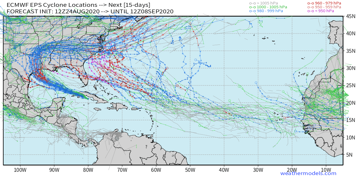
Euro goes crazy in the 12z run
-
Right, hence the "seeing a lot of signs", yet haven't seen much discussion about it here so I brought it up.
-
Still a long way away but I'm seeing a lot of signs for the next wave (would be Sally) to be a low rider and possibly make it across the Atlantic.
-
That wave south of Hispanola is the one that the GFS Para was calling to become a hurricane to slam into the northeast earlier this week but then backed off. It's got some spin to it already....
-
Euro shows two cyclones in the Atlantic
-
Models are finally agreeing on a big uptick of MDR activity in about 8-10 days from now.
-
Well... the group of us will watch
-
But with CSU's forecast of 24/12/5, we have a LONG way to go if that's gonna verify. Do you think we will still see 11/8/4 over the rest of the season?
-
Yeah that's quite a monster
-
This Euro storm appears to be the same one the GFS has in the above post. Definitely now one to watch. Looks like it should be coming off Africa sometime this weekend.
-
Laura really makes a great case showing why we can't trust the models 5+ days out. These were the GFS and Euro runs from this past Friday, exactly 5 days ago, valid today:
-
Last two GFS runs show a long tracking MDR storm reaching the western Atlantic as a huge storm.
-
Last night's 00z Euro shows a 1003 mb system in the Caribbean, today's 12z CMC shows a 1006 mb system near the Bahamas, the 12z ICON shows a 999 mb system near the Caribbean, and the 12z GFS shows an open wave. The global models have been terrible this year with cyclongenesis in the MDR, especially the GFS, so all of these models showing some sort of development of this wave seems like a pretty good indicator that it will develop. The 12z GFS and the past few Euro runs also show another wave developing behind this next one. Looks like this one should be pretty hefty coming off Africa. Don't forget the Euro showed run after run Laura falling apart in the Gulf...
-
But Florida is obviously still in play. Who would have thought Texas would be in play with Laura based on this run only 6 days ago?
-
I'd say Florida is well in play
-
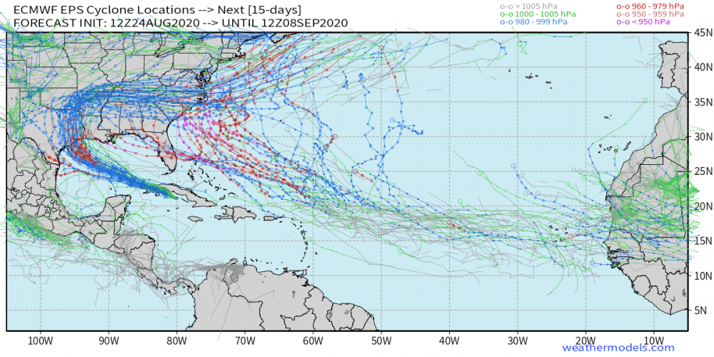
Euro showing possible Nana approaching the first week of September.