
Holston_River_Rambler
-
Posts
6,212 -
Joined
-
Last visited
Content Type
Profiles
Blogs
Forums
American Weather
Media Demo
Store
Gallery
Everything posted by Holston_River_Rambler
-

Fall/Winter Banter - Football, Basketball, Snowball?
Holston_River_Rambler replied to John1122's topic in Tennessee Valley
-
Fall/Winter 20-21 General Observations
Holston_River_Rambler replied to John1122's topic in Tennessee Valley
Chilly early Fall AM at Obed definitely saw some frost on the way there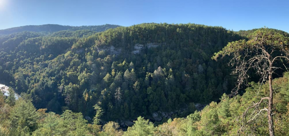
-
Fall/Winter 20-21 General Observations
Holston_River_Rambler replied to John1122's topic in Tennessee Valley
Some Wunderground stations reporting freezing or below up here on the plateau this AM. The closest one to me is at 39. -
Fall/Winter Banter - Football, Basketball, Snowball?
Holston_River_Rambler replied to John1122's topic in Tennessee Valley
Seen on MRX at 5 PM, 9/23/20 Getting twitchy enough to start looking at Hydrometeor classification. -
It completely died before it made it to my place in Morgan County; I didn't even see a drop of rain. Some nice wind gusts as what was left came through, but that was it.
-
-
This convective system looks pretty healthy to me, compared to the CAMs anyway: Good and sunny upstream too, between it and me, although beyond that I'm not too good at ready the mesoscale analysis pages for severe/ strong storm parameters. To me it looks like it will make a nice charge Paris -> Nashville -> Crossville -> Knoxville
-
Got some pea sized hail with this line as it is coming through Morgan County
-
That plateau one is about to hammer me. Looks like it was bowing out a bit the last few NEXRAD frames
-
Sorry the above should say glad there's **NOT** a ton of sunshine.
-
12z new HRRR4 or whatever it is now is throwing some sort (I say that because it has a little black swath overhead) of severe storm right over my head at 23 - 0z this evening. Also popping some CAPE and decent (300 -occasionally 400) helicity values in my neck of the woods. 14z old HRRR looks similar. Not sure it will make a difference, but glad there's a ton of sunshine in sight right now.
-
There's a storm in N AL that's looking healthy.
-
We hit about 30 and a couple of basil plants bit the dust, but surprisingly the tomatoes look good. This is the first year we've owned a house and this one came with a garden, so will be interested to see how all this does.
-
Yeah same here. Lucked out with some heavy rain to knock the pollen down though.
-
Thanks Jeff and Calderon for the replies. McMinn, sorry about the outbreak word, I was probably too loose with that as far off as things are now. It is 2020 after all though, so my mind just went to worst case right away, lol. Yeah, hopefully something kills this threat Sunday AM, no one needs power outages and other major infrastructure problems right now.
-
This Easter Sunday outbreak looks like it could be ugly to me on the Euro. I don't know very much about severe parameters or exactly how ugly, but as Webb's cyclone map that Windspeed posted says, one look at that is all I need. I am not a fan of storms moving SW -> NE with a strong upper low moving over the bootheel of Missouri, since that can send them right up the river valleys in East TN with a lot of shear. Most damaging storms I can remember have that motion. Looking at Pivotal soundings, still looks like most of the worst is S and SE of east TN, but all I'm going on is the "threat box" if that is what it is called, where it tells you the possible wx threats. Most soundings over middle E TN give a "Marginal Severe" result, with "Marginal Tornado" nearer Nashville, but near Chatt it is giving a tornado result, with storms moving up the TN river valley near the mts. Euro suggests that there could be a bigger line/ clusters of cells moving through first, and then more with a secondary line of discrete cells as the front moves through. What do y'all who know a lot more about severe weather think?
-
Morgan county sheriff is reporting that the NWS has confirmed an EF0 in western parts of the county. I'm guessing it was what was left of the same cell when it got here.
-
Yeah I woke up about 2 to some critter scratching in my attic and decided that maybe I should check out the radar. I saw what was going on just east of Nashville and then logged on here and saw what y'all were saying and tried to stay awake until it got closer, but fell asleep until 5 AM. By then the main storm had moved just north of me and the smaller ones were rolling through. Freaked my dogs out pretty good (and me until I saw that the worst on was east of me), but thankfully no major problems in my neighborhood this AM.
-
Def. looks like a healthy cell right now in S. Illinois
-
Overnight Euro OP looks pretty good for y'all in terms of its pattern. As is my custom, here is some random map that I don't quite understand, but since I'm still paying these people for access to their stuff, might as well use it for something.
-
You severe folks can correct me, but this looks to me like it has severe potential written all over it:
-
TN valley heavy rain/flooding week of whenever
Holston_River_Rambler replied to janetjanet998's topic in Tennessee Valley
Yeah I think I it’s just going to depend on where the firehouse sets up. It was showing 6+ in some places south and west. Not a guarantee, but I’d say there is a potential to overperform -
TN valley heavy rain/flooding week of whenever
Holston_River_Rambler replied to janetjanet998's topic in Tennessee Valley
EPS means of 7.5- 8 inches back in N Alabama: -
TN valley heavy rain/flooding week of whenever
Holston_River_Rambler replied to janetjanet998's topic in Tennessee Valley
Oliver Springs area: -
TN valley heavy rain/flooding week of whenever
Holston_River_Rambler replied to janetjanet998's topic in Tennessee Valley
wow. was wondering how things were down your way, looks like y'all still getting hammered