

HeadInTheClouds
-
Posts
1,691 -
Joined
-
Last visited
Content Type
Profiles
Blogs
Forums
American Weather
Media Demo
Store
Gallery
Everything posted by HeadInTheClouds
-
 25 with a mix of ZR and sleet. Very icy and about an inch of sleet. Schools closed.
 -
FWIW GFS was the only model to have me with ZR before midnight.
-
31 with ZR. Dropped 6 degrees in last hour. Starting to see some light icing on wires. This is earlier than expected.
-
I could see that. I just dropped to 33.
-
Down to 35.
-
Im just south of you in Hyde Park right near Vanderbilts and I'm at 37.
-
38 and rain in central Dutchess county after a high of 44.
-
Most models have me changing to ZR around midnight. The question up here is how much ZR and how much sleet. NWS still calling for around .25 of ZR and 1-2 inches of sleet/snow.
-
Just like a broken clock.
-
It was still a decent winter month and pretty damn cold. I had snow cover for most of the month even though I am one of the few who actually had below normal snowfall.
-
It was still a month of below normal temps and above normal snowfall for most of this forum.
-
Parts of Long Island had 2ft with the last storm.
-
That is all he's got because he is always wrong.
-
NWS Albany Ice and Snow forecasts. Most of frozen precip falls as sleet in MHV.
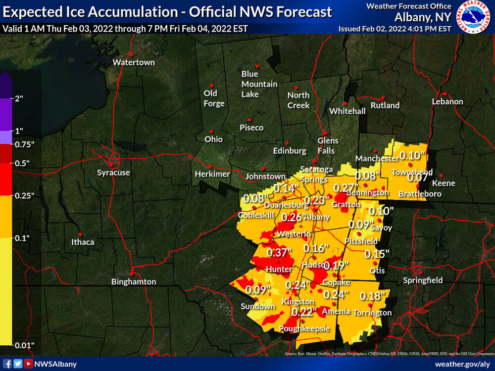
snow.thumb.jpg.0dce01ce17aa073e1d90d3d22e5d810b.jpg)
-
Don't underestimate .1 or .2 of ice. It could cause problems and you could fall on your ass.
-
General comments like this are ridiculous in this situation. It's says no to ice NYC metro and Long Island, its shows significant icing N and W of there.
-
Really tough forecast. NWS Albany isn't buying the .50+ ZR in my area and calling for about .20 ZR and 1-2 inches of sleet and then 1-3 of snow. We shall see.
-
Honestly it won't be in it's best range until 12z tomorrow at the earliest.
-
Nam is clueless. The wave is not going north of NYC.
-
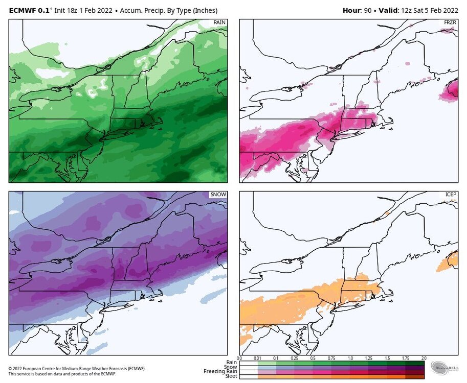
18z Euro precip panels
-
People make these blanket statements about how the area is going to get this or that but don't realize that people in this forum are separated by 100 miles or more. Some places on the Island picked up 2ft with the latest storm and I got 2-3 inches. The climo is vastly different from eastern Long Island to Mid Hudson Valley.
-
I looked at soundings. It's snow in my area from 12z on. They are available on TT.
-
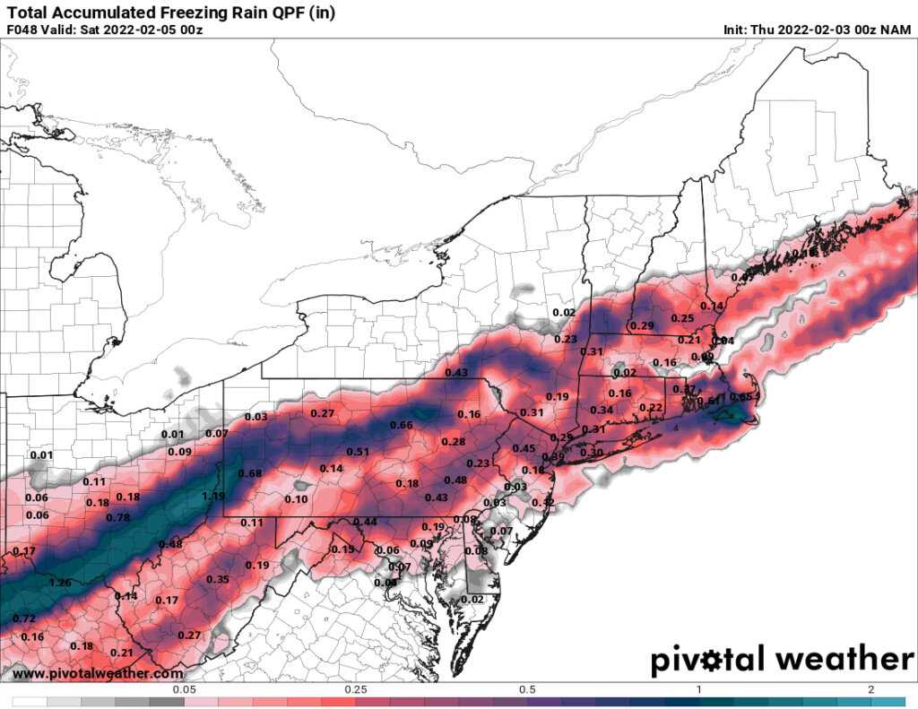
Not true. A lot of posters here live along or north of 84. My 850's get below 0 by 12z on the Euro with cold air continuing to push south and it gives me .35 of liquid after 12z. I'm not saying it's right but GFS and Ukie also show that possibility.
-
It certainly can wind up as some snow 50+ miles N and W. Ukie, GFS, and Euro all show that.


snow.jpg.4170ffb5c505b3adee493cb22e953eeb.jpg)
