OrdIowPitMsp
-
Posts
2,632 -
Joined
-
Last visited
Content Type
Profiles
Blogs
Forums
American Weather
Media Demo
Store
Gallery
Everything posted by OrdIowPitMsp
-
-

Winter 2022/23 Short/Medium Range Discussion
OrdIowPitMsp replied to Chicago Storm's topic in Lakes/Ohio Valley
At this point in the year we need to start stat padding to keep our snowpack from decaying. -
Minneapolis received 0.47” of precipitation today. Glad this one trending down.
-
Everyone smoke a bowl and calm down.
-
0.16” of ice accumulation was recorded at the airport in the heart of the metro. Wasn’t expecting anything.
-
Confirmed. Walked the dog, sidewalks are a skating rink and the trees have a light glaze. Edit: Airport temp dropped from 34 to 30. Didn’t think we’d get dynamic cooling.
-
Light rain and 33 degrees this morning, we might pick up a light glaze before the sun comes up. Gotta turn that fresh snow into new glacier to add to our existing one I guess.
-
I’ll take number 30
-
Whatever the models are showing knock 30-40% off the qpf.
-
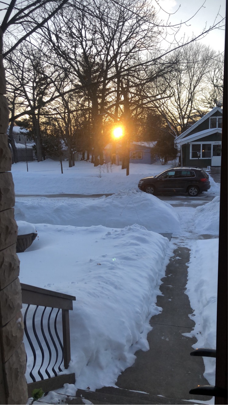
Solid front door sunset.

-
Winter 2022/23 Short/Medium Range Discussion
OrdIowPitMsp replied to Chicago Storm's topic in Lakes/Ohio Valley
Gonna be on the far NW side of a deep low in February and it’s still gonna rain. Weird year. -
0.3” of fluff overnight bringing the seasonal total to 71.0” with a low of 3 this morning.
-
I don’t know how much of an impact it has, or the validity, but I’ve heard urban areas create low level dry air and it take longer for storms to saturate the air column as a result. If that’s incorrect someone please correct me.
-
Upslope enhanced snowfall from north winds going up the Minnesota river valley bluffs?
-
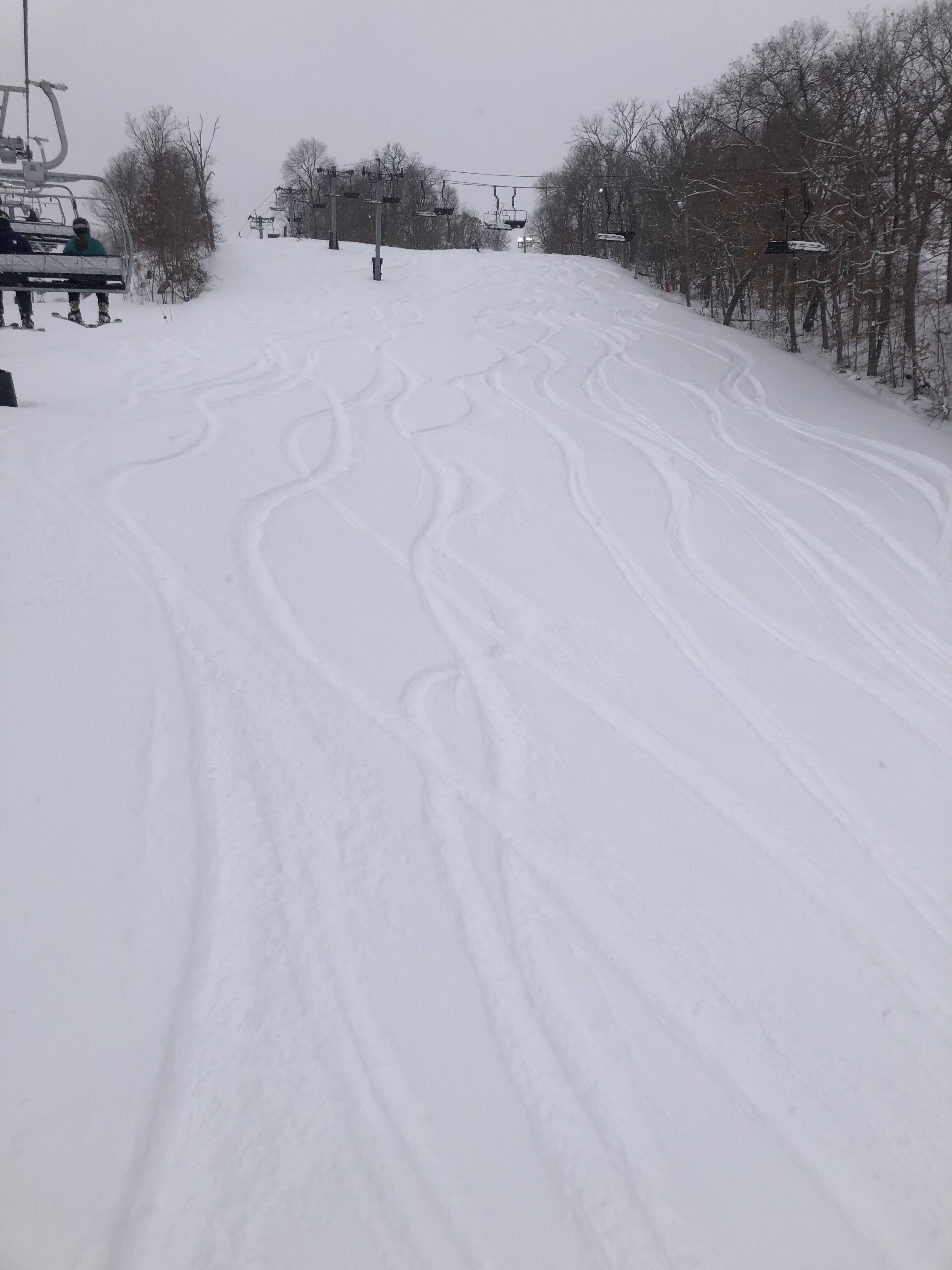
This is an A+ winter anyway you slice it.
-
Pretty broad area of 12”+
-
Thanks for the memory refresh. I remember now.
-
Whatever happened to Will in Calumet? Haven’t heard from him in awhile.
-
Low of -8 this morning. Radiational cooling ftw
-
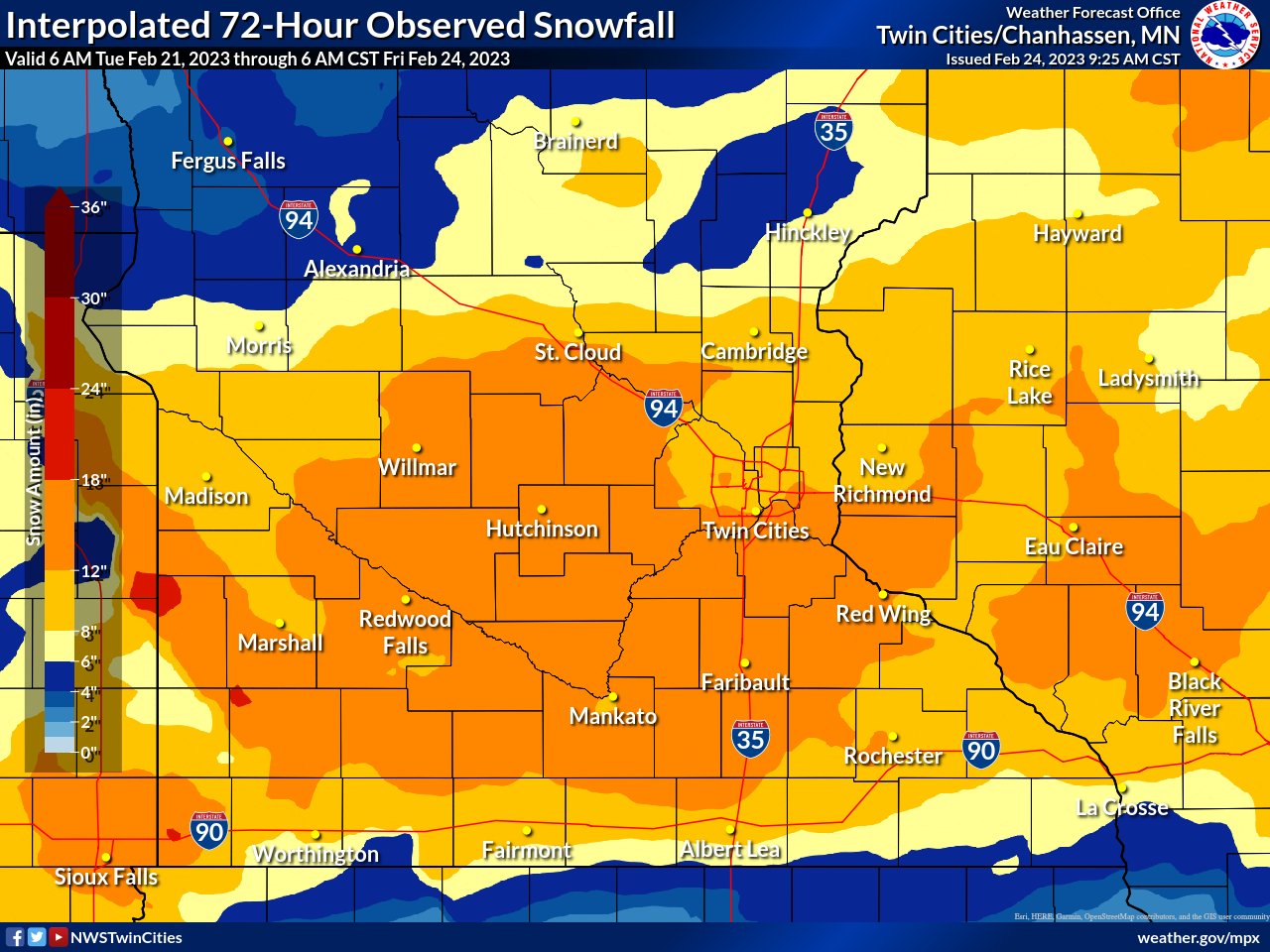
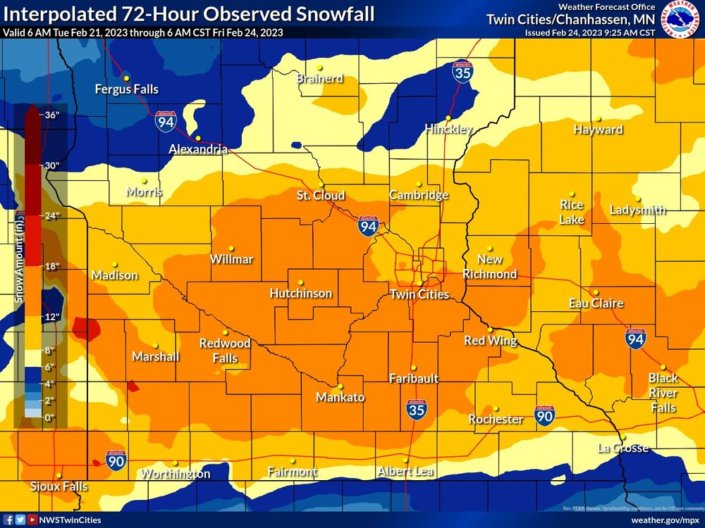
Second largest February storm ever at MSP. If that weenie band of 18-20” in the southern burbs was 10 miles north this would have been a top 5 snowfall all time. Given the full evolution of the storm, it’s was incredible to witness all major global model lock into a solution a week in advance that more or less verified.
-
After the latest storm, seasonal snowfall now stands at 70.4” in Minneapolis.
-

- 776 replies
-
- 12
-

-
There’s now several 18-19” reports and one 20” report. A NWS employee measured 17.5” at their home.
-
13.1” at MSP still ripping. 0.7” away from monthly single storm record.
-
Maybe it’s legit