OrdIowPitMsp
-
Posts
2,815 -
Joined
-
Last visited
Content Type
Profiles
Blogs
Forums
American Weather
Media Demo
Store
Gallery
Everything posted by OrdIowPitMsp
-

April 2023 General Discussion
OrdIowPitMsp replied to PositiveEPOEnjoyer's topic in Lakes/Ohio Valley
28 and snow squalling. We’d have a solid dusting of new snow but the wind is whipping it around. -
Spring 2023 Medium/Long Range Discussion
OrdIowPitMsp replied to Chicago Storm's topic in Lakes/Ohio Valley
I’ve done enough psychedelic drugs in my day to kill a horse but I’m pretty sure I’m not hallucinating and the calendar says April. -
April 2023 General Discussion
OrdIowPitMsp replied to PositiveEPOEnjoyer's topic in Lakes/Ohio Valley
To each their own. I love it. Long live king winter. 90 degrees with a dew point of 65 is utterly disgusting to me. -
April 2023 General Discussion
OrdIowPitMsp replied to PositiveEPOEnjoyer's topic in Lakes/Ohio Valley
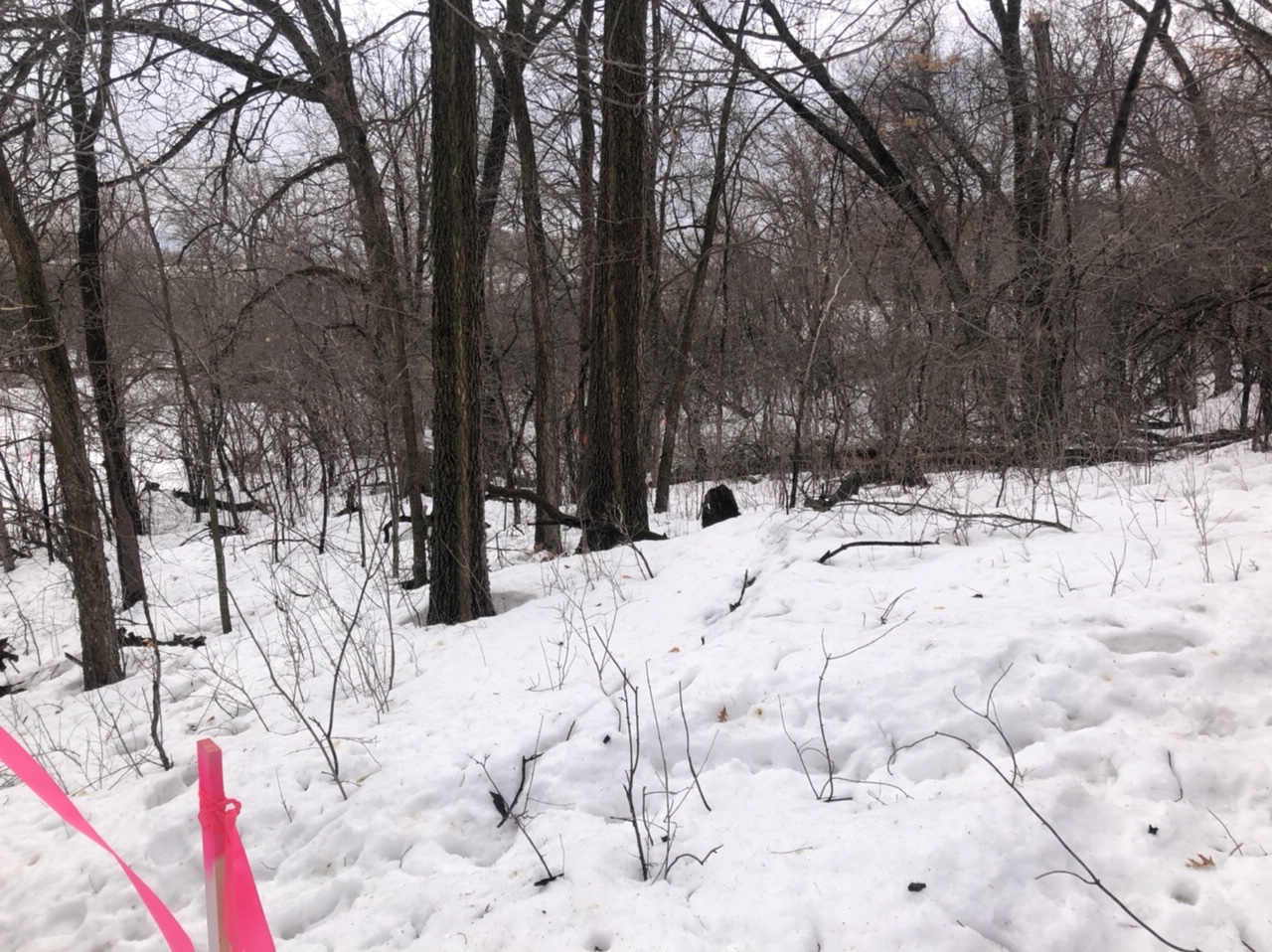
30 and spitting flurries. Winter is hanging on strong this year. I’m on a job site in the woods in Lakeville MN (southern suburb) and there’s still easily 12-20” of snow here.
-
Spring 2023 Medium/Long Range Discussion
OrdIowPitMsp replied to Chicago Storm's topic in Lakes/Ohio Valley
We’re gonna go from the first 50 of the year to the first 70 of the year in a 10 day span. -
Flipped to hail then rain here. Precip will be winding down shortly, we stayed frozen longer then anticipated. Northern suburbs might stay almost totally frozen. Didn’t even get a rumble of thunder….
-
Getting some snowflakes/sleet now
-
Probably will be too far north for severe and too far south for snow.
-
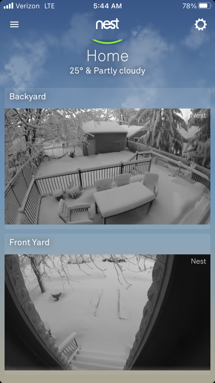
A+ Top 3 snowiest winter all time. Top 10 longest snow cover streak. Multiple 12”+ storms. 2nd wettest winter on record. This winter had it all besides deep prolonged cold. Plenty of below zero lows and a few highs below zero, but no noteworthy pioneer cold. My backyard is still completely snow covered and has been since midday on 11/29/22. The lake a few blocks from my house is still frozen over. Not sure I’ll experience a winter this relentless again ever.
-
April 2023 General Discussion
OrdIowPitMsp replied to PositiveEPOEnjoyer's topic in Lakes/Ohio Valley
Today was the first official high temperature of 50 or above at Minneapolis in 2023 with a high of 52. It’s only the 16th time on record Minneapolis failed to hit 50 degrees before April 1st. Today was also my 35th day on skis this season. -
April 2023 General Discussion
OrdIowPitMsp replied to PositiveEPOEnjoyer's topic in Lakes/Ohio Valley
It’s April 2nd, there’s 6-8” of rock hard snow otg, I enjoyed 10 days skiing out west in March including getting home from Sun Valley yesterday where it was non stop powder. I think I’ll go ski my local hill today for the closing party. -
April 2023 General Discussion
OrdIowPitMsp replied to PositiveEPOEnjoyer's topic in Lakes/Ohio Valley
It’s possible we make a push for the record but time is starting to come off the clock quickly. Of course April 14-16 2018 with nearly 16” of snow proved anything can happen this time of year. If we measured snow at the NWS site in the suburbs we’d already be there. Duluth has a very realistic shot with less then 10” to go and 4-6 more weeks of realistic time left. -
April 2023 General Discussion
OrdIowPitMsp replied to PositiveEPOEnjoyer's topic in Lakes/Ohio Valley
-
April 2023 General Discussion
OrdIowPitMsp replied to PositiveEPOEnjoyer's topic in Lakes/Ohio Valley
https://twitter.com/NWSTwinCities/status/1642153614226649089?s=20 Storm total of 8.5” -
April 2023 General Discussion
OrdIowPitMsp replied to PositiveEPOEnjoyer's topic in Lakes/Ohio Valley
To the residents of Minneapolis, April Fools! Signed, Mother Nature.
-
It’s been nonstop snowing since I got to Ketchum Idaho on Monday, I’m not exactly sure what I’m coming home to on Saturday. Anywhere from 2-12” from the looks of things.
-
Officially in the record books.
-
Cloud cover and fresh snow. Shouldn’t come as a surprise.
-
The streak is over. Meanwhile most of the metro still has 6”+ on the ground. Too bad it won’t matter in the record books.
-
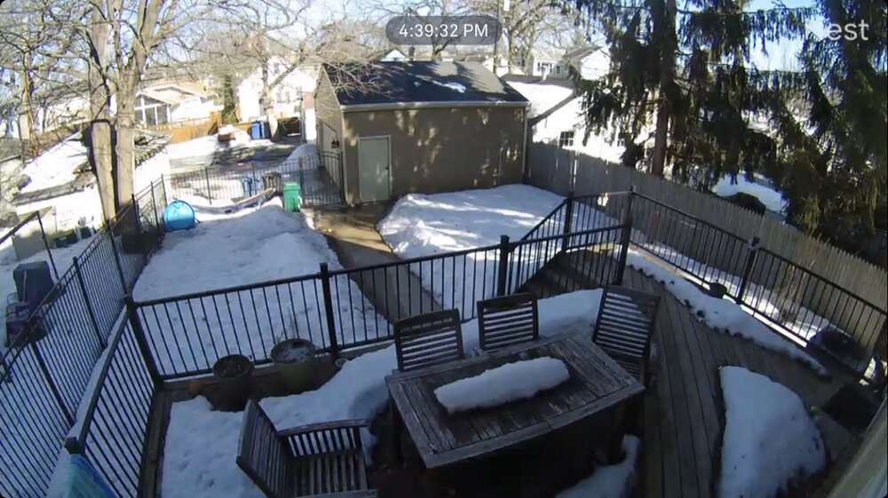
45 today. The warmest reading of the year for Minneapolis. Snow pack is barely hanging on, plenty of bare ground under trees and south facing. Of course shaded and north facing areas are still 8-12” deep and going nowhere fast.
-
Up to 43 today. It won’t be long now until the ground makes an appearance in spots.
-
They are writing news articles about the snow piles in the Twin Cities this year. The city of Bloomington dumps all its snow in a field by my office, I don’t think that will completely melt til mid May. https://www.cbsnews.com/amp/minnesota/news/massive-snow-pile-lovingly-named-mt-eden-prairie/
-
March 24-25 Palm Killer (Snow Event)
OrdIowPitMsp replied to hardypalmguy's topic in Lakes/Ohio Valley
With all this Florida talk I’m excited to say I’m going to Sun Valley Idaho next week for more skiing. This is a banter thread now. -
March 24-25 Palm Killer (Snow Event)
OrdIowPitMsp replied to hardypalmguy's topic in Lakes/Ohio Valley
Florida has a time and place, it’s for Disney and the 50+ crowd. Looks like a nice spring paste job coming for the Milwaukee palms. -
I’ve got a friend in Venice Beach CA trying to convince me to ski Mammoth with him on the 4th of July. They’ll be open