Hotair
-
Posts
548 -
Joined
-
Last visited
Content Type
Profiles
Blogs
Forums
American Weather
Media Demo
Store
Gallery
Everything posted by Hotair
-
Satellite presentation now looks much better organized. Idalia could easily set records for RI given the hot waters in its path
-
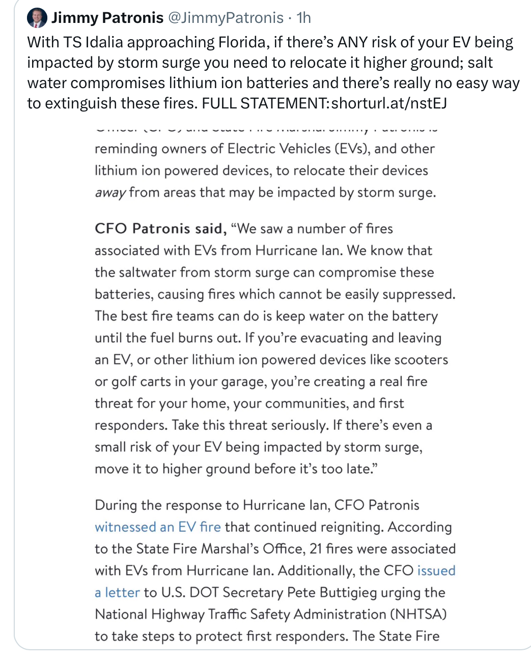
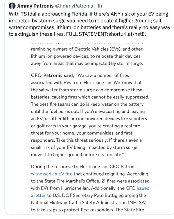
FL CFO reminds of the fire danger of leaving EVs at risk to storm surge. I just got back from my Clearwater beach condo and counted 7 teslas in the lower parking garage. I certainly hope they are moved by tomorrow. I almost wish they would all get towed if they haven’t been moved by 5 pm tomorrow
-
Nice simulation of Gulfport FL flooding due to expected storm surge from Idalia https://twitter.com/mikebettes/status/1696249278191083764?s=20
-
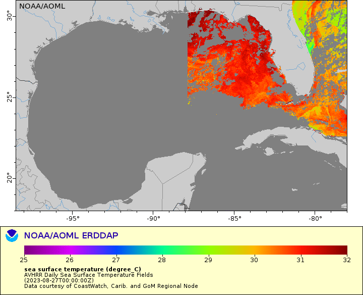
A glance at SST in the GoM shows nice 32+° water on the way to LF
-
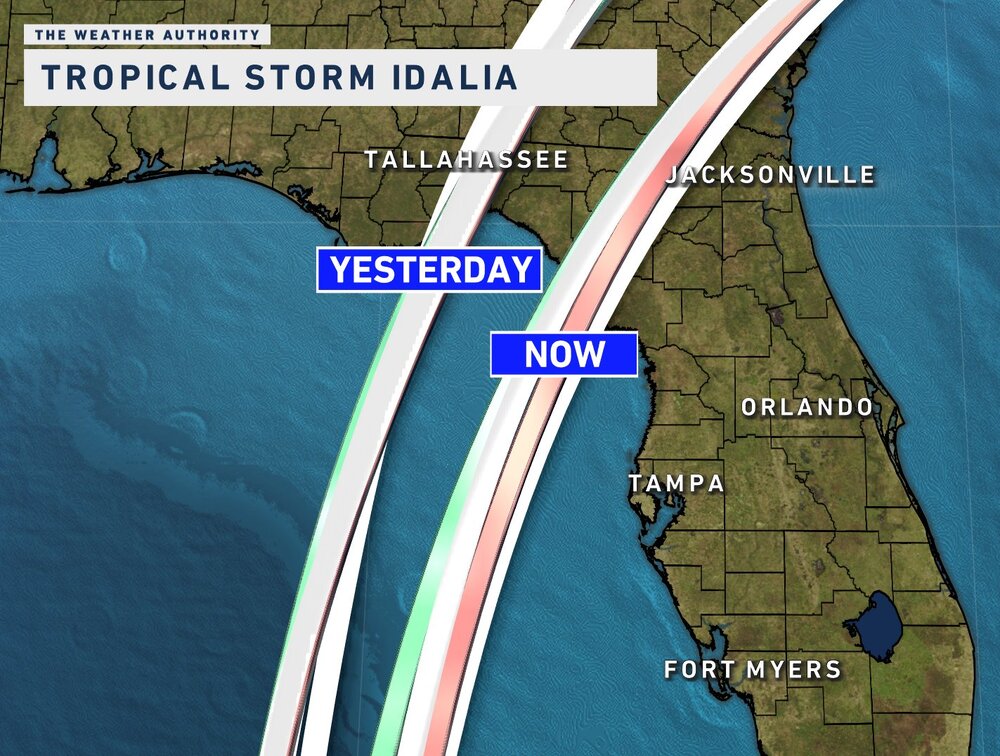
Is it just me or has the northward motion stalled a bit in the last hour or so?
-
Probably great for wind claims. Not so much for storm surge I don’t recall the last time we had 7 foot surge into the bay
-
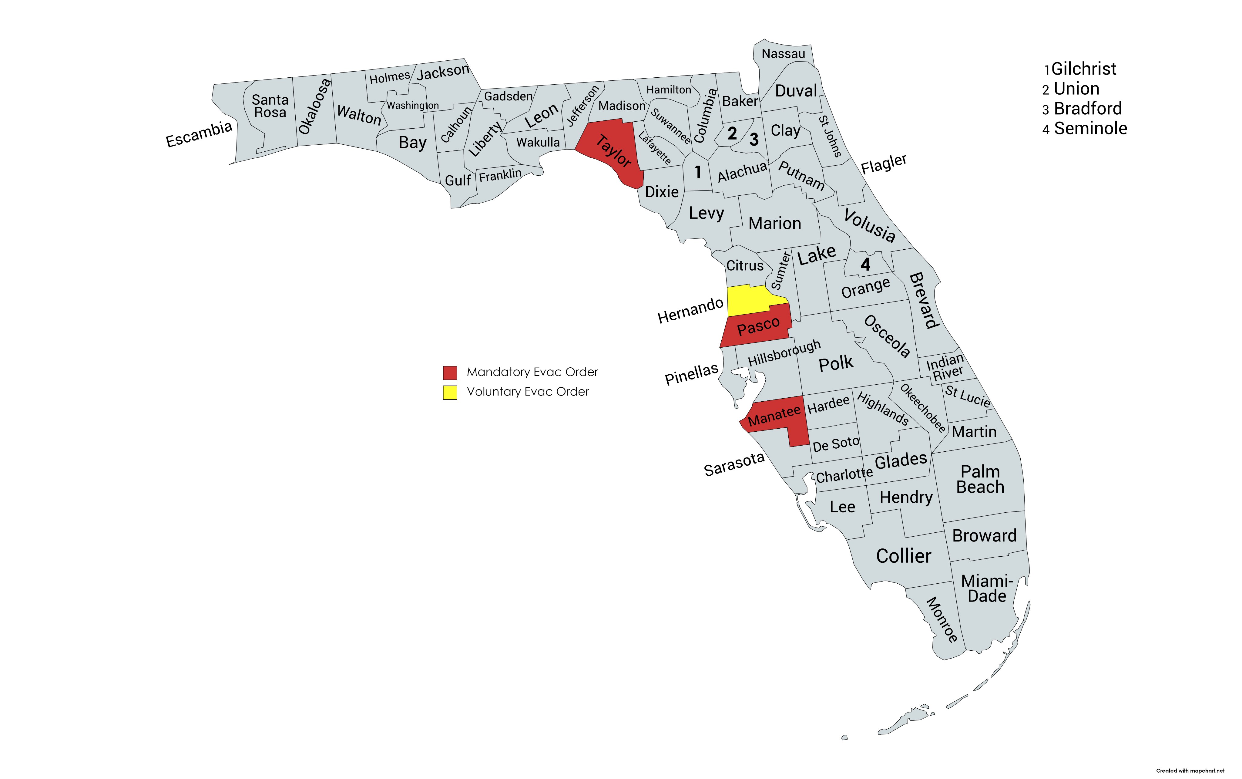
Evac orders at this time

-
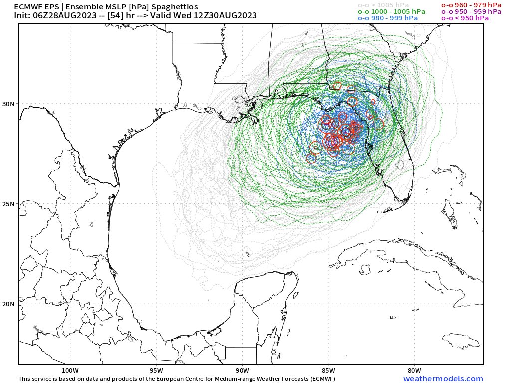
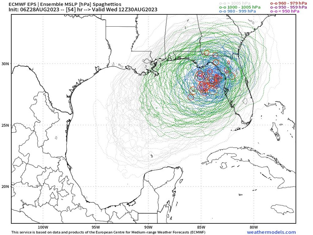
Euro ensembles from @HurricanesJames show tight overlap.
-
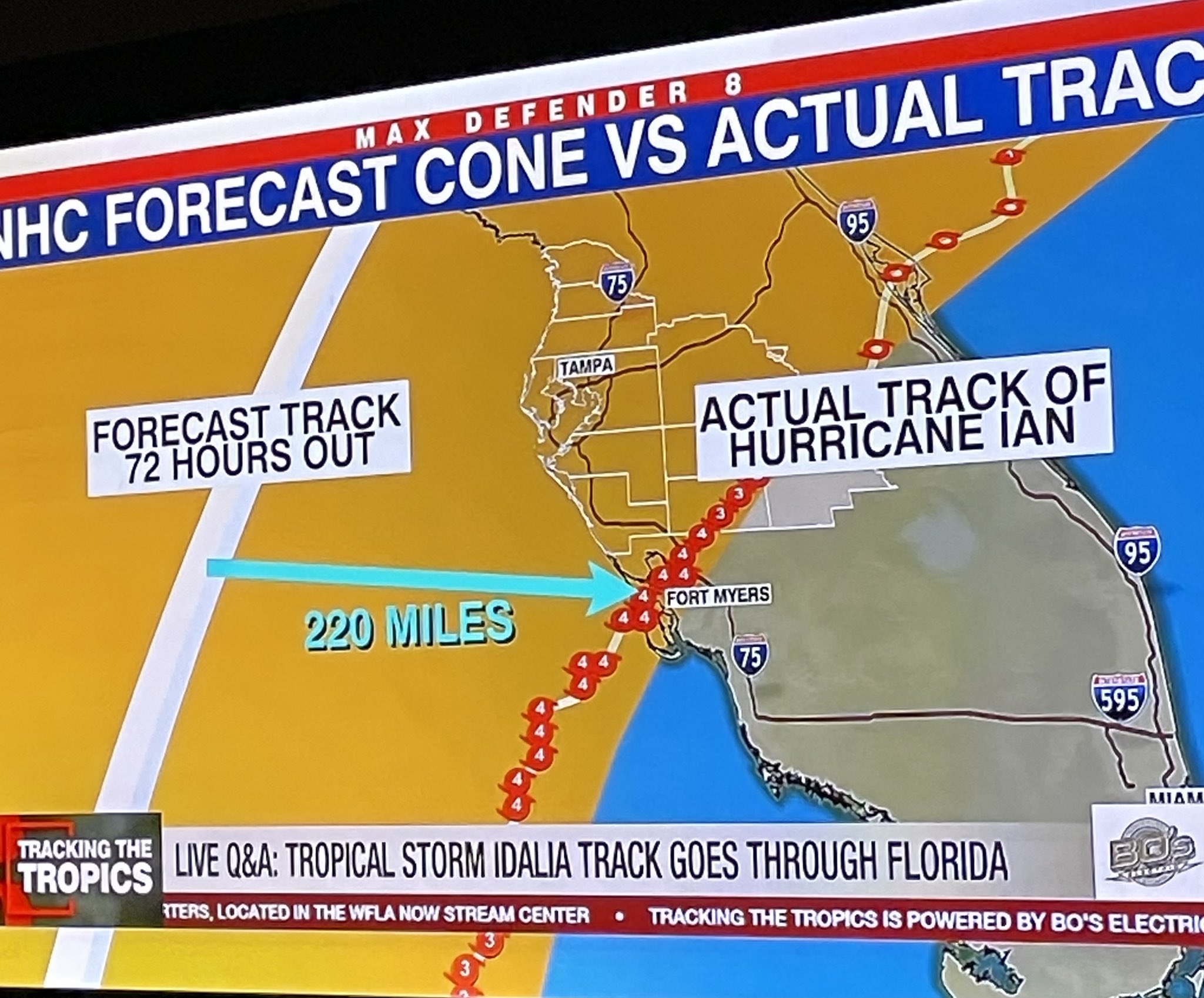
TV reminding folks how far Ian track was from actual LF 72 hours out. I do believe the steering patterns are a little better behaved this time given the multi model consensus, but no one inside the cone should let their guard down

-
NOAA3
-
Satellite is suggestive of Idalia forming an eye .
-
Uni of Florida should be preparing for a possible direct hit given this scenario
-
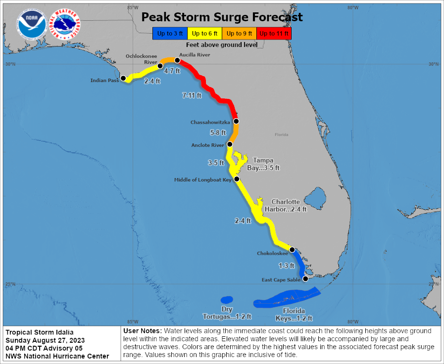
Storm surge would be disastrous for parts of St Pete and along the Tampa Bay region even if LF ends up being well North of us. 11 ft in the bend would literally bury many communities in water along the armpit
-
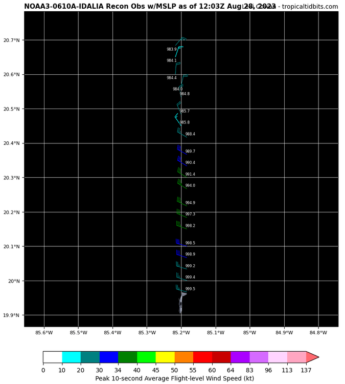
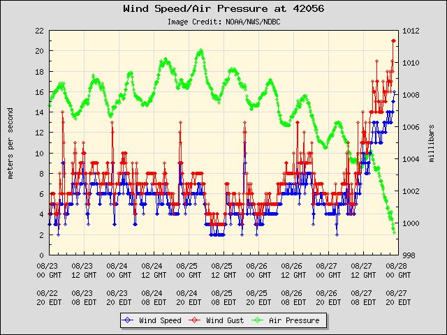
Buoy near Idalia showing rapid pressure drop. Storm could be intensifying rapidly
-
@tbrite89 just said the following: IF tropical storm (soon to be #hurricane #Idalia) were to achieve MH intensity and make landfall in the area between Apalachicola and Horseshoe Beach, FL…it will be the first known occurrence in recorded history (dating back to 1851). For the area between Horseshoe Beach and Cedar Key, it was 1896. For Cedar Key to Spring Hill, 1950. Spring Hill to Tampa, 1921.
-
Eric Webb @webberweather Fwiw, #Idalia's current analyzed minimum central pressure (SLP) on the latest NHC advisory is in the bottom 4% of all 35-40 knot tropical storms in this part of the Atlantic basin since 1970.
-
I’m very concerned over a potential Tampa LF. This storm is not on many folks radar and given it’s already late Sunday and folks go to school and work tomorrow means there’s less free time for any proper preparation
-
What the heck are fractional predictions ?
-
The cone on this one seems rather unusual to me. Do we get many storms in the gulf that transit North to South ?
-
stats for a named storm in June.
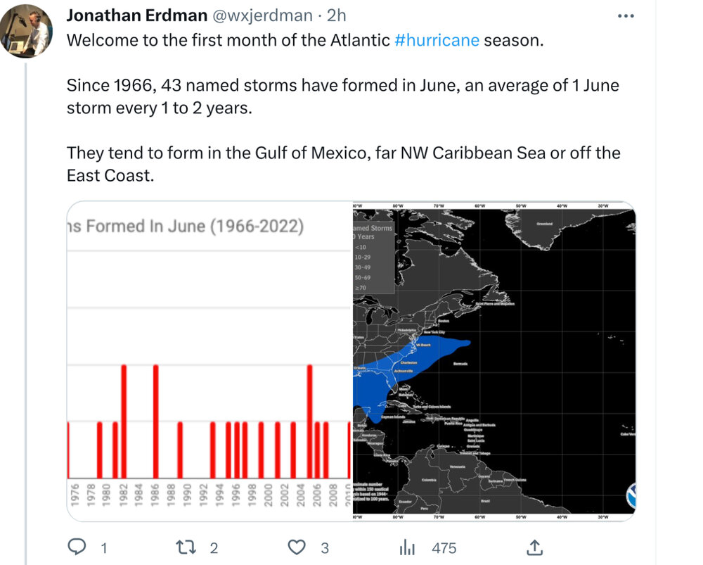
-
16/6/3
-
000 WTNT62 KNHC 091653 TCUAT2 Tropical Storm Nicole Tropical Cyclone Update NWS National Hurricane Center Miami FL AL172022 1155 AM EST Wed Nov 09 2022 ...NICOLE MAKES LANDFALL ON GREAT ABACO ISLAND... Weather radar data from the Bahamas and surface observations indicate that the center of Nicole has made landfall on Great Abaco Island in the northwestern Bahamas with an estimated intensity of 70 mph (110 km/h). A private weather station on Elbow Cay, just east of Great Abaco Island, reported a minimum pressure of 986.8 mb (29.14 inches) as the center passed near it. Data from an Air Force Reserve reconnaissance aircraft indicate that the estimated minimum pressure is 985 mb (29.09 inches). SUMMARY OF 1155 AM EST...1655 UTC...INFORMATION --------------------------------------------------- LOCATION...26.5N 77.1W ABOUT 0 MI...0 KM N OF MARSH HARBOR GREAT ABACO ISLAND ABOUT 185 MI...300 KM E OF WEST PALM BEACH FLORIDA MAXIMUM SUSTAINED WINDS...70 MPH...110 KM/H PRESENT MOVEMENT...W OR 265 DEGREES AT 12 MPH...19 KM/H MINIMUM CENTRAL PRESSURE...985 MB...29.09 INCHES $$ Forecaster Beven
-
Many friends and family in Ft lauderdale and North to West Palm Beach. Not a Single one is taking this storm seriously. Like zero. I hope it’s because they have extra supplies from Ian but I y family there boarded up for Ian and they are not planning to board up for this. Keeping it at TS intensity < 48 to landfall has a lot to do with the thinking that it won’t get dangerous in time
-
I had a good run. 2022 sure gave the models a run for their money.
-
Same here. Bummer. I had already spent my prize money for winning the forecast contest