Hotair
-
Posts
548 -
Joined
-
Last visited
Content Type
Profiles
Blogs
Forums
American Weather
Media Demo
Store
Gallery
Everything posted by Hotair
-
-
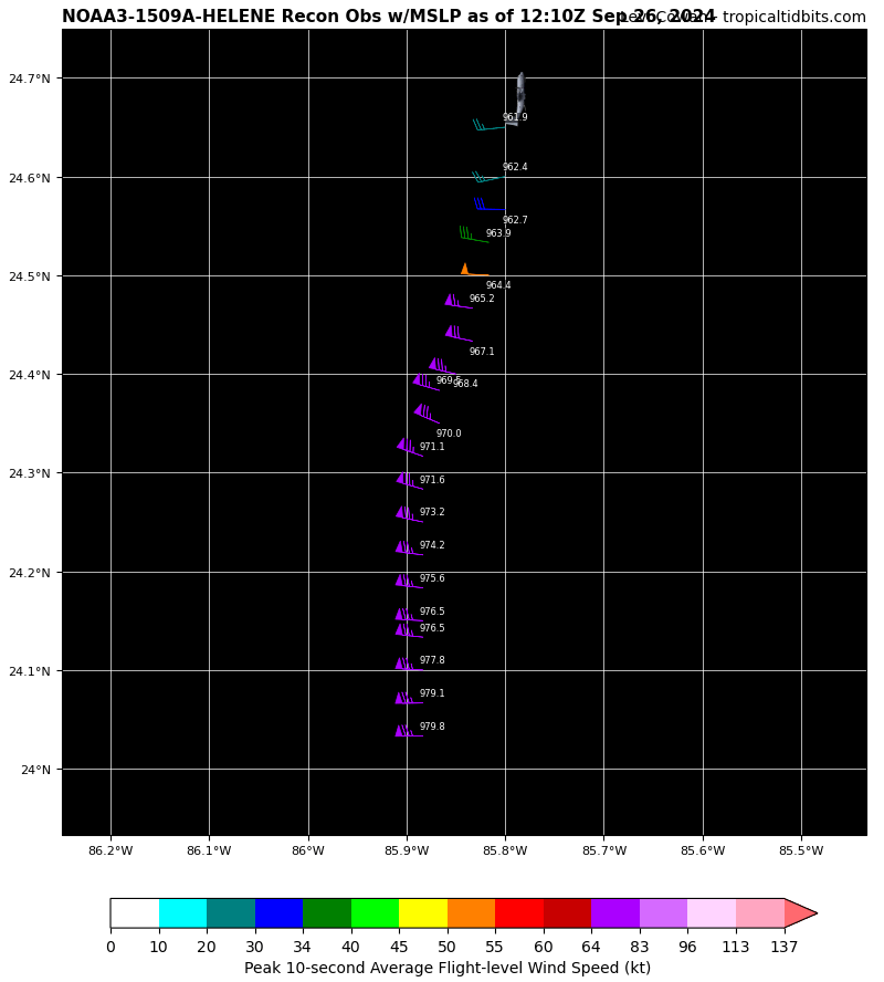
I thought it was 42036 but that one is coming up now. I haven’t been able to cross reference the image.
-
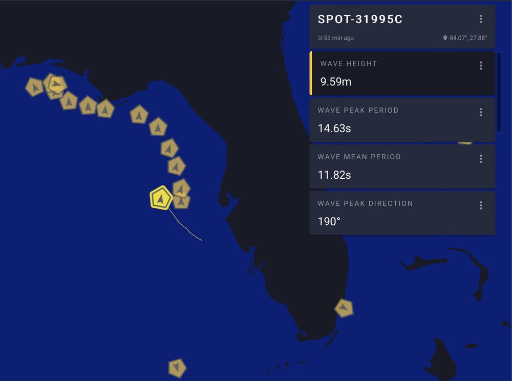
Buoy off Florida recording 31 foot waves near Helene
-
People leaving their cars to get bathed in salt water don’t seem so bright.
-
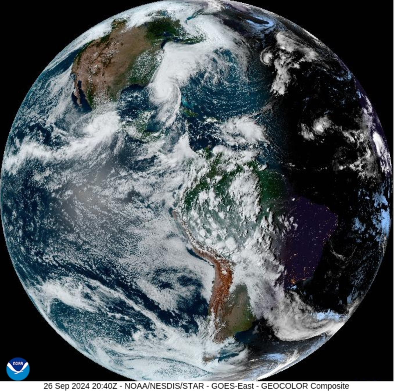
A Newly Released Image of Planet Earth Taken 30 Minutes Ago By the GOES-East Satellite. Helene can be seen

-
Howard Frankland bridge has been shut down connecting Tampa to Clearwater
-
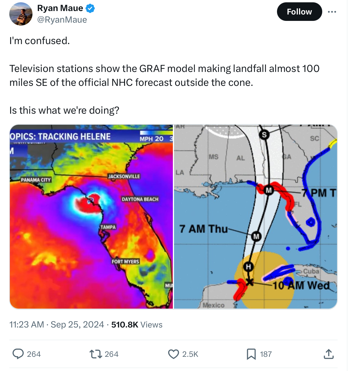
Has this GRAF model proved accurate previously ? My kids are in Gainesville and this would be catastrophic for the area there.

-
Some structural damage being reported in Cape Coral área now. Possible tornado activity
-
Jim Rosica @JimRosicaFL Now it's official -- All @WaffleHouse locations in Tallahassee and Crawfordville closing as Helene approaches https://tallahassee.com/story/news/hurricane/2024/09/26/first-waffle-house-in-tallahassee-closes-before-hurricane-helene/75392750007/ via @TDOnline
-
Sunshine Skyway bridge now closed.
-

-
-
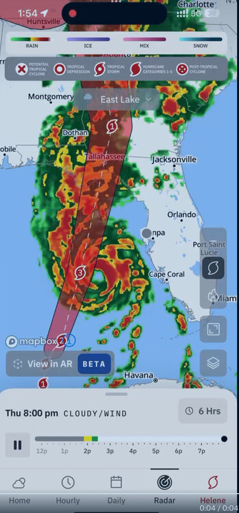
Update from GRAF model
-
The IBM GRAF model has this storm headed on a more easterly track and making landfall towards the direction of Gainesville!
-
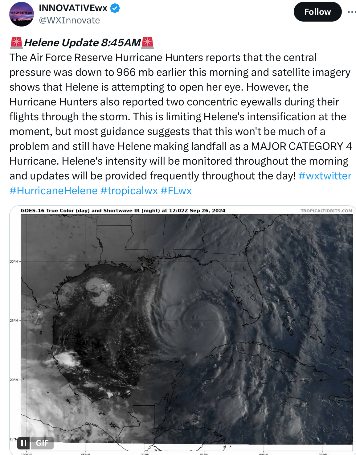
Starting to cook now

-
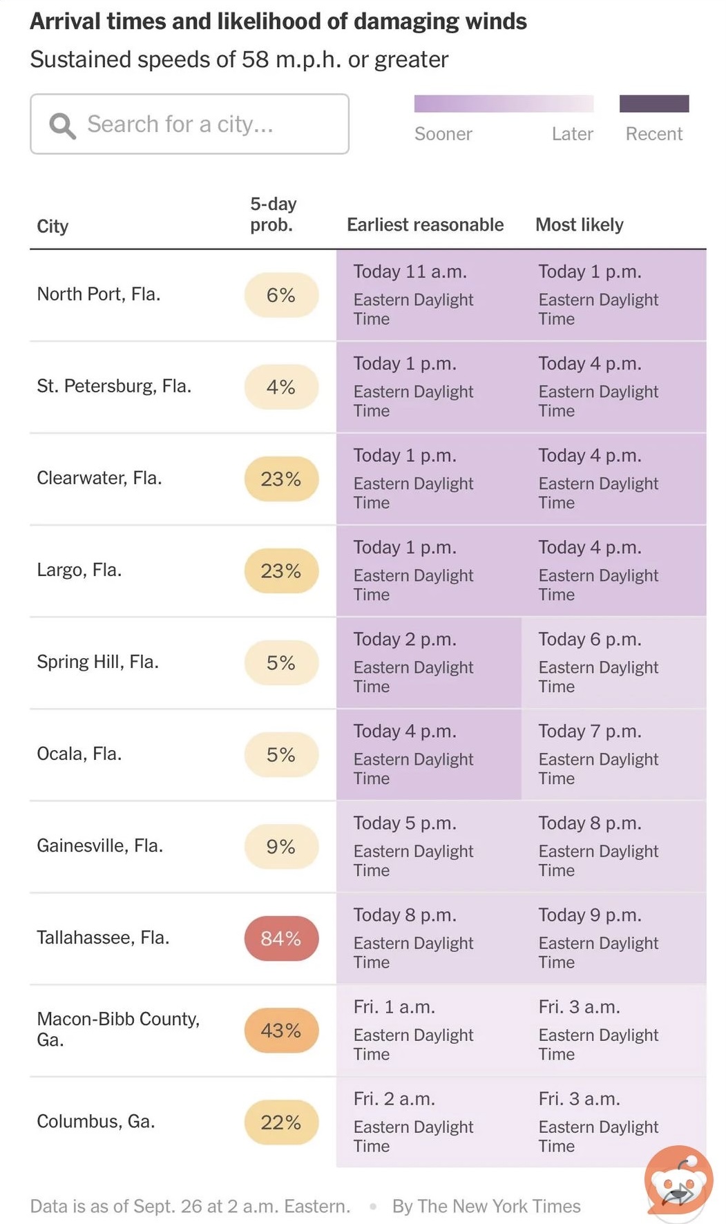
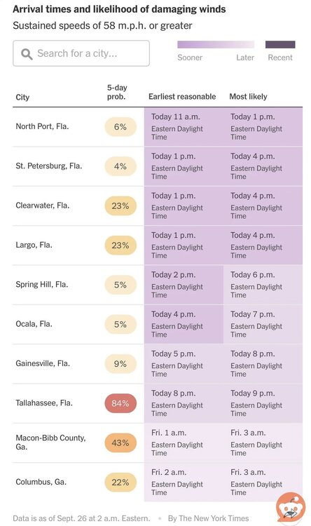
Graphic from NYT showing probabilities of damaging winds for different regions. Concerned this will downplay dangers as you often have damaging tornado events well outside the forecast track
-
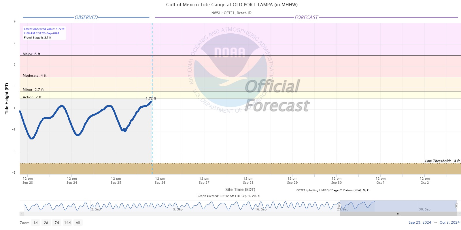
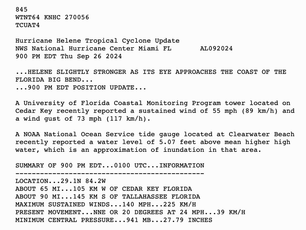
Tide around Tampa beginning to show effects of storm

-
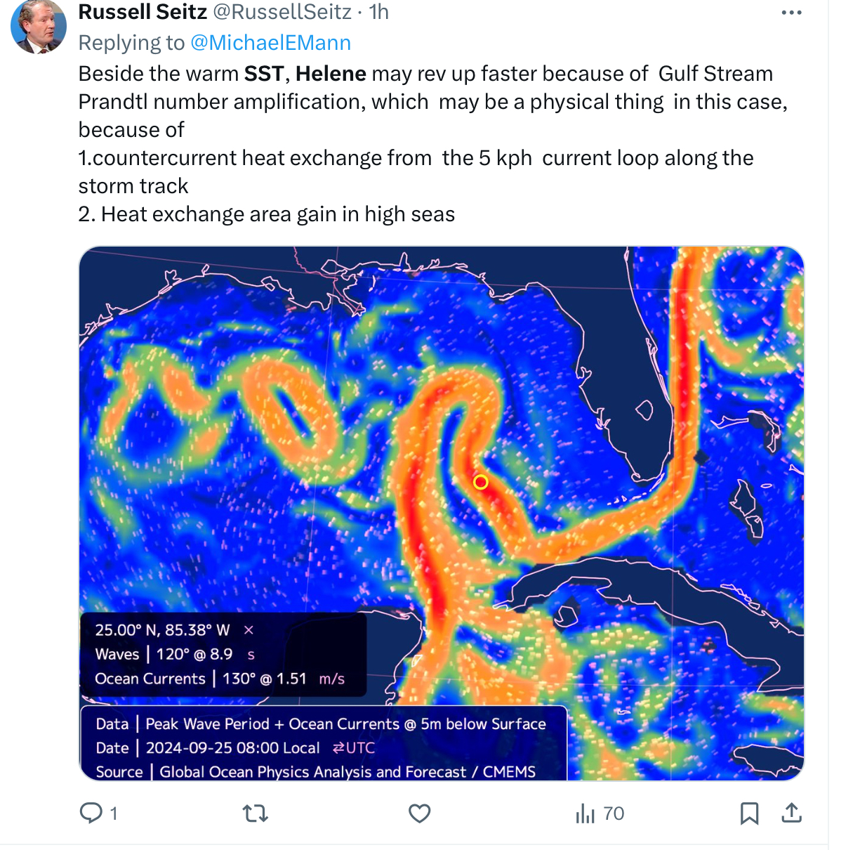
Given all possible outcomes, Helene’s forecasted high forward speed and track into the armpit is possibly the best anyone here in the west coast Florida could have hoped for. Hoping the next recon flights keep it pointed that way
-
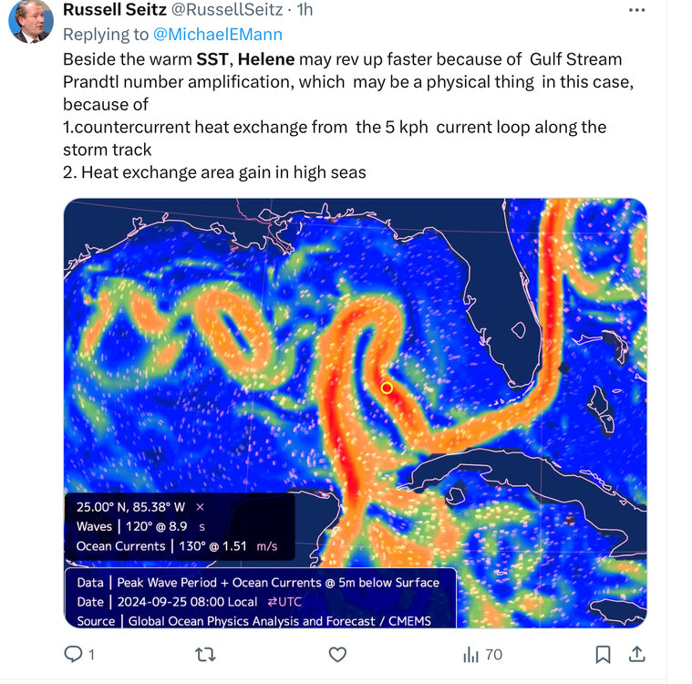
First I hear of this term “Prandtl number amplification” Is this founded on solid science? If so, is it already baked In into the mainstream models ?
-
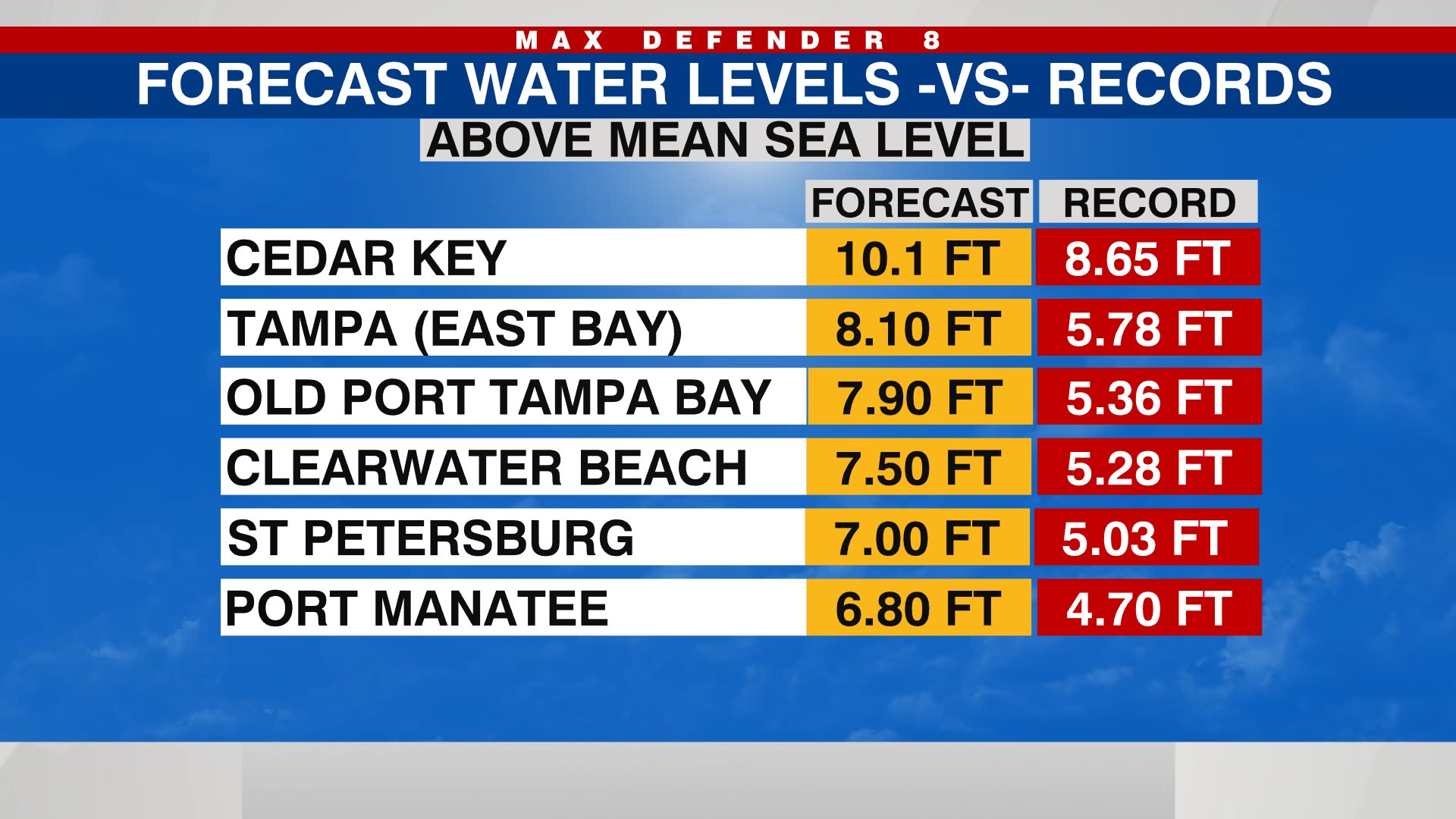
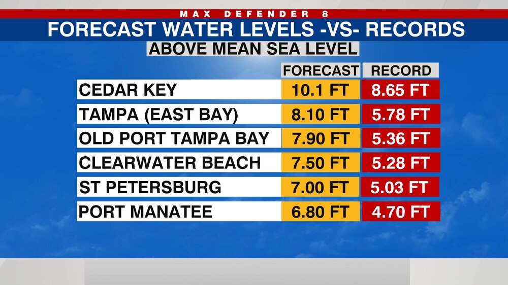
Tampa and neighboring areas have a real strong chance of breaking all-time storm surge records during this storm. Forecasts are +/- 2 ft
-
True
-
Wow I looked it up. 7 to 200 ft ASL. Learn something new everyday. Thought all of Florida was pretty much at sea level.
-
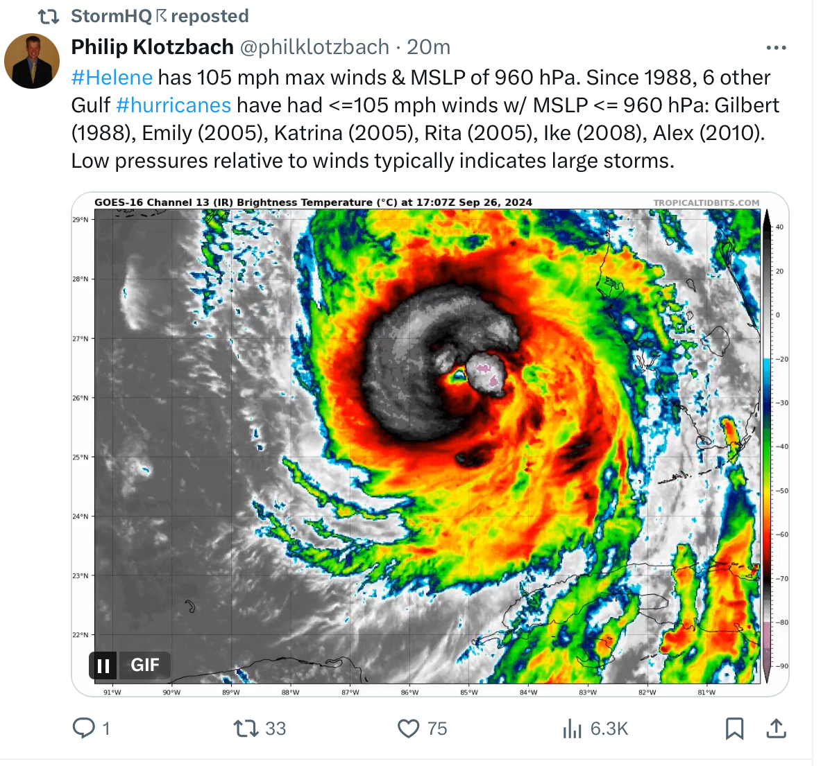
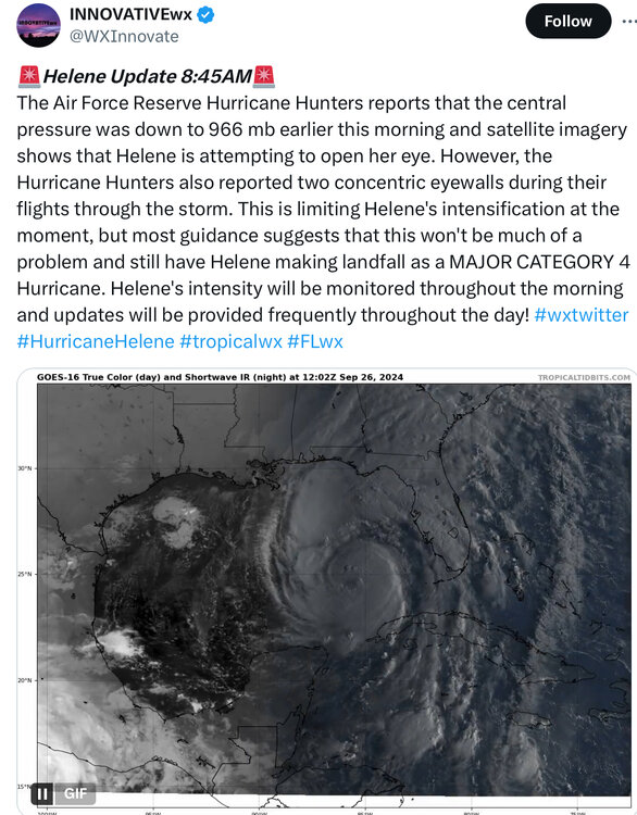
If Helene makes landfall as a Cat 4 as some anticipate it will be the 5th consecutive year we get a major cane striking the US
-
From an impact perspective would a more Easterly track away from Tally cause less storm surge issues for folks there? As the wind field would be predominantly pushing out to sea?
-
Very windy and drenching rain in Tampa now. Soil is going to be saturated soon not good