

NeffsvilleWx
-
Posts
6,908 -
Joined
-
Last visited
About NeffsvilleWx

Recent Profile Visitors
3,127 profile views

.thumb.jpg.a628c2147efdff1c820341d5143d9237.jpg)


-

2025 Atlantic Hurricane Season
NeffsvilleWx replied to BarryStantonGBP's topic in Tropical Headquarters
Dude….. chill. -
Title needs updated - down to 40% 7 day
-
oh no doubt. And our elected officials made it even harder for us to collect what we’ve paid for. Myriad problems without one easy solution.
-
2 miles from the coast, “lake” (drainage basin) in our backyard. so not really. Which is kind of what I was hinting at. There are underlying reasons why properties are more expensive to insure, and there SHOULD be — but that doesn’t really seem to be part of the conversation. What we’re seeing now is a reaction to climate change. Or more accurately, an industry updating its risk profiles near-real-time as the climate changes vs a regulatory body that doesn’t even want to acknowledge that climate change exists.
-
I'm paying about double here in FL compared to what I was paying for a home with half the value in PA. Same insurance company. Property taxes were higher in PA. And here, my assessed value is not going to change significantly until I sell the home thanks to homestead exemption.
-
Additionally, FMV of home is currently about $700k with assessed value of $550k. If insurance is so big of an issue for literally everyone in the state as the internet would have you believe, why is our insurance so cheap? (note: I'm not downplaying the insurance crisis in the state. I'm just trying to figure out why ours is so much cheaper than what's typically reported).
-
We're paying $2620.42 per year for almost $500k of coverage with State Farm, on a home with current market value of around $700k. Any thoughts about why we're paying so much less than what just about everyone "on the internet" says they pay?
-
Meanwhile, I'm paying $2500/yr for a home twice the size, 2 miles inland on the Space coast. Home build after 2000, wind mitigation discounts fully maximized, and not in a flood zone. That $2500 includes the flood insurance we carry just in case. There's a lot of nuance to Florida insurance that is often omitted from conversation. Location and age of structure are 2 of the big ones.
-
Northeastern-most TOR looks to pass about 10 miles west of me. think I could see it if I head over to the closest I-95 interchange as soon as the associated rain passes?
-
Anyone have any decent livestreams for landfall?
-
The Space Coast seems to be taking this much more seriously than they did Ian. Come to think of it, haven't heard much "muh hurr-i-can party WOOOOOOOOO" at all for this one.
-
Flight into ATL was surprisingly smooth. Thought for sure there’d be significant turbulence
-
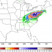
That’s not really attenuation. What’s happening is that the density of the precipitable water is such that the majority of the transmit pulse energy is returned to the transmitter at that point. The energy that DOES get through that first “wall” is too weak to reflect a signal back through it, so it appears like there’s nothing beyond those first returns. likely a hardware limitation if I had to guess. Though there might be a way with time domain reflectometry to recover some of that energy. Would be a cool grad student project.
-
Mentioned it a few pages ago in response to the flight path when people were speculating that they were just doing continuous fixes to find the center and it got deleted.


