

CheeselandSkies
-
Posts
3,246 -
Joined
-
Last visited
Content Type
Profiles
Blogs
Forums
American Weather
Media Demo
Store
Gallery
Posts posted by CheeselandSkies
-
-
We'll see how much action happens in this sub, GFS has consistently been very amped with the trough next Tuesday/Wednesday resulting in highly meridional 500mb flow. It has also been consistent with wanting to get the moist sector pretty far north yet showing large areas of it with nil SBCAPE.
-
 1
1
-
 1
1
-
-
Just had a brief but vigorous snow shower here. No accumulations that I can see but visibility was kind of dicey there for a minute. @madwx
-
1
-
-
30 minutes ago, michsnowfreak said:
individual pics


Pretty...in N/D/J/F. You can keep it.
-
1
-
 1
1
-
-
1 hour ago, Chicago Storm said:
I'd be hesitant to get too hyped about the Euro at this range. We've seen too many times where the first trough in a pattern change is the sacrifice for the greater good of later times.
I agree, but isn't that the system with the Day 4-5 outlooks currently for Friday/Saturday?
-
2 hours ago, SchaumburgStormer said:
zzzzz...
Lots of hype for a cold FROPA. Seasonal trend of over amped medium range signals shall not be denied.
Hope that doesn't extend to potential severe systems as well (mid-next week). Although, that trough as modeled ATTM (at least on the deterministic GFS and the one Euro run I looked at) is actually a little TOO amped for quality chase-type severe in this neck of the woods, so...

-
Also noting that the PDS tornado watch included southern Wisconsin, but as usual the state line acted like a brick wall for severe convection.
-
Low of 31 today, but the record for the day is 21 set only in 2018, so it has been worse and not all that long ago. That year is still the worst April in my adult memory (narrowly edging out 2014), but the fact that every one since seems to have tried to challenge it is not good.
-
1
-
-
6 hours ago, Hoosier said:
Tornadoes
Remember those were a thing in April in the Midwest?
I guess Rochelle wasn't that long ago...I try to block it out though since the atmosphere practically tried to gift-wrap it for me and I still managed to not catch it.
-
9 hours ago, Chicago Storm said:
I’ve been out in the Cedar Rapids/Iowa City area this weekend, and there’s still a lot of tree damage in CID even now 8 months after the derecho.
Driving through the neighborhood on the west side of downtown, you notice a relative minimum of trees left standing...and the ones that are still standing have significant damage. Still numerous piles of tree debris curbside on some streets. Came across a few buildings and houses that are still significantly damaged and have been untouched, and wooded areas (such as alongside 380) where it reminds me of a forest blow down.
.
Still boggles my mind that such a historically violent storm system took place with a.) almost no forecast lead time from the models/SPC, and b.) in such an overall down year for severe weather activity.
-
1
-
-
31 minutes ago, michsnowfreak said:
Last year southern WI just missed a few snows to their south and east in later April.
These are pics I took last April/May.

Dig that right photo.

-
2
-
-
25 minutes ago, TimB84 said:
I seem to remember just about every Memorial Day when I lived in Wisconsin, some news outlet or the NWS always documented the May 27-29, 1947 snowstorm that affected Wisconsin. Also, 4/12/07 and even 5/11/06 come to mind from when I lived up there (but I think the latter was just a dusting).
I seem to remember the May 2006 snow but I was in Green Bay for school then so it didn't seem as objectionable.
-
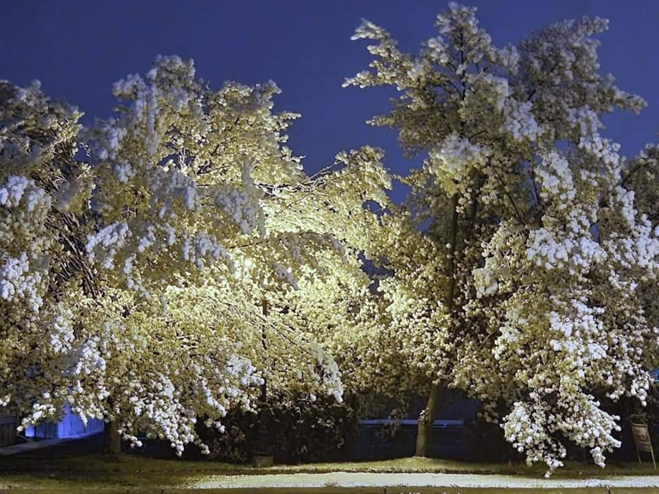
Snow patches remaining on the ground in southern Wisconsin on 4/20/18. It stayed so cold so long that year the greenup hadn't even started:

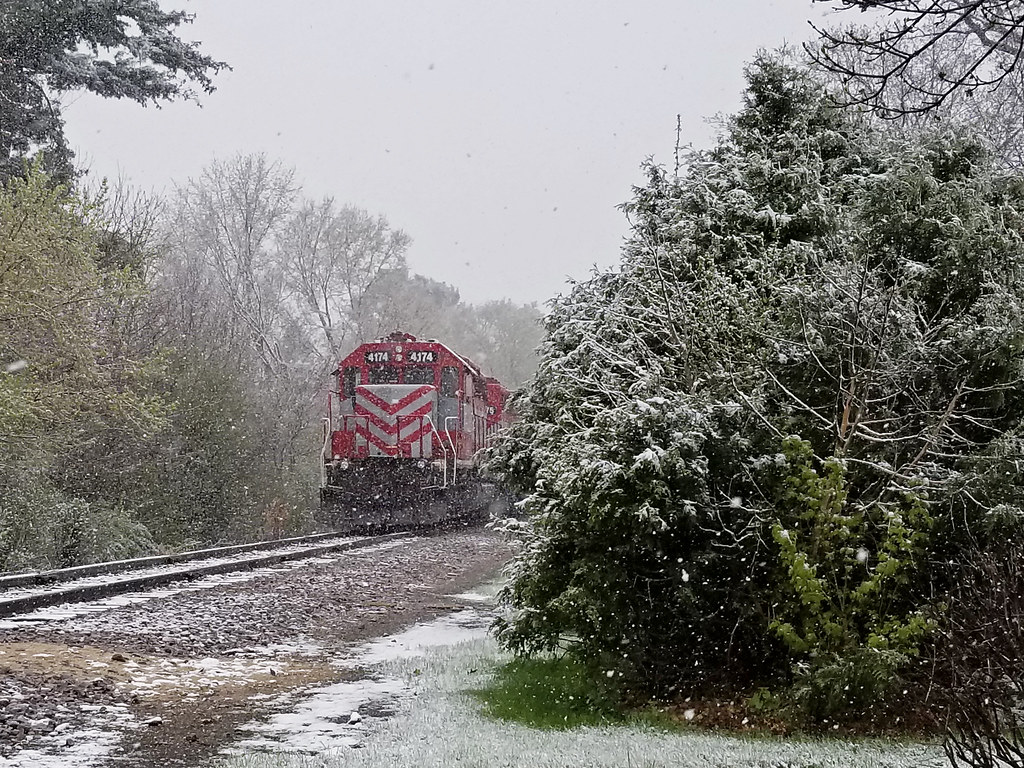
4/27/19 (coincidentally happened to catch the same locomotive)...greenup underway due to nice weather earlier in the month but then this:
Pretty sure it snowed in April last year, too, but it probably just p***ed me off too much to photograph and I wasn't going out anyway due to the COVID lockdown. Way too much of this **** lately.
-
2
-
1
-
-
14 minutes ago, NTXYankee said:
Pass as well. 4/20 should be a severe weather thread not snow potential.
100%
-
 1
1
-
-
@andyhb bringing some hope over on Stormtrack:
https://stormtrack.org/community/threads/state-of-the-chase-season-2021.31689/post-371308
-
1 hour ago, Witness Protection Program said:
I'm on a long term assignment in EF5land
Is that Moore, OK or Tanner, AL?
-
1 hour ago, TimB84 said:
How often in April do the SPC outlooks for both D3 and D4-8 show absolutely zero chance of severe anywhere in the CONUS? And not “predictability too low,” this is “potential too low.”
Depressingly common in recent years...May too.

-
14 minutes ago, Powerball said:
Dixie Alley has been getting all of the action (2 high risk events in a matter of days). It's been fairly quiet everywhere else (including Tornado Alley).
That said, at least here, we still got a few more weeks until the peak of severe weather season. And the peak for much of the Midwest isn't until mid/late June.
Need the MJO to wake things up again...and hope that whatever bizarre confluence of events that made the atmosphere forget it was May last year and in 2018 doesn't re-appear. Not to mention 2019's sequence which mostly failed to live up to its potential, but at least it was something.
Last few GFS runs have shown signs of life toward the end of the month but suggest it may be mostly Dixie again...some possibility the Southern Plains get in on the action per the current (14/06Z) run. Not prime time for us yet, but it shouldn't be this much of a nail-biter. As @beavis1729 likes to say about cold and snow in D/J/F, you shouldn't need a bunch of indices to line up just right for
 potential in A/M/J. You really need an absolutely hostile pattern to prevent it from happening...but amazingly it seems that's what we have been getting more often than not these past few years. It seems the only "season" that's really reliable anymore is hurricanes in A/S/O (except in 2013, lol).
-
1
-
-
-
1 hour ago, CheeselandSkies said:
It's only 300~ hours out...

Nice to at least see signs of potential life.
Of course, 12Z is back to

-
3
-
-
15 minutes ago, Malacka11 said:
I said it before months ago, and I'll say it again now:
I am a semi-elite runner. I know of at least two running buddies (both of whom are way, way, fitter than you think you are), both my age, who had Covid. The first is an idiot who got it at a party and was sick as hell for a week, and had lingering weakness for over a month. The other was also extremely sick for about two weeks and ended up with fears about heart problems, going back and forth to the hospital for various tests. He is just now, five months later, back to about the same fitness level he was at before.
I don't care who the hell you think you are, or what you think your statistical chances are of getting sick; if you're not afraid of contracting this disease, you're a certified, grade-A dumbass. If you're scared of the vaccine but not the disease itself, then you're even dumber.
I'm 35 (was 34 when I got COVID last August). It barely touched me, other than a nearly two-week long total loss of taste and smell. I've had bouts with the flu, even colds where I felt way worse, and for longer. Only really noticed the cough at night for about a week.
It put my fiancee, also 34 at the time (she's 4 months older than me) into the hospital for 4 days, although she never had any severe breathing problems she had extreme weakness/lethargy and wild blood pressure fluctuations. It also sent her into kidney failure and she is now on dialysis (granted, she had some preexisting conditions that predisposed her to kidney issues, but her function levels were holding their own before COVID).
My friend Dan, a year older and a heavier guy, was in a coma on a ventilator for almost two weeks, nearly died, and still deals with lingering shortness of breath and weakness. He got it early in the pandemic (late March of 2020) when hardly anything was known about COVID-19, let alone how to treat severe cases, so he was lucky to survive.
-
6
-
-
36 minutes ago, cstrunk said:
06z GFS is showing potential for the 4/23-4/28 timeframe.
It's only 300~ hours out...
Nice to at least see signs of potential life.
-
1
-
-
2 minutes ago, TexMexWx said:
Reports of 8 homes destroyed (manufactured/mobile homes?), 1 fatality, and multiple injuries from there

Yeah, I was just watching the aerial video on that linked from Talkweather. Based on the street he named and looking at Google Maps, it looks like it actually missed Palmetto proper to the south. There's a school, post office, two churches, and several businesses in addition to many more homes there.
-
9 hours ago, TexMexWx said:
Well, I noticed a lot of SVR watches over the 10% but a TOR watch just got issued for basically the 10% hatched area. Still also found the earlier watches a bit unusual, but given how I can really only recall one tornado actually confirmed at this point in time, I guess it was the correct decision overall. Hoping we don't have any strong tornadoes overnight given that the ingredients are still favorable over southern LA/MS where the new tornado watch just got issued, going until 7 AM.
LOL, they must have issued that right after I posted and went to bed. Sounds like there was a destructive tornado at Palmetto, LA although it doesn't show as a tornado on the SPC LSR page...yet.
-
Does anyone find odd the lack of any tornado watches covering a 10% hatched area on the convective outlook? Especially since they routinely issue red boxes for 5% contours.


Severe Weather April 27-28th 2021
in Central/Western States
Posted
Since I do not pay to access the EURO soundings on Pivotal, my analysis has been limited to the GFS which has been intent on showing a very deep trough with strongly meridional 500mb flow, and a more subdued ceiling for the event as a result. The Euro also appears to show a secondary surface low in SE NE with a warm front extending into Iowa (and the GFS, for all its flaws with the setup as portrayed, has been consistently showing some of the strongest warm sector instability over N IL/WI/MN/IA), so it could be a potential regional chase for me since I get out of work at noon Tuesday and have Wednesday off.