WesternFringe
-
Posts
1,131 -
Joined
-
Last visited
Content Type
Profiles
Blogs
Forums
American Weather
Media Demo
Store
Gallery
Everything posted by WesternFringe
-
Name checks out
-
Those will be the biggest runs of our lives!
-
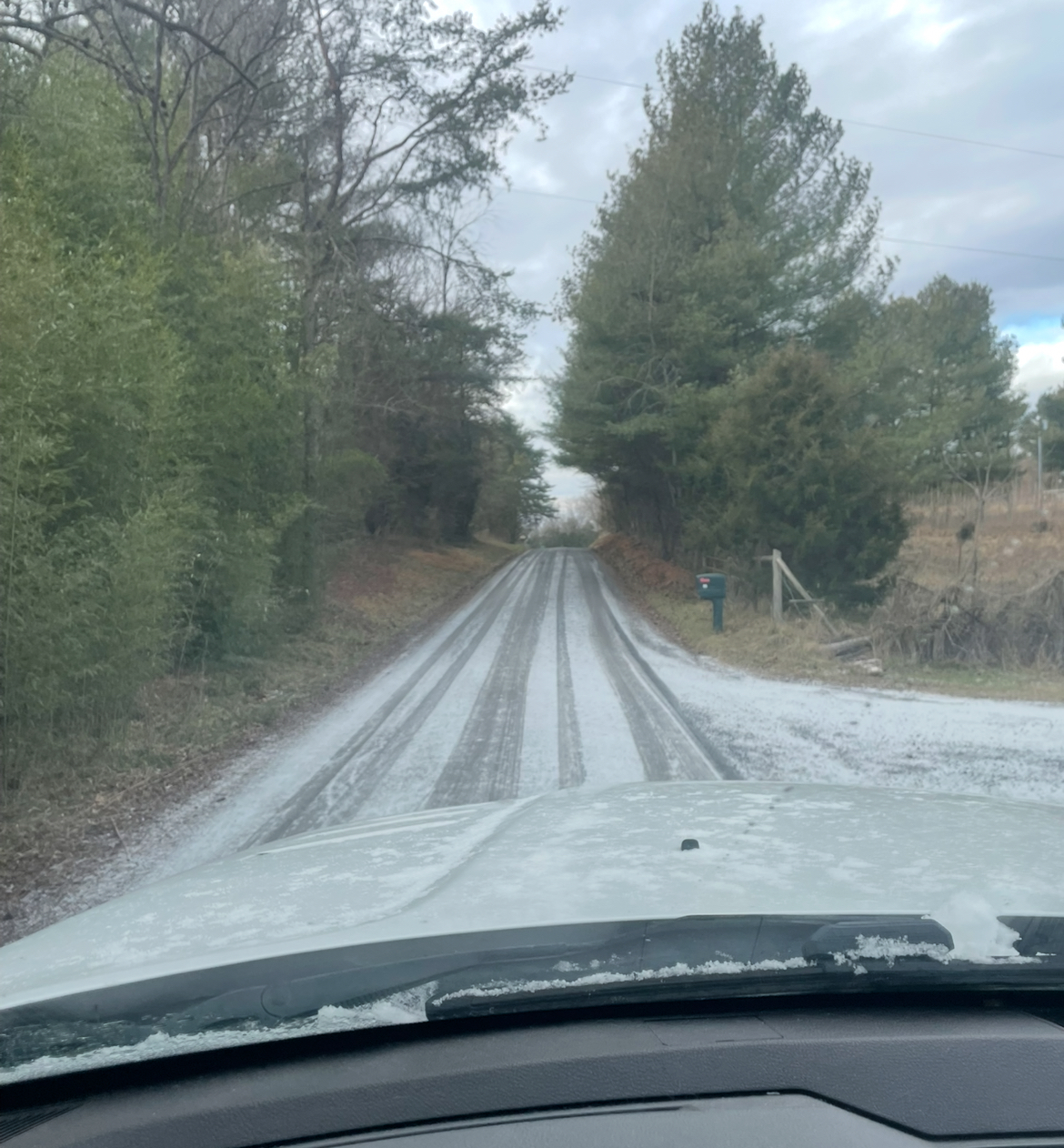
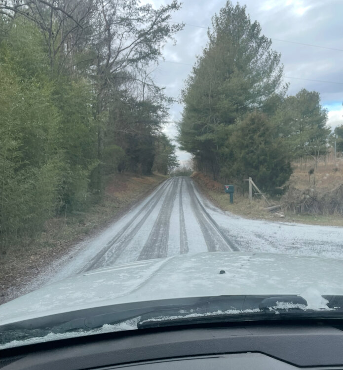
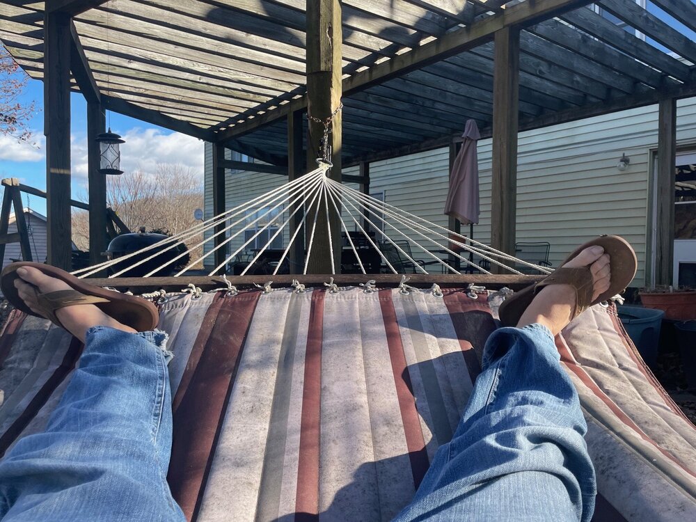
Had half snow and half graupel here this morning for about .25”. Made it pretty for a few hours before temps went above freezing. NW of Staunton in Augusta County.
-
You should ask Stormtracker if you should reschedule the appointment or not and what the weather is likely going to be that day.
-
Who cares about the 26th?
-
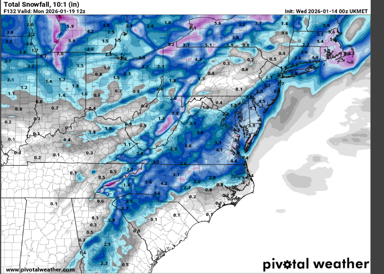
Yeah, if the inch the Euro depicts materializes in Augusta County it would be falling at just below freezing, only to melt within a couple hours.
-
I see accumulating snow in our subforum on the Euro, GFS, CMC, ICON, RGEM, NAM, etc and we are heading into peak climo with some nice teleconnections starting to line up in our favor. So yes, I don't think these are desperate times and I think saying so and/or cliff jumping is a silly weenie thing to do at this juncture. There is a panic thread for a reason, no?
-
Expect the weenies to keep coming when you say weenie things like this that are just a bit melodramatic imo (lol): Respectfully, we're all in for disappointment waiting for the lousy GFS to lead and score a coup with one of these. Desperate times.
-
0z vs 12 z
-
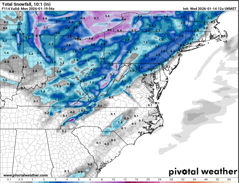
The Ukie (posted earlier) looked a lot like the 12z GFS

-
Why are we posting screenshots of weather apps (which no one does here) for locations outside our forum?
-
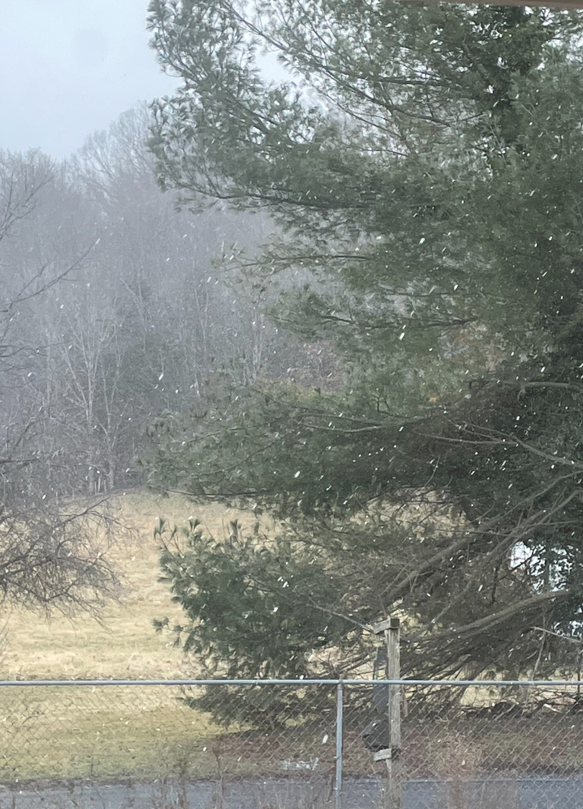
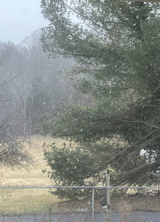
40° and windy with steady flurries here NW of Staunton in Augusta County.
-
Ignore him and please don’t stop doing that. The whole board would rather you post more and Ji post less.
-
Well, I live in the same county as you and we are getting poured on right now with forecasts for up to 2”, so hopefully today helps a bunch!
-
Week 4 to Week 5 surface temp anomaly maps are completely worthless, and they always have been.
-
Leaf blower maybe?
-
100%! Had snow this morning in Chincoteague where my wife and I were the last couple of days. Home now where it feels like 26° and the low last night was 18°.
-
The vast majority of roofs there are built very steeply for that reason. My uncle and aunt lived in the Buffalo area and we loved to visit them. I grew up north of Albany where we ‘only’ got 70” a year or so.
-
I grew up in Upstate NY. It never got boring for my snow lover friends or for me and my family.
-
This weather sucks…
-
But I thought doom memes of Santa with fire meant Christmas was certain to be super warm for all?
-
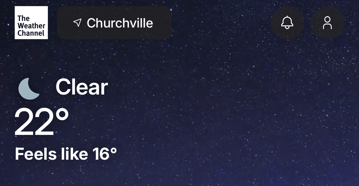
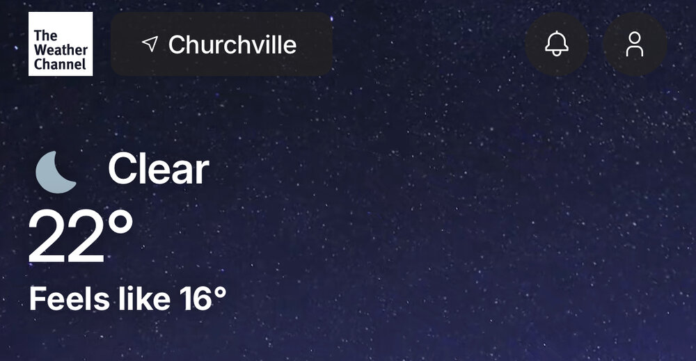
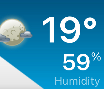
It is cold. First is weather channel. Second is the temp live from my heat pump.
-
-4 windchill here right now!

-

12/12: The little Friday clipper that could? Or won't.
WesternFringe replied to dailylurker's topic in Mid Atlantic
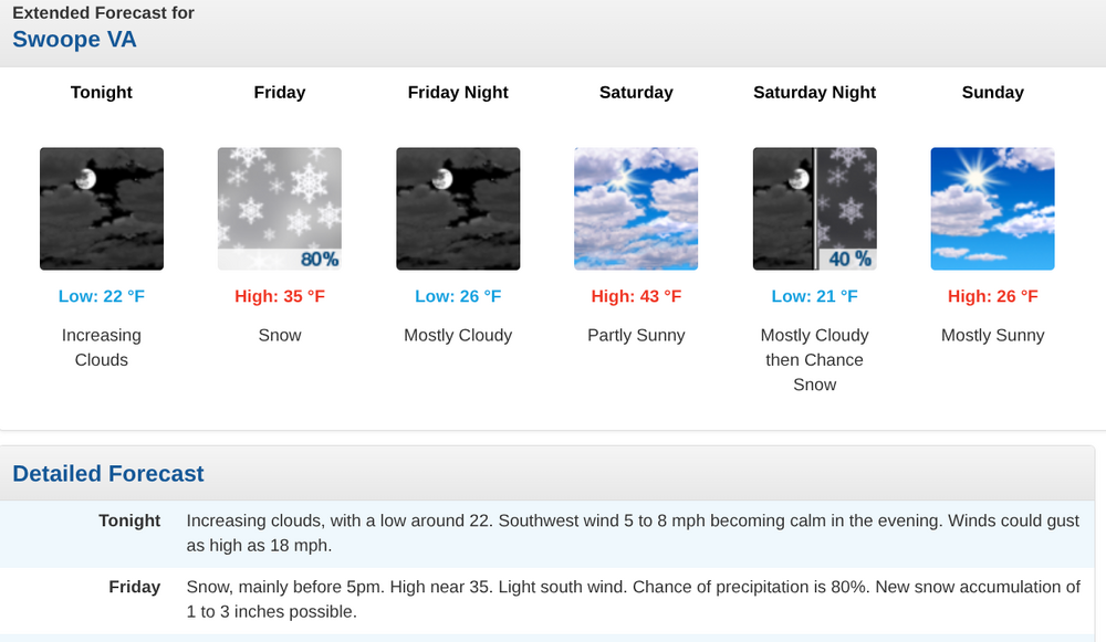
Right when the storm started to disappear on the majority of guidance this afternoon is when the national weather service upped their forecast for my area to 1 to 3 inches from less than 1/2 of an inch. I’m super confused. They must have information I don’t have access to. -
12/12: The little Friday clipper that could? Or won't.
WesternFringe replied to dailylurker's topic in Mid Atlantic
NWS says 1-3" for western Augusta County tomorrow: