RDRY
-
Posts
795 -
Joined
-
Last visited
Content Type
Profiles
Blogs
Forums
American Weather
Media Demo
Store
Gallery
Everything posted by RDRY
-
This could work.
-
2/13 Light/Moderate Snowfall Nowcasting & Observations
RDRY replied to Northof78's topic in New York City Metro
Surprised a WWA hasn't been issued for NYC, etc. Weather Channel app still has no accumulation for Queens. -
Then it can't disappoint.
-
Potent energy on the CMC -- this would deliver for many. Drop it 100+ miles south, and it would REALLY deliver.

-
It was rhetorical, but even at this long lead time this one looks bleak.
-
Will that northern energy act as a kicker or a magnet?
-
The Earth has been spinning for over 4 billion years. The "warmest year on record" trope that encompasses a couple hundred years is absurd. But it makes for an excellent sound bite.
-
NAM puts the Berks back in the game for decent snows.
-
Are the models programmed to always vehemently disagree with each other?
-
Lots more moisture this run after the frontal passage.
-
GFS pulling a '94.
-
As long as the freezing boundary stays within 50 miles on the models, this has a shot for the Berks. That's some serious cold air, and the southern system just isn't that strong.
-
18+ hours of snow on GFS. That's a ski resort weenie run.
-
Bands bullying their way north and west. Positive NAO can have its benefits.
-
Radar looks great. Bands with no problem advancing north and west.
-
Yup. Compare with previous run -- the southwest low is robbing energy from the northeast low.

-
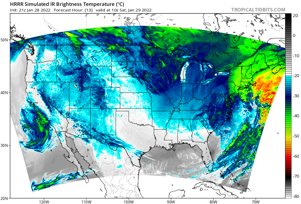
A bit better HRRR run so far through hour 9. Millibar stronger and leaning northwest. Through hour 12, definite improvement.
-
It's still there.

-
That's baked in at this short lead time. The 2 feet-plus totals are likely off the table for everyone, except maybe the Cape.
-
The storm chases the convection on the hour 22 NAM and splits into two lows at hour 23. Then it takes until hour 29 for the western low to take over, but it's further east and 8 MB weaker than 6z. And moves east instead of north once it does. This all likely happens because the trough shifted slightly east, which bumped the initial surface low just far enough east to where it could chase that convection.
-
NAM's fun, but no real support for jackpotting NYC.
-
I think the modeling is pretty locked in on this being a Long Island special. The city may see a mega band or two traverse the area, but they'll be camped out on the island for the duration.
-
Anyone thinking the GFS will pull a big cave don't know the GFS. Probably a nice shift west, but still an eastern outlier.
-
With a 960s low in that spot with that track, you'd have to think the precip shield should be more expansive to the west.
-
At 48 hours, it's 5 MB stronger and a bit more north, but the precip shield is less expansive. Odd. Maybe it's more occluded.