RDRY
-
Posts
795 -
Joined
-
Last visited
Content Type
Profiles
Blogs
Forums
American Weather
Media Demo
Store
Gallery
Everything posted by RDRY
-
Well, some still do ...
-
That upper low seems to be gaining steam on the models. Could get interesting.
-
Looks like the surface low is still running too far ahead of the upper energy on the 12z Euro, but it's certainly closer.
-
-
The first low hangs way back west, so there's no separate, second follow-up. And disaster ensues.
-
Bizarre evolution of the three lows on the GFS - probably still sorting things out.
-
Don't tease me, GFS.
-
Probably cyclical. The previous two decades saw an inordinate number of prolific phasers, at least on the east coast.
-
Poor Niners. They'd have multiple Super Bowls with this team with a solid QB.
-
Bone dry with a side-order of bitter cold.
-
-
What a clunker. Cloud-storm.
-
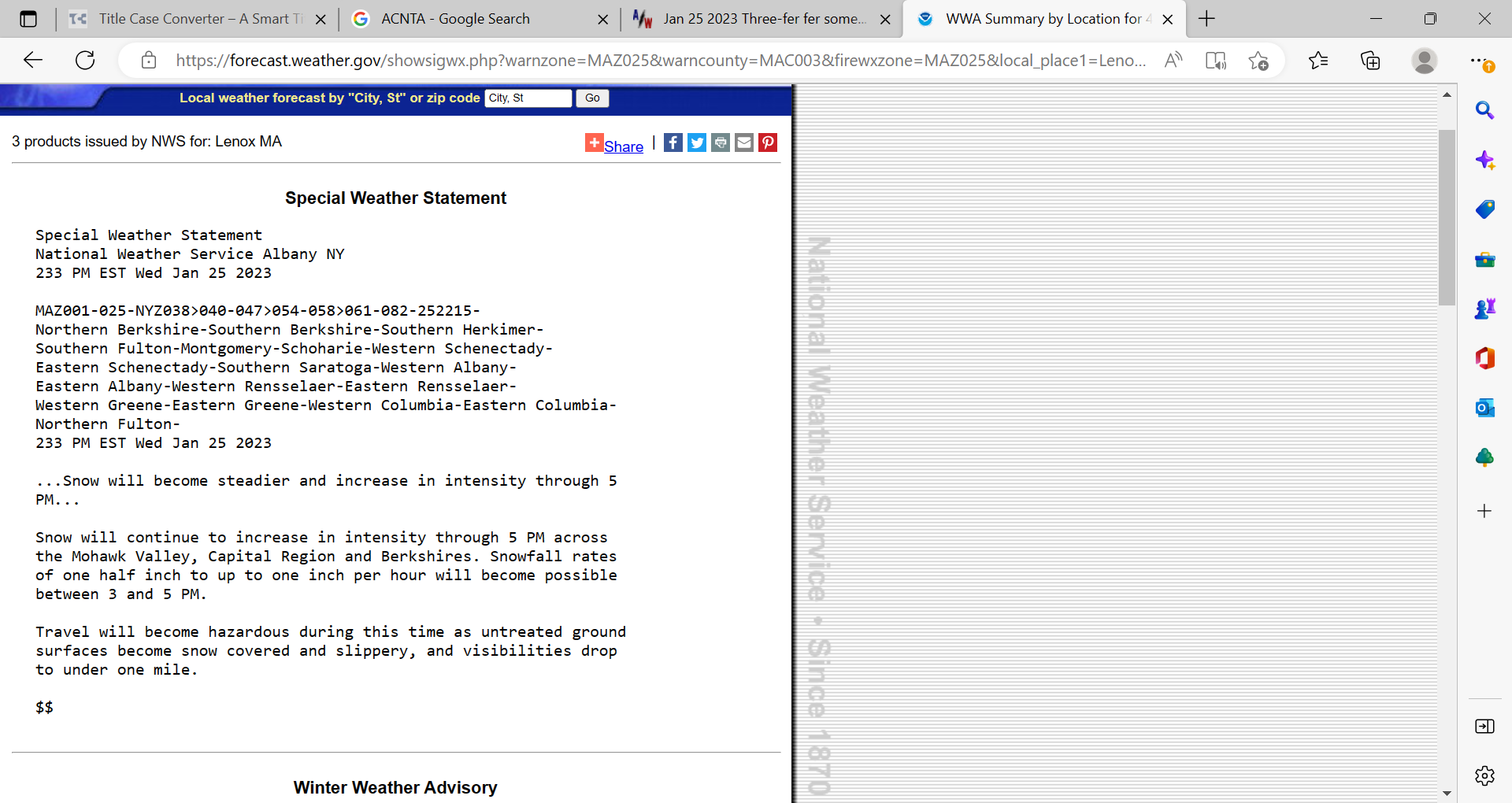
This is for the Berks (8 for WSW, less if ice is part of forecast, which it's not in this case -- snow to rain).
-
They issued a WWA for last storm, when 8+ looked inevitable, which it was. Now they issue a Winter Storm Watch when 4 or less looks inevitable. Get with it!!
-
GFS shutting down the east coast at 234.
-
Looks like about 8 in Lenox.
-
Part 1 of this storm didn't really deliver, but it's been ripping here in Lenox to make up for it.
-
In western Mass, a few models have this NE/SW orientation while others have the opposite, with a warm punch through the Berks.
-
NAM consistent with several hours of rain through all of western Mass.
-
Nice shift south.
-
That works for most. A lot depends on the wraparound though.
-
Spectrum Channel 1 still showing mostly rain throughout all of Massachusetts, including west and north.
-
It's amazing to watch the models consistently unable to forecast the pattern until 3 days out. Like clockwork.
-
Yeah, the track is fine for interior. But the rain/snow line extends way north and west of the system.
-
Seems like the system will just fall in behind the confluence and still cut.