Newman
-
Posts
2,484 -
Joined
-
Last visited
Content Type
Profiles
Blogs
Forums
American Weather
Media Demo
Store
Gallery
Everything posted by Newman
-
RGEM is ummm, concerning
-
The RRFS would be fun if you're a Berks/Lehigh Valley weenie... 2-4" of snow only LOL. FV3-GFS also went east a bit... Not all of these NOAA meso models should at all be taken seriously though, they don't excel in large synoptic systems
-
Oh totally, it literally rotates in a firehose of supercells off the ocean and has 6"/hour rates for hours over NJ. Reasonable local lolli will probably be more in the 30-34" range
-
0z NAM. I've lost the words at this point, I mean this is just insane
-
It's insane. Somehow the NAM keeps upping itself each run.
-
Toms River NJ, 32.5
-
21z SREFs coming in more tucked/amped. Should mean NAM holds serve at 0z.
-
Sleep now because you won't be sleeping tomorrow night
-
Don't be concerned, what happens will happen. For all we know western Berks could end up in the deformation band and eastern Berks in subsidence. I'd feel the same way if I was still in Fleetwood. The tracking is just as fun to me and we'll get to witness a historic storm for some within the subforum
-
The gradient being depicted across Berks County has been consistent and crazy. I wouldn't be surprised if somewhere like Bernville gets 6" and Boyertown 16".
-
Top 3 NESIS storm on the NAM. You dump 2-3 feet from Philly to Boston you're rivaling 93 and 96
-
You still going 5-10" for Philly?
-
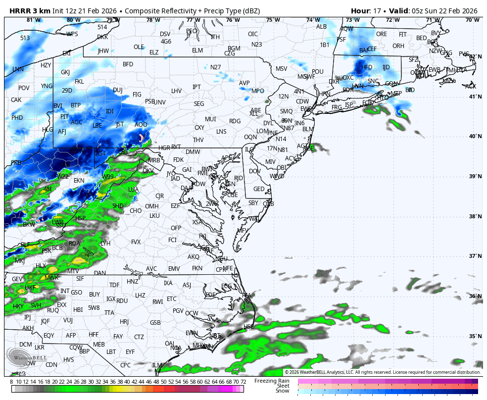
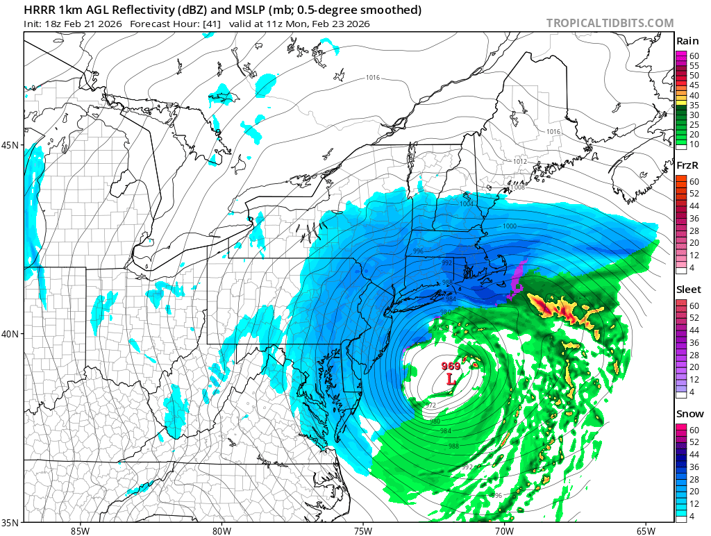
18z HRRR... Lost for words

-
This is going to be one hell of a storm y'all, easily Top 5 for some and some near the Jersey coast may even see their largest storm ever. Enjoy it and savor it, I will be living vicariously through all of y'all
-
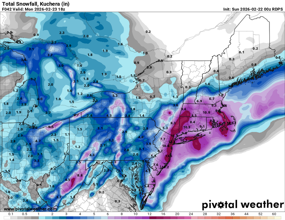
Widespread winter storm warnings now in effect, blizzard warnings for the coast. Berks and Lehigh Valley are 8-16". 14-18 for Philly, 20-24 for Jersey coast under Blizzard Warning
-
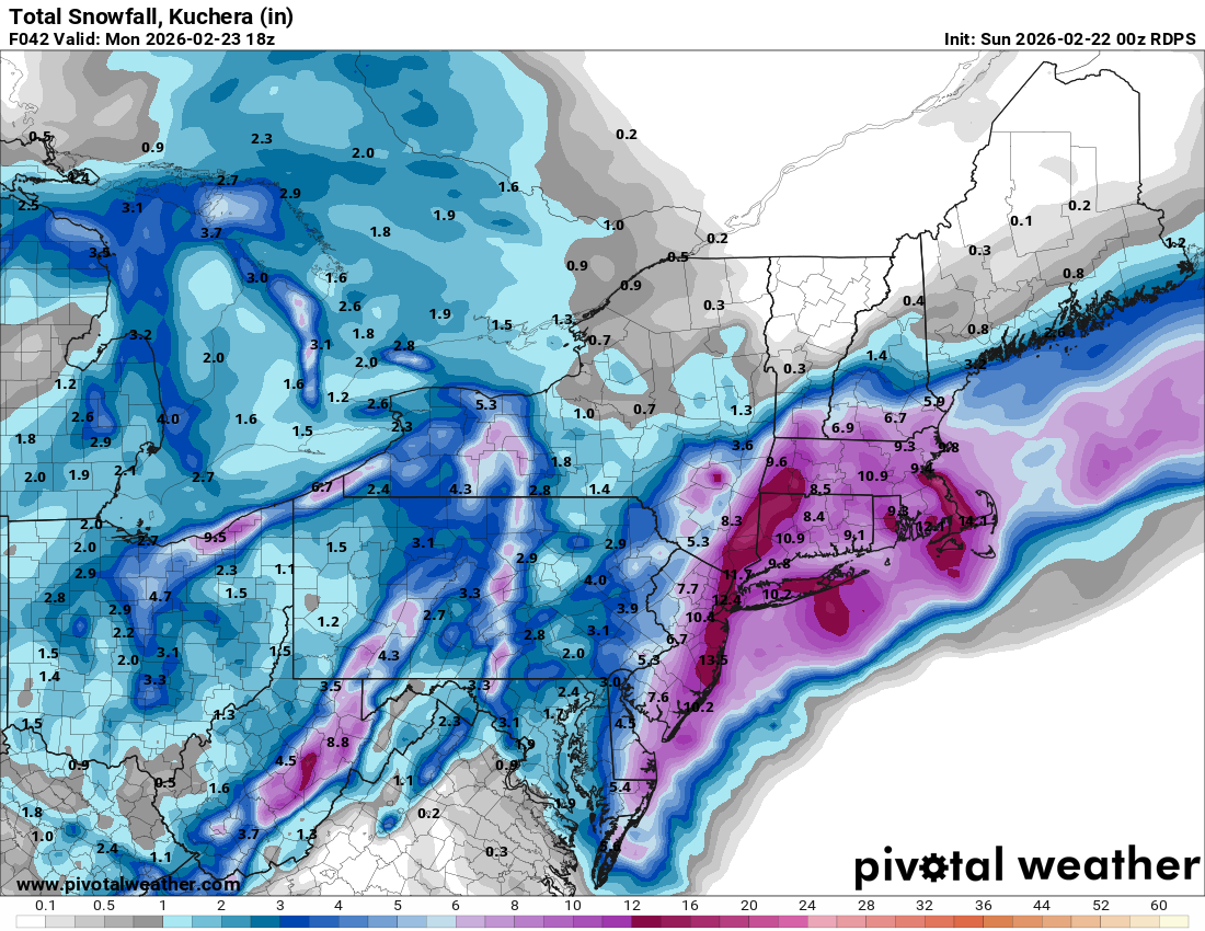
Ukie looks good, coming into alignment here. This would honestly be my "base" snow map as far as spatial coverage of heaviest snows
.thumb.png.cc477cb95c2c4148683497d55a57fef7.png)
-
Yeah GFS is a tick east but it's just noise at this point. There will be a deep 700mb fronto band on the NW side of this thing that models will not pin down at all. Right now the meso models/GFS have Berks, Lehigh, Northampton, Chester as the far western edge of that. It could be east of that, or west. There will be a sharp cutoff
-
Very much agree, these h500 tick improvements are more important than surface output
-
RGEM continues to be unenthused in truly tucking and stalling the low into the coast. The mid-level lows close off just a bit too late and it scoots ENE quicker. It may also be chasing the convection to the east
-
This is again where you go and bring up the Top 5-10 all time lists
-
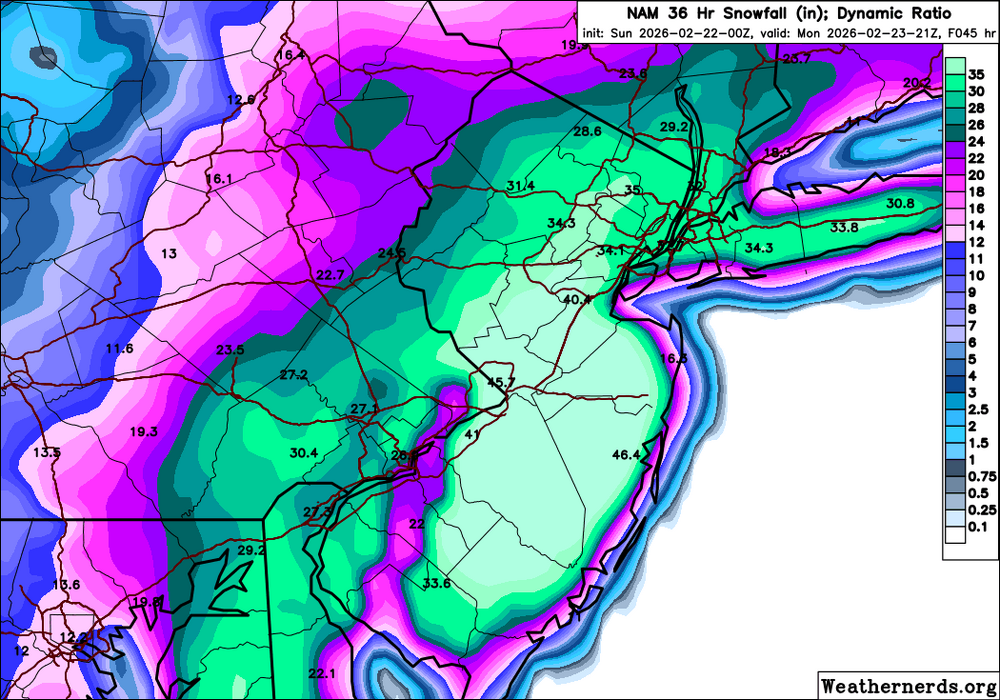
NAM is a significant increase in totals for Berks and the Lehigh Valley. 12-18" for everyone. Philly and Jersey 2-3 feet. Actually there might be more coming...
-
Agreed, they'll probably go 8-12". Might even see 10-14
-
NAM coming in even more amped, heights higher and cleaner phase. Here we go
-
Not my gif, got this from somewhere else. But wow.

-
HRRR develops an eyewall


.png.6ab0e1e79fb1ad7c7040a9ce50121199.png)