SnowDawg
-
Posts
1,253 -
Joined
-
Last visited
Content Type
Profiles
Blogs
Forums
American Weather
Media Demo
Store
Gallery
Everything posted by SnowDawg
-
That's honestly amazing to me given the relative close proximity between us. Even the lower elevations here, down at the river near the SC border, have had at least 2 near 12 inch storms and a lot of 4 inch+ just since 2010. That Lee side screw zone running through GA/SC/NC is just a terrible thing.
-
Euro and EPS control continue to be in near lock step with one another. EPS mean is down just a bit, but at this range it's gonna jump around some so I wouldn't worry about it unless a downward trend over several runs shows up. But even then, all the ensembles spiraled downward in the medium range for this past weekend only to come back inside day 2-3.
-
I feel like in this pattern that is quite possibly the best look we could hope for board wide. Weak over running, followed by late coastal development, means literally no one has to deal with any warm air advection. If it bombed out earlier it'd screw the eastern zones, and if it lost the over running it'd screw us to the west. Can't imagine the mood on this board if such a region wide event were to go down.
-
Being in Athens at the time I hated that storm. Back in the Mtns now I'd love to have another go at it.
-
Yep, 850's and 925's both looked great throughout. No warm nose at all.
-
Possibly. I honestly don't know. People reference biases so much it's hard to tell which ones are real and which ones aren't anymore lol. There's definitely a window of potential, but as always we are threading some tiny needles.
-
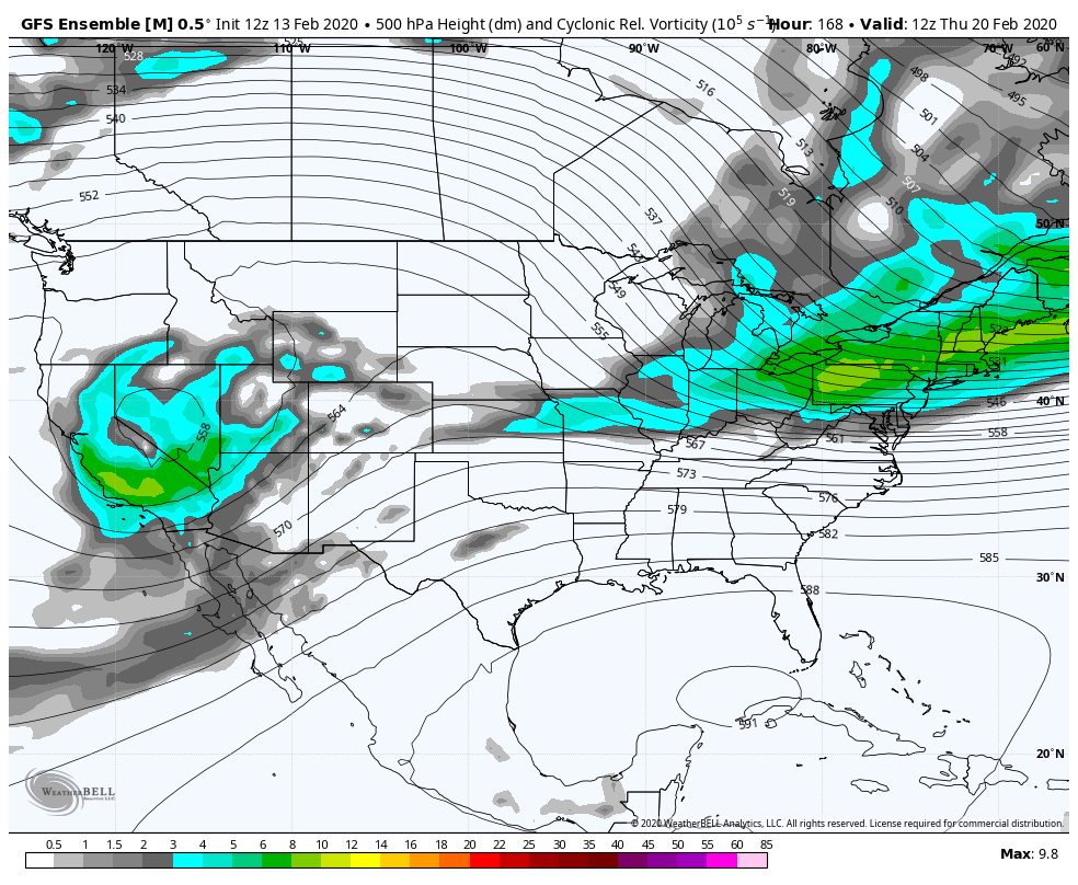
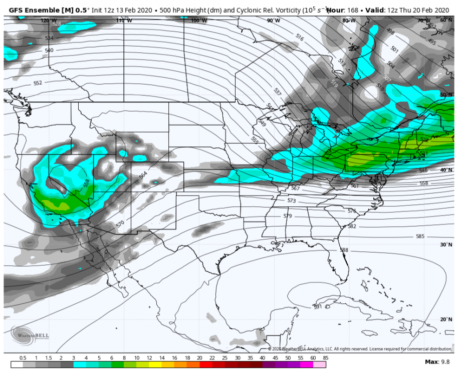
GFS Ensemble largely supports the OP in the energy getting cutoff and left behind out west. 0z EPS for comparison. GFS very well may have the right idea here, it's just too early to tell.

-
The key difference I'm seeing is the energy getting cutoff in the SW, on the GFS, before moving east. This let's heights rise just ahead of it. Needs to come in nose down and spin up at the last second. Preferably just slightly earlier than 0z showed and it'd be a basically board wide crusher.
-
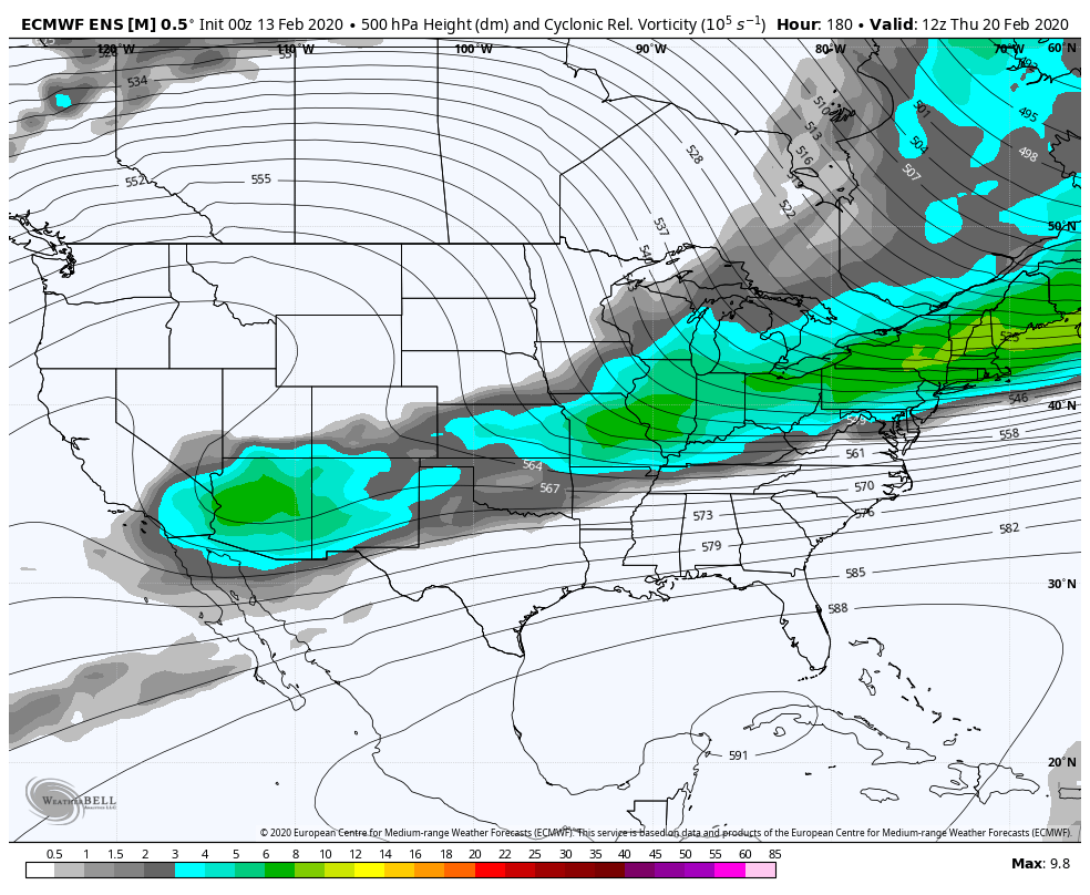
EPS control run is almost identical. And the EPS Mean is starting to make some noise. That shortwave not getting cutoff in the SW is a big key in giving this potential legs.
-
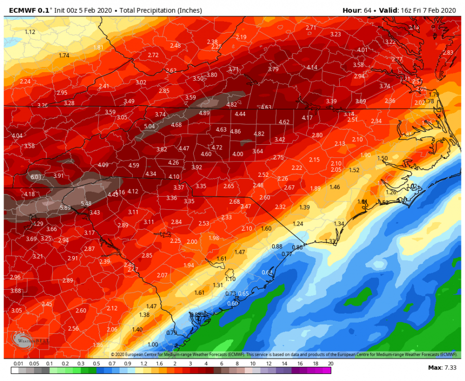
To be fair the Euro actually picked up the system from this past weekend quite a bit further out than that. I think 0z Euro on the 2nd was the first signs of snow in the interior southeast. It moved around a lot and the amounts went up and down after that, but it did at least pick up the "threat" at a decent lead time. But yeah inside day 3 is when things really solidified and all the guidance started to converge on the same solution.
-
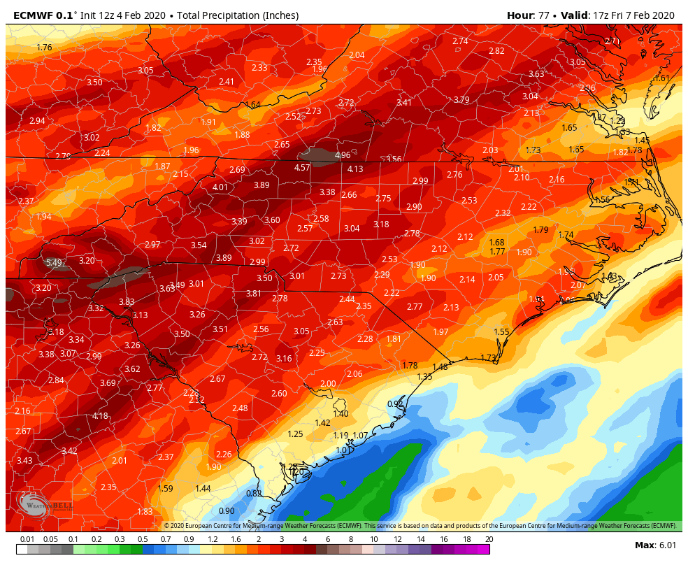
Dramatic increase in totals from the 12z run on Euro. That amount in that short of time here in the N GA Mtns just screams landslide threat over the next couple days with how saturated the soils already are.
-
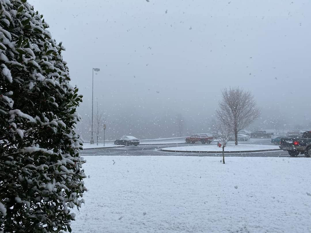
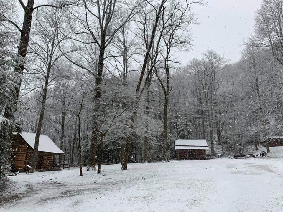
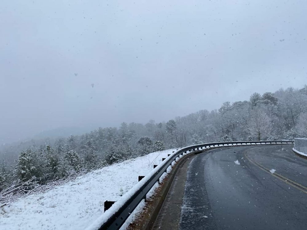
Amazing morning. Caught me completely off guard to say the least but I needed that. 400+ day snow less streak is officially over here in Clayton, GA.
-
Decent, but nothing that really sticks out as a legit threat yet. EPS looks better. But 2 weeks ago it was the opposite and we all know which ensemble won that fight.
-
Yeah the lack of HP is the real killer there. Still close enough to something to keep an eye on though for sure.
-
-
I don't remember the EPS looking anything like this during our last period of long range "threats". GEFS yes, but the EPS was pretty much telling us no from the jump outside of an off run here or there. I'm cautiously interested going forward.
-
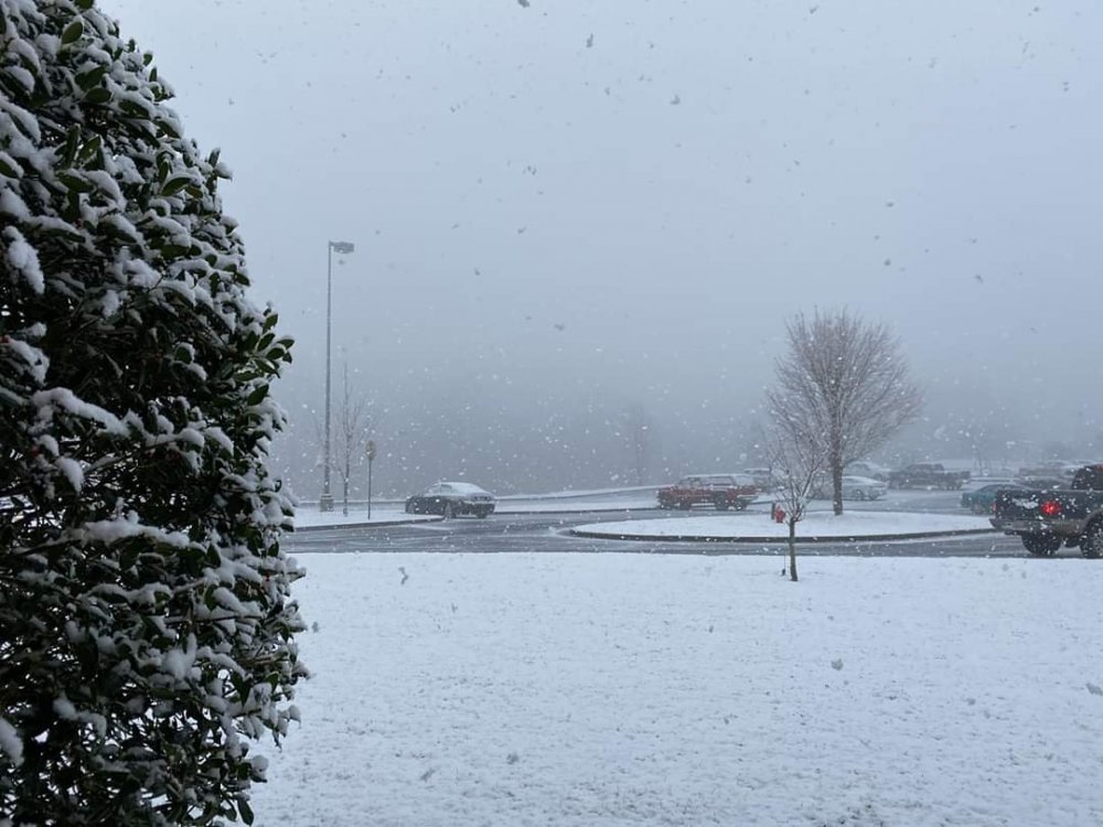
Barely managed the slightest flurry in Clayton this morning. The highest elevations here in Rabun County up around Sky Valley have seen a dusting, but the rest of the county has been completely shutout so far. In my lifetime we've never not had any measurable snow in a winter. I can't imagine it actually finishing that way but I'm certainly not optimistic right now.
-
Euro looked great for the Northern NC Mtns next weekend.
-
Honestly feels fairly optimistic. I'm getting somewhat worried up here in the Mtns. Haven't had more than a skiff on the porch since December 2018, and that's at an elevation that averages 10-12 inches a year. The upcoming pattern is certainly better than where we've been as far as temps go, but it seems fairly hostile for snow because of the fast flow. Just gonna keep hoping climo eventually throws me a bone.
-
The EPS and the GEFS after the brief warmup. The warmup is happening but it doesn't seem long lasting for now. Let's try not to freak out over it until there's actually reason to, and the reload stops showing up. How strong or how long the reload is remains to be seen and is just a waiting game I suppose. This could all still go down the crapper and turn warm on us long term, but until it actually shows that I gleefully kiss this month long death ridge goodbye and welcome the new pattern.
-
Can't disagree with you there, if you're looking for dry it doesn't appear to be coming anytime soon. At least if we'd get some snow it'd be a slow melt and soak instead of all this runoff and mudslides we've been having.
-
I don't think it looks terrible. I mean at this point we pretty much know a brief warmup is coming after the cold shot, just gotta deal with it and move on. It does cool down again behind it though. And frankly, I'd like to just see an extended period of normal to slightly below. Here in the southern Apps, and even more so where you are than me, that plus good track and HP can deliver big time. Screw arctic cold, all that ever seems to do is dry us out. I'm tired of wildly swinging between death ridge and anomalous cold. Give me normal to slightly below with an active STJ, and I'll take my chances on climo working out in my favor.
-
28th storm left the Baja cutoff low behind this time so it's not a beast like at 18z. Hopefully as we get inside day 10 we'll start to see some ensemble support consolidate around that time frame.
-
The weekend one is gonna jump around a lot for a while I'd say. Very minor H5 changes are resulting in big surface changes. Still had the 50/50 and developing block, but the trough took off north towards the great lakes instead of digging a bit more eastward like at 18z. Even if that one misses, the 50/50 and the block could be important for the following week.
-
I feel like a weenie even posting such a thing but this is definitely a gorgeous storm. Signs of the potential going forward if nothing else.