


NJwx85
-
Posts
19,806 -
Joined
-
Last visited
Content Type
Profiles
Blogs
Forums
American Weather
Media Demo
Store
Gallery
Everything posted by NJwx85
-
Bit of a lull here in Rockland County but radar looks juiced.
-
3 tornado watches for parts of NJ in less than a week.
-
The HRRR has not been very good with this event so far.
-
Lights came on in the parking lot here.
-
Getting drilled here in Ramsey. Very heavy rain and lightning.
-
The rain will be widespread. The excessive totals will be localized.
-
I had over 2” of rain yesterday in 45 minutes and my office 10 miles away had nothing. This is what happens in these events. It doesn’t mean the storm busted.
-
You’re still going to get a good soaking, just not the amounts further West.
-
This was never supposed to be a big deal East of the Hudson. Radar looks juiced for big rains in NJ and the Hudson Valley.
-
This always looked to me like the max would be near Passaic/Bergen/Rockland Counties and I still feel that way.
-
It’s the same people that call bust before an event even starts every time. They over analyze the radar instead of just letting things play out.
-
Tornado Warning NW NJ.
-
Some of the takes here are just profoundly ridiculous.
-
Almost all of Central NJ is under a severe thunderstorm warning now. 60mph wind gusts.
-
You do realize that line will intensify and build East right?
-
Each model has a different jackpot area which is typical in convective setups. It’s very hard to pinpoint exact locations. Most of the rain today and tonight will fall in a relatively short period. There’s also quite a high risk of microbursts today, like what we saw yesterday, hence the watch. Could also see an isolated tornado.
-
Looks like the moderate risk for excessive rainfall has been expanded.
-
PWAT’s are 1.6 to 1.8” with ample moisture on a SW flow.
-
This is a convective event so there will be winners and losers. I had 2.29” yesterday under that stationary storm in less than an hour. The storms today should be moving but there will be training. Someone is going to see a ridiculous total. Bullseye area looks to be along the I-287 corridor from Morristown up into the LHV.
-
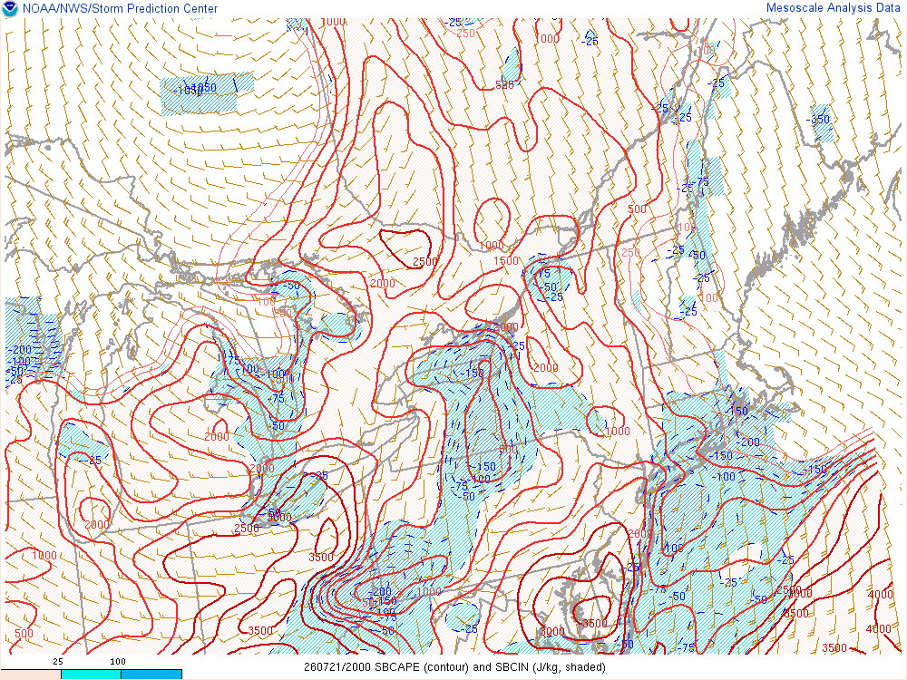
Believe it or not, the atmosphere is still fairly unstable West of the city. We shall see.
-
I think the tornado threat is over for the most part. The best parameters have shifted East and are mainly offshore. Also looks like the squall line threat for later is diminishing.
-
Would not shock me at all if we end up with 1 or 2 strong tornadoes.
-
Watch the storm near Allentown. That’s next to go boom.
-
4 separate tornado warnings now in NNJ and storms are training.
-
Source?

