
Icy Hot
-
Posts
231 -
Joined
-
Last visited
Content Type
Profiles
Blogs
Forums
American Weather
Media Demo
Store
Gallery
Everything posted by Icy Hot
-
NOAA is downplaying any snow potential.
-
Rain and snow showers this morning along with blustery conditions. Temp has dropped to 38.
- 361 replies
-
- 4
-

-
- severe
- mountain snow
- (and 1 more)
-
Intense line of rain and wind rolling through. Wind gusts over 45 mph and downpours! Ground is saturated by this week’s rains so trees could be coming down soon.
-
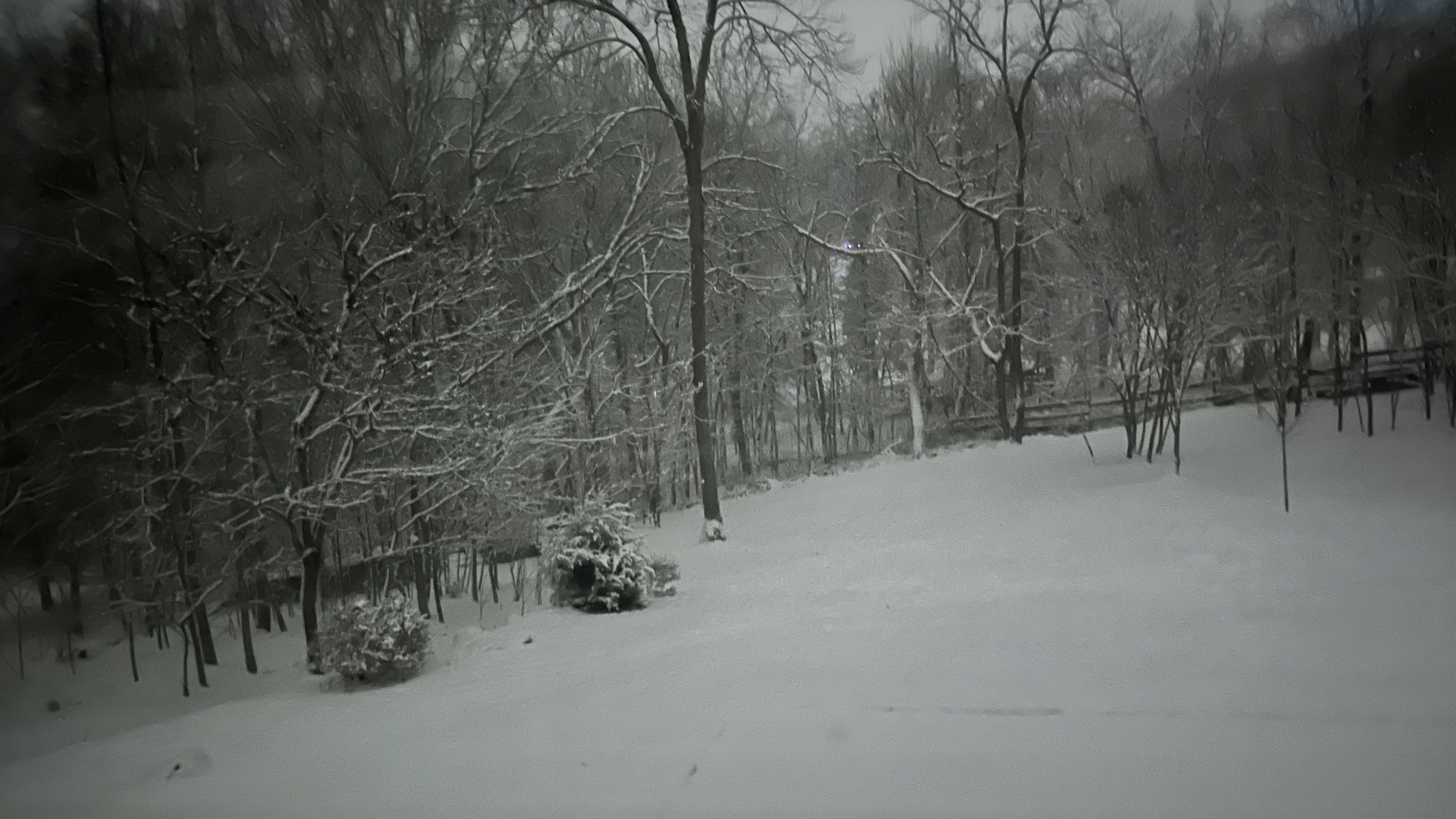
I can confirm. Still coming down steadily in Colonial Heights. Everything has a fresh coat of snow.
-
Light snow and mist. Temp is 33.
-

Jan 30th-February 1st 2026 Arctic Blast/ULL Snow OBS Thread.
Icy Hot replied to John1122's topic in Tennessee Valley
So Google says this is Hoarfrost, not to be confused with Rime Ice. Either way, it is so cool to look at!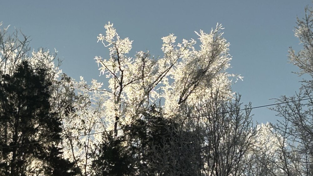
-
Jan 30th-February 1st 2026 Arctic Blast/ULL Snow OBS Thread.
Icy Hot replied to John1122's topic in Tennessee Valley
I noticed you said, ended up with? Am I missing something? Radar is still lit and NOAA and Weather Channel show snow lasting till late tonight. -
Jan 30th-February 1st 2026 Arctic Blast/ULL Snow OBS Thread.
Icy Hot replied to John1122's topic in Tennessee Valley

-
Jan 30th-February 1st 2026 Arctic Blast/ULL Snow OBS Thread.
Icy Hot replied to John1122's topic in Tennessee Valley
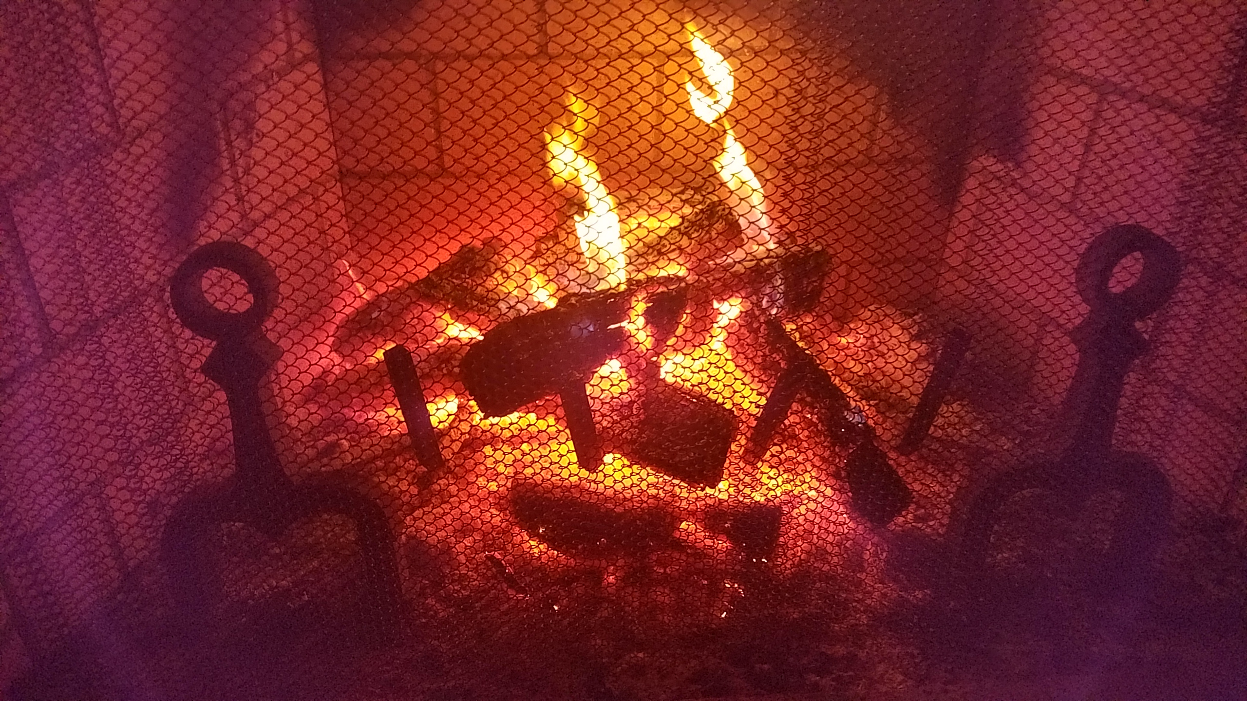
Truly epic here in Colonial Heights. 7 inches, 15 degrees at the moment. Sharing pics soon. -
Jan 30th-February 1st 2026 Arctic Blast/ULL Snow OBS Thread.
Icy Hot replied to John1122's topic in Tennessee Valley
Colonial Heights - Temp 30. Little flakes picking up now and ground is turning white. -
In their forecast discussion, MRX said 15/1 and they do love the NBM.
- 782 replies
-
- 1
-
-
- extreme cold
- snow
- (and 1 more)
-
17 this morning and Winds at 5 mph. It’s chilly! Waiting for tomorrow’s forecasted snow.
-
The “I bring the mojo” Jan 30-Feb 1 potential winter storm
Icy Hot replied to lilj4425's topic in Southeastern States
Really hoping all our NC, SC, and GA friends can cash in. We are still waiting in NETN but I know for many of you, you've been waiting much longer. -
Perhaps but they always said there is the potential for heavy snow and they certainly got the heavy part right, it was just rain in the Tri-Cities. Currently they see little to no potential for the next one. As always, I guess we will find out in 5 more days. “Sitting here reeling em in”
-
NOAA says dry weather for the next 7 days. They aren’t buying stock in this. Perhaps that will change.
-
It could happen but do any of us feel good about trusting the GFS any more?
-
It’s better to have the public in that county informed of the potential rather than no Notification and then get hit with ice
-
They are slow updating the map, but it’s winter storm warnings, ice storm warnings and winter weather advisories
-
NOAA just posted a winter storm warning for most of East Tennessee up to 3 inches of snow and up to 4/10 of an inch of ice
-
Local Met (WJHL) went off the air with this statement - some significant changes are starting to be modeled. More updates at 6. Sheesh - is that must see tv or click bait?
-
URGENT - WINTER WEATHER MESSAGE National Weather Service Morristown TN 1227 PM EST Wed Jan 21 2026 NCZ060-061-TNZ012>018-035>047-067>074-081>087-098>102-VAZ001-002-005- 006-008-220700- /O.NEW.KMRX.WS.A.0001.260124T0600Z-260126T0000Z/ Cherokee-Clay-Scott TN-Campbell-Claiborne-Hancock-Hawkins- Sullivan-Johnson-Morgan-Anderson-Union-Grainger-Hamblen-Northwest Cocke-Cocke Smoky Mountains-Northwest Greene-Southeast Greene- Washington TN-Unicoi-Northwest Carter-Southeast Carter-Roane- Loudon-Knox-Jefferson-Northwest Blount-Blount Smoky Mountains- North Sevier-Sevier Smoky Mountains-Sequatchie-Bledsoe-Rhea-Meigs- McMinn-Northwest Monroe-Southeast Monroe-Marion-Hamilton-Bradley- West Polk-East Polk-Lee-Wise-Scott VA-Russell-Washington VA- Including the cities of Cleveland, Mountain City, Cades Cove, Bullet Creek, Arthur, Unicoi, Lenoir City, Lake Forest, Chattanooga, Palio, Maynardville, Benton, Castlewood, Clairfield, Erwin, White Oak, Harriman, Sneedville, Old Washington, Huntsville, Pigeon Forge, Rockwood, Violet, Luttrell, Haletown (Guild), Kingston, South Holston Dam, Oneida, Strawberry Plains, White Pine, Archville, Old Cumberland, Big South Fork National, Topton, Cedar Creek, Bybee, Mount Crest, Big Frog Mountain, Jellico, Fincastle, Kyles Ford, Smokey Junction, Elgin, Big Spring, Maryville, Mooresburg, Unaka, Limestone Cove, Big Stone Gap, Lone Mountain, Lebanon, Newport, Evensville, Conasauga, Norton, Wise, Powells Crossroads, Bristol VA, La Follette, Elkmont, Bradbury, Russellville, Chestnut Hill, Clinton, Athens, Coker Creek, Martin Springs, Bristol TN, Cagle, Laurel Bloomery, Gatlinburg, Madisonville, Seymour, Signal Mountain, Eagle Furnace, Oliver Springs, Rose Hill, Norma, Monteagle, Pardee, High Point, Hiltons, Rosedale, Evanston, Jefferson City, Kingsport, Brayton, Parksville, Lone Oak, Sweetwater, Alpha, Andrews, Kodak, Neva, Marble, Abingdon, Oak Ridge, Norris Lake, Greeneville, Lookout Mountain, Elizabethton, Appalachia, Pikeville, South Pittsburg, Hartford, Happy Valley, Slick Rock, Tusquitee, Dentville, Pine Orchard, Knoxville, Hiawasse Dam, Shooting Creek, Treadway, Reliance, Doeville, Tasso, Springdale, Fairview, Morristown, Benhams, Loudon, Bearden, McMahan, Melvine, Honaker, Petros, Whitwell, Sevierville, Johnson City, Cartwright, Brasstown, Grandview, Harrisburg, Harrogate-Shawanee, Dye, Turtletown, Murphy, Hansonville, Shady Valley, Dandridge, Paulette, Ducktown, Howard Quarter, Dayton, Jasper, Sharps Chapel, Sandlick, Alcoa, Elk Valley, Clear Water, Royal Blue, Spring City, Coeburn, Etowah, Dunlap, Caryville, Trade, Citico, Hayesville, Bean Station, and Hampton 1227 PM EST Wed Jan 21 2026 /1127 AM CST Wed Jan 21 2026/ ...WINTER STORM WATCH IN EFFECT FROM LATE FRIDAY NIGHT THROUGH SUNDAY EVENING... * WHAT...Heavy mixed precipitation possible. Total snow accumulations between 4 and 10 inches will be possible, primarily north of Knoxville with the heaviest accumulations near the Kentucky border and far western Virginia. In addition to the snow, ice accumulations up to one half of an inch will be possible, primarily south of Knoxville. The greatest ice accumulations will likely be south of a line from Crossville to Tellico Plains, especially the southern Cumberland Plateau. * WHERE...Portions of southwest North Carolina, east Tennessee, and southwest Virginia. * WHEN...From late Friday night through Sunday evening. * IMPACTS...Expect power outages and tree damage due to the ice. Travel could be impossible. * ADDITIONAL DETAILS...This is a complicated forecast and details regarding the location of heaviest snowfall and freezing rain totals remain uncertain. Significant changes could occur in the coming days so please continue to monitor future forecasts.
-
LOL - they just posted a Winter Strom Watch as well. Great timing!
-
Somebody wake up Stovepipe.
-
Sugar highs are nice, but as has been the story all winter, the can always gets kicked 2 weeks down the road. But don't get me wrong, once it's inside 3 days, I'll be smiling at the Hot sign!