Eskimo Joe
-
Posts
24,697 -
Joined
-
Last visited
Content Type
Profiles
Blogs
Forums
American Weather
Media Demo
Store
Gallery
Everything posted by Eskimo Joe
-
Headed out to Berkley Speings, WV tomorrow through Tuesday. Anyone got a favorite restaurant out there worth recommending?
-
Big ones are sniffed out early.
-
Chincoteague would be a good chase spot tomorrow for any snow starved weenies.
-
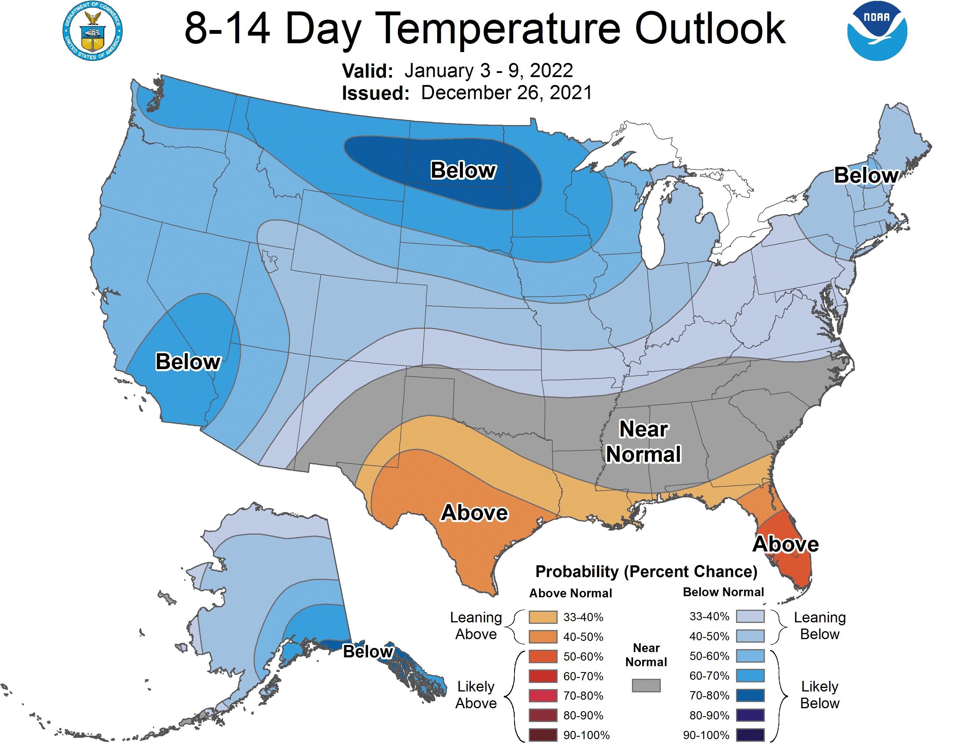
12z GFS would imply BWI, DCA, and IAD all get their first measurable snow of the year.
-
I hope this works out for the southern folks. You deserve this. Hope you get a foot!
-
Looks like outright cross polar flow on the EPS next weekend.
-
-
-
Might have to head down to Chincoteague for this one. Never seen snow down there before on the wildlife refuge.
-
Love Lionel trains. Really nice setup! @MillvilleWx glad your wife is doing better!
-
Congrats Chincoteague.
-
-
I sincerely hope you get a solid warning level event or two this year. You get screwed over so much.
-
-
Yea this is pretty bad. I'm trying to be optimistic, but this might be a game over scenario. We're entering peak climo for temps and we're still +10 to +20.
-
Westminster ASOS flipped to SN-
-
 Yup. Whole staff is solid!
 -
Surprise deck/mulch/car topper!
-
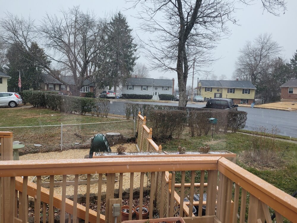
Snow in Reisterstown!
-
Steady sleet in Reisterstown. Got a very light accumulation on the deck and elevated surfaces.
-
Co-worker lost over 70,000 bees due to the temp swings. Total collapse of his colonies.
-
Bust. Shocker.
-
I think the Jan 2nd - 5th window sets everything up, higher elevations folks get their first accumulation and then we follow up with the first widespread event around the 10th.
-
I don't believe it until I see it falling from the sky. Model guidance has to earn my trust back.
-
Finally out of the reds