Eskimo Joe
-
Posts
24,697 -
Joined
-
Last visited
Content Type
Profiles
Blogs
Forums
American Weather
Media Demo
Store
Gallery
Everything posted by Eskimo Joe
-
My benchmark is a solid advisory level event, 4" - 6".
-
RE: Thursday event
-
06z GFS usually comes in dry or warm it seems. Everyone panics then 12z calms folks down. To see it give us a decent event gives me hope. Also, GFS seems to handle northern stream storms better than the Euro.
-
Set your sites reasonable. Expect an advisory level event. This is going to potentially be another event that we could steal within a week of being close to 20 degrees above normal.
-
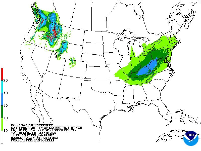
FWIW, 18Z GEFS is more enthused than OP for snow. It has a 60% chance that DCA, IAD, and BWI exceed 1" snow. That's usually a good sign for an advisory level event in these parts. I'd post the graphics but they're through a paywall site.
-
Yea I'll take this in a skinny minute.
-
-
Looks like that to me. Hey, northern crew gets solid advisory event and today's winners get snow-on-snow. What's not to like?
-
I'll buy the RGEM in a heartbeat.
-
Almost the entire EMS system in Maryland and NOVA is strained right now.
-
Euro is nice. Everybody wins.
-
Good. We snow.
-
Wow that's amazing! Pics if you got any please
-
Yes there's been thundetsnow. Got a push notification about it on my Tempest about an hour ago.
-
This storm is amazing. Just a degree or two warmer aloft and this would've been sleet or rain.
-
-
Keep the pictures coming, and for those of us on mobile, please say where you're posting from.
-
Poor Wes is in Florida and missing the biggest storm in like 6 years.
-
Really happy for you southern folks. We always cash in while you mix or flip. Even better is that you stole a storm from within 60 hours! Big winner today might be the GFS though. IMO, big win for American NWP.
-
So close
-
Death, taxes, and Tommy T busting on snow amounts.
-
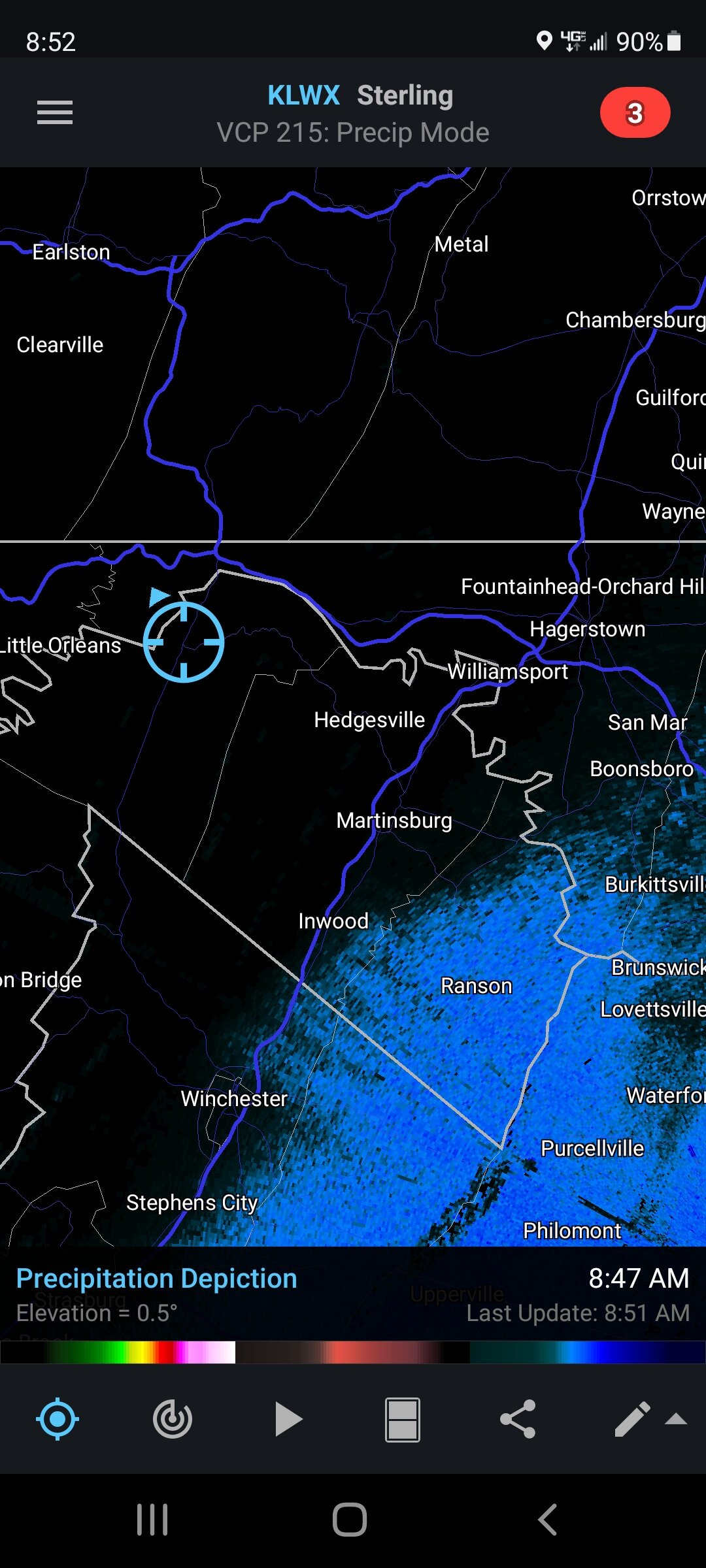
Looks like the radar is trying to fill in across Carroll and Frederick counties.
-
Nice to see the southern folks getting snow. Hope it continues all day for y'all!
-
39/28 Berkeley Springs, WV
-
NAM is north. 18z had the surface low in SC, 00z has it in NC. If you're south of I-70, you look good for a solid event. Really amazing how this event has appeared out of thin air.