

Eskimo Joe
-
Posts
24,697 -
Joined
-
Last visited
Content Type
Profiles
Blogs
Forums
American Weather
Media Demo
Store
Gallery
Everything posted by Eskimo Joe
-
What is the best MJO phase for us...8?
-
WxTwitter was talking about that today. Seems like a data processing error.
-
It's really nice actually. Probably the best look in a couple of years. Couple of observations from my igloo: 1.) So far, we aren't kicking this pattern down the road. The Dec 31 - Jan 2 pattern change timeframe seems reasonably agreed upon. 2.) The -NAO doesn't seems to just wash away. It looks kind of stable. 3.) The past couple of days have started to show better signs of a -EPO forming to help secure more cold air.
-
-
Lunch time GooFuS
-
-

December 2021 Medium/Long Range Discussion Thread
Eskimo Joe replied to North Balti Zen's topic in Mid Atlantic
-
December 2021 Medium/Long Range Discussion Thread
Eskimo Joe replied to North Balti Zen's topic in Mid Atlantic
Curious to know, since I'm not good with historic analogs, what was the winter of 1940-41 like for DC and Baltimore? -
December 2021 Medium/Long Range Discussion Thread
Eskimo Joe replied to North Balti Zen's topic in Mid Atlantic

-
December 2021 Medium/Long Range Discussion Thread
Eskimo Joe replied to North Balti Zen's topic in Mid Atlantic
@brooklynwx99 great post, very informative. Thank you for your thoughts. -
December 2021 Medium/Long Range Discussion Thread
Eskimo Joe replied to North Balti Zen's topic in Mid Atlantic
Good news is that it appears the Canadian and GFS ensembles have the cold lasting into early/mid January. Looks like they're trying to get the Pacific to cooperate more, or at least it isn't as hostile. This would imply that we aren't going to wobble back and forth between Lows 50s and Mid 60s for highs....sustained at or below normal temperatures. -
December 2021 Medium/Long Range Discussion Thread
Eskimo Joe replied to North Balti Zen's topic in Mid Atlantic
Also, with Potter not having to buy Bailey's Building & Loan, no toxic assets were inherited by the bank. Double win. -
December 2021 Medium/Long Range Discussion Thread
Eskimo Joe replied to North Balti Zen's topic in Mid Atlantic
Eskimo Express™ I reserve all rights to this event including obs threads. In all seriousness, we probably should wait until we're inside Day 5 before considering a thread for just this event. -
December 2021 Medium/Long Range Discussion Thread
Eskimo Joe replied to North Balti Zen's topic in Mid Atlantic
Now we wait and beg.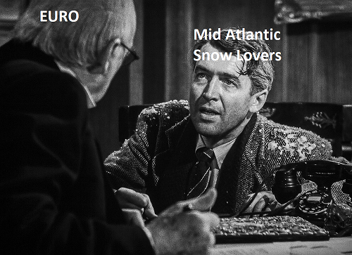
-
December 2021 Medium/Long Range Discussion Thread
Eskimo Joe replied to North Balti Zen's topic in Mid Atlantic
-
December 2021 Medium/Long Range Discussion Thread
Eskimo Joe replied to North Balti Zen's topic in Mid Atlantic
Yup. One of my Top 10 WxTwitter accounts that I follow. -
December 2021 Medium/Long Range Discussion Thread
Eskimo Joe replied to North Balti Zen's topic in Mid Atlantic
Not a forecast, but worth bookmarking this tweet: -
December 2021 Medium/Long Range Discussion Thread
Eskimo Joe replied to North Balti Zen's topic in Mid Atlantic

-
December 2021 Medium/Long Range Discussion Thread
Eskimo Joe replied to North Balti Zen's topic in Mid Atlantic
It would be interesting to get like a 3 week period where we don't hit 40° and get our climo from cold powder clipper after cold powder clipper. Get a nice setting sun from the cirrus shield coming in and then it just rains pixie dust overnight. -
December 2021 Medium/Long Range Discussion Thread
Eskimo Joe replied to North Balti Zen's topic in Mid Atlantic
I'm at the point where if we can even manage a string of clippers that give us advisory level events with BN temps, it'll be a win. I mean, snow on snow is just as good. -
December 2021 Medium/Long Range Discussion Thread
Eskimo Joe replied to North Balti Zen's topic in Mid Atlantic
-
I want to know what weather god JI pissed off for us to get this kind of weather in December.
-
December 2021 Medium/Long Range Discussion Thread
Eskimo Joe replied to North Balti Zen's topic in Mid Atlantic
On a local/regional level, I argue climate change. Urbanization is changing the built environment in the DC/Baltimore/Frederick/Leesburg area. More concrete, more roads means we hold onto temperatures more and it kills marginal events. I see this every day on my drive to work. You go from 34 degrees in West Friendship, MD then it shoots right up to 40 degrees when you get on US 29. We're shifting the climate of the planet and it's just a fact at this point. -
December 2021 Medium/Long Range Discussion Thread
Eskimo Joe replied to North Balti Zen's topic in Mid Atlantic
Good points. I'm really trigger shy after the past few years where "good" patterns were kicked down the road into March and we were desperate for a 2" - 4" slopfest. -
December 2021 Medium/Long Range Discussion Thread
Eskimo Joe replied to North Balti Zen's topic in Mid Atlantic
Might be the kiss of death for us this winter. We're about to enter peak climo for cool temps and if the Pacific isn't going to cooperate, then it's probably best to just turn off the lights and hope for something better next year or move north.


