StormchaserChuck!
-
Posts
2,274 -
Joined
-
Last visited
Content Type
Profiles
Blogs
Forums
American Weather
Media Demo
Store
Gallery
Everything posted by StormchaserChuck!
-

January Medium/Long Range Discussion
StormchaserChuck! replied to WinterWxLuvr's topic in Mid Atlantic
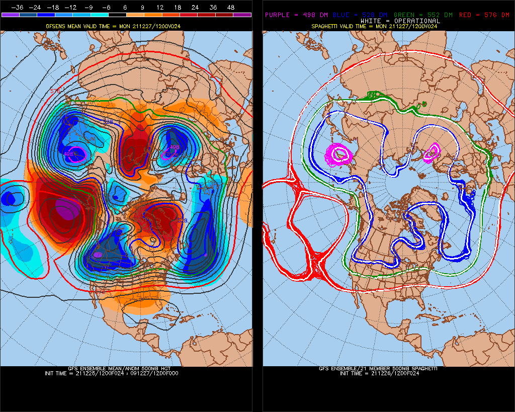
The beginning of the end. We have a 70% probability for -PNA next January and February, but 23-24 is going to be -QBO again so if we have El Nino..! -
January Medium/Long Range Discussion
StormchaserChuck! replied to WinterWxLuvr's topic in Mid Atlantic
N. Atlantic SST NAO index which has been 11-1-4 since inception, was -0.25 for DJFM, +0.54SD50%, so NAO might not get that positive. We are also, though, flipping last year---
-
January Medium/Long Range Discussion
StormchaserChuck! replied to WinterWxLuvr's topic in Mid Atlantic
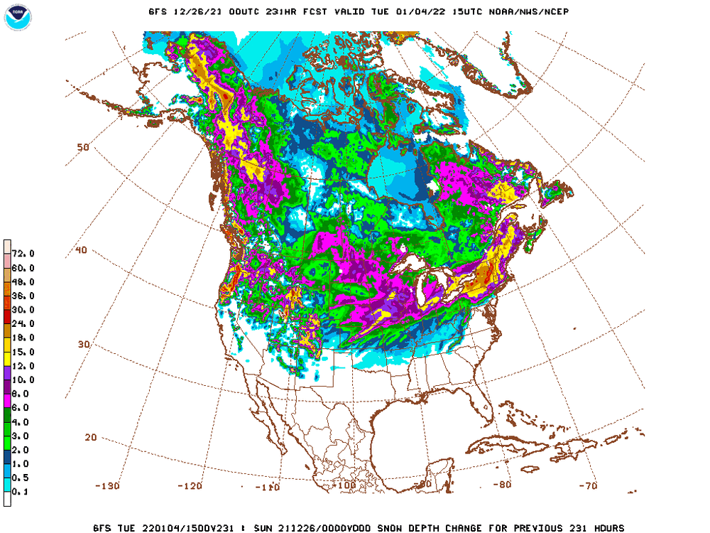
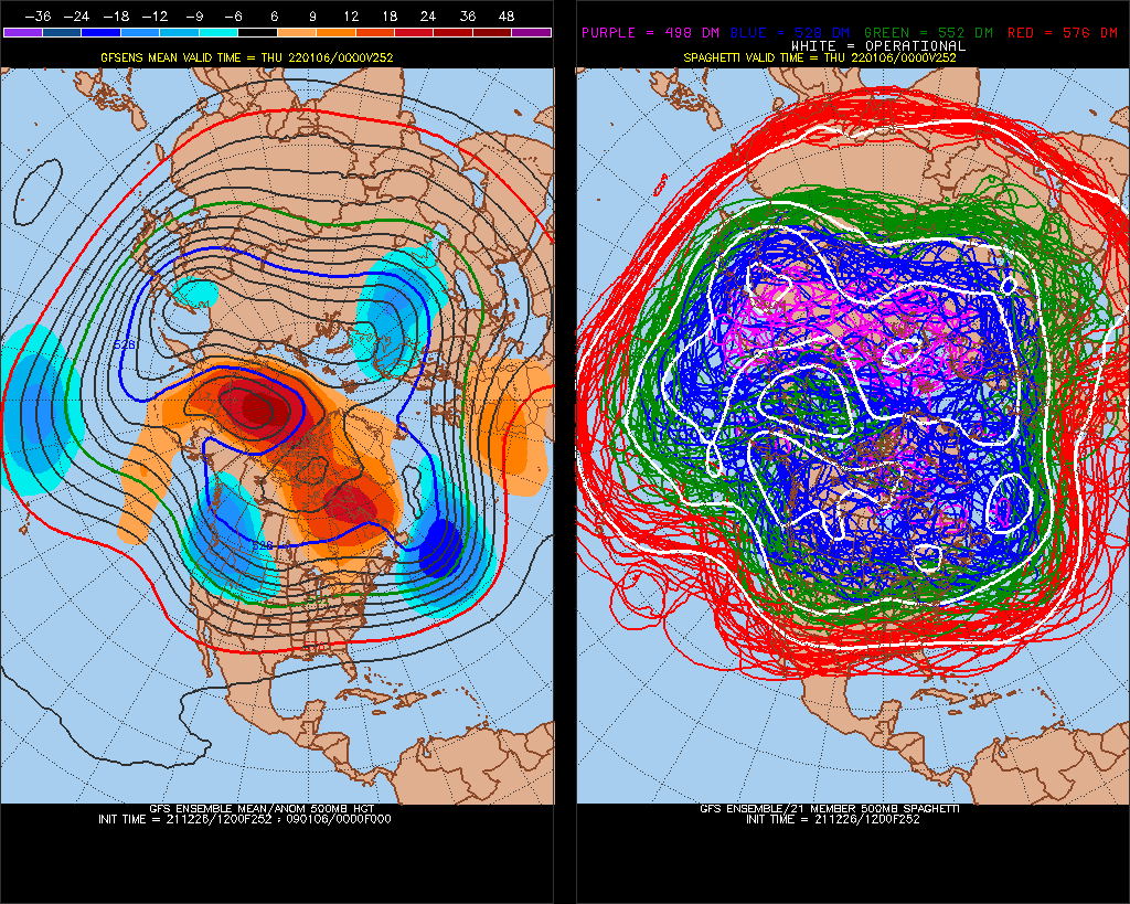
Not liking this 384hr GFS Looks like composite of top 20 years where PNA dominated Dec 1 - Jan 3 rolled forward I have a slight +PNA signal ~Jan 15th>, but February might turn out warmer, especially if that verifies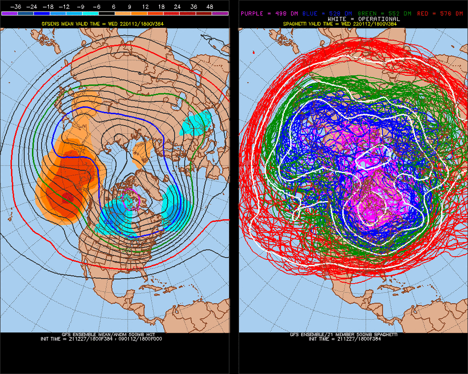
-
January Medium/Long Range Discussion
StormchaserChuck! replied to WinterWxLuvr's topic in Mid Atlantic
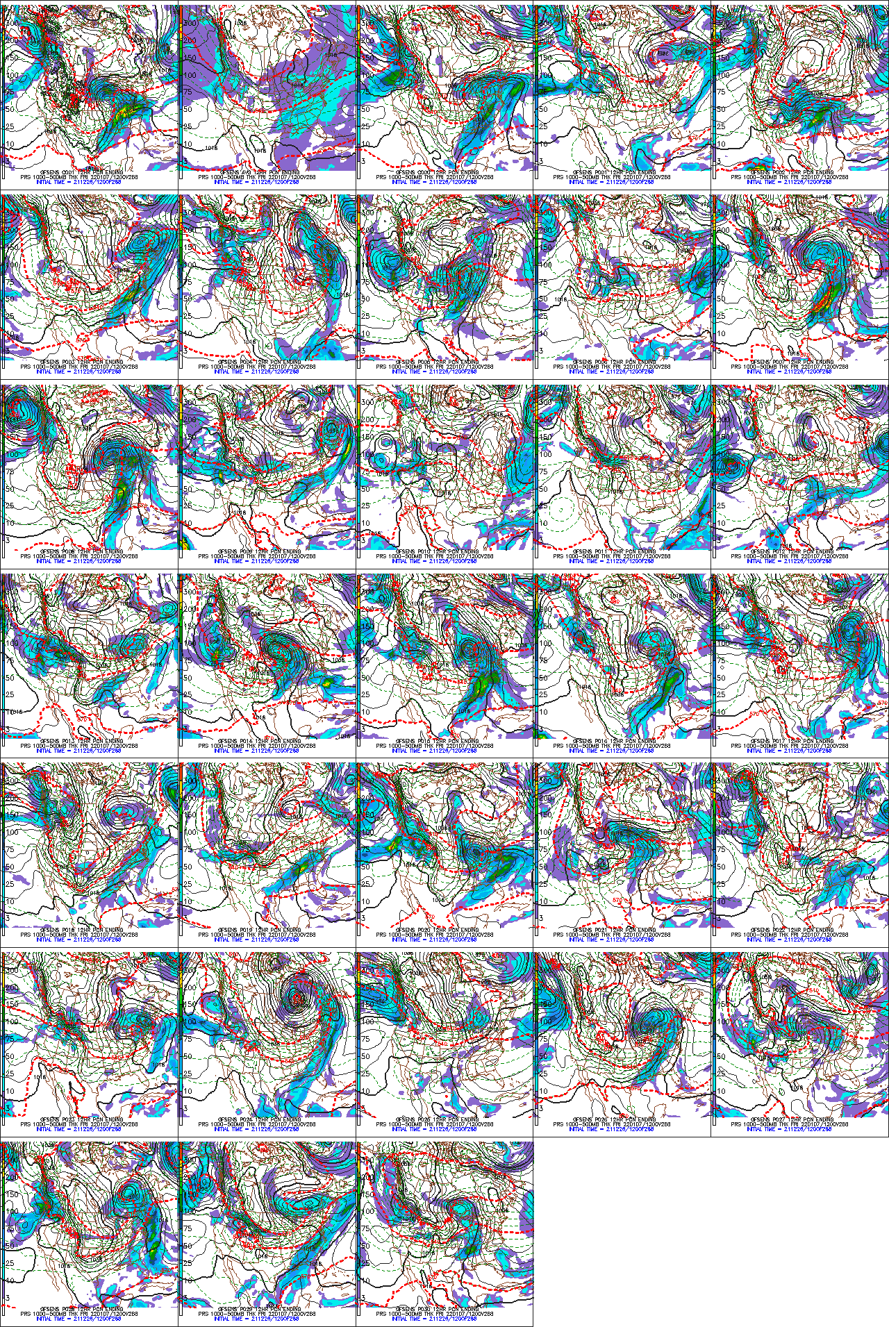
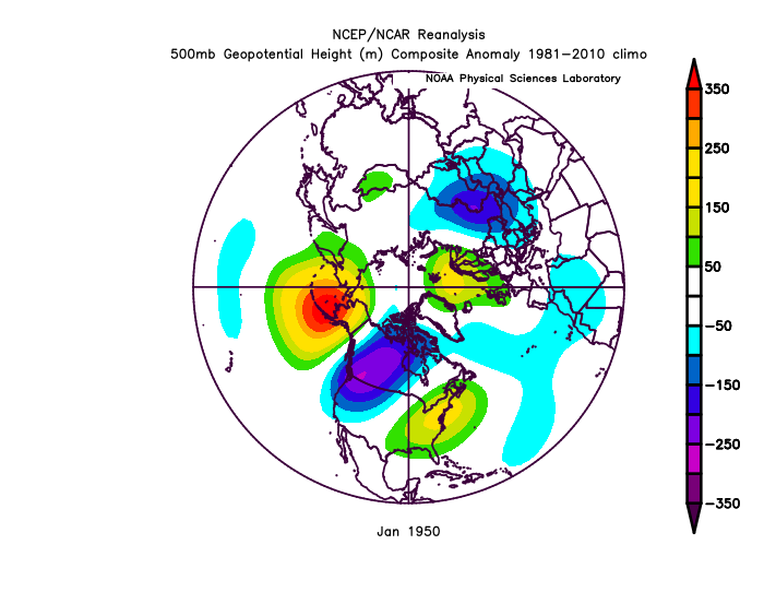
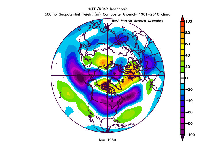
-EPO can be +8 in the upper levels, and below freezing at the surface. It's a below average temp pattern. -EPO with -NAO, which it should be, gives us snow, but the clouds are thin and it melts quickly. Both 2010 and 1950 had big -EPO's for a few days while transitioning away from -PNA. see how warm it is The 2 biggest -PNA's on record, in transition, both produced big -EPO's, 2/2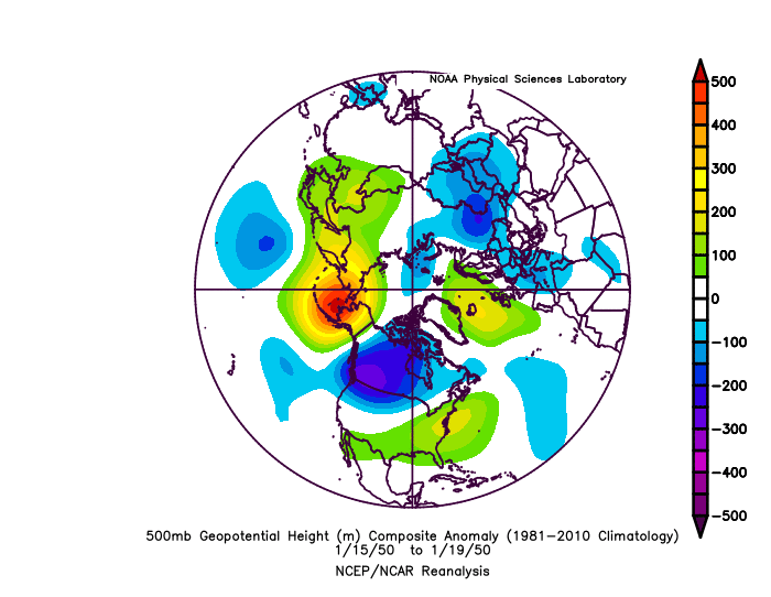
-
January Medium/Long Range Discussion
StormchaserChuck! replied to WinterWxLuvr's topic in Mid Atlantic
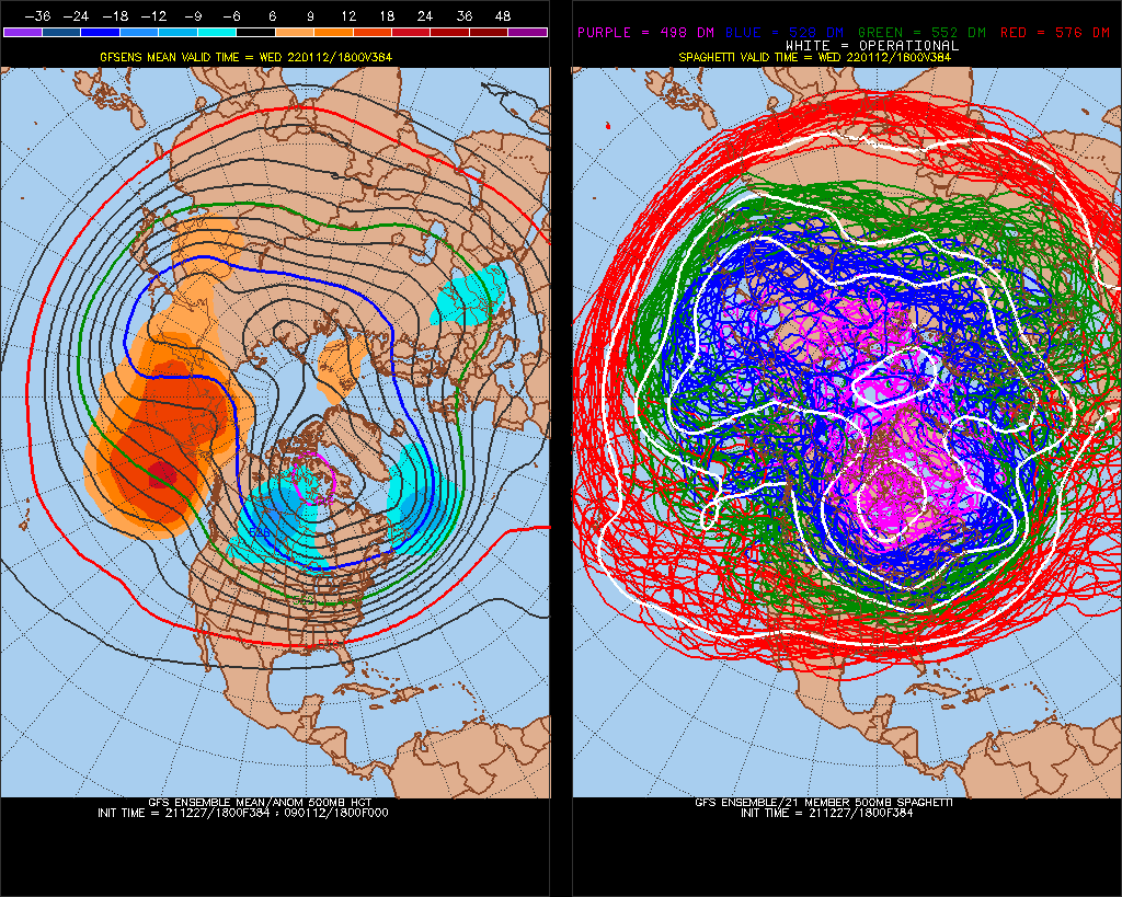
0z GFS ensemble mean had +400dm -PNA, 6z has -EPO. It will be -EPO with Low underneath +PNA. We'll be cold as long as the NAO stays negative -
-
January Medium/Long Range Discussion
StormchaserChuck! replied to WinterWxLuvr's topic in Mid Atlantic
Super warm ENSO subsurface water in the west, if it moves east.. 1988 is the only example, Stronger El Nino with negative subsurface waters (opposite correlation) I think subsurface dominates lately.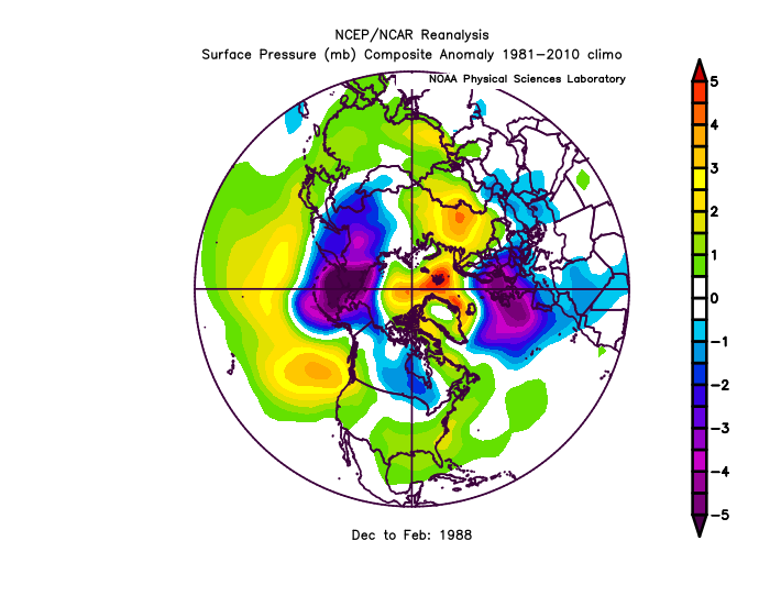
-
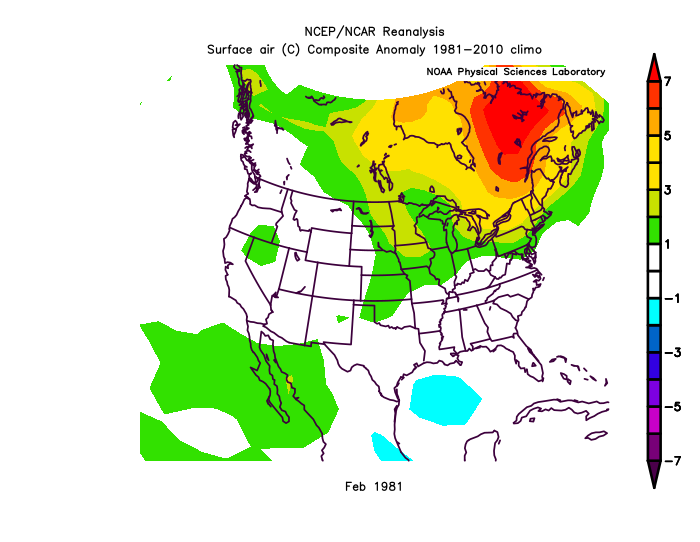
Jan 1981 was the biggest +PNA on record for DJFM(CPC)
-
I wonder if it's correlated with western ENSO subsurface breaking +6c on CPC maps (today)
-
Bengals have always played the Ravens good.
-
January Medium/Long Range Discussion
StormchaserChuck! replied to WinterWxLuvr's topic in Mid Atlantic
I like this one
-
2021-2022 ENSO
StormchaserChuck! replied to StormchaserChuck!'s topic in Weather Forecasting and Discussion
+4 now in the western subsurface.. recent analogs 2000,2008,2009,-2010,2011,2012 Next Winter 3 La Nina - 1 Neutral - 1 El Nino for +4> western subsurface wave/cold east since 2000 -
+ to -

-
tied for this year for #1 strongest PNA Strong La Nina satellite era


-
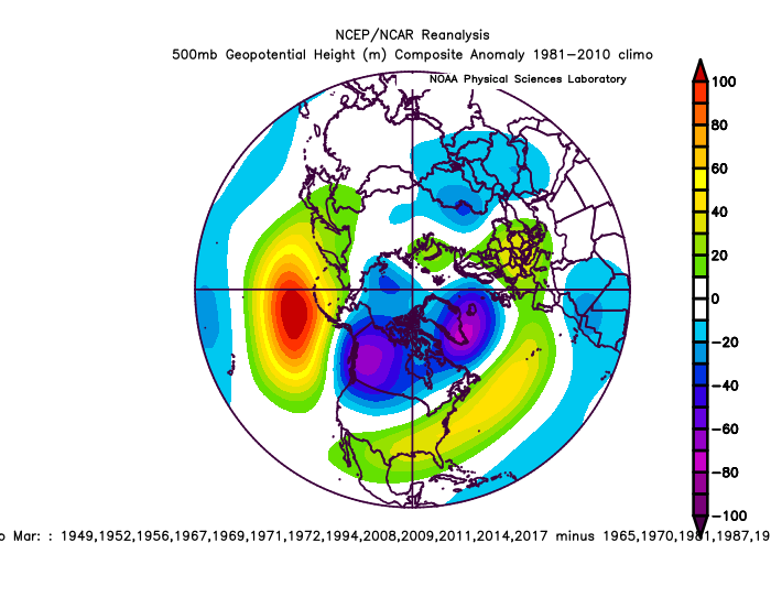
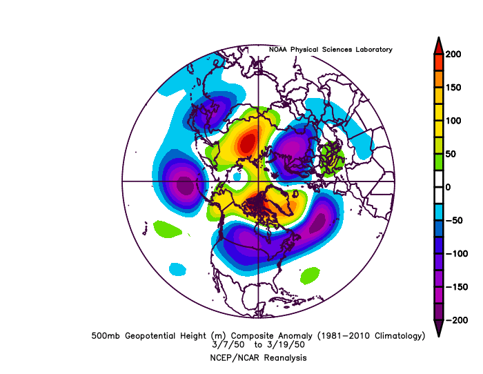
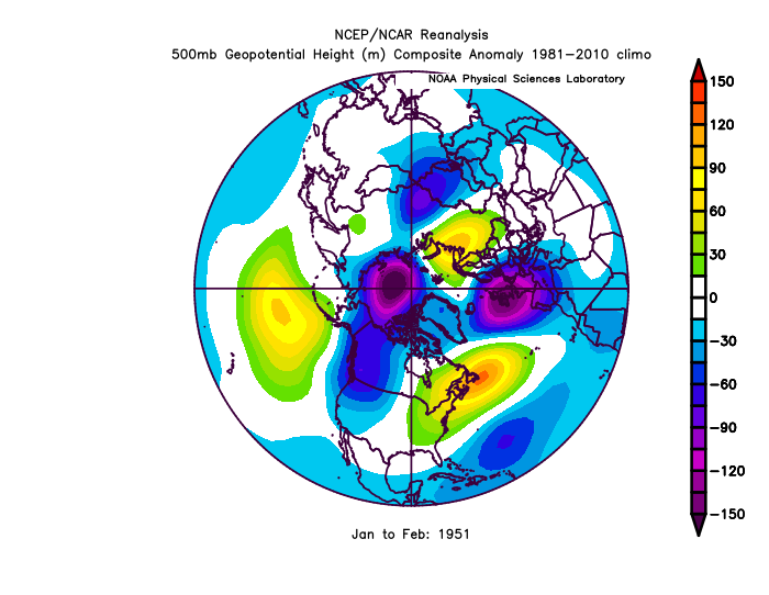
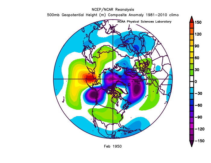
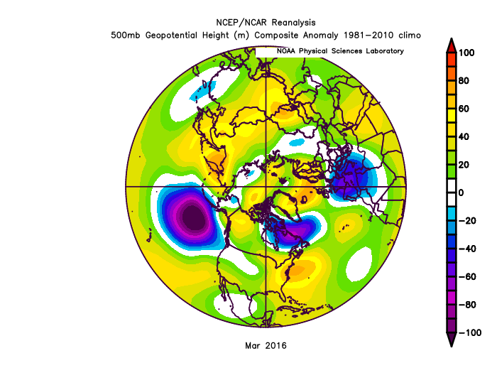
Look at this -PNA and how it evolved

-
Might even drop into the PNA
-
He was QB for Buccaneers for a few years.
-
January Medium/Long Range Discussion
StormchaserChuck! replied to WinterWxLuvr's topic in Mid Atlantic
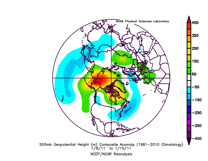
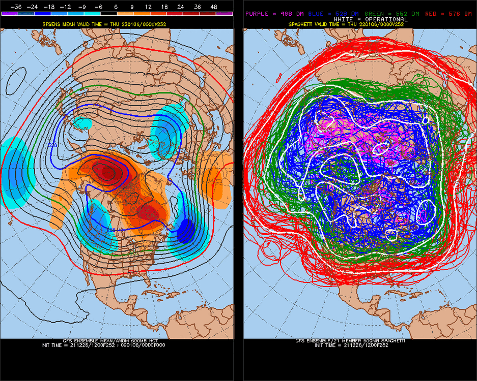
What does this get up to, +650? (Pacific ridge) This is new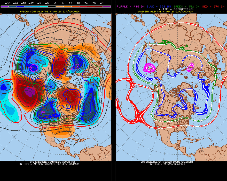
-
Mid to Long Range Discussion ~ 2022
StormchaserChuck! replied to buckeyefan1's topic in Southeastern States
We'll probably have a SE ridge in February. La Nina you will think is breaking because of January, but it will come back in February, the roll forward -PNA Dec is over/under +100dm -PNA for February, which I would take under, but NAO will likely even out the SE ridge difference. -
El Nino states seem to be more about the globe warming
-
January Medium/Long Range Discussion
StormchaserChuck! replied to WinterWxLuvr's topic in Mid Atlantic
Reminds me alot of the last few Winters. It will probably be warmer than average March, April, May. -PNA -
January Medium/Long Range Discussion
StormchaserChuck! replied to WinterWxLuvr's topic in Mid Atlantic
Well leave them outside today, it feels like April. We will probably get a few good snows in January. -
January Medium/Long Range Discussion
StormchaserChuck! replied to WinterWxLuvr's topic in Mid Atlantic
Yeah guys GOA Low will dig more than current models I think. (maybe a little bit weaker) -NAO persisting, that is the key. Stronger -NAO will be a good snowstorm. Stronger GOA low would be a major snowstorm, but that will dampen I think. -
Beautiful day, feels like March or April. I wonder if we'll have an early Spring this year, probably -PNA.
-
January Medium/Long Range Discussion
StormchaserChuck! replied to WinterWxLuvr's topic in Mid Atlantic
We're pretty close to a major storm here