StormchaserChuck!
-
Posts
2,274 -
Joined
-
Last visited
Content Type
Profiles
Blogs
Forums
American Weather
Media Demo
Store
Gallery
Everything posted by StormchaserChuck!
-

January Medium/Long Range Discussion
StormchaserChuck! replied to WinterWxLuvr's topic in Mid Atlantic
Yeah, it's going to be a very cold January. Let's see if we can get some precip patterns.. at the very least, La Nina is canceled out. It's usually wetter late Jan into Feb anyway. 15-16 is actually coming up as an analog, although we won't bomb a 30" blizzard probably.
-
Almost 70. With a strong -NAO too. I was impressed when the highs were in the upper 30s with -NAO, now I'm not impressed.
-
2021-2022 ENSO
StormchaserChuck! replied to StormchaserChuck!'s topic in Weather Forecasting and Discussion
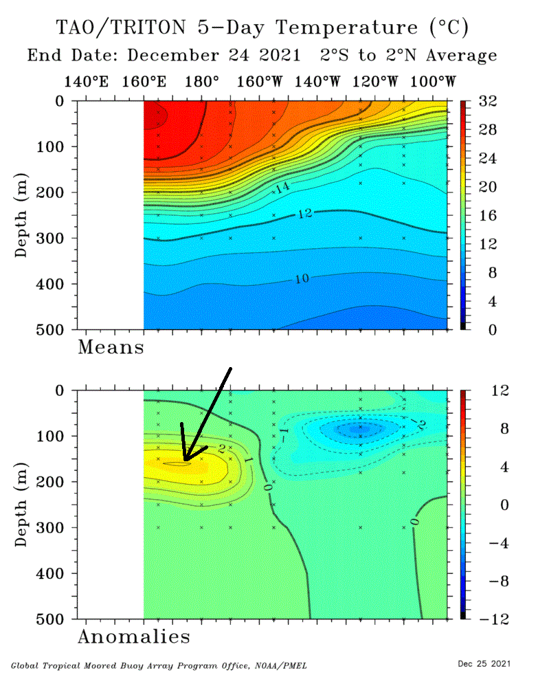
La Nina/+QBO = +AO, and El Nino/-QBO = -AO is a really good correlation. 10mb heights are best showing. -
January Medium/Long Range Discussion
StormchaserChuck! replied to WinterWxLuvr's topic in Mid Atlantic
Well, we'll get snow if there is a +360dm -EPO and -NAO too (384hr GFS ensembles) -
January Medium/Long Range Discussion
StormchaserChuck! replied to WinterWxLuvr's topic in Mid Atlantic
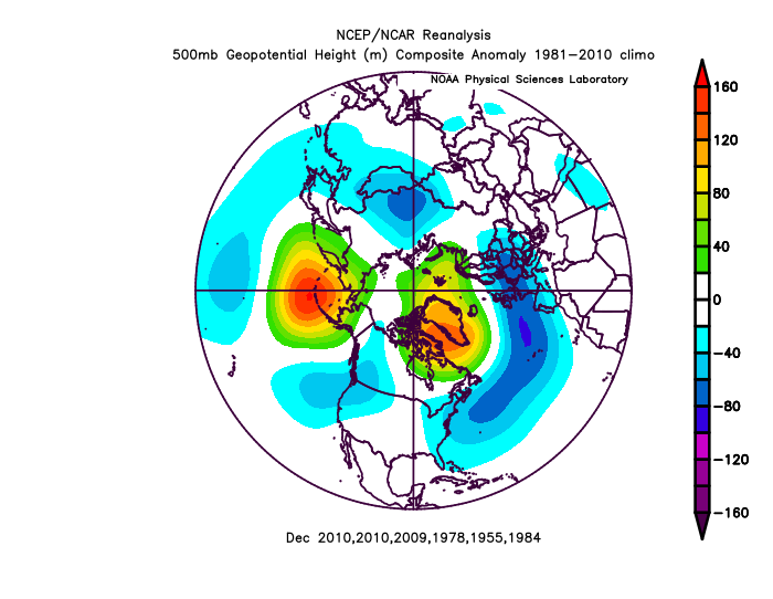
All my analogs had a -NAO January. -PNA's power to make it to Jan 15th is going to collapse. Here's what 2010 did,.. The record, A +300dm -PNA December Strong Nina. (#1 2010 +300, #2 1955 +230) ^It also began a pattern off the West coast that would really strengthen thereafter.. so we'll see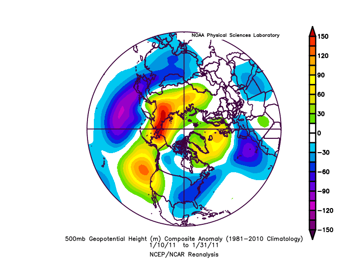
-
2021-2022 ENSO
StormchaserChuck! replied to StormchaserChuck!'s topic in Weather Forecasting and Discussion
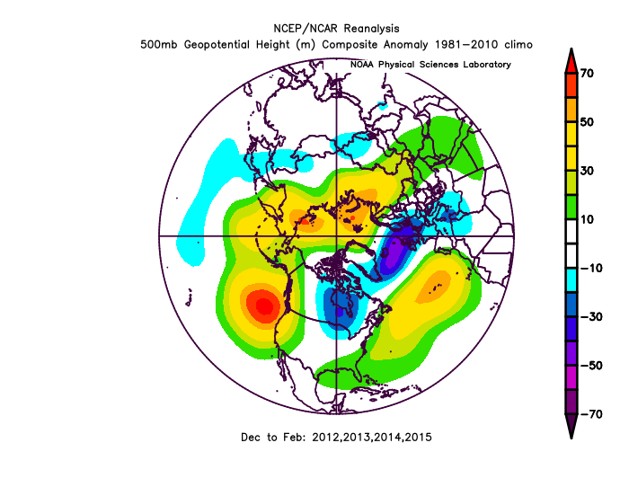
2010 was the last time we had record -PNA (+300dm in December) and we did bounce back a few years later in the PDO: 2014 0.30 0.38 0.97 1.13 1.80 0.82 0.70 0.67 1.08 1.49 1.72 2.51 1.13 2015 2.45 2.30 2.00 1.44 1.20 1.54 1.84 1.56 1.94 1.47 0.86 1.01 1.63 2016 1.53 1.75 2.40 2.62 2.35 2.03 1.25 0.52 0.45 0.56 1.88 1.17 1.54 -
January Medium/Long Range Discussion
StormchaserChuck! replied to WinterWxLuvr's topic in Mid Atlantic
SE ridge is strong on Monday. Btw, if this Pacific continues.. it's only logical We are 2x above #2 for Pacific ridge strength. 140% vs anytime any Winter since satelites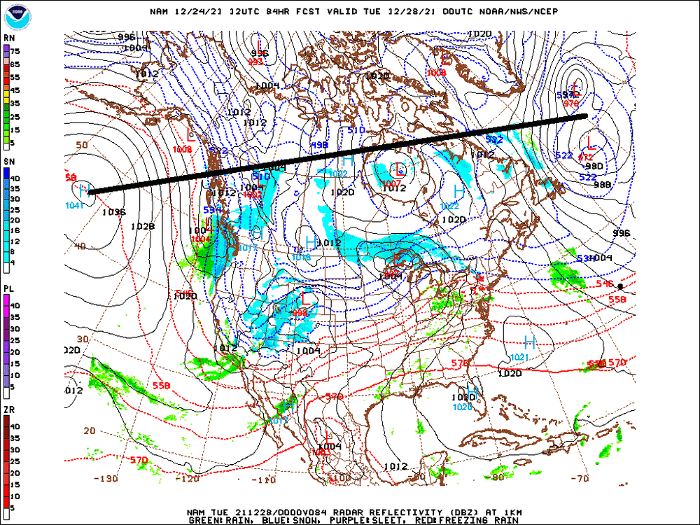
-
January Medium/Long Range Discussion
StormchaserChuck! replied to WinterWxLuvr's topic in Mid Atlantic
trying to link the Polar ridge from pacific/atlantic on 6z GFS ensembles hr384. If this fails, we might go really +NAO. -
2021-2022 ENSO
StormchaserChuck! replied to StormchaserChuck!'s topic in Weather Forecasting and Discussion
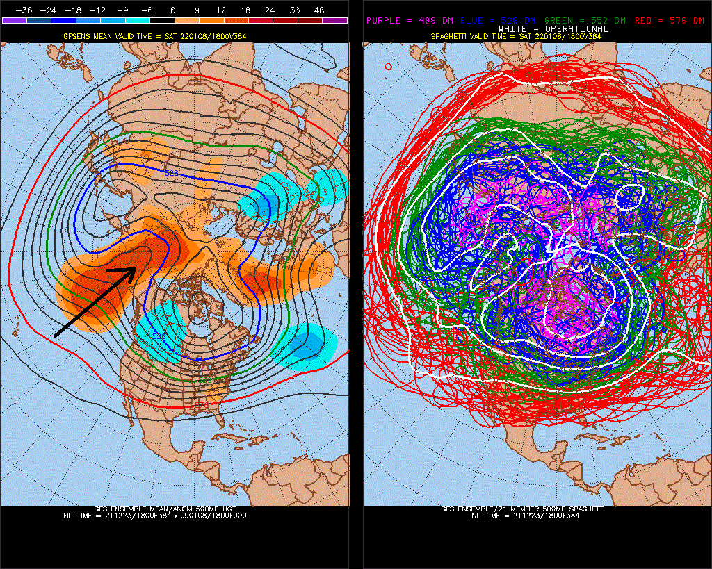
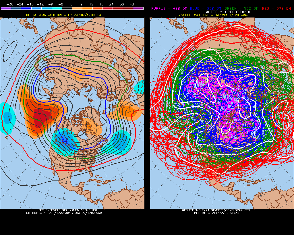
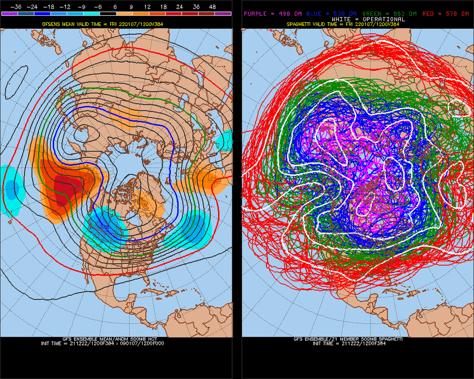
I can't believe the -PNA on GFS ensembles at 384 (Jan 10th), mean average is almost +400dm, still! That's about what we will be Dec - Jan 10 at that point (+400).. nothing before this (since 1948) was over +200. It may take several years to cool off of that, maybe 5. -
January Medium/Long Range Discussion
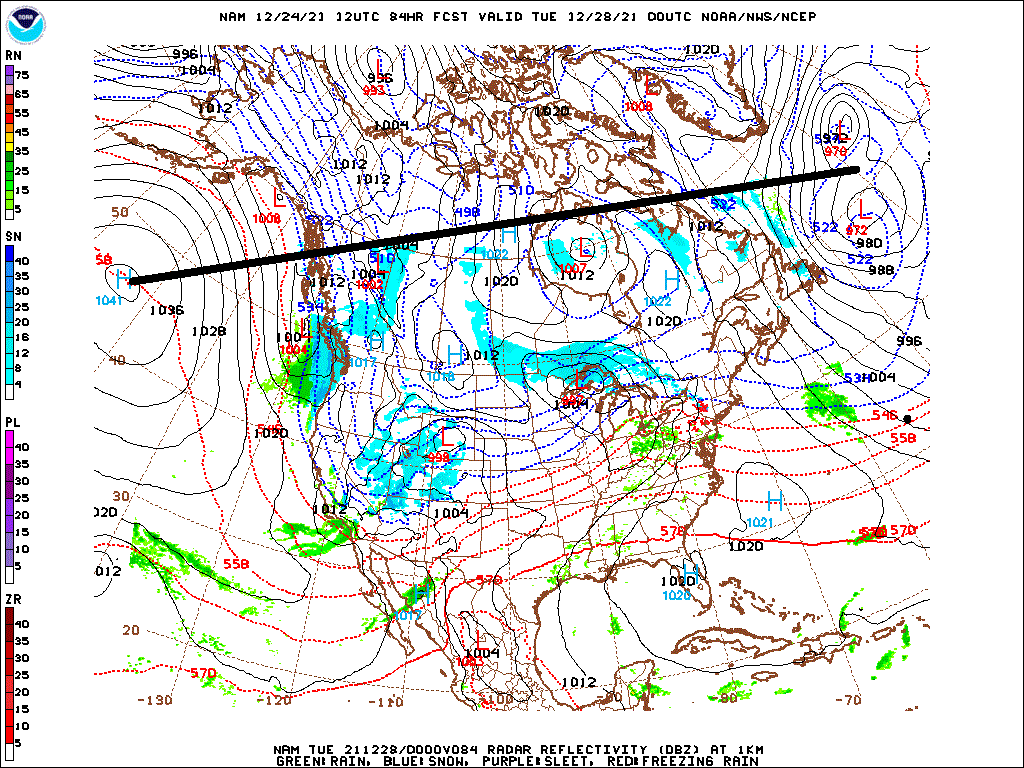
StormchaserChuck! replied to WinterWxLuvr's topic in Mid Atlantic
Monday -
2020 vs 2021
StormchaserChuck! replied to StormchaserChuck!'s topic in Weather Forecasting and Discussion
-EPO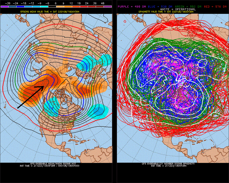
-
January Medium/Long Range Discussion
StormchaserChuck! replied to WinterWxLuvr's topic in Mid Atlantic
18z GFS ensembles went really cold in the long range -
Natural gas was highest during these Winters ^10/40 years
-
That's a good post, I don't see how CA/NV/AZ/UT/NM/CO can get cold again/trough that brings Spring severe weather in the Spring, without some major change. High pressure is setting up permanently there.
-
2020 vs 2021
StormchaserChuck! replied to StormchaserChuck!'s topic in Weather Forecasting and Discussion
Watching the Pacific +PNA +EPO -PNA -NAO Little +PNA here 2-21-22 could be +PNA 2-22-22 could be +PNA
-
fwiw
-
-NAO was stronger
-
January Medium/Long Range Discussion
StormchaserChuck! replied to WinterWxLuvr's topic in Mid Atlantic
I actually think we are experiencing everything now. Dec -PNA vs warm ENSOsubsurface is probably a less than 0.0c Nino3.4 signal through next Winter, (although it may wave+ in April-May). -
2021-2022 ENSO
StormchaserChuck! replied to StormchaserChuck!'s topic in Weather Forecasting and Discussion
Love MJO7. But it's bad news that PNA is not positive for 15 days, so the swing will probably be less. MJO7=-PNAto+swing, I think. -
January Medium/Long Range Discussion
StormchaserChuck! replied to WinterWxLuvr's topic in Mid Atlantic
I wouldn't be surprised if the NAO starts trending more negative at D10+ in future model runs.. -
January Medium/Long Range Discussion
StormchaserChuck! replied to WinterWxLuvr's topic in Mid Atlantic
-
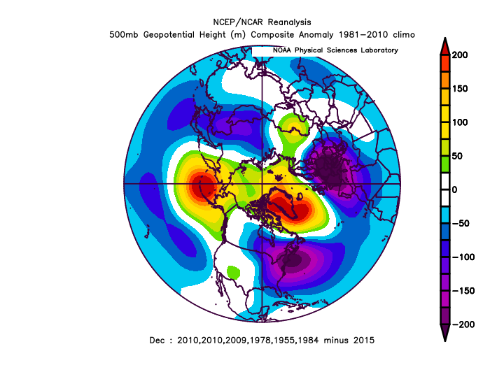
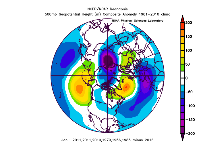
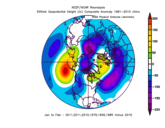
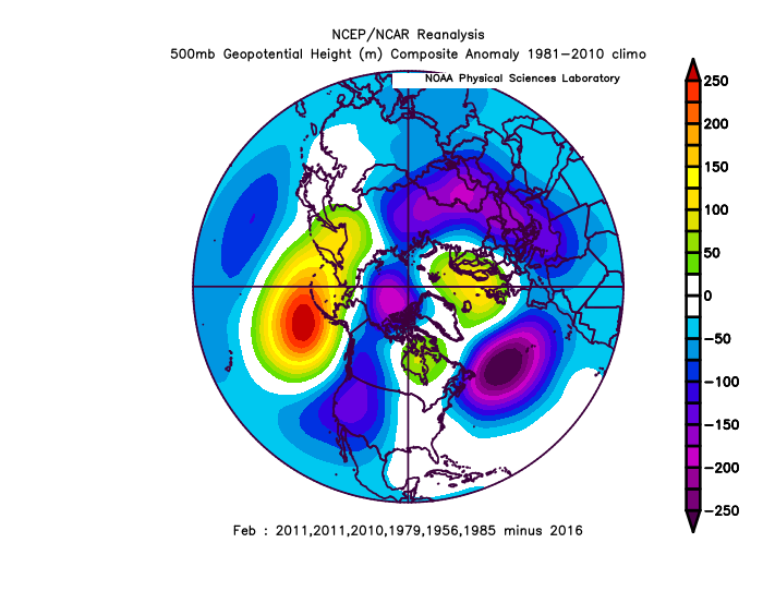
Largest 500mb December events since 1948 Defaults to northern nonfrozen water +warm/land cold January Hits AAM (Pacific + vs N Atlantic -) in February Minus negative (low pressure events)
-
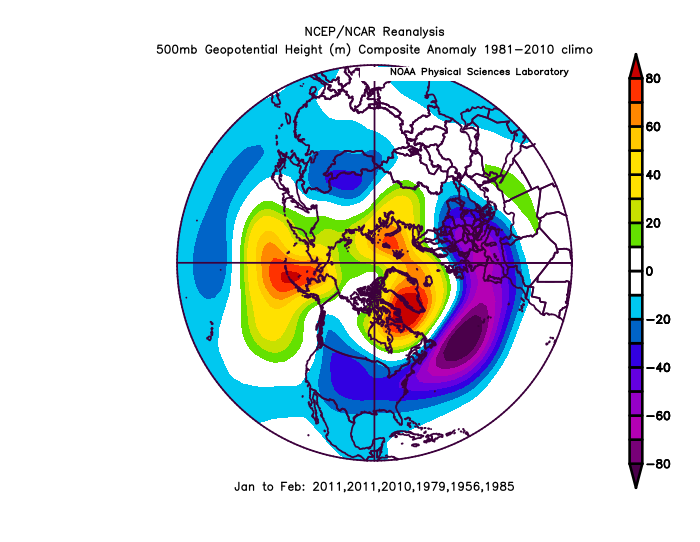
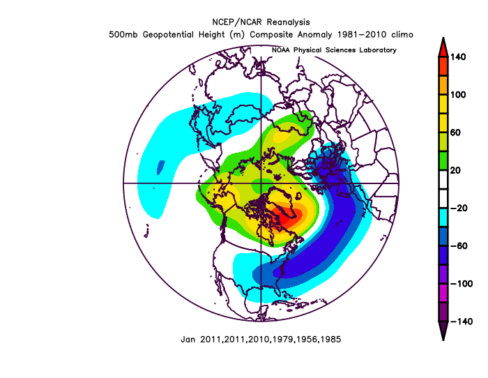
You guys have to see the decadal trend, 13-15 had a big NPH, Pacific coast High. We followed that with a Strong El Nino, then 7 years of -PNA. Everything since 2013 has happened repetitively/consistently.
-
January Medium/Long Range Discussion
StormchaserChuck! replied to WinterWxLuvr's topic in Mid Atlantic
STJ is weak.. I can see the pattern breaking down or nothing. -
Blowtorch alert for February.. -PNA is a really tough correlation with Dec-PNA/La Nina. late Jan last year ran at 3std's-NAO, we might want to flip that this late Jan/early Feb. January is our month I think.