The Iceman
-
Posts
12,313 -
Joined
-
Last visited
Content Type
Profiles
Blogs
Forums
American Weather
Media Demo
Store
Gallery
Everything posted by The Iceman
-
I haven’t found one yet, all I have are the couple screenshots I was posting as it was happening.
-
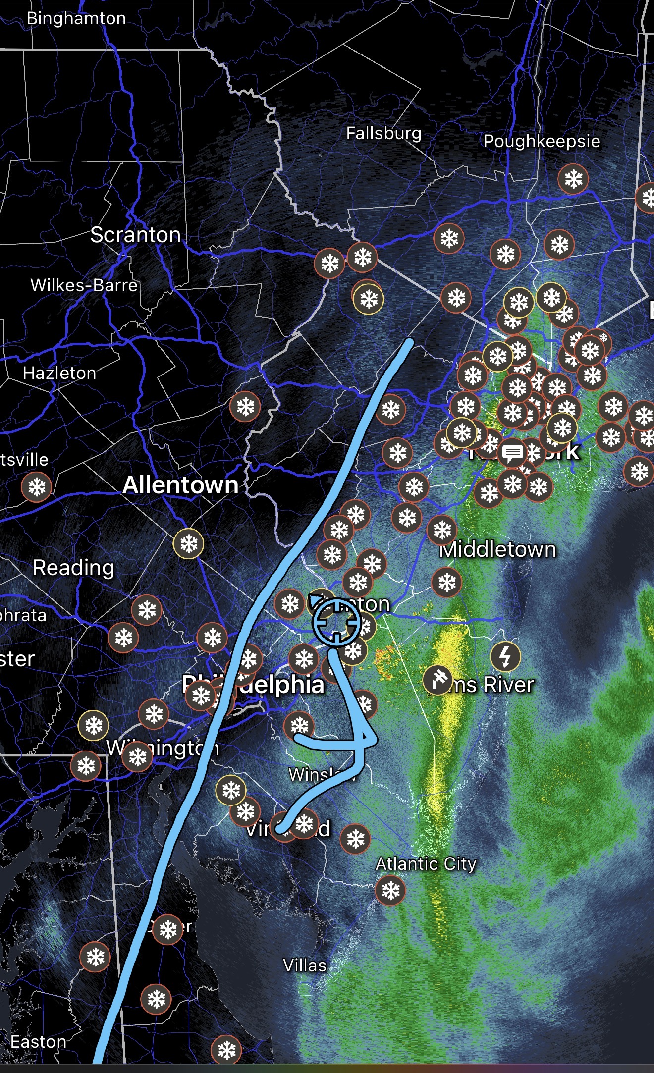
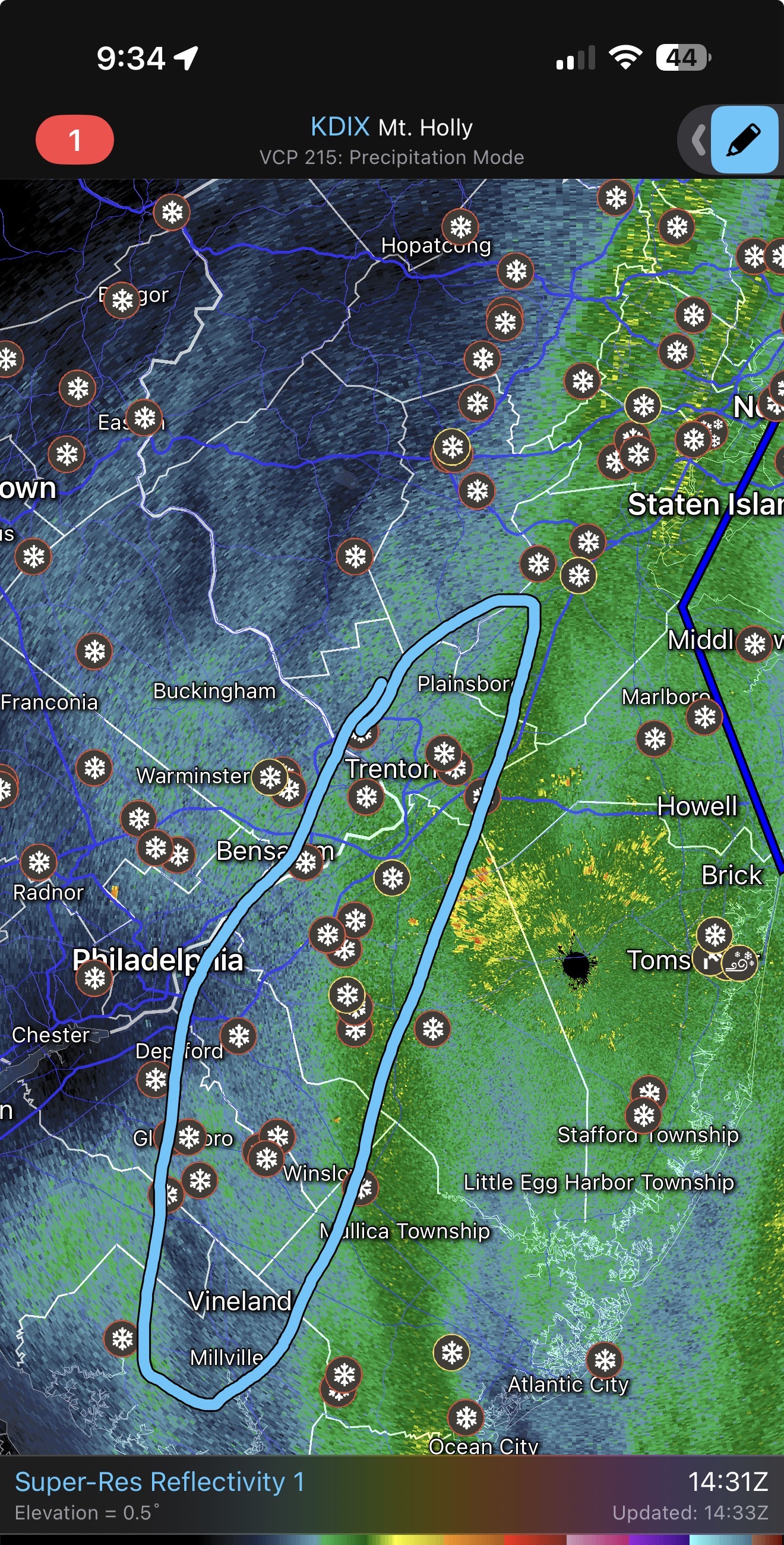
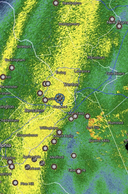
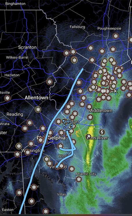
Does anyone have a storm radar loop for mt holly or where to find one? That deformation band really was a thing of beauty.
-
I believe that actually, the edge of that deform band rotted right there. West side of town probably didn’t get into the pivot.
-
Various pics of the storm and aftermath and one of my cat watching the snow out the window like her daddy.
-
The real ones planned in advance
-
Somehow it’s still snowing here and honestly picked back up a little bit. Full 24 hours of snow now. 30 hours of precipitation. The band that just won’t die
-
Compaction for sure. Most of my yard is 17-18” depths now. I was measuring my snowboard every hour basically all night and I cleared the board at 11 pm so that’s why. You’re not supposed to clear it I think until 12 hours but I needed to because of the blowing. That could have inflated my total by an inch or two. Several other reports near by of 20+ though!
-
That was me I put my spotter location as Falls Township because Levittown is so large.
-

E PA/NJ/DE Winter 2025-26 Obs/Discussion
The Iceman replied to LVblizzard's topic in Philadelphia Region
49.4” here absolutely agree this is an A+ winter now. All timer even if we were to torch tomorrow. -
Fast mover? Bro it’s been snowing for 22 hours here.
-
It’s somehow still snowing here… lol we might make it to 22” after all…
-
Yeah accuweather had me at 4-8” then upped it to 8-12 as I had 8” already. They were way too low for 95 to the coast.
-
Calling it at 21.8” as we taper to flurries. Not quite 2 feet @LowerBucksWx. Did you guys get there in lower makefield? My brother on river road said he had 21”.
-
Again that is a too Lehigh valley centric view. They do not consist of 3/4 the cwa. Everyone on the line below is going to verify easily.
-
Be careful shoveling above anything with snow… had a big chunk of snow/slush blow off the roof and nearly decapitate me…
-
I think somewhere in Monmouth or Burlington is going to be the true jackpot in our cwa. Freehold had 24.2” a few hours ago and they been under heavy echoes since then, someone in there is going to hit 30”. Manchester/Jackson area as well. They’ve gotten hit even harder than us in se bucks/ne Burlington.
-
Snow continues to redevelop over bucks county.. every time I think we are about done we get another little burst. 21.5”
-
lol hyperbolic to the extreme. If you believe 3/4 of the mt holly cwa underperformed there’s no arguing because that just isn’t reality.
-
I know you’re a little salty because you’re in the screw zone but let’s just say I disagree. There is a widespread area of 18-24” and 12-18”. This did not greatly underperform unless your expectations were out of whack.
-
That’s the nature of banding and coastal storms…some areas jack while others underperform. Overall this was well forecasted outside of the nw and sw edge.
-
I trust the NWS Mets at the office know how to take measurements over whoever the fuck Ginger Zee is.
-
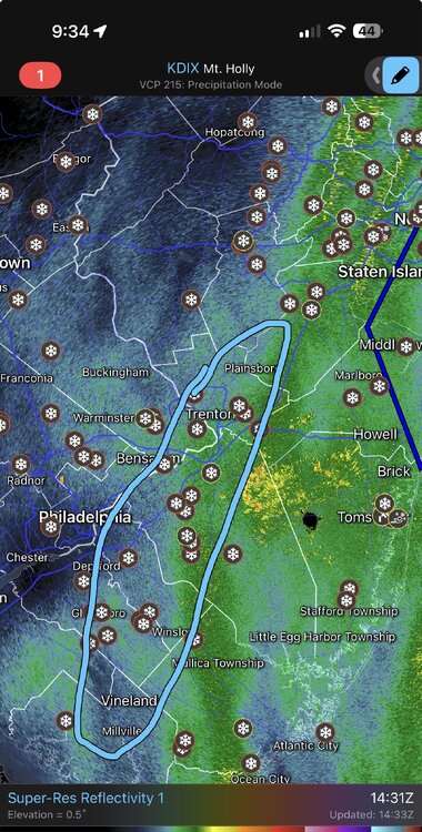
Not high at all, the deform band pivoted right in that area. Also lol at implying the NWS is measuring high…watch the radar loop
-
Everyone in this circle is 18-24” then it looks like a secondary maximum in freehold/monmouth area. It was actually pretty well modeled I would say.
-
21.3” 9 am
-
E PA/NJ/DE Winter 2025-26 Obs/Discussion
The Iceman replied to LVblizzard's topic in Philadelphia Region
I think technically 17-18 we had snow all 4 months but not above average for all 4.