WestMichigan
-
Posts
1,382 -
Joined
-
Last visited
Content Type
Profiles
Blogs
Forums
American Weather
Media Demo
Store
Gallery
Everything posted by WestMichigan
-

November 2024 General Discussion
WestMichigan replied to SchaumburgStormer's topic in Lakes/Ohio Valley
The last couple days salvaged the Fall snowfall for GRR. -
Winter 2024-25 Medium/Long Range Discussion
WestMichigan replied to michsnowfreak's topic in Lakes/Ohio Valley
Depending on the wind either you or I should be able to take advantage of the lake assuming the cold materializes. -
I-80/90 and would be a total disaster if that happens.
-
November 2024 General Discussion
WestMichigan replied to SchaumburgStormer's topic in Lakes/Ohio Valley
I am in one of those microclimates also. 33.8°F is my lowest so far this fall while everywhere around me has been into the upper 20's so far. -
Pivotal Weather also has the ECMWF out to 360. Looks like everyone has picked up on the change.
-
November 2024 General Discussion
WestMichigan replied to SchaumburgStormer's topic in Lakes/Ohio Valley
I grew up there and still have several family members living there. It is crazy dry down there. Wells are running dry, smaller creeks have stopped flowing, the cracks in the hard clay ground are exactly what you would think of when you think of dry western scenes. Many trees basically didn't turn color, they just lost their leaves. I know of farmers that didn't bother harvesting corn because it would cost more to harvest than they would get out of it. They just turned it under and are hoping for crop insurance to help out until they can plant next spring. It is everything you would imagine severe drought would look like in an area that doesn't normally experience those conditions. -
Complete whiff here, but GRR did manage to get 0.02". Everything split and went north or south of here. I am picking up some drizzle this morning from the lake.
-
It has been a windy last couple of days. Had a peak gust of 44 yesterday and 51 so far today.
-
Muskegon County hanging on for dear life.
-
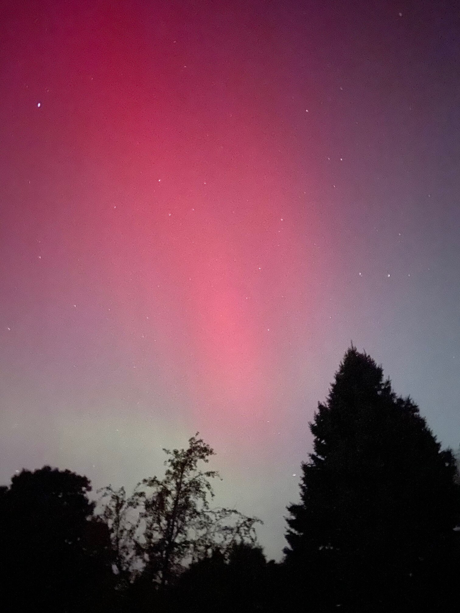
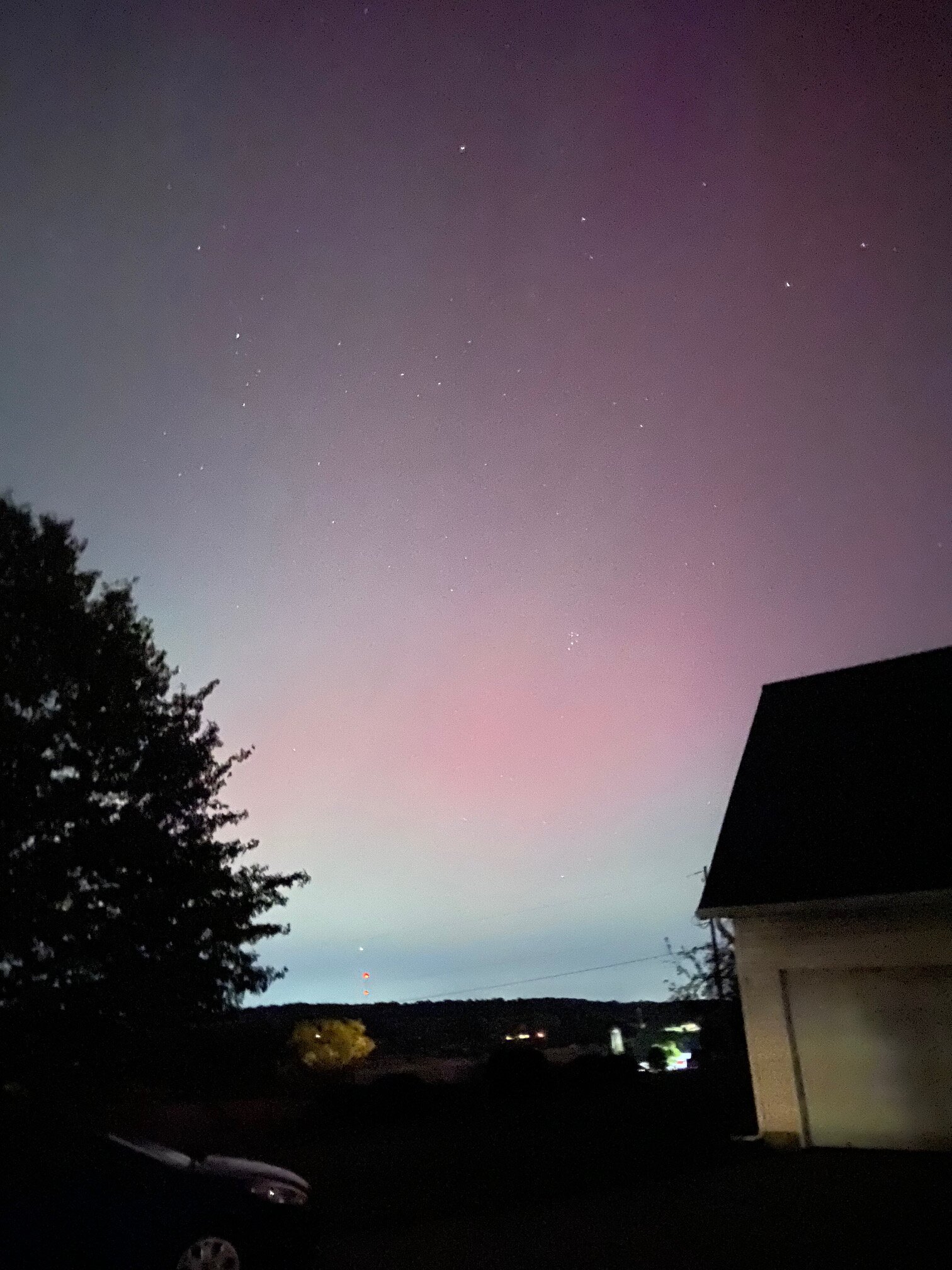
From one side of the state to the other. This was last night's view near me.
-
Greenfield Village?
-
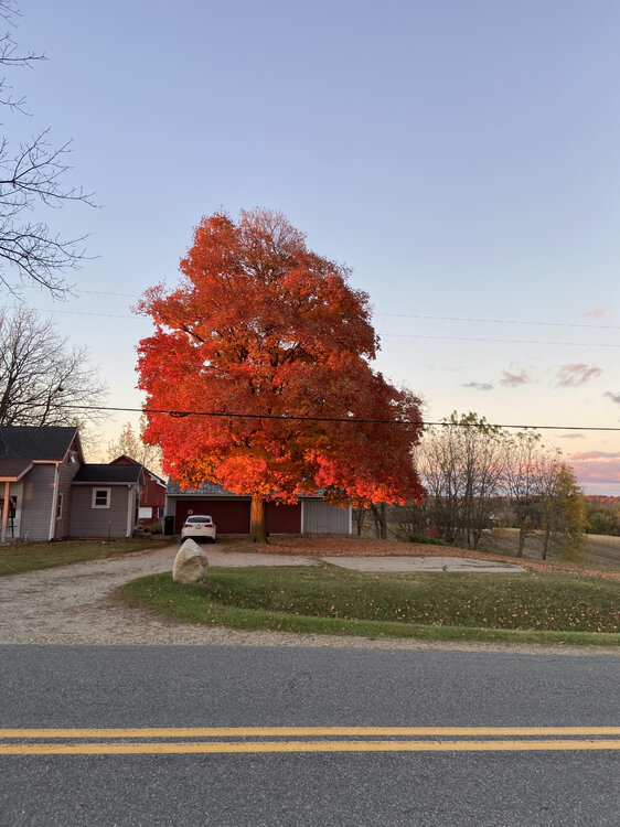
39° at my house on top of a hill this morning and about a half mile away at the bottom of the hill my car read 34°. Small change in location make a large difference on clear nights that radiate well.
-
Looks like one spot in the UP is on the boards with 0.1" of snow.
-
Not a great show last night, but I did manage to get a couple of ok pics.


-
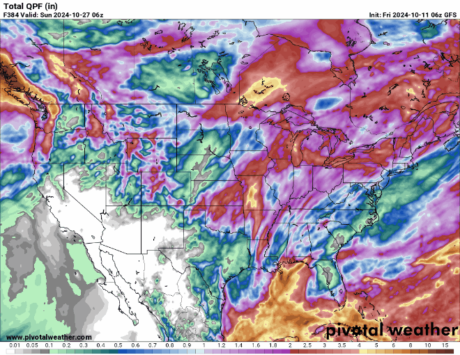
Nice to finally see some precipitation showing up. Yeah, it is the GFS but hopefully after weeks of dryness it is on to something.
-
Play the time lapse backwards and you can see some cool shots.
-
Fall/Winter '24 Banter and Complaints Go Here
WestMichigan replied to IWXwx's topic in Lakes/Ohio Valley
NOAA Kp index breakdown Oct 10-Oct 12 2024 Oct 10 Oct 11 Oct 12 00-03UT 2.00 7.67 (G4) 5.33 (G1) 03-06UT 2.67 8.00 (G4) 5.00 (G1) 06-09UT 1.67 7.33 (G3) 4.67 (G1) 09-12UT 2.00 6.67 (G3) 4.33 12-15UT 4.67 (G1) 6.33 (G2) 4.33 15-18UT 6.67 (G3) 6.33 (G2) 5.33 (G1) 18-21UT 8.33 (G4) 6.00 (G2) 4.67 (G1) 21-00UT 7.67 (G4) 5.33 (G1) 4.33 The 3 hour window from 1200 - 1500 UT averages out to 3.33 right now so if anything it is either smaller or later than expected. -
Fall/Winter '24 Banter and Complaints Go Here
WestMichigan replied to IWXwx's topic in Lakes/Ohio Valley
Looks like around sunset and again around 11:00PM EDT are supposed to be the peaks. A high KP most of the night would indicate a good chance of seeing something tonight. -
120,000+ without power now in Florida. That is going to be a very large number by morning.
-
If GRR hits 80° today it will be 16th of the month and the most on record.
-
Same amount here. Could definitely use more but nice to see it rain again.
-
I look forward to this thread every year.
-
Any reason why?
-
-
+0.2° departure for the summer. You have to have a little ± departure allowed to be still called normal. I would call that NAW (normal and wet) not WAW.
- 231 replies
-
- 1
-

-
- absolute trainwreck?
- abandon all hope?
- (and 1 more)