EastonSN+
-
Posts
9,110 -
Joined
-
Last visited
Content Type
Profiles
Blogs
Forums
American Weather
Media Demo
Store
Gallery
Everything posted by EastonSN+
-
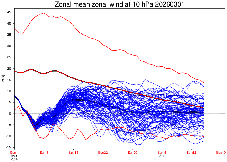
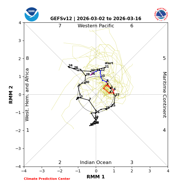
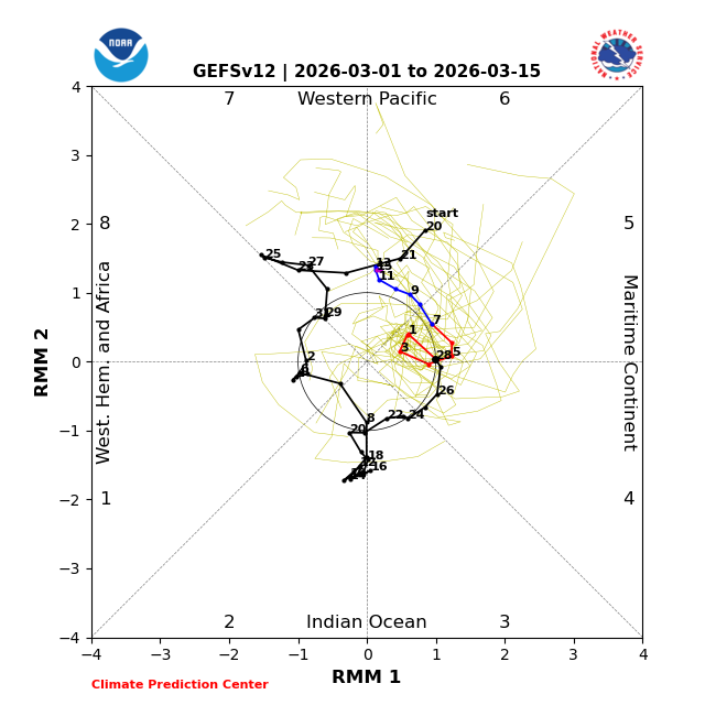
It could be the case - out of curiosity what drove the persistent-ao this year? Looks like we do hit 8 once again but will see if its early enough.
-
Also working against March and April snow is the fact that it seems decadal. 90s snowed often in March and April. 00s hardly snowed 10s snowed often 20s barely snows Of course all this is timing. If we were hitting phase 8 now and the current reversal happened 2 weeks ago we may be looking at heavy snow in March. Looking at the CPK snowfall chart, oddly it seems that when we have an above average snowfall December March is not snowy and vice versa (for example this year, 18/19, 13/14, 14/15 etc...). Only in rare winters like 95/96 and 02/03 do we have "wall to wall" snowfall. 13/14 came close but DC "stole the snow" that year.
-
Thanks Don. This morning we are finally seeing a movement to phase 8 where previously it was stuck in 6. Also the wind reversal is imminent. Of course, all this may effect us too late where we would need everything line up perfectly (night, high rates, arctic air, track...).

-
Starting to show movement to phase 8.
-
The next period starting to show up on the ensembles. We will see if its cold enough tk het CPK to 50 inches.
-
My TWC forecast has a chance of showers or rain from the 3rd through the 15th. Only two days of sun. Yay for spring in the NE. With we could just jump to June.
-
-
NWS has a great page for the storm. Radar loop as well as surface map loop.
-
-
That's so dd I see it.
-
Time will tell. However the waters in the phase 7 and 8 regions are warming fast which will allow for more big storms.
-
1.47 inches of snow loss is probably right IF we have started to see a decline. I still contend that a lot is up in the air like storm intensity increase and general added moisture leading to higher snowfall per event, even if the number of storms potentially decrease. Also the first 6 years of that horrible 30 year stretch averaged 15.85 inches, including one 2.8 inch snowfall year, which we are 4.58 inches ahead of the first 6 years of this decade.
-
I like comparing that 30 year period to now as 1970/71 followed the epic snowfall stretch of 1955 to 1969 just like we have recently exited the recent epic stretch.
-
If we have seen the last snowfall for NYC this season, the average snowfall for this decade so far would be 20.43 The average for the 30 year period of 1970 through 1999 was 21.91 NYC is behind by 1.47 inches. The 1970s avg was 21.25. NYC is behind by 0.82 The # of above average snowfall winters from 1970 through 1999 was 4 (including 78/79 which was 29.4). NYC has already received 2 above average snowfall winters in 6 seasons this decade, well ahead of the pace. We have seen 3 <50% snowfall winters this decade. The 1970 through 1999 total was 11, NYC is ahead of that pace. Will continue to monitor.
-
Here are a couple recent


-
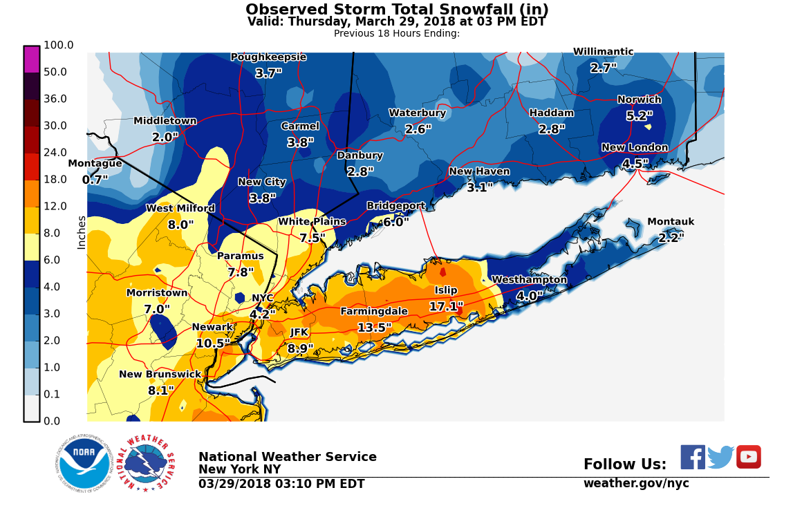
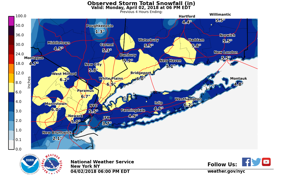
Yup or a frigid airmass like April 2018 (6 inches CPK). I just feel that it would really put this winter into epic category for NYC. IMBY at approx. 52 which is the most since 56 inches in 17/18. Would rate as an A- IMBY if this was the last of the snowfall.
-
RGEM and ICON really nailed that snowfall spike over NYC north to Danbury.
-
Still holding out hope that NYC can somehow reach 50 inches of snow. Last window will be late so will not be easy.
-
@GaWx this is hilarious. Brick wall.
-
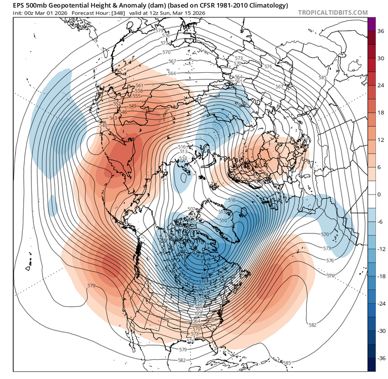
The GEFS takes longer to get to phase 8. Likely around the 20th.
-
Can start to see the phase 8 effects here. Blocking weaker than I expected given the reversal.
-
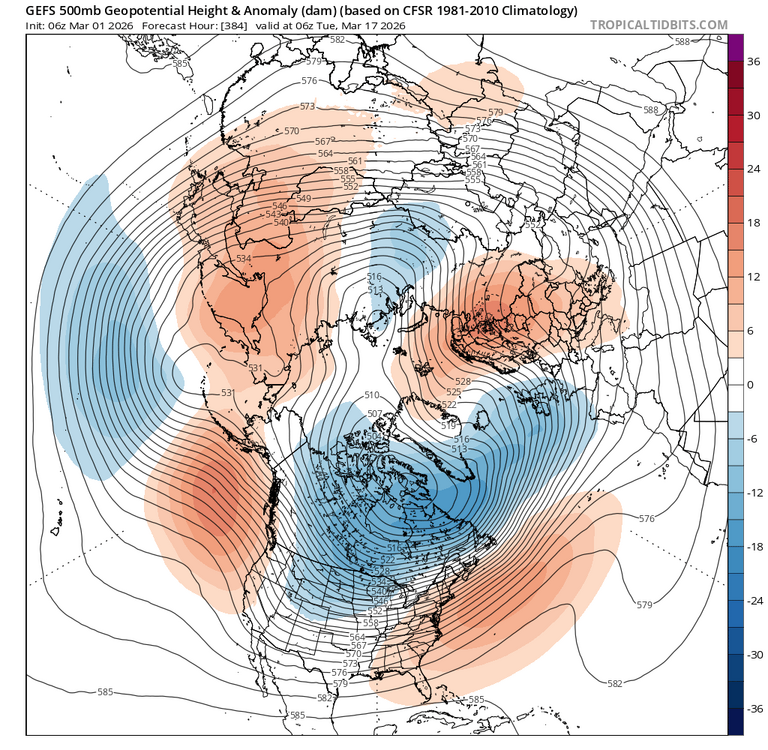
Likely will be March 20th through first week of April as the next window.
-
-
Phase 8 going into April.
-
I would have rather hit the cold phases of the MJO now since its still early and delay the warmth to April (obviously the temps would be higher then). Now we are going to have some warmth in March at the expense of April.