Blizzard of 93
-
Posts
11,789 -
Joined
-
Last visited
Content Type
Profiles
Blogs
Forums
American Weather
Media Demo
Store
Gallery
Everything posted by Blizzard of 93
-
Central PA - Winter 2020/2021
Blizzard of 93 replied to MAG5035's topic in Upstate New York/Pennsylvania
Here is the 6z GFS for Christmas Eve night! Rain changes to snow as soon as the cold front comes through. This run verbatim it delivers 3 or 4 inches of snow to a good chunk of CTP just in time for Christmas! -
Central PA - Winter 2020/2021
Blizzard of 93 replied to MAG5035's topic in Upstate New York/Pennsylvania
The 6z GFS has a little period of light snow tomorrow for a good part of CTP. -
Central PA - Winter 2020/2021
Blizzard of 93 replied to MAG5035's topic in Upstate New York/Pennsylvania
Great analysis @showmethesnow I would be happy with just a few snow showers or minor period of light snow over the next couple of days to give a coating to the current snowpack. What are your thoughts on the chances for the Christmas Eve front and potential for a post front period of snow ? -
Central PA - Winter 2020/2021
Blizzard of 93 replied to MAG5035's topic in Upstate New York/Pennsylvania
@showmethesnow Thanks for posting in here and please come back as much as possible! This pattern is loaded with potential! Before we even get to the Christmas possibility, there are a couple of small events to keep an eye on from Sunday to Tuesday that could freshen up our snowpack with light snow. -
Central PA - Winter 2020/2021
Blizzard of 93 replied to MAG5035's topic in Upstate New York/Pennsylvania
The 12z Euro & 18z GFS are on board with the post front snow chance on Christmas! If we lose some of our snow pack before the front, so be it if that is the price to pay for a several hour period of Christmas Eve or Christmas Day snow that could put down a few inches. It’s just great that this is even on table to track this week! -
December 16 2020 CTP Snowstorm Disco and Obs
Blizzard of 93 replied to pasnownut's topic in Upstate New York/Pennsylvania
Sounds great! I live just up the road from there! -
December 16 2020 CTP Snowstorm Disco and Obs
Blizzard of 93 replied to pasnownut's topic in Upstate New York/Pennsylvania
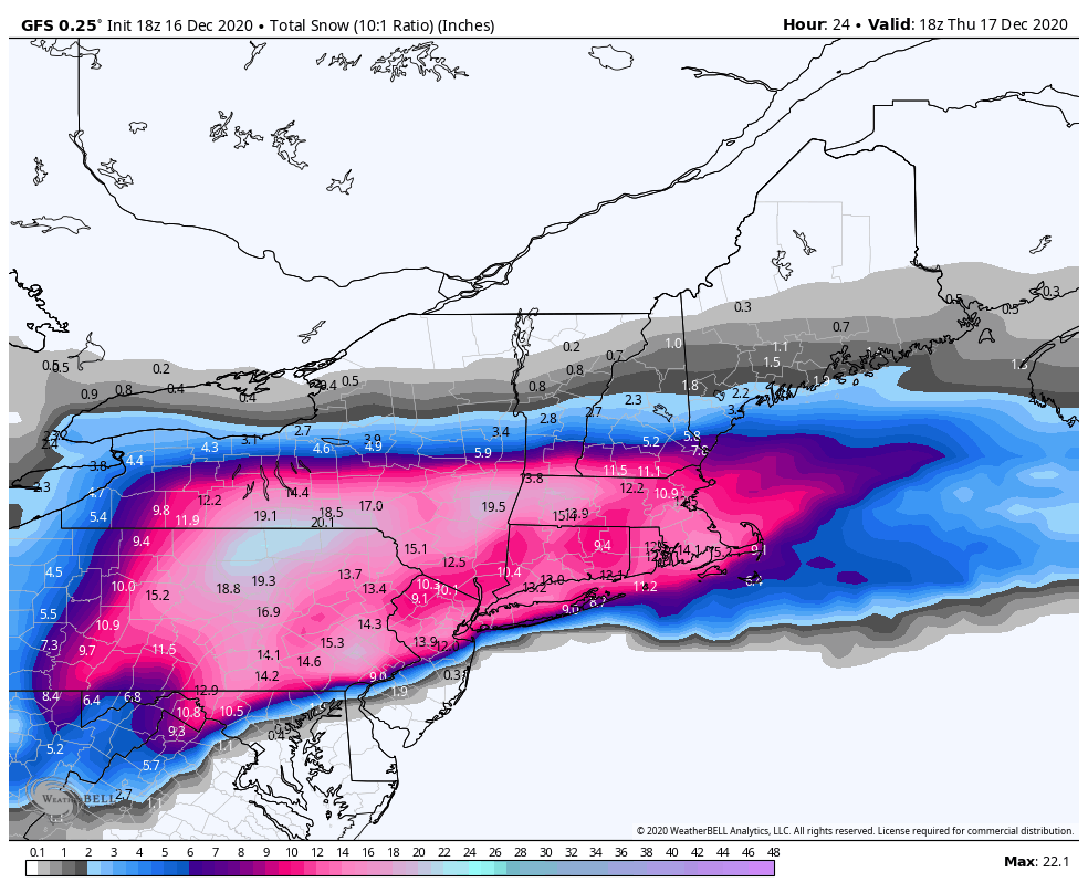
MDT 2 day storm total came in at 11.2 inches of snow. Great start to the season! -
December 16 2020 CTP Snowstorm Disco and Obs
Blizzard of 93 replied to pasnownut's topic in Upstate New York/Pennsylvania
After round 1 of snow, the nearly 4 hours of Sleet, then several hours of back end snow, I made it to 10 inches here in Marysville! It was a great storm for the LSV, especially by historical December standards. It looks like MDT will land in the top 5 for December snowstorms on record. They measured 9.3 yesterday as of Midnight, and there should be a couple of inches that get added today for the few hours of snow after midnight. It will be interesting to see where the 2 day total lands officially! Have fun digging out of the snow today! -
December 16 2020 CTP Snowstorm Disco and Obs
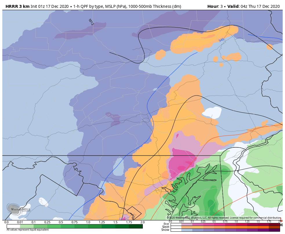
Blizzard of 93 replied to pasnownut's topic in Upstate New York/Pennsylvania
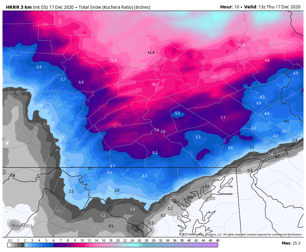
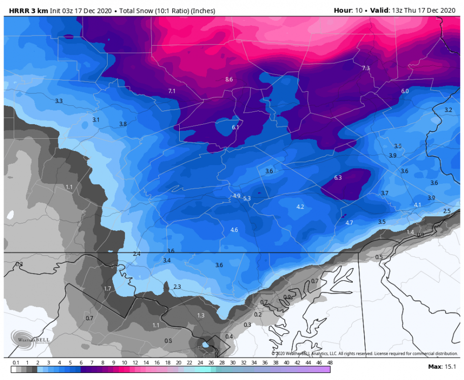
Latest HRRR has about 4 to 6 more inches of snow to go yet depending on which ratio wins out tonight in the LSV!
-
December 16 2020 CTP Snowstorm Disco and Obs
Blizzard of 93 replied to pasnownut's topic in Upstate New York/Pennsylvania
Yes, all snow in Marysville as well. -
December 16 2020 CTP Snowstorm Disco and Obs
Blizzard of 93 replied to pasnownut's topic in Upstate New York/Pennsylvania
The pivot on the radar is beautiful to watch develop. It is really filling in nicely! Do you guys think that the precip in western PA & WV will also pivot east towards the Susquehanna Valley? -
December 16 2020 CTP Snowstorm Disco and Obs
Blizzard of 93 replied to pasnownut's topic in Upstate New York/Pennsylvania
Mostly back to snow in Marysville with a little sleet mix. Rates are picking up as well. -
December 16 2020 CTP Snowstorm Disco and Obs
Blizzard of 93 replied to pasnownut's topic in Upstate New York/Pennsylvania
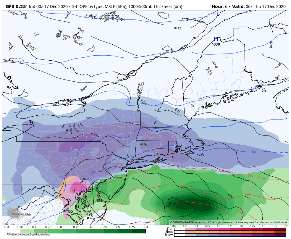
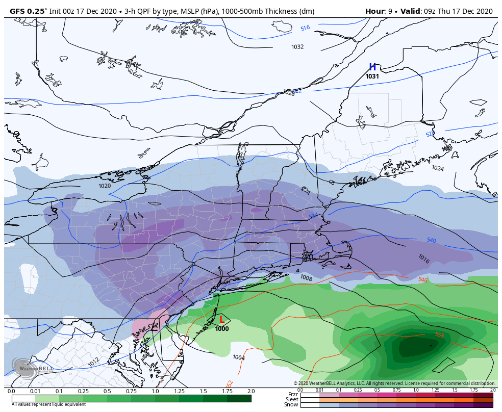
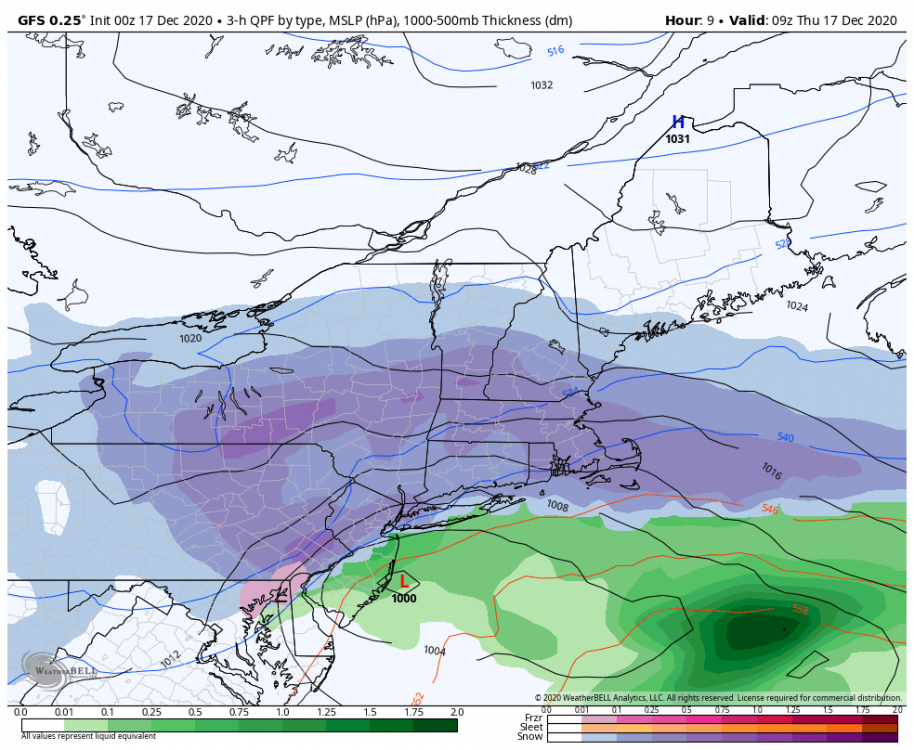
The 0z GFS is on board with the back end end snow for the LSV as well!
-
December 16 2020 CTP Snowstorm Disco and Obs
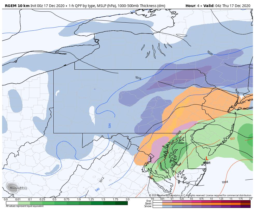
Blizzard of 93 replied to pasnownut's topic in Upstate New York/Pennsylvania
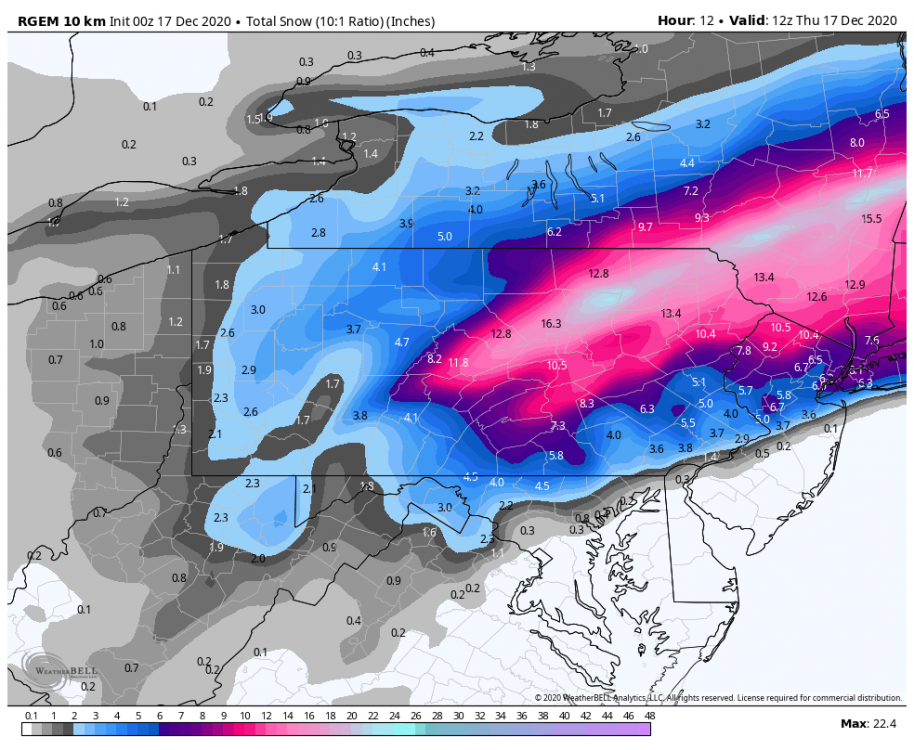
The 0z RGEM is on board with the back end snow for the LSV.
-
December 16 2020 CTP Snowstorm Disco and Obs
Blizzard of 93 replied to pasnownut's topic in Upstate New York/Pennsylvania
It looks like the radar is beginning to pivot with the band of precip from central PA down to northern VA. -
December 16 2020 CTP Snowstorm Disco and Obs
Blizzard of 93 replied to pasnownut's topic in Upstate New York/Pennsylvania
Sleet & snow mix in Marysville now. The latest HRRR says the Harrisburg area goes back to snow in the next couple of hours.

-
December 16 2020 CTP Snowstorm Disco and Obs
Blizzard of 93 replied to pasnownut's topic in Upstate New York/Pennsylvania
@Eskimo Joe I just read some of your analysis in the Mid Atlantic thread on the possibility of changing back to snow in northern MD. What are your thoughts for southern PA? -
December 16 2020 CTP Snowstorm Disco and Obs
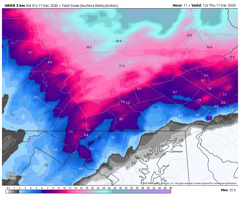
Blizzard of 93 replied to pasnownut's topic in Upstate New York/Pennsylvania
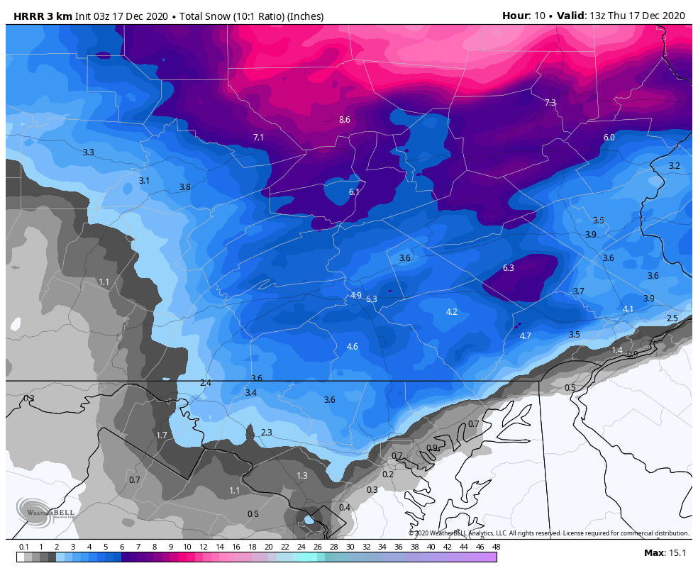
The 23z HRRR has another 6 or 7 inches of snow tonight for the Harrisburg, Lancaster, & York areas, with even a little more in Cumberland & Perry counties. -
December 16 2020 CTP Snowstorm Disco and Obs
Blizzard of 93 replied to pasnownut's topic in Upstate New York/Pennsylvania
How is the surface low track looking in real time? How soon could the LSV go back to snow as the coastal low further develops & heads northeast? -
December 16 2020 CTP Snowstorm Disco and Obs
Blizzard of 93 replied to pasnownut's topic in Upstate New York/Pennsylvania
CTP has this near term update this evening. .NEAR TERM /UNTIL 6 AM THURSDAY MORNING/... Lots of sleet over York and Lanc counties and even working up toward Harriburg and Lebanon, now. This will hold the numbers down, but may make it even more difficult travel-wise since people drive on the sleet and compact it, making it a sheet of ice. That can be tough for the plows to clear. Snow has returned to THV, though as the precip has lightened up. Dry slot expanding a bit as it moves into far srn PA. But, instability still there with thundersnow over Mt Davis (Somerset Co). The dry slot is somewhat concerning as any break of a couple of hours would kill the snow totals if we don`t see the N-S oriented bands set up and move at a turtle-like pace. There are bands over wrn PA (with the thundersnow) and it still looks like we will have the same conditions over central PA for the first half of the night. The lack of seeding over the clouds in the dry slot means it will be a snizzly/freezing drizzle which could fall for those couple of hours from now until 8 or 9 PM. The HRRR has the snow closing in around the dry slot about that time. Will mention --ZR for the next few hrs in the srn mtns/lower susq. -
December 16 2020 CTP Snowstorm Disco and Obs
Blizzard of 93 replied to pasnownut's topic in Upstate New York/Pennsylvania
6 inches of snow in Marysville as of a little after 6 pm, but we have now mixed with sleet as well here. -
December 16 2020 CTP Snowstorm Disco and Obs
Blizzard of 93 replied to pasnownut's topic in Upstate New York/Pennsylvania
MDT reported 4 inches as of the 5pm daily summary. -
December 16 2020 CTP Snowstorm Disco and Obs
Blizzard of 93 replied to pasnownut's topic in Upstate New York/Pennsylvania
Yes, same here in Marysville! The flake size increased in the last 15 minutes and intensity picked up even after the heavy band on radar moved through. -
December 16 2020 CTP Snowstorm Disco and Obs
Blizzard of 93 replied to pasnownut's topic in Upstate New York/Pennsylvania
The 18z GFS still buries the LSV despite some mixing for a few hours in parts of the LSV.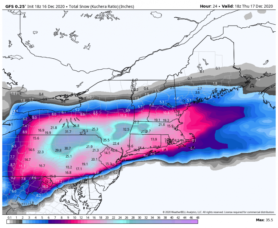
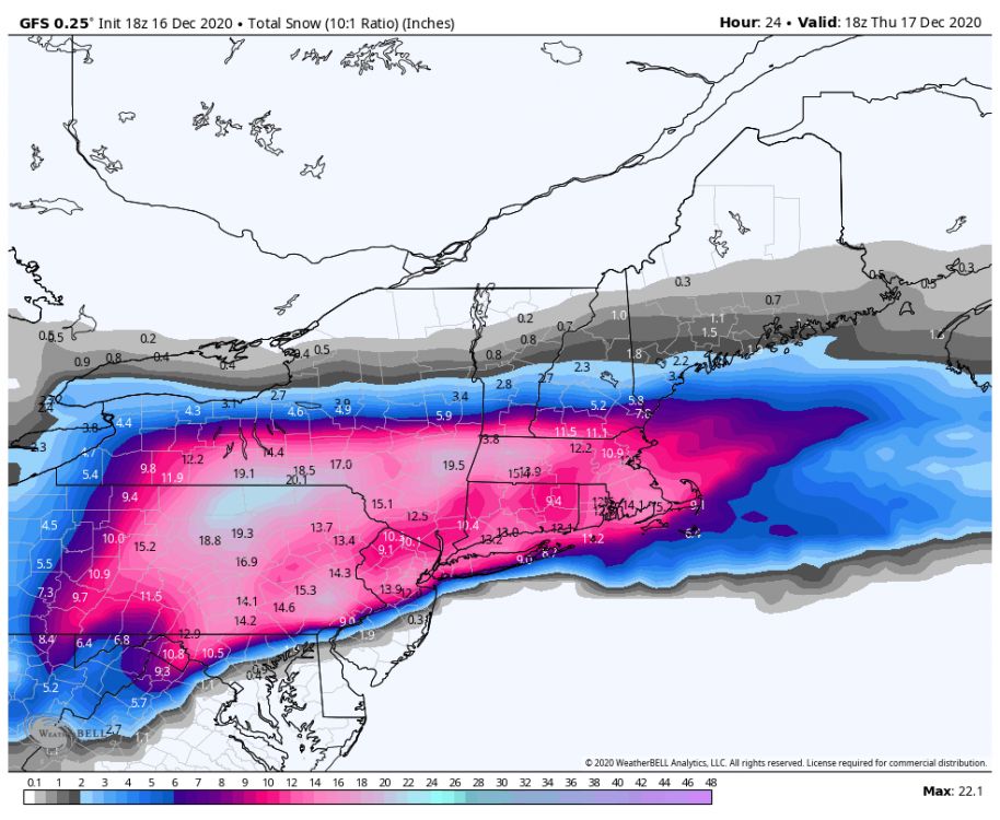
-
December 16 2020 CTP Snowstorm Disco and Obs
Blizzard of 93 replied to pasnownut's topic in Upstate New York/Pennsylvania
It is absolutely dumping snow under this heavy band that is approaching from the south.