Poimen
-
Posts
2,150 -
Joined
-
Last visited
Content Type
Profiles
Blogs
Forums
American Weather
Media Demo
Store
Gallery
Everything posted by Poimen
-
The Canadian is phasing the northern stream wave into the southern stream wave early--causing a more northward motion of the surface low and warm air overwhelming the CAD. The GFS has no such phasing so early.
-
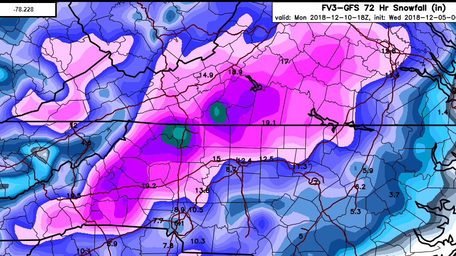
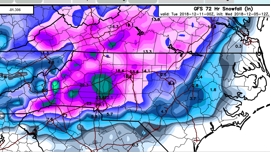
A close up view of the GFS with Kuchera method:
-
The soundings in the Triad from the GFS are pure snow until 0Z Mon. That's a good 12-16 hours of snow if true.
-
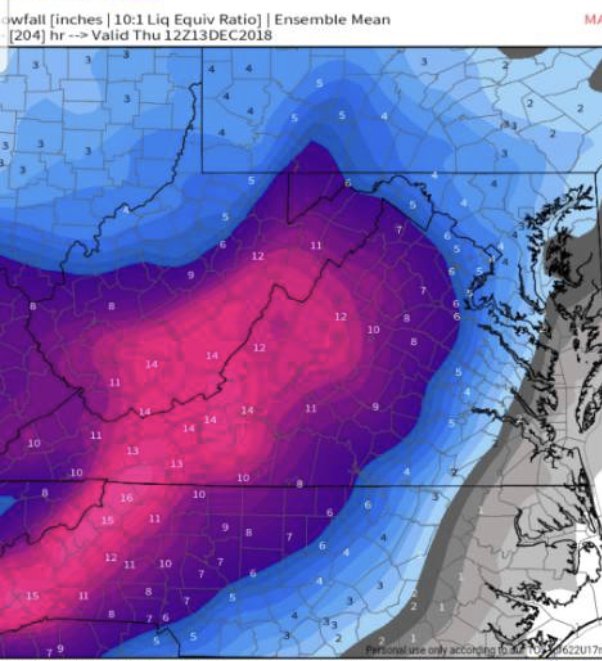
Yeah, the GEFS mean snowfall still focuses the highest totals over WRN NC/SW VA. Widespread 10-15" amounts from I-85 west.
-
I'm hearing a lot of talk about the EURO moving "north" overnight. From what I can tell, it takes the same basic southerly track along the Gulf Coast to off the SE coast as before. Any northward adjustment seems to be in relation to how far north it climbs the coast before exiting out to sea, which should have little bearing on the Saturday night/Sunday portion of the storm. So long as the track remains off the SE coast to Hatteras, I don't really care what it does thereafter. Just my 2 cent.
-
Stole this EPS map from the MA forum.
-
Neither model is as cold as the NAM at the outset, but they're cold enough to get the job done. We're still going to need to wait a few cycles before we can confirm if the NAM's thermal profile is closer to reality.
-
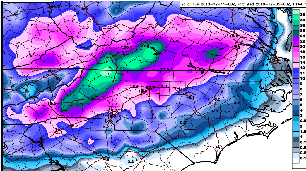
6Z FV 3 does it again. Just like the GFS, it's a classic Miller A. Should be big totals on those clown maps.
-
Waiting on the FV 3 to load is like waiting for my wife at the mall...lol. This thing is slower than molasses going uphill in the middle of January.
-
Keep in mind, the GFS is considerably warmer compared to the NAM at the outset and yet it still produces a great storm.
-
The 6Z GFS is a classic Miller A snow storm for the Carolinas. It begins with a good thump of snow for many, narrowing to the favored areas as the storm makes its closest approach...becoming mainly a snow vs. rain event, with little ice. The soundings for the Triad are all snow soundings through the storm (perhaps some sleet around 18Z Sunday)...thus the high totals.
-
The 0Z FV 3 and 6Z GFS were great runs for the NC Piedmont.
-
Big picture: I think there is strong confidence in a solid front-end thump for a good portion of the NC Piedmont Saturday night/Sunday morning, transitioning to mixed p-types during the day Sunday. All in all, confidence seems high right now in a significant winter storm that will feature heavy wet snow, sleet, perhaps freezing rain and then plain rain for some. Regardless of the totals, this should be a good way to kick off the winter.
-
In other news, the Canadian says "Don't sleep on that backside deform band."
-
Sitting here looking at 7-10" amounts from the GFS for the Triad and felt lousy for a second, then I realized that 7-10" is a really good storm. lol.
-
GGEM is tracking close to the previous EURO..a shift for this model. I see a trend here...and it's a good one.
-
ICON with a favorable track off the SE coast with snows for the Piedmont.
-
The NAM finishes with an impressive 1041 mb HP over IL at hour 84. sub zero 850 temps well into SC and dew points into the teens in northern NC.
-
at HR 63 on the NAM, HP over Iowa is 1040 MB. That's the strongest I've seen it modeled.
-
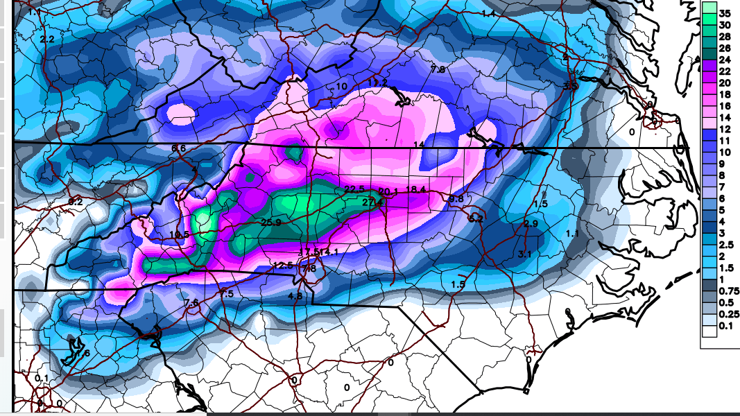
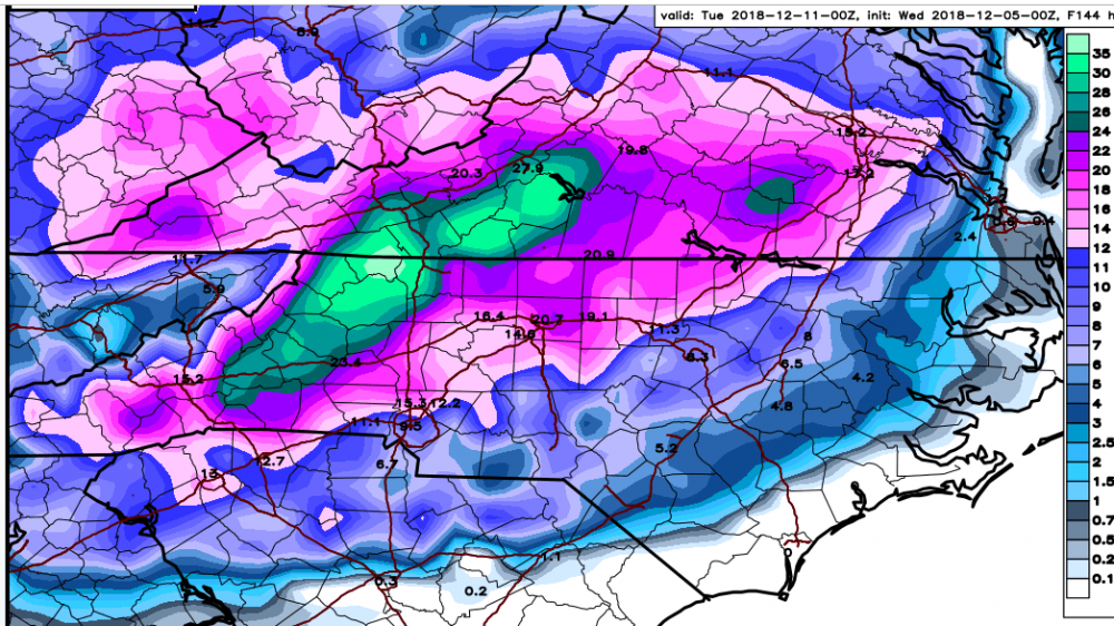
FV 3 Kuchera through 0Z Mon.

-
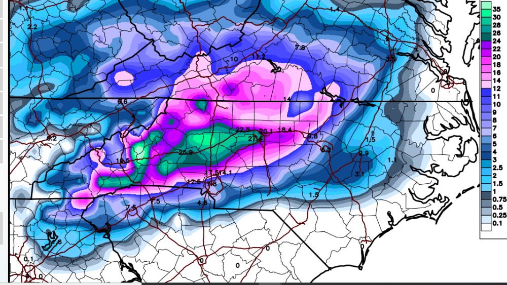
18Z FV 3 is a crush job for western NC. Much better track this run, farther from the coast. Clowns should be fun.
-
Looking at the GFS, it seems as if the model is indicating dynamical cooling over the NC Piedmont at the onset...note how the 850 temps cool over central NC from west to east overnight Saturday/Sunday morning, forming a pocket of below zero temps cutoff from warmer temps to the north. Just something interesting to me.
-
I thought so, too. But it matches with the Kuchera map from Pivotal.
-
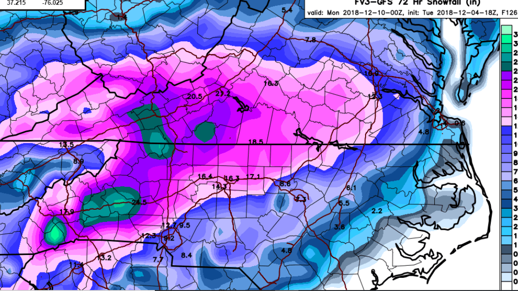
I'm not sure if this really matches the model, but I believe this is based on the Kuchera method, FWIW: