Poimen
-
Posts
2,150 -
Joined
-
Last visited
Content Type
Profiles
Blogs
Forums
American Weather
Media Demo
Store
Gallery
Everything posted by Poimen
-
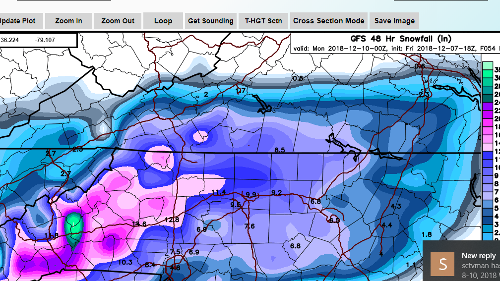
I noticed the SREF QPF mean at GSO was 2" at 21Z.
-
It's at www.weathernerds.org (I just discovered it this week myself). It's a great free site.
-
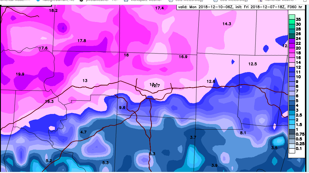
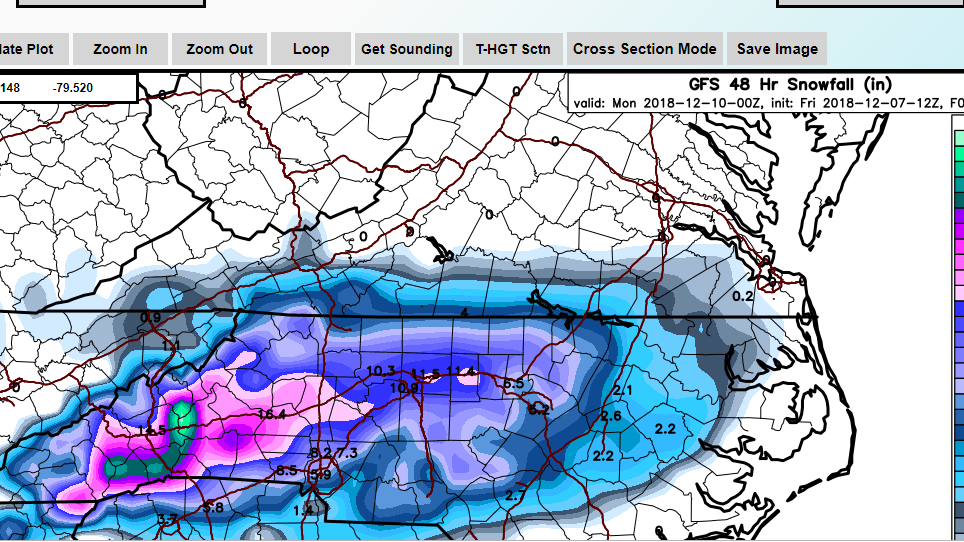
The NAMs brought the goods tonight. Gotta love the way the qpf is trending at this time. Here's the 3K Kuchera:
-
18Z GFS below. I'm out until 0Z. My orphaned family is begging for my attention. lol. See y'all later.

-
They looked about the same from what I could tell on the NCEP maps.
-
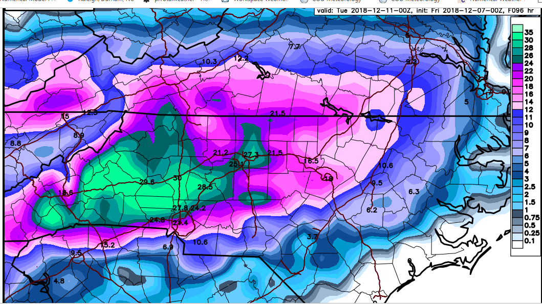
FV3 is going to be just like previous runs Here's the total qpf from the 18Z run. Nearing 2" in the Triad this time:
-
I just figured out that you can zoom in even closer on these www.weathernerds.org maps. Here's a super close-up of the counties in and around the Triad from the 3k NAM:
-
Close up of 3k NAM Kuchera:
-
It's a beaut, Clark!
-
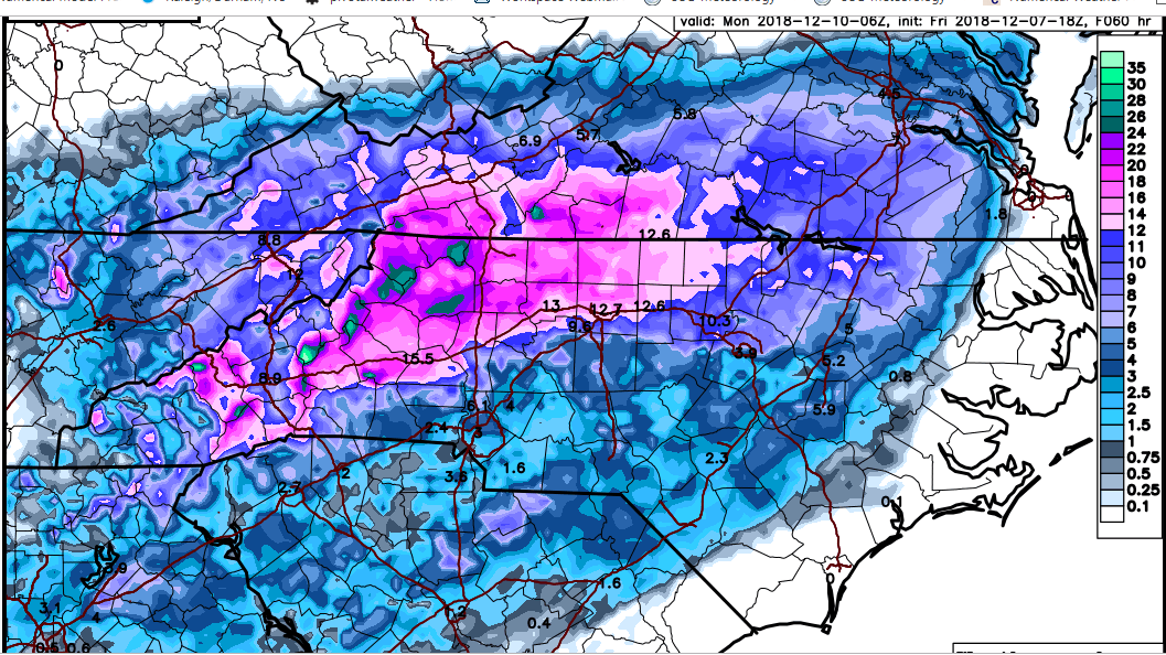
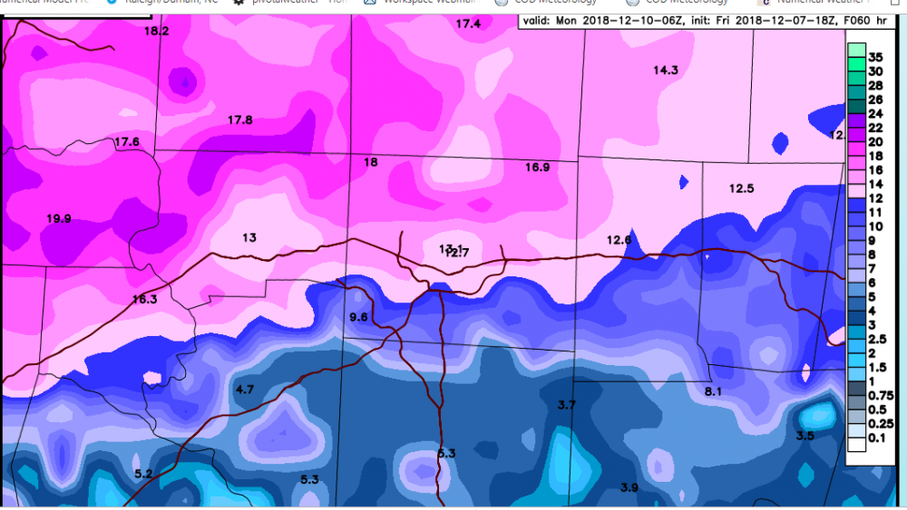
FV 3 Hours 42, 48, 54, 60:
-
GFS Kuchera:
-
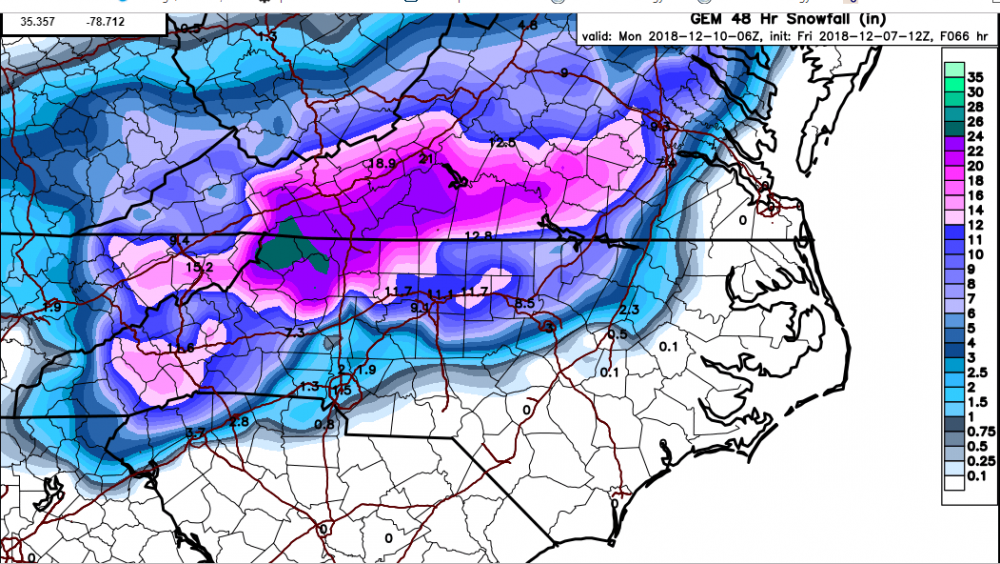
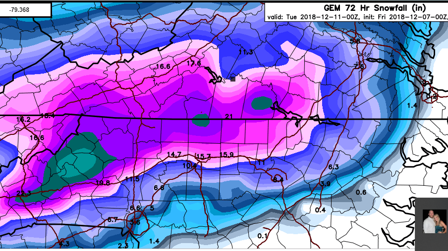
12Z Canadian Kuchera output:
-
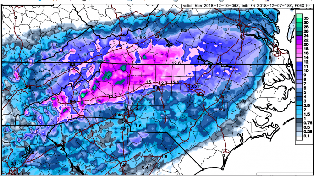
This is a classic case of the CAD winning out--it helps us NC peeps achieve more snow/frozen precip, but also puts a dent in the overall qpf totals. I'll gladly take that trade, however.
-
The FV3 is still relatively beefy with the qpf amounts, but tempered a bit perhaps from previous runs.
-
I just click on the map in the zoomed-in mode on Pivotal. I'm able to click close to my location in eastern Forsyth. I will say that areas south of 85 in the Triad look to have more sleet than north of 85. It's close. Either way, should be a good storm for all of us int he area.
-
Models are coming around to the idea of moistening the column earlier, resulting in higher snow totals. Soundings from the NAM were terrific for Forsyth county. We're squarely in line for a 12"-15" in storm here.
-
SREF mean qpf is about 1.75" for GSO. Snow mean not all that impressive, but I'm thinking we might see a juicy NAM run upcoming in respects to qpf.
-
you are correct. I just deleted it and started over.
-
yeah...it's a great site. By the way...I goofed on that original post. Those are the wrong images. So I deleted and made a new post with the correct images.
-
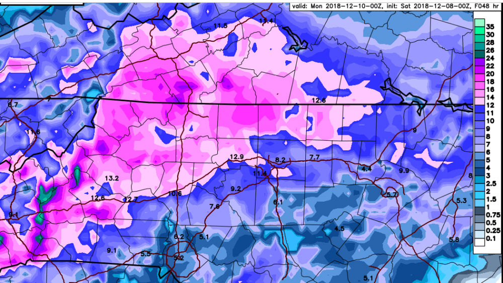
www.weatherners.org is the site I've been using for these Kuchera maps. Below is the 6Z FV 3 and the 0Z Canadian for comparison sake.

-
The FV-3 is another whopper for western NC. The Kuchera map is insane again. Obviously, this model may have a problem with its qpf output, as it seems to be higher than others, though the EC/GGEM aren't far behind.
-
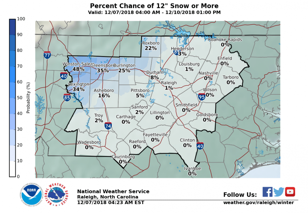
It's on the RAH "Winter Weather" age under the probabilities tab.
-
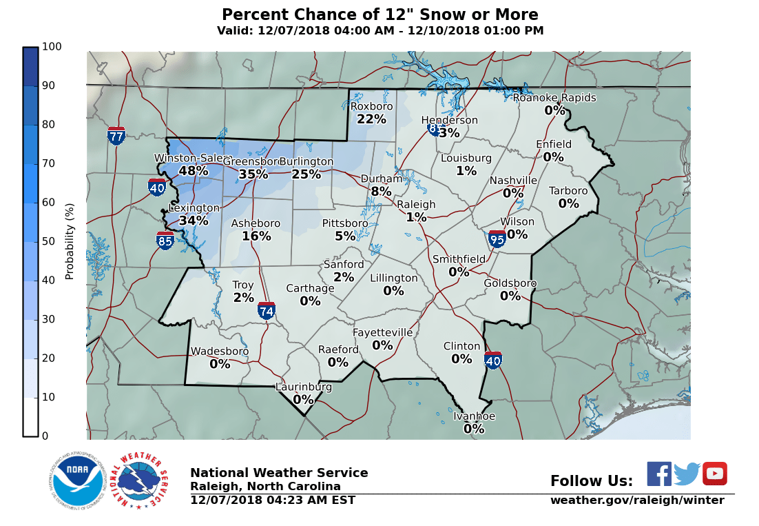
According to the NWS probabilities, roughly a 50% possibility of more than one foot in Forsyth.
-
If my math is correct, that's roughly 1.5" qpf for NW NC, which is in line with other guidance overnight. Don, thanks for contributing to our forum!