

Poimen
-
Posts
2,150 -
Joined
-
Last visited
Content Type
Profiles
Blogs
Forums
American Weather
Media Demo
Store
Gallery
Everything posted by Poimen
-
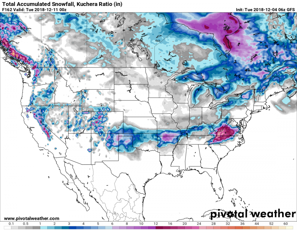
Kuchera output on pivotal weather has ~20" around the Triad, FWIW.
-
Here comes the backside blizzard!
-
Here you go: https://weather.cod.edu/forecast/
-
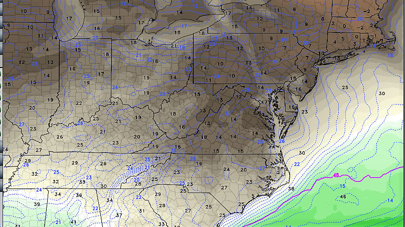
Dew points from the 84 HR NAM: Mid teens throughout VA and NW NC.
-
With the Pineapple Express in tow!
-
FWIW: The NAVGEM looks a lot like the EURO. SLP track across the FL Panhandle before making the turn NE and off the Carolina coast. Like the EURO, precip doesn't make it to NC until Sunday morning.
-
It's track is faster/farther west than the others..hence the difference.
-
12"-15" mean for all of the western Piedmont ain't nothing to sneeze at.
-
-
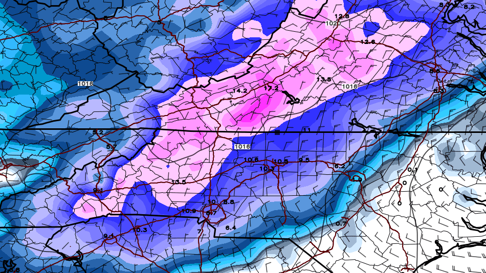
GFS Kuchera: 21"-36" amounts for the NW Piedmont/Foothills/Mountains. Wow.
-
The GFS soundings for the Triad area are pure snow soundings from the onset through mid-day Sunday, with surface temps falling into the upper twenties. By 18Z Sunday, it's a mixed bag sounding...maybe even plain rain, but by then plenty of snow has fallen.
-
ICON finally brings down some snow over the Piedmont Sunday morning. It also never really gets the precip into VA (Through the daylight hours Sunday).
-
The ICON is coming in really mild for Saturday...no snow to speak of. This with a southerly track, mind you. I'd like to see this model jump on board.
-
I'd include the NW/N Piedmont, too.
-
At this point, I feel fairly confident in a front-end snow for the favored climo areas of NC Saturday afternoon/night, yielding at least a few inches...beyond that confidence is low.
-
Bear in mind that in years past, a reduction of at least 50 percent in the clown maps ends up closer to reality around here. But even with that, there is still a reasonable shot of a widespread 6-12" storm for some on this board (if things remain as they are). Those numbers also seem much more realistic and in line with past events.
-
Still a good thump for many here, per the FV 3. However, those amounts SE of the I 85 corridor are suspect.
-
FV3 ends up climbing the coast and smacking the MA. It looks like a front-end snow for the CAD/favored climo areas of NC, transitioning to freezing rain/sleet, then perhaps rain.
-
Perhaps both, but in general I think they're picking up on colder surface temps. The GFS soundings for our area looked considerably colder this run than previous runs through the entire column.
-
Here's the Kuchera map for the 6Z GFS. Again, widespread 16"-20"+ amounts.
-
I think the models are beginning to sniff the colder CAD air mass. Within the last two model cycles (0Z AND 6z), the EC, GFS, and ICON have all turned colder compared to previous runs. So far, the FV 3 has been leading the way. With that said, don't be surprised if the snow ends up being largely confined to the northern Piedmont/Foothills/Mountains.
-
See if this link will work for you: http://www.pivotalweather.com/model.php?m=gfs&p=snku_acc&rh=2018120400&fh=168&r=conus&dpdt=
-
Kuchera map for GFS is widespread 16-22" for much of the NC Piedmont.
-
Not sure how that map is generated, but there really shouldn't be much if any snow outside of the western/northern piedmont (aside from some at the beginning), based off a quick glance of the modeled 850 temps.
-
Looks like a lot of sleet in the Triad Saturday night, per this run.


