Poimen
-
Posts
2,150 -
Joined
-
Last visited
About Poimen

Recent Profile Visitors


-

MO/KS/AR/OK 2025-2026 Winter Discussion
Poimen replied to stormdragonwx's topic in Central/Western States
I'm pulling for you guys to my south. Best of luck to all of you. -
MO/KS/AR/OK 2025-2026 Winter Discussion
Poimen replied to stormdragonwx's topic in Central/Western States
https://x.com/bam_weather/status/2014120141697769771 -
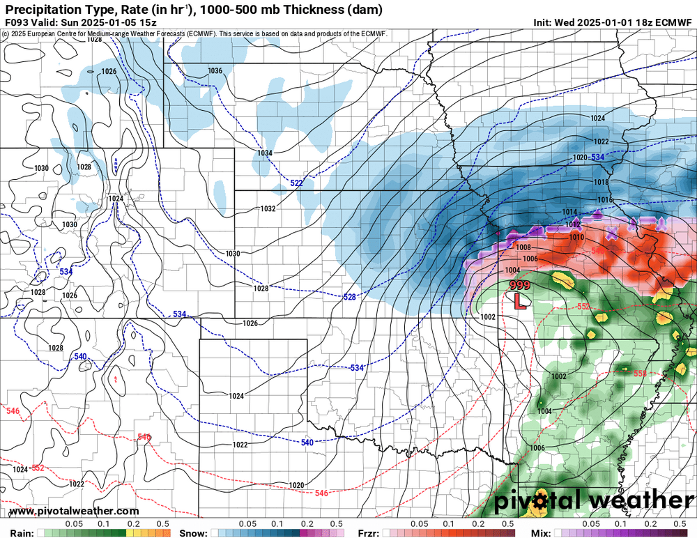
18Z EC is a beast of a storm. The FZRA potential is something to keep an eye one.


-
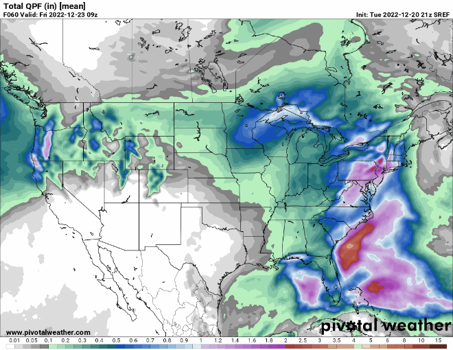
Here are the last three runs of the SREF:
-
For what it's worth: the 9Z SREF run has a noticeable uptick in qpf for much of the area. In fact, the snow plumes for K.C. jumped to a mean of 5" at 9Z. The mean was 1.5" in the previous run. This should result in a noticeable uptick in qpf for the 12Z suite of NAMs. We'll see.
-
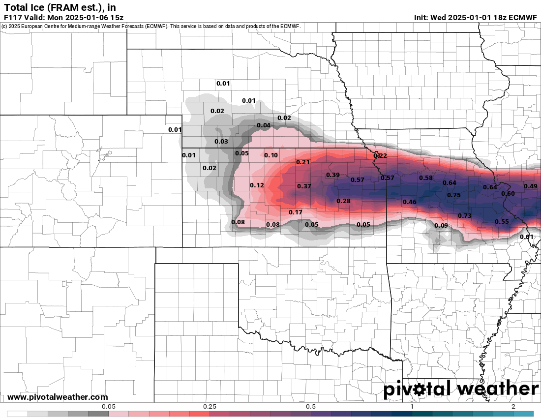
According to the afternoon AFD, the Topeka office is forecasting 20:1 ratios.
-
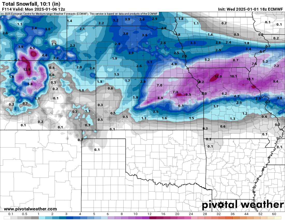
Here's the 10:1 snowfall output from the 12Z EC. These were higher than I thought it would be. I suppose we can expect ratios greater than 10:1--but I've lived my whole life in the south where 8:1 ratios are the going rate. I've never seen soundings like the one's I'm looking at now.

-
I've been loosely tracking the GFS Kuchera totals for my backyard. It just went from 17-20" in the prior runs to 5" on the 12Z. Don't get me wrong, I'd be happy with 5" of snow, but the trend this morning seems to be a quicker and less amped system for this area. Still plenty of time for things to change.
-
Hey guys. I recently relocated from North Carolina to the Northland of K.C. (MO). I'm looking forward to experiencing my first midwest winter storm (hopefully). Thanks for all the info here.
-
I never thought I'd consider sowing fescue in late December, but it is tempting right now...
-
@lilj4425
-
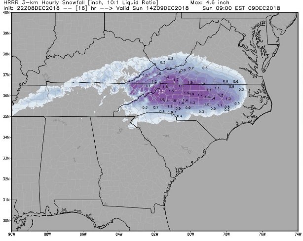
Another 2" qpf run for the RAP with 18" snow totals in the Triad. HRRR isn't far behind.
-
2” per hour rates in the Triad at 9am per the HRRR
-
The 22Z RAP has 2" qpf amounts just south of the Triad and 17" snow totals in the Triad.