Chinook
-
Posts
10,674 -
Joined
-
Last visited
Content Type
Profiles
Blogs
Forums
American Weather
Media Demo
Store
Gallery
Everything posted by Chinook
-
Looks like the snow just isn't going to be there. Keep up the hope for more snow in March. Northern Colorado isn't doing badly on total snow for the cities (I think). The snow water equivalent is 104%/121% in the mountains. The areas well east of I-25 seem to have gotten quite a bit of snow over this winter. DIA: 41.6" Boulder: 67.3", just a bit above normal Fort Collins: 28.5", below normal Greeley: 31.1", above normal Longmont Co-op: 41.9" that seems much better than Fort Collins Walden: 60.2 (above normal for this higher elevation location)
-
actually Radarscope showed zero lightning strikes (cloud-ground)
-
south of Minneapolis
-
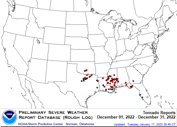
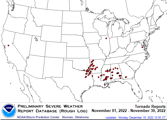
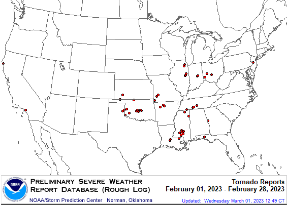
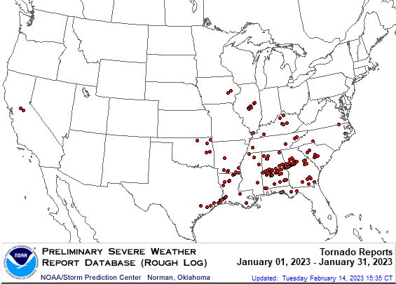
Let's look at how many confirmed tornadoes there were in the winter, counting from the end of November. (Source: Wikipedia) November 29-30, 2022 tornadoes: 25, max: EF3, fatalities: 2 December 2022 tornadoes: 70, max: EF3. There were 68 tornadoes on December 12-15, with 3 fatalities in this outbreak. One tornado occurred on Dec. 29 and one on Dec. 30. January 2023 tornadoes: 125, max: EF3. There were 41 tornadoes on January 12th, with max EF3, and 8 fatalities. On January 24th, an EF3 tornado was in the Houston metro area. February 2023 tornadoes: 53, max: EF2. On February 26th and EF2 tornado moved through Norman Oklahoma with a 27 mile track. Fatalities: I didn't see anything on this, maybe zero. March 2023 tornadoes: 22, to this date, (posting date: March 5th). max: EF2 (two of them). Some tornadoes have been recent, but most likely the NWS has completed storm surveys (?) total tornadoes: 295 number of days from November 29th to March 4th: 96 average of 3.0 tornadoes per day. I think 3.0 tornadoes per day is way above average.
- 1 reply
-
- 6
-

-

-
Looks like the new storm is moving in to Minneapolis
-
The GFS has a complicated snowy scenario for a lot of the northern Plains coming up this week, which would include northern Colorado in the snow. The ECMWF does not really have the snow.
-
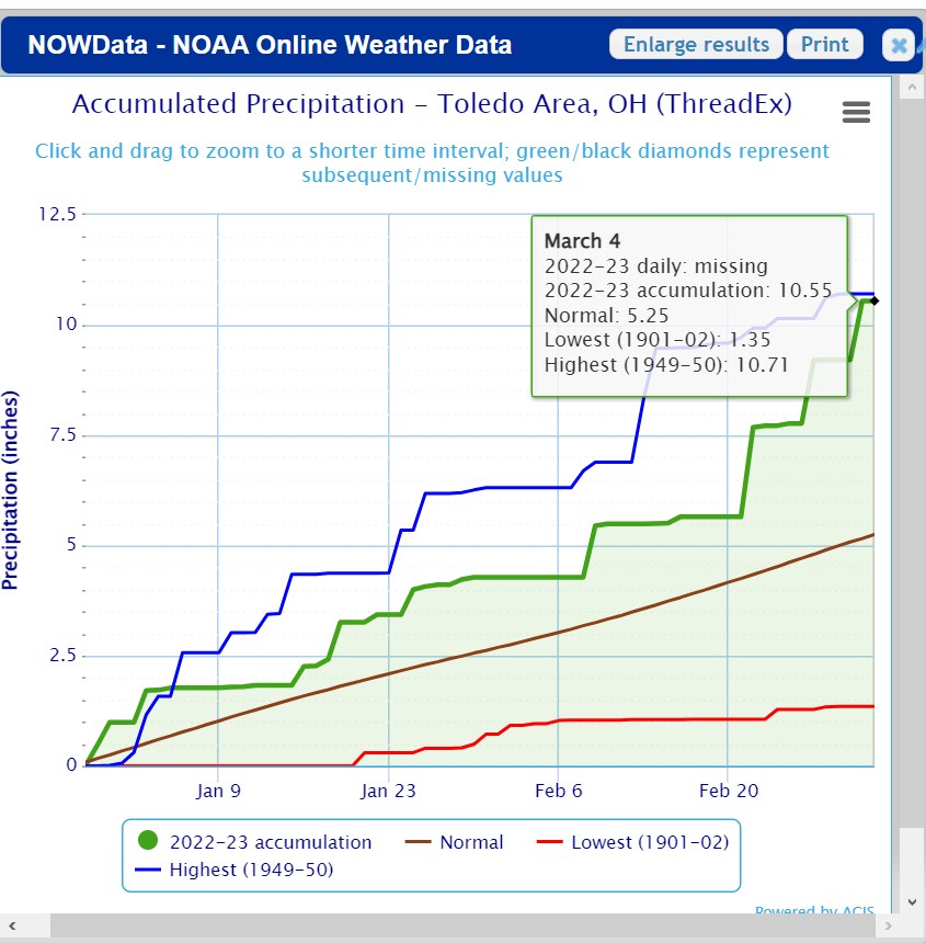
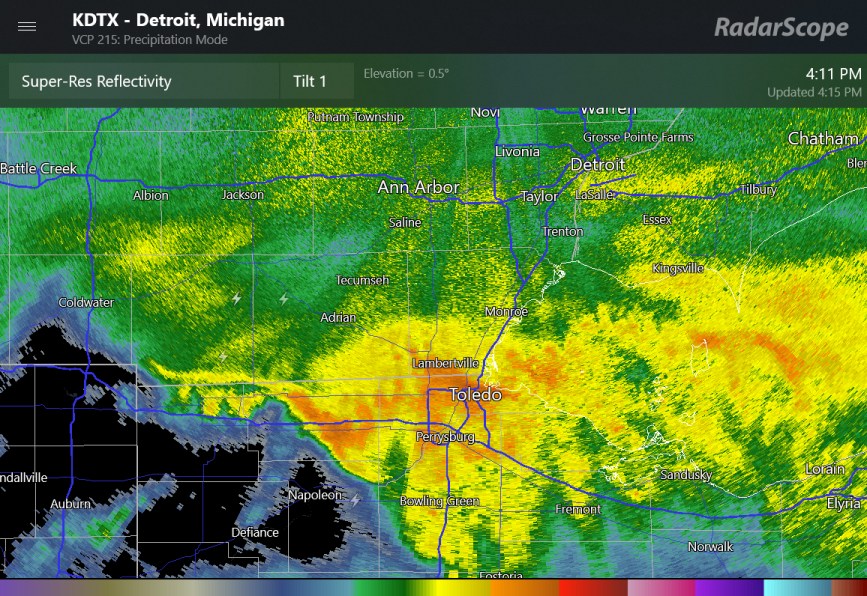
Toledo has had 2 months of soggy rainstorms since Dec 29, as shown on this chart. Relatively little of this total precipitation was snow.

-
a solid zone of snow on radar has transitioned to a few localized moderate snow bands
-
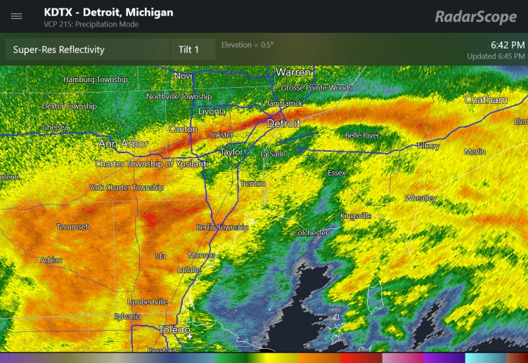
preliminary storm reports are 3.5" to 6" (isolated) in northwest Detroit
-
This must be wet snowflakes that are bright banding
-
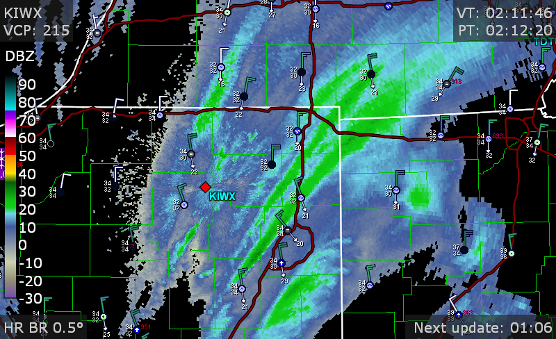
thundersnow on the radar screen as well as local airport observations at Adrian MI, Decatur IL
-
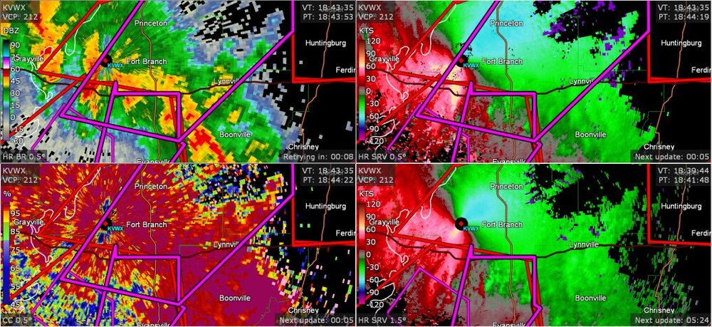
well, this is in the Ohio Valley area... apparently this was a confirmed tornado, and a few more warnings in the Evansville region
-
I found this preliminary information
-

2023 Short/Medium Range Severe Weather Discussion
Chinook replied to Chicago Storm's topic in Lakes/Ohio Valley
There have been preliminary tornado reports near Champaign, Plainfield, and Naperville -
new confirmed tornado near Meeker/ Johnson about 35 miles from Oklahoma city
-
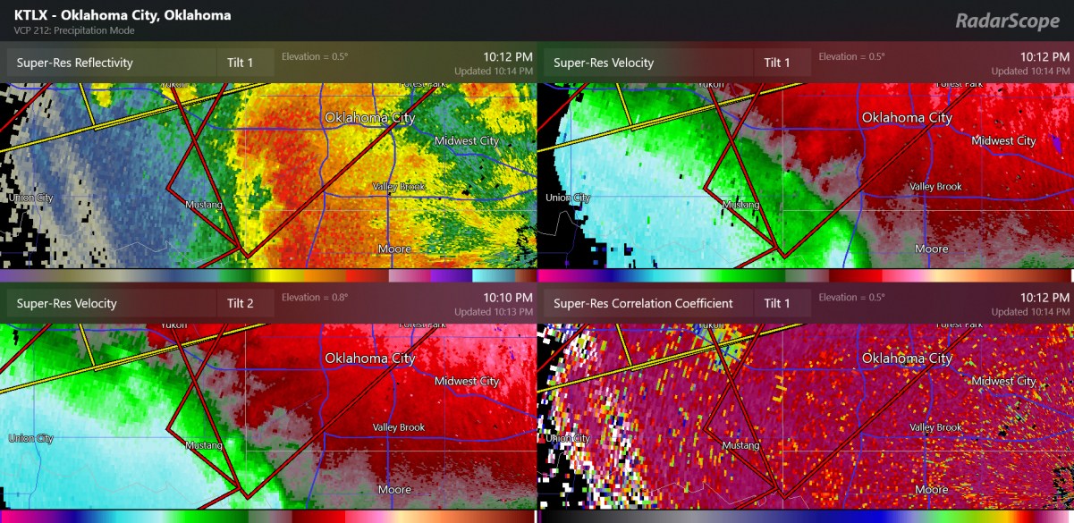
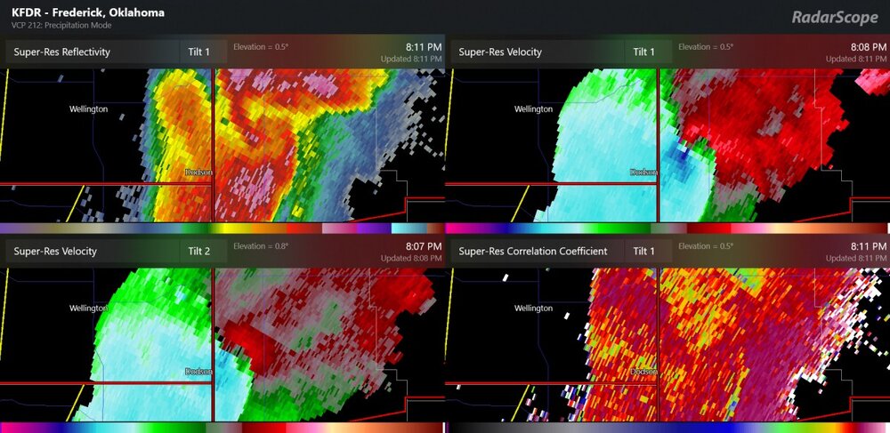
the radar's tilt-2 is doing a better job of picking up the debris as it is close to KTLX radar, and I suppose could even hit it
-
confirmed tornado passed US77 highway on the south side of Norman
-
Such a strange day for February. I've honestly never seen the shear parameters we've seen today with storms. I mean, 0-6km shear of 100 kt only happens with colder air, right?
-
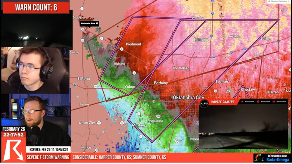
Oklahoma City confirmed tornado warning (I believe TDS occurred recently next to Mustang)

-
some near hurricane force wind gusts
-
TDS popped up next to Hobart OK
-
possible tornado at the TX/OK border (same cell with the 114mph wind gust measured a while ago). The SPC mesoanalysis now has 1000 m2/s2 of 0-3km storm relative helicity here. confirmed tornado announced at 724pm central time
-
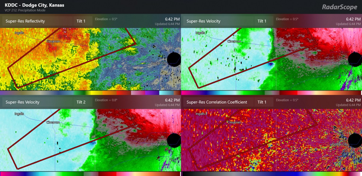
New tornado may be forming west of Dodge City

-
This tornado-warned storm is northwest of Dodge City and is on the edge of the CAPE. It's just so unusual to see severe weather so far west
-
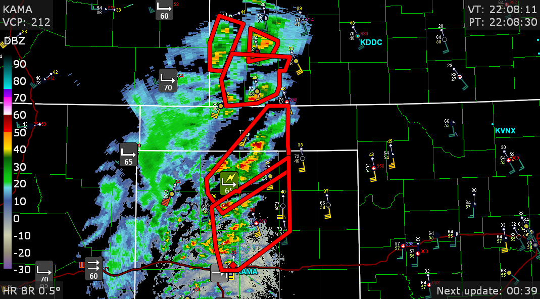
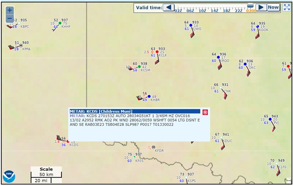
Here is radar right now, near the start of the severe weather event. Some non-thunderstorm wind gusts of 55mph-80mph have been in the region. I'm assuming some blowing dust is the reason that some stations report haze.