Chinook
-
Posts
10,674 -
Joined
-
Last visited
Content Type
Profiles
Blogs
Forums
American Weather
Media Demo
Store
Gallery
Everything posted by Chinook
-
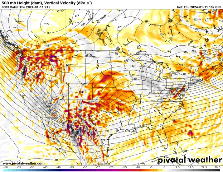
look at this vertical motion
-
is this as bad as it's going to get?
-
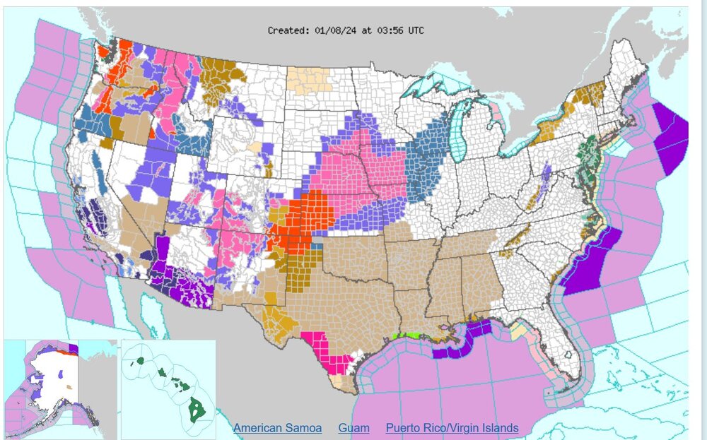
Day-2 convective outlook changed significantly to reduce the enhanced risk area
-
March 10 was my last inch. Maybe I'll drive back to Colorado.
-
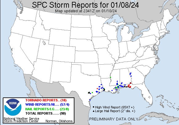
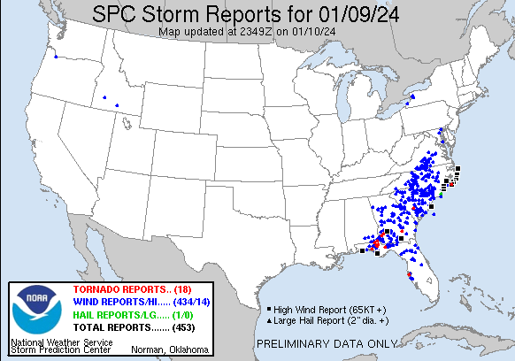
There are always way more reports on the SPC database a couple of days after things happen. There was a significant amount of severe thunderstorm winds and also non-thunderstorm 50mph+ winds in the last two days. Tornadoes were in fact somewhat numerous, but perhaps short lived, and I have no idea if a bunch of these were EF0 or worse.
-

Jan 8/9 Super Cutter - Rain, Severe, and Strong Winds
Chinook replied to eyewall's topic in Southeastern States
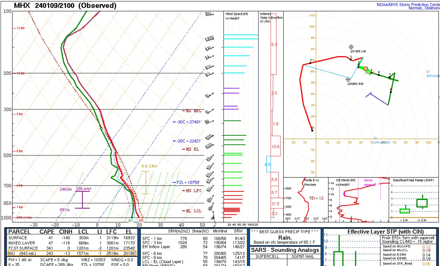
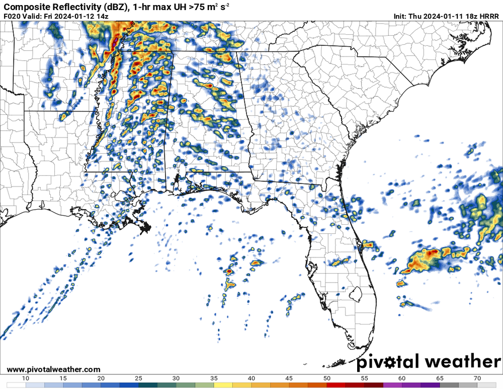
a thousand helicity charleston 18z sounding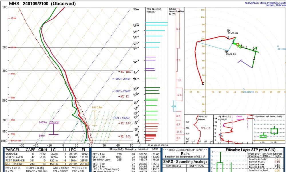
-
Jan 8/9 Super Cutter - Rain, Severe, and Strong Winds
Chinook replied to eyewall's topic in Southeastern States
today's storm reports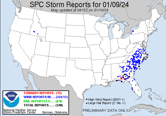
-
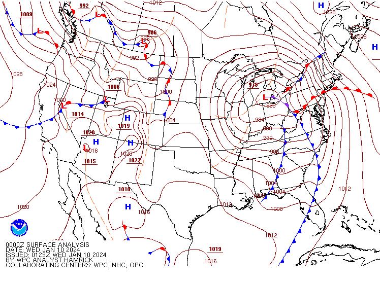
It's hard to believe this is so low of a pressure, and not in the Atlantic Ocean
-
Jan 8/9 Super Cutter - Rain, Severe, and Strong Winds
Chinook replied to eyewall's topic in Southeastern States
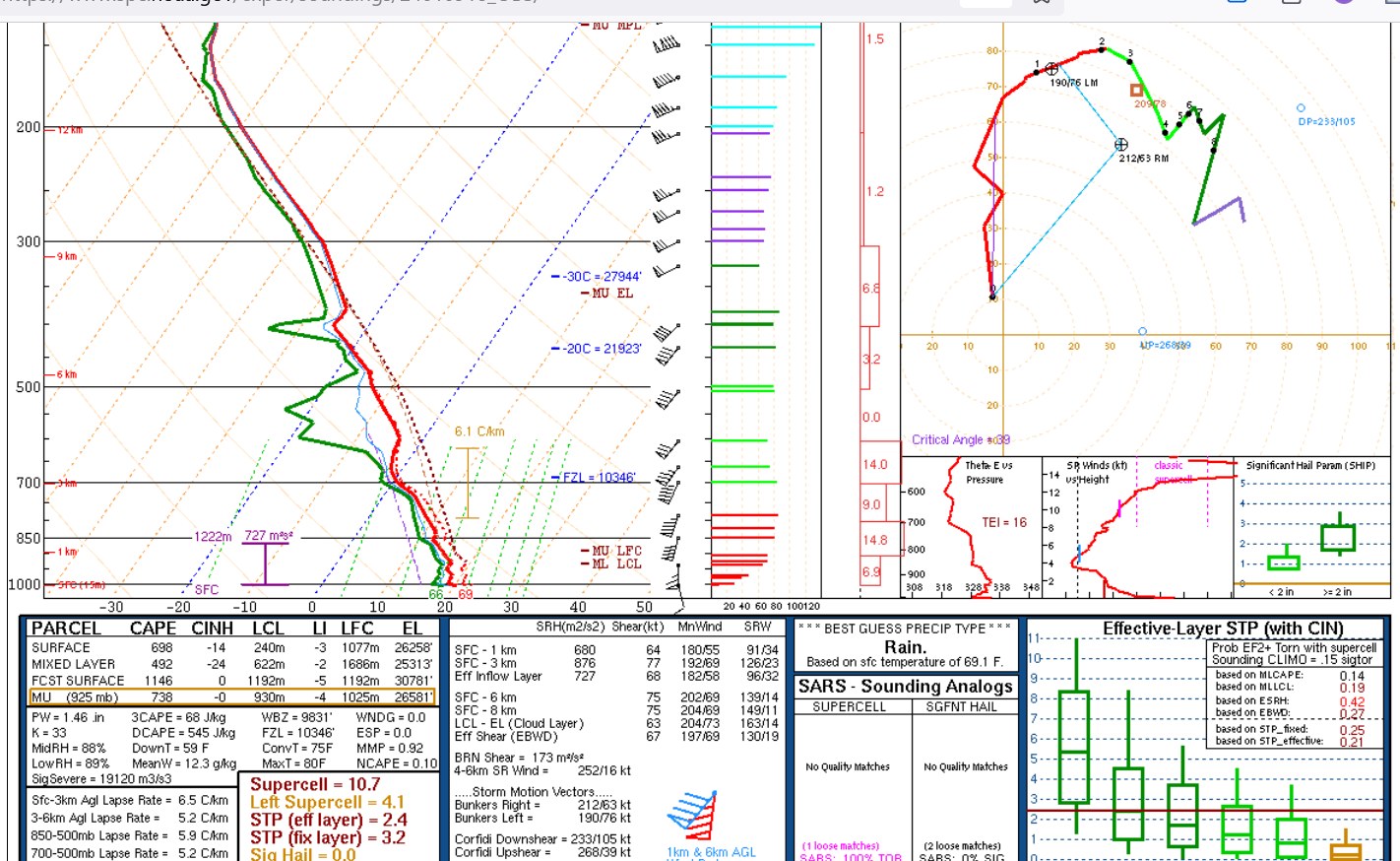
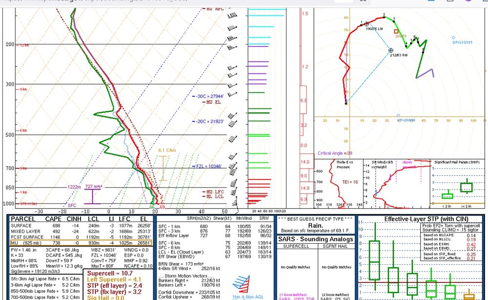
STP: about a billion % of normal for January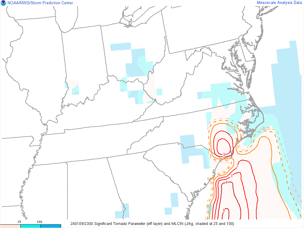
-
Mountain West Discussion- cool season '23-24
Chinook replied to mayjawintastawm's topic in Central/Western States
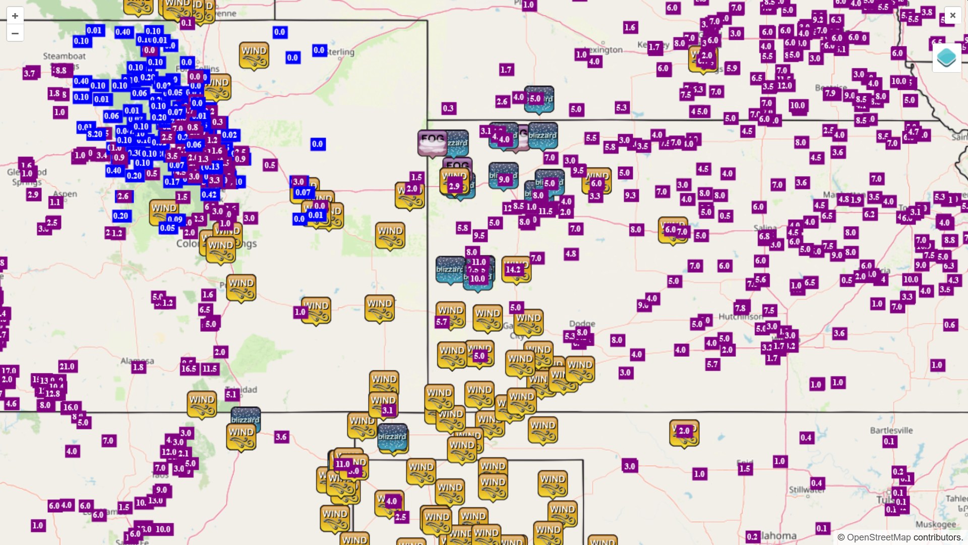
some plains storm reports
-
I will magnetize the storm toward us. I will make the 500mb low grab a lot of moisture from the Pacific, and be at the Four Corners, that is, while a northeasterly barrier jet develops in Wyoming to give the foothills 2" per hour snow rates. Oh wait wait wait, wrong thinking. Sorry.
-
Jan 8/9 Super Cutter - Rain, Severe, and Strong Winds
Chinook replied to eyewall's topic in Southeastern States
waterspout/tornado at the beach -
Jan 8/9 Super Cutter - Rain, Severe, and Strong Winds
Chinook replied to eyewall's topic in Southeastern States
possible waterspout coming onshore at N Myrtle or NC/SC border -
Jan 8/9 Super Cutter - Rain, Severe, and Strong Winds
Chinook replied to eyewall's topic in Southeastern States
possible tornado near Sylvania Georgia. It's likely some tornado warnings will be in SC soon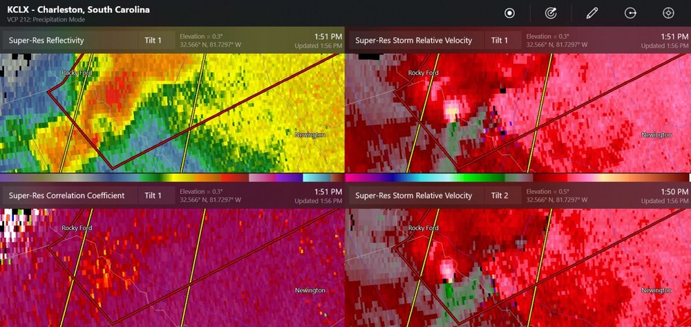
-
I don't believe it's from the Far Side.
-
How to forecast
-
downslopin.... yikes, blow your roof off. Well, anyway, some people in Kansas/Colorado will have some stories of extreme conditions and 5-10 ft snow drifts.
-
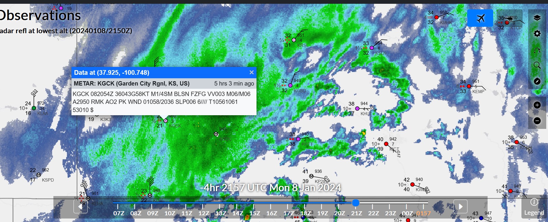
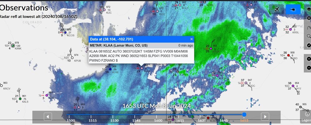
this was earlier today, with over 60mph winds creating severe blizzard conditions in some areas of Kansas

-
tornado warning W of New Orleans. For right now TMSY short-range radar has it but KLIX doesn't!
-
wow, the STP value is huge in SE Texas, with a couple of tornado warnings and a couple of severe thunderstorm warnings. Things are starting to get going.
-
Mountain West Discussion- cool season '23-24
Chinook replied to mayjawintastawm's topic in Central/Western States
-
Mountain West Discussion- cool season '23-24
Chinook replied to mayjawintastawm's topic in Central/Western States
Heavy snowfall rates with blizzard conditions for E Colorado and W Kansas. The HRRR shows a temperature of 21 degrees, snow, and winds of 30kt-50kt in the southeastern section of Colorado.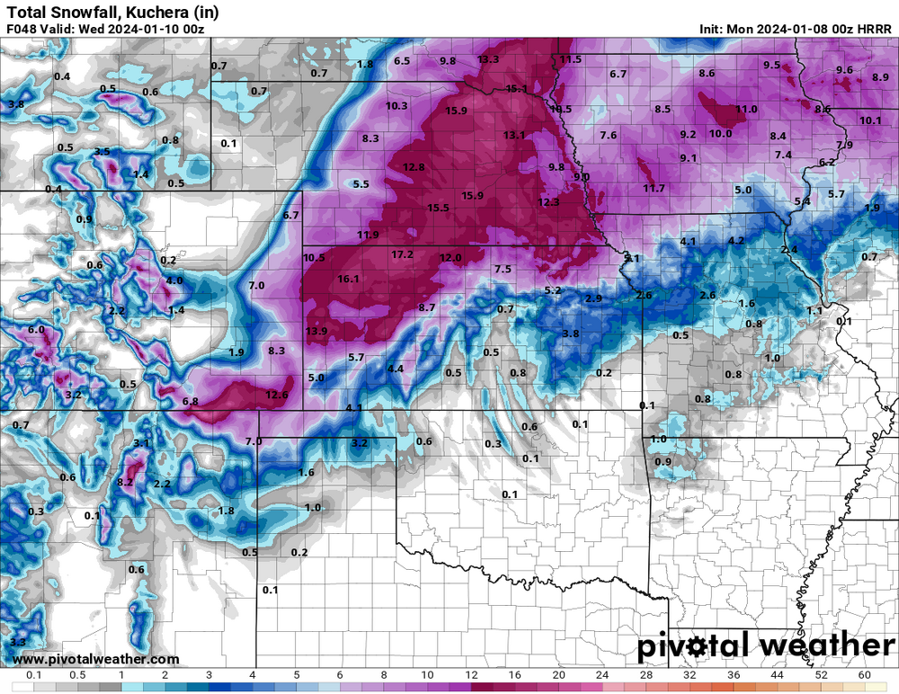
-
Mountain West Discussion- cool season '23-24
Chinook replied to mayjawintastawm's topic in Central/Western States
Blizzard warnings for the Cascades and Olympic Mountains. I didn't think they did that. -
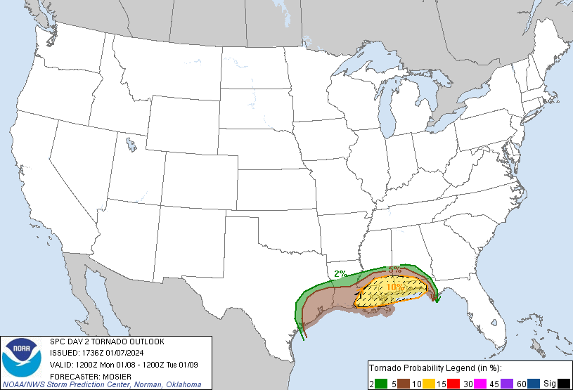
tornado threat for a good amount of the Gulf Coast
-