jbenedet
-
Posts
7,617 -
Joined
-
Last visited
Content Type
Profiles
Blogs
Forums
American Weather
Media Demo
Store
Gallery
Everything posted by jbenedet
-
Can’t handle the truth.
-

1/13/24 Sultan Slicer #2 - Heavy rain, snow, wind?
jbenedet replied to Torch Tiger's topic in New England
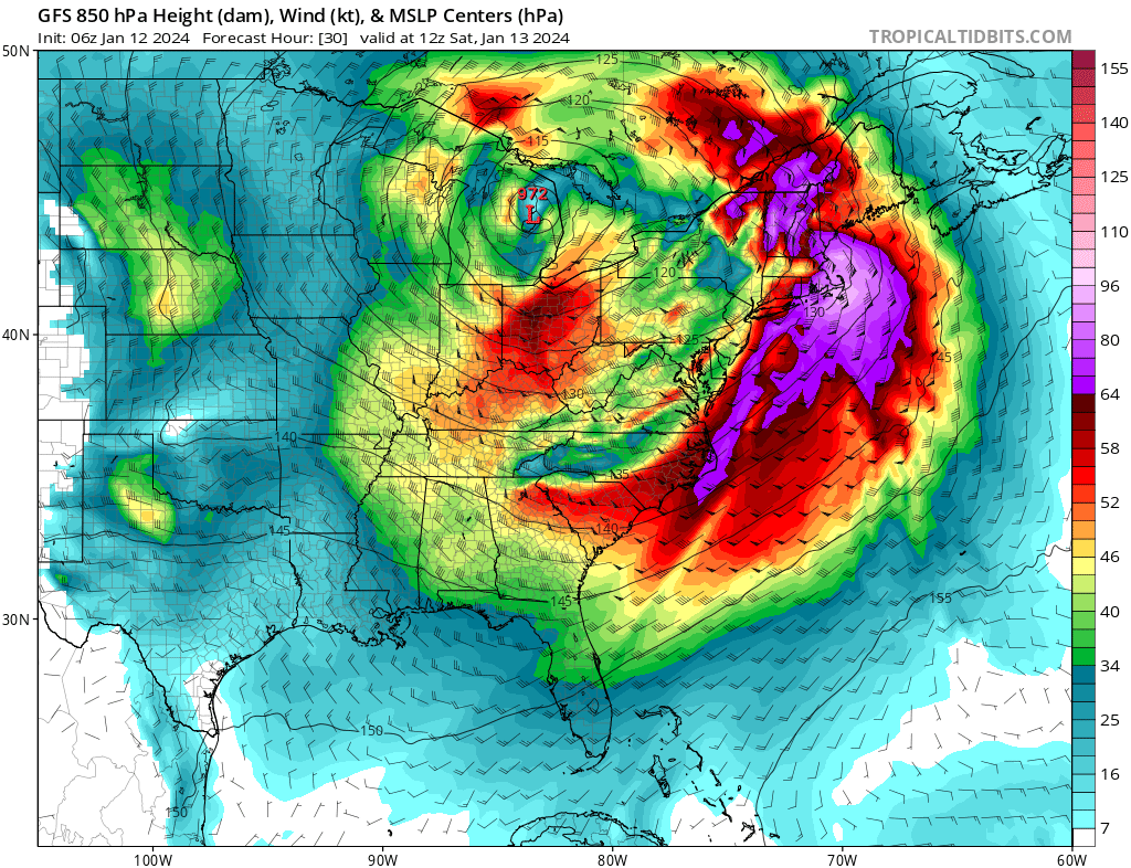
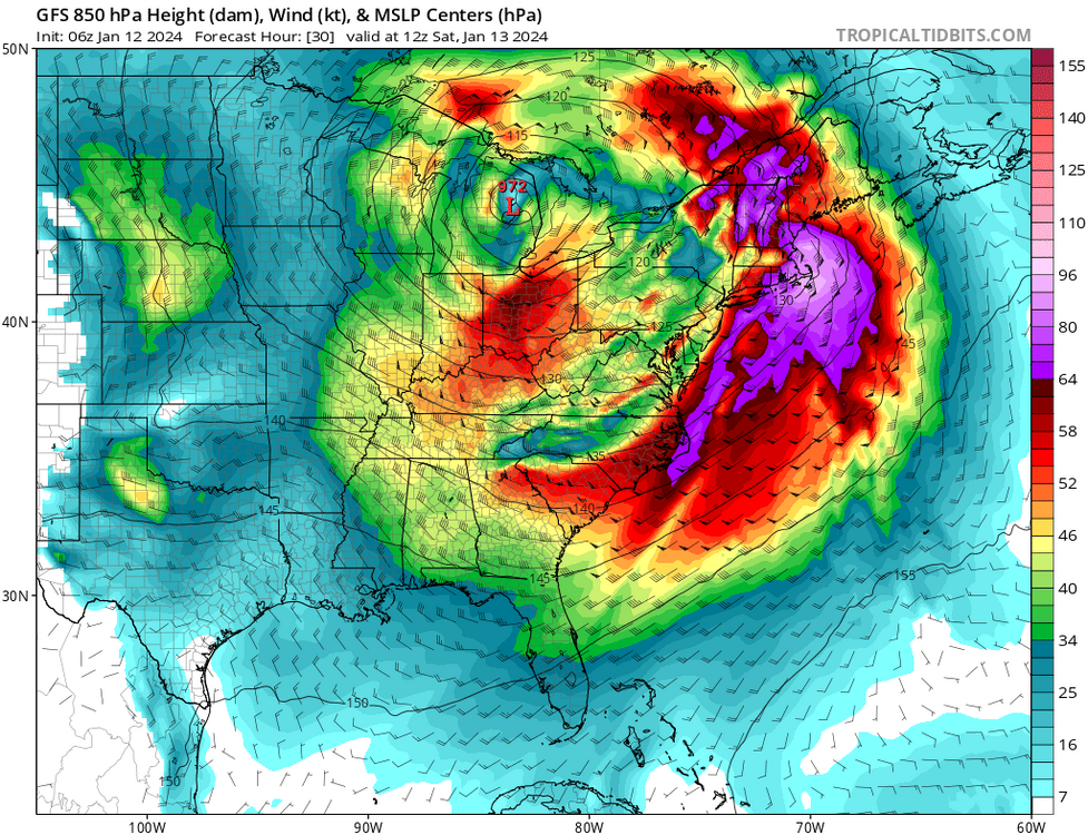
The wind and hydro threat looks more impressive than the previous stemwinder -Warmer antecedent airmass… Much higher dews. -less snow cover; reduce chances of low level inversion. -Southeasterly fetch tracing back to Bermuda. -low level jet pointed perpendicular to larger area of New England coastline. Very high wind threat looks to be in much more densely populated areas. Not a “just in Maine” story. SE MA, Boston in focus. -Deeper low ~972; vs 977 at our latitude.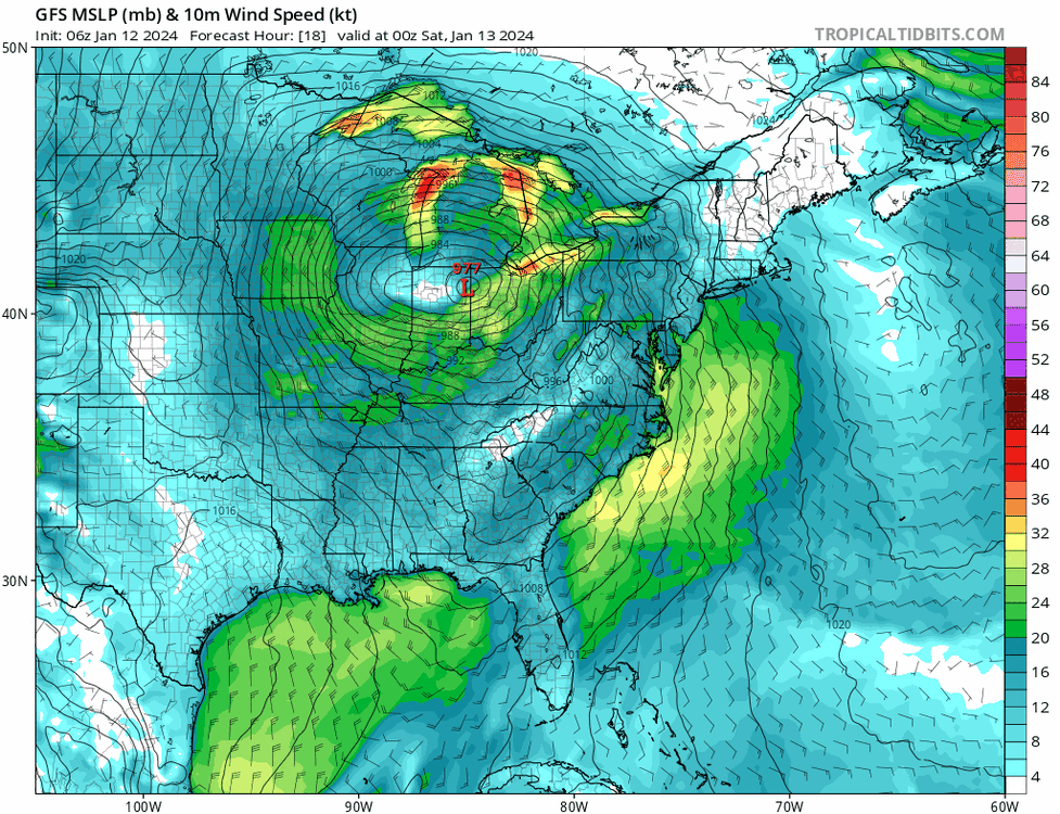
-
-
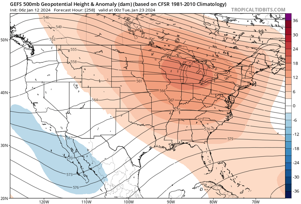
I’m not looking out that far. Post Jan 20th increasingly looks like a torch period, a window of a week or more.
-
I don’t like that the El Niño forcing calmed (relaxed) this month; while El Niño state actually intensified to major territory. I believe that means it is more likely that it makes its biggest appearance yet, as MJO 4,5,6 at end of the month.
-
Agreed. Not looking frigid. Not severe cold. N to BN for bulk of the week. Closer to N along the coast. But a very big warmup follows.
-
Looks like for a week, with best snow chances for SNE of the season. But I see a big warmup beginning around the 20th. Not sure it can classify as a January “thaw” given how warm it’s been outside of far interior of NNE, but that’s the cliche. Might pass for a thaw after next week’s cold.
-
1/9-1/10 Now Morphing to Less-Than-Exciting Power Cutter
jbenedet replied to Torch Tiger's topic in New England
Not true, if you closed the shades as I'd told you, you wouldn't have noticed it even snowed. -
1/9-1/10 Now Morphing to Less-Than-Exciting Power Cutter
jbenedet replied to Torch Tiger's topic in New England
35/25 at PSM. Allow the great melt to commence. 37/27 BOS -
1/9-1/10 Now Morphing to Less-Than-Exciting Power Cutter
jbenedet replied to Torch Tiger's topic in New England
It always snows Winne—> north Just get them storms and a normal season is attainable -
1/9-1/10 Now Morphing to Less-Than-Exciting Power Cutter
jbenedet replied to Torch Tiger's topic in New England
Absolutely, assuredly no. There is no depth to the cold outside your house. You will be above freezing a few hours after sunrise, max. -
1/9-1/10 Now Morphing to Less-Than-Exciting Power Cutter
jbenedet replied to Torch Tiger's topic in New England
Fake cold. 850s already near 0C in SNE. torch it. -
1/9-1/10 Now Morphing to Less-Than-Exciting Power Cutter
jbenedet replied to Torch Tiger's topic in New England
Denial ain’t a river in Egypt. It’s gone. It’s gonna be okay. -
1/9-1/10 Now Morphing to Less-Than-Exciting Power Cutter
jbenedet replied to Torch Tiger's topic in New England
We back to brown -
1/9-1/10 Now Morphing to Less-Than-Exciting Power Cutter
jbenedet replied to Torch Tiger's topic in New England
Queen. The one behind it is the king. -
You all can put me on mute. Don't care. Your loss; not mine.
-
CT Rhode Island SE MA up to BOSTON. BUST. Most people live here. OOPS. This is trending well into ratter already for these locations; not even considering the next two cutters. Good luck @40/70 Benchmark Hopefully all these people haven't been paying attention...
-
@40/70 Benchmark: Normal to AN snowfall forecast for 2023-2024. How it's going: snowless December. One SECS in January while blizzards slam the Midwest. OOPS. "I was wrong about December" "I was wrong about January".. "I was wrong about....." Wow. Appreciate the honesty.
-
Bro get a life. Seriously. January snowfall expectations have gone DOWN even with yesterday's storm. Probability is absolutely lost on you. Even the most basic shit. I said to close the shades. You'd be much better off. I stand by it. Or we could all be holding on with great expectations following your BS, for what will be a "Don't blink, your snow is gone, January." Ratter. January is running as expected. My well below normal snowfall forecast to verify. Now you're clinging onto this storm because your January forecast and seasonal forecast is trending from worse to abysmal. You're the fool pounding your chest when January --despite this last storm--looks like dogshit against your calls. With 2 major stemwinders dumping on the midwest, and cutting the warm sector to Quebec City. Funny just a few short weeks ago you and brooklyn were celebrating those weeklies for this???? Good to know you're still standing by your shit call of Normal to AN snowfall this winter. Can't wait for the facade of accountability "I was wrong" mea culpa. And we're supposed to think this means something. Ratter odds are up; don't get it twisted.
-
“There are many ways to skin a rat” Winter 2023-2024 SNE re-analysis
-
CNE will cash in. Berks best. Still likely that area down to upstate NY, to northeast PA/extreme NW jersey Crap winter storm for the densely populated areas in New England. Lots of snow obs with little to show for it. So snow starved around here that latch onto any crap potential.
-
In all seriousness this one will be fun to watch; how much background warmth and significant El Niño conditions can muck up peak climo with a decent SLP track.
-
Nice morning out with the dog. 32/21 PSM @8:50 am +5 T departures against guidance. Who coulda seen that?
-
You’ve been tracking a crap storm potential for 10 days. We knew. Enjoy mostly white rain.