
Knoxtron
-
Posts
331 -
Joined
-
Last visited
About Knoxtron

- Birthday 06/08/1987
Recent Profile Visitors
4,603 profile views


-
Wish I was better about recording all the nickel and Dime events we received this year, I'd be curious to see how close we are to John (definitely less than him) Flurries never stopped and still ongoing with nearly clear skies. Got down to 17 this am, currently 22 and appears we will stay below freezing today. Guessing the snow will dissappear very quickly with the sun angle Ignore the abundance of half completed projects at my house lol
- 349 replies
-
- 5
-

-
- severe
- mountain snow
- (and 1 more)
-
I swear, last one haha The rates earlier were insane, what a cool experience. Check out this high shutter speed photo! Looks like noise
- 349 replies
-
- 4
-
-
- severe
- mountain snow
- (and 1 more)
-
We got a slushy 2-3 inches, heavy snows stopped about 2 hours ago but just got under a small NW flow band with heaviest rates so far. Roads/gravel melted but most of the rest seems to be holding, maybe we can keep a little overnight haha
- 349 replies
-
- 5
-
-
- severe
- mountain snow
- (and 1 more)
-
Best snowballs of the entire season
- 349 replies
-
- 6
-
-

-
- severe
- mountain snow
- (and 1 more)
-
Experiencing some incredible white out conditions
- 349 replies
-
- 4
-
-

-
- severe
- mountain snow
- (and 1 more)
-
- 349 replies
-
- 6
-
-
- severe
- mountain snow
- (and 1 more)
-
FWIW, is it to much to ask for one decent late snow? Ensemble Average 10 day snowfall Individual Ensemble 10 day Runs Select City Temp Cross Sections
- 349 replies
-
- 2
-
-
-
- severe
- mountain snow
- (and 1 more)
-
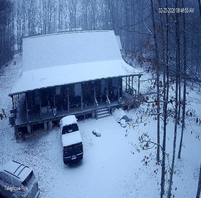
Nice surpise this am, roads coated quickly
-

Jan 30th-February 1st 2026 Arctic Blast/ULL Snow OBS Thread.
Knoxtron replied to John1122's topic in Tennessee Valley
-
Jan 30th-February 1st 2026 Arctic Blast/ULL Snow OBS Thread.
Knoxtron replied to John1122's topic in Tennessee Valley
Pixie dust snow showers still going since about 9pm last night, picked up another 1/2inch or so but hard to tell with how much is blowing around Winds finally died down a little (average of 5-8 mph versus 15-20 over the last 36 hours). Hoping the 0° windchill feels less biting than the -15° yesterday or I may have a 3 year old revolt haha Roads covered and very much a gamble without chains. Anyone in the chatt area get more snow last night? Curious if school with happen tomorrow, have my doubts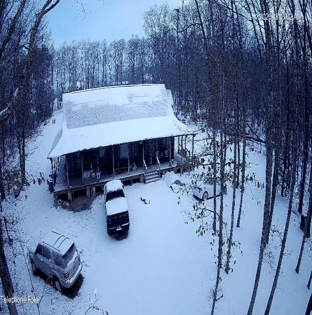
-
Yeah flatop has a good 3-5" currently, pouring tiny flakes with drifts everywhere. Roads are completely covered and impassable without chains Current 8 with a windchill of -10, super fun snow to sled in but dang that cold hurts haha The amount of lake affect moisture caught up/swirling around in the rust belt headed our way is promising!
- 782 replies
-
- 3
-
-
-
- extreme cold
- snow
- (and 1 more)
-
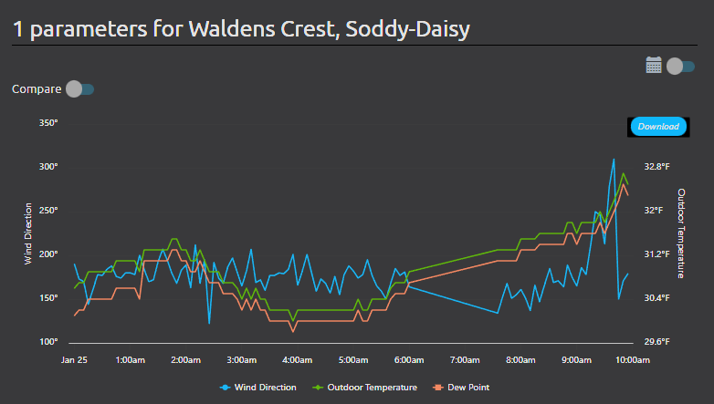
Winds finally shifted from out of the southeast to out of the north in the last hour. Temps shot up to 32.9, thankfully power is back.
- 618 replies
-
- 5
-
-
- observations
- obs thread
- (and 1 more)
-
No I'm at 2100ft MSL up on waldens ridge between Soddy-daisy and dunlap.
- 618 replies
-
- 2
-
-
- observations
- obs thread
- (and 1 more)
-
Current 30 with .3-.5 ice accumulation. Winds are whipping and I can hear tree/limb falls everywhere. Still have power but not expecting it for long.
- 618 replies
-
- 2
-

-
- observations
- obs thread
- (and 1 more)