ILSNOW
-
Posts
1,644 -
Joined
-
Last visited
Content Type
Profiles
Blogs
Forums
American Weather
Media Demo
Store
Gallery
Everything posted by ILSNOW
-
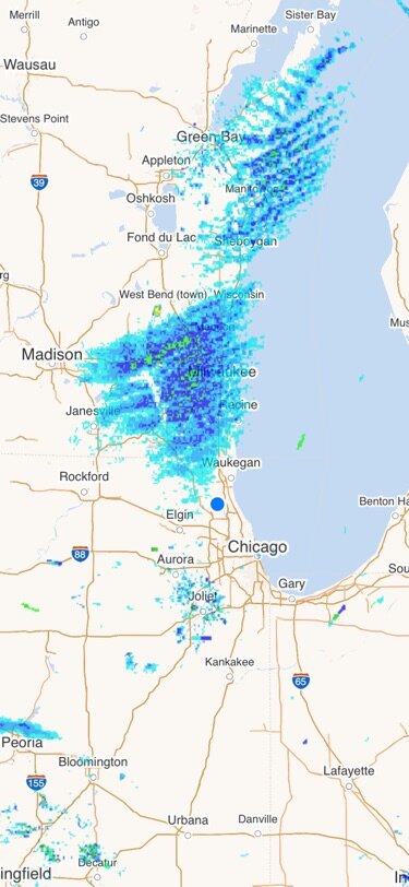
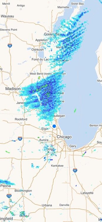
Is this lake effect going to come south
-
Currently cloudy with 0.0 of new snow!!!
-
and model support from the 12Z RGEM
-
reel it it boys!!! Best of luck!!!
-
chicago area next snowstorm
-
-
What is truly amazing is if we didnt have the one snow event this board would be in meltdown mode. As is we can possible go the months of December and January with one snow event. February is going to rock !!!! corrected
-
The V is expanding again

-
0z NAM better for cyclone and Iowa peeps

-
the V lives but moves east some
-
where? Nashville or Louisville
-
big one
-
Welcome to the V!!!
-
18Zgfs delivers to N IL hour 336!!!!!!!
-
midwest version of 2022 snowmageddon
-
can we order one of these for the midwest please!!!
-
this winter blows 12z GFS parts of GA,SC and NC will get more snow next week then parts of the Midwest (chicago) have had all winter!!!
-
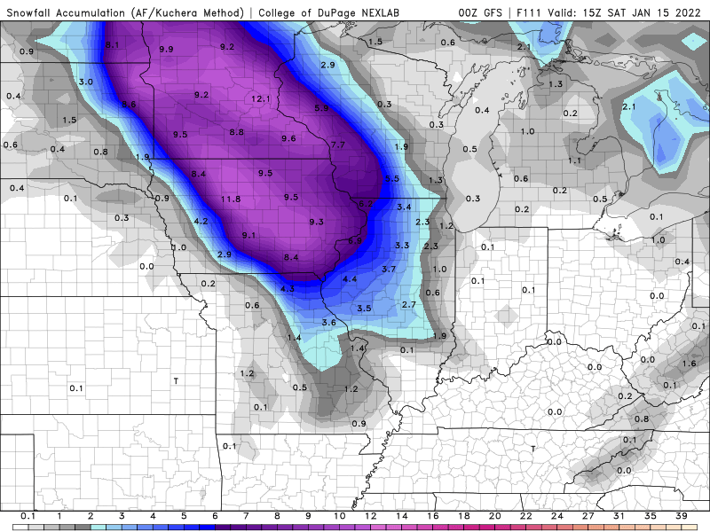
12z RGEM bringing the goods for N IL
-
NAM joins wagons west
-
congrats Kansas
-
0z GFS is west
-
Winter 2021-22 Short/Medium Range Discussion
ILSNOW replied to Chicago Storm's topic in Lakes/Ohio Valley
In McHenry county -
Winter 2021-22 Short/Medium Range Discussion
ILSNOW replied to Chicago Storm's topic in Lakes/Ohio Valley
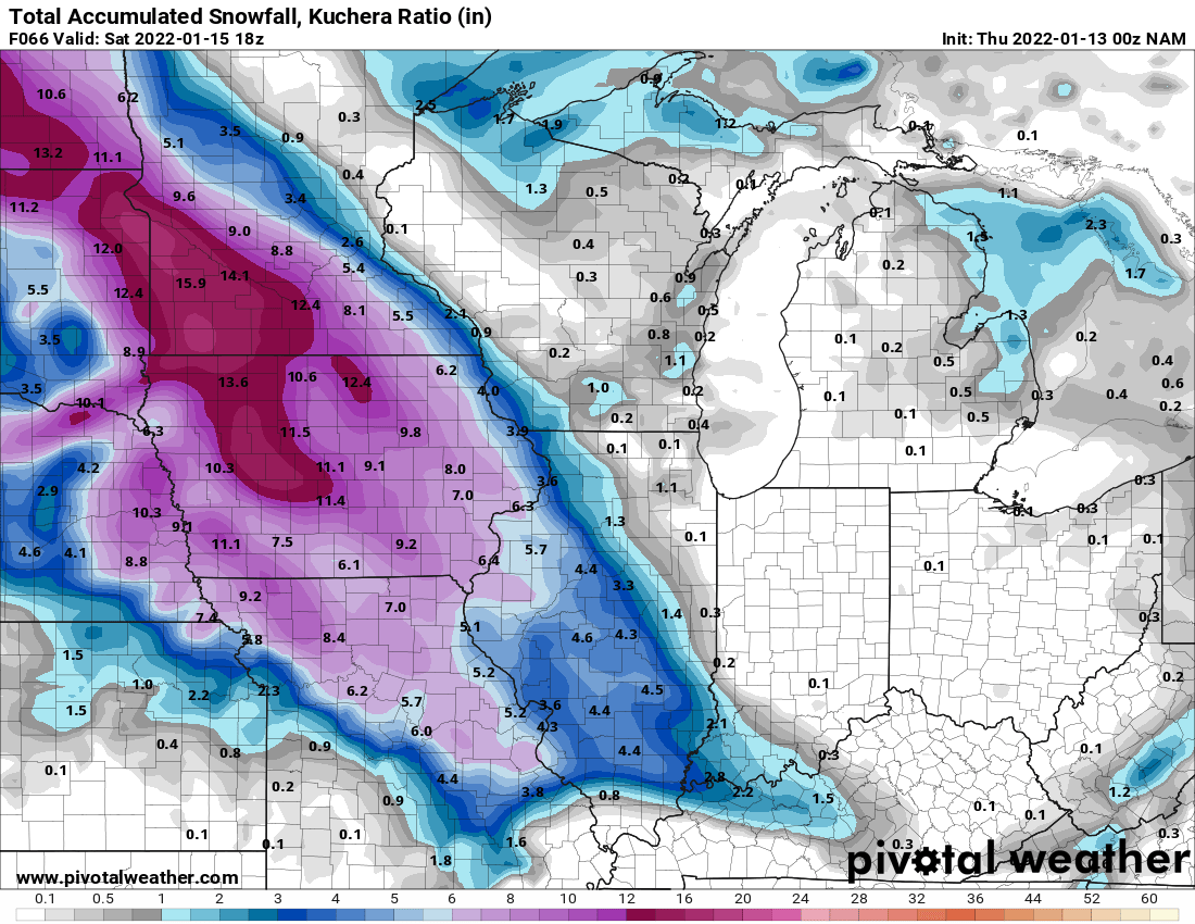
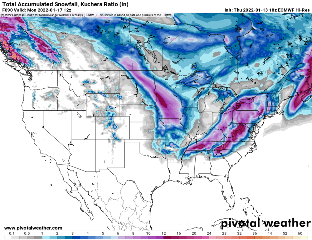
Kuchera -
Looking forward to my flurries storm tonight
-
12Z GEM still has a storm but trending weaker 12z 0Z