ILSNOW
-
Posts
1,644 -
Joined
-
Last visited
Content Type
Profiles
Blogs
Forums
American Weather
Media Demo
Store
Gallery
Everything posted by ILSNOW
-
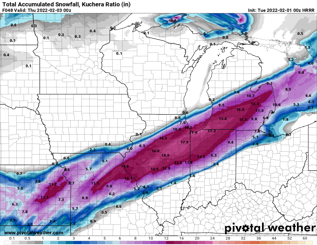
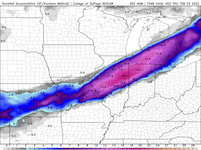
15z RAP still rapping (best model) 12z RGEM holds serve
-
HRRR comes south
-
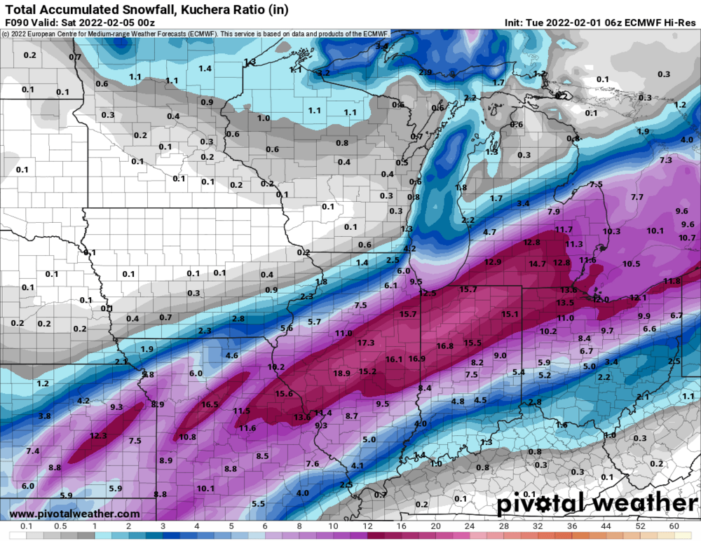
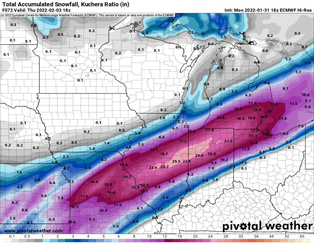
6z Euro
-
GEM Alek low balling again
-
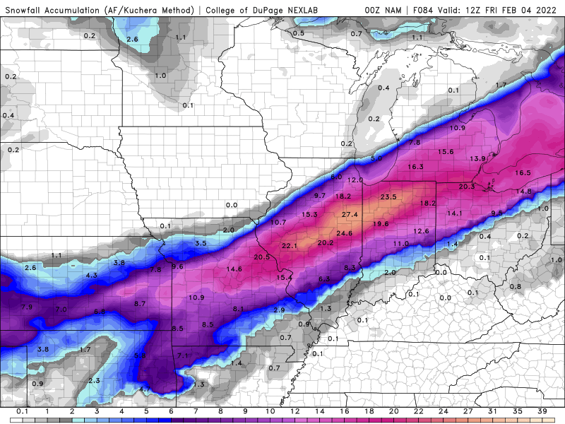
come on we have the RGEM,RAP, HRRR, NAM and GEM on our side!!!!!
-
yep a different orientation!!
-
3z RAP will be north of 21z
-
Need confirmation from the RAP
-
no way
-
whoa. ALEK right on the screws!!!
-
Following RAP and HRRR
-
Without a doubt the RAP and HRRR are on to something
-
Enjoy
-
huge improvement (best model)
-
yep but lake effect saves the day for Lake and Northern Cook and we know how that works. Has the 18z RGEM ever verified?
-
best model
-
the way this is going the wednesday forecast for Chicago will Partly sunny, with a high near 30. What time does the 18z ICON come out?
-
you should
-
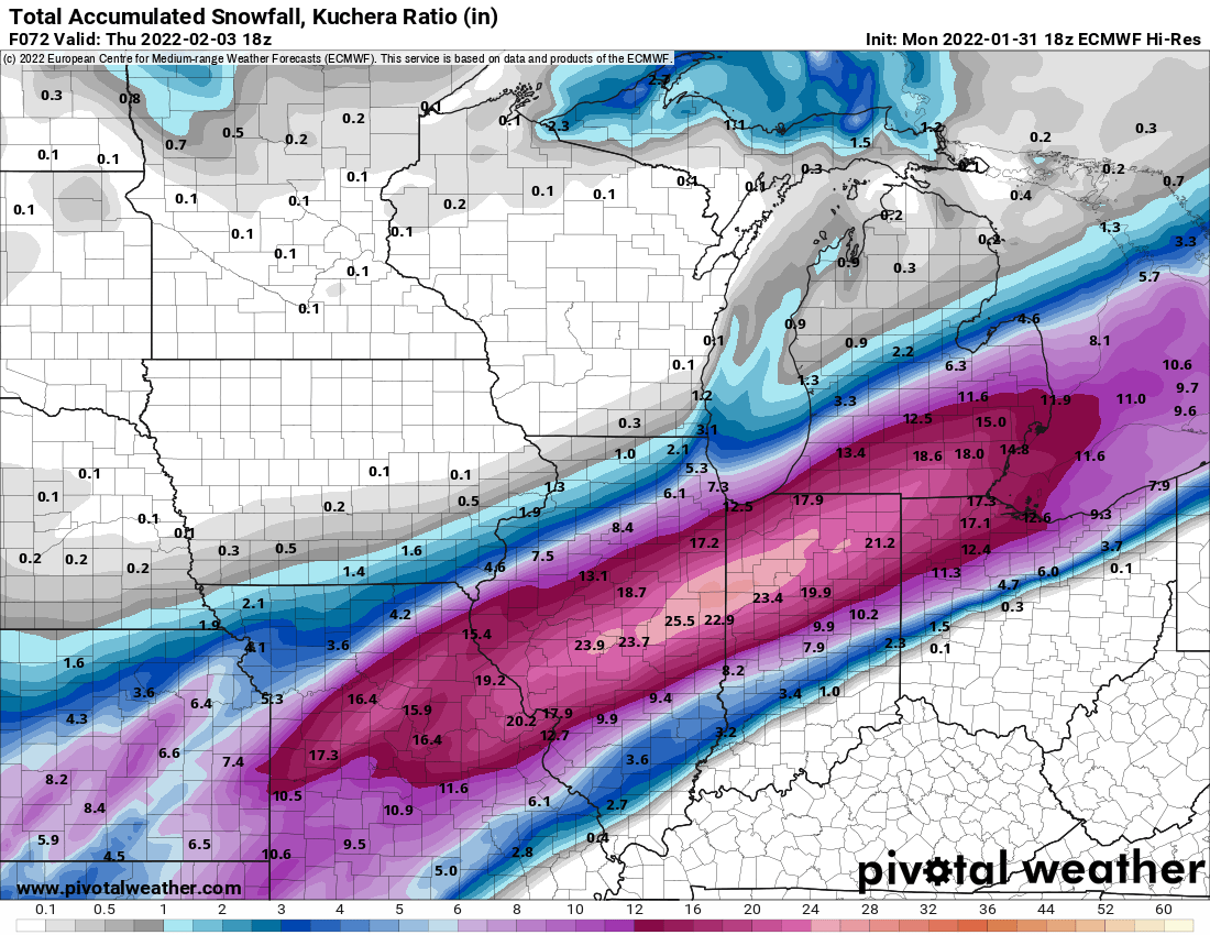
right about now Chicago storm will say 18z NAM has bumped south
-
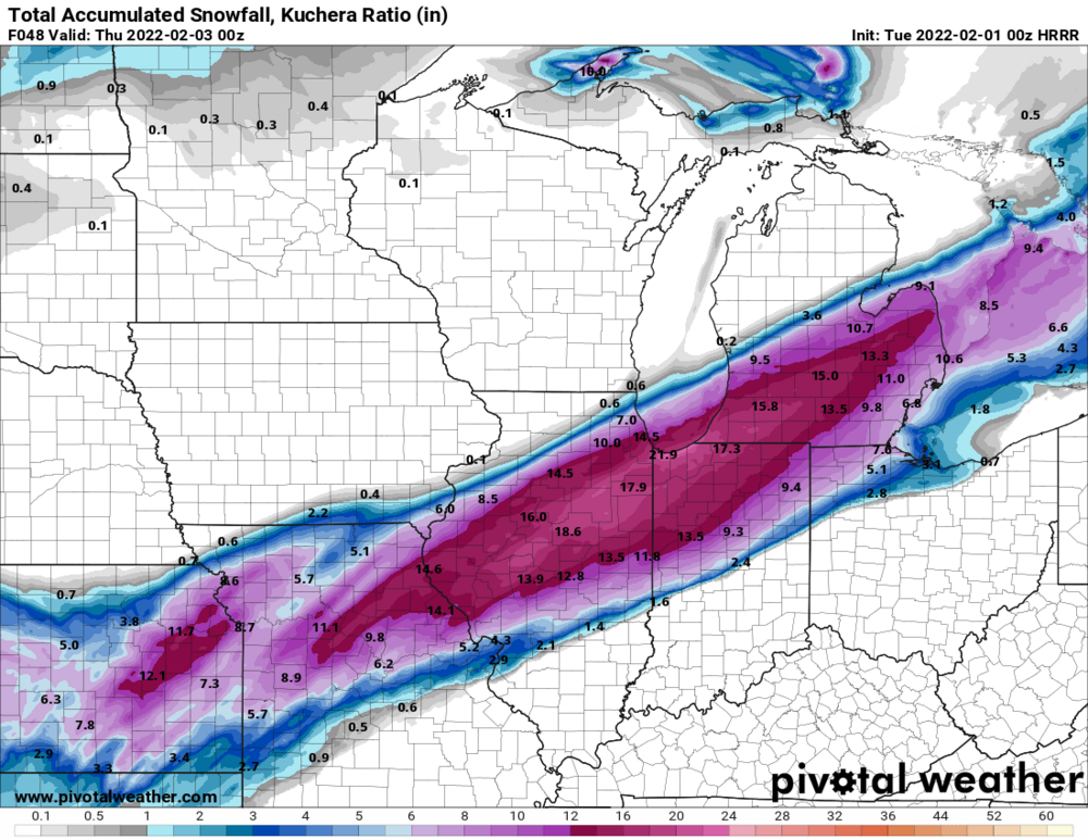
can you post a map if you have it
-
I know that there are many players on the board but this close to the storm why are the models struggling so much. I fully expect the southern placement of snow to remain south.
-
Is RC more optimistic then Joe?
-
Grasping for any model that works for N IL even checked ICON which was way south so it was an easy toss!!!
-
Euro has been pretty steady over last few runs
-
and of course 12z RGEM comes north