Ricky
Here`s a breakdown of 3 general clusters of outcomes, in which the
12z global operational models fit decently into:
1) Weaker and farther north Hudson Bay PV will allow for slightly
more pronounced eastern height rises, which enables strong
moisture surge Tuesday evening and night to reach farther north
into the CWA for potentially significant snow accums into Wed eve.
The short-wave out over the eastern Pacific is slower to eject
and positively tilted and subsequent stronger synoptic system
later Wednesday night into Thursday takes off too far south and
east for meaningful additional snow (aside from any lake effect
chances).
Similar 12z model run: ECMWF
2) Weaker and farther north Hudson Bay PV, more pronounced
downstream ridging allows for moderate to heavy overrunning snow.
THEN southwest short-wave takes on neutral to negative tilt and
ejects out to favorably develop a stronger system with ~1005 mb
surface low tracking near or north of Ohio River. This progression
would bring another round of moderate to heavy snow along with
even stronger winds into or through Thursday, aided by impressive
right entrance region jet dynamics. In most amplified ensemble
members, could even be some wintry mix p-type issues in parts of
the area.
Similar 12z model run: GFS
3) Stronger and farther south Hudson Bay PV lobe results in
confluence and slightly suppressed positive height anomalies, and
the strong/drying influence of incoming Arctic high to have more
influence. Result would be banded overrunning precip having a very
sharp northern cut off and focus the heaviest precip and snow axis
into our southern CWA and points south and east (or even south of
CWA altogether in most northern stream dominant ensemble members).
Similar 12z model run: Canadian.
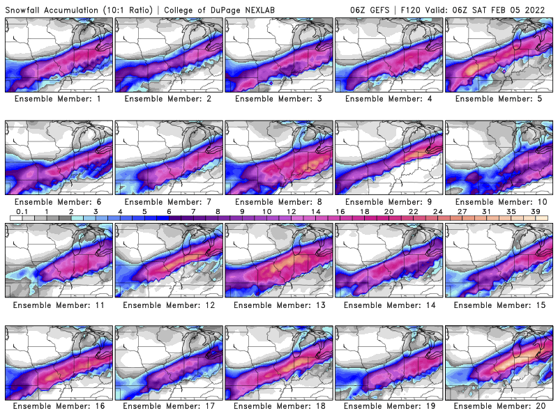
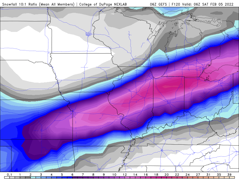
Suffice to say that all three of these outcomes remain plausible
and represented by the distribution of ensemble members of the
three parent models. Overall, there is *currently* a slight lean
in the ensemble means toward roughly outcome 1, favoring our
southeast half or third, occurring amidst brisk northerly winds.
For this reason, the most recent WPC Day 5 accumulating snow/sleet
outlook appears reasonable with southeast half having higher
(50-70% probabilities) vs. northwest (30-50% probabilities). Since
the three approximate clusters described above remain plausible
outcomes, we continue to urge caution with any individual model
run snowfall outputs being shared. Stay tuned for updates as the
potential event draws closer when we can be more confident on some
of these still uncertain details.