ILSNOW
-
Posts
1,644 -
Joined
-
Last visited
Content Type
Profiles
Blogs
Forums
American Weather
Media Demo
Store
Gallery
Everything posted by ILSNOW
-
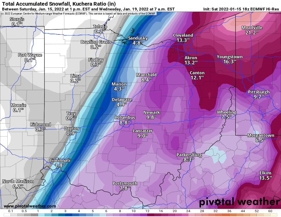
part of Ricky writeup A look at the 12z GEFS and ECMWF (EPS) ensemble mean and members certainly stands out for increasing confidence in a significant winter event for part of if not much of the CWA despite the rather extended lead time. 4-day (10:1) snowfall means up in 5-9" range, along with 30-40% probabilities of 6"+ totals and 60-90% probabilities of 3"+ totals highlights the high % of members with significant snow swaths. Can`t rule out the outlier members with everything shunted a bit south, though with that said, felt comfortable even slightly adjusting PoPs upward a bit from NBM initialization due to likely to categorical probabilities of measurable precip. Regarding the wintry mix threat, should a more amplified wave shunt elevated baroclinic zone back north a bit (such as on 12z operational GFS and several ensemble members), this would increase risk of a zone of freezing rain and sleet given northerly cold air drain. Added in slight chance wintry mix mention for areas south of US-24 Wednesday through Wednesday evening. Timing wise, looking at a late Tuesday night/Wednesday morning start, though there`s certainly wiggle room on this element 5 days out. Accumulating snow could potentially continue into or through Thursday per some of the slower solutions, ending as a window of favorable lake effect parameters Thursday night into Friday. If we do add to the already extensive snow pack, both Thursday night and Friday night could be exceptionally cold as the high pressure transits our area. Castro
-
Winter 2021-22 Short/Medium Range Discussion
ILSNOW replied to Chicago Storm's topic in Lakes/Ohio Valley
HRRR has been moving steadily west and now north hammering northern cook -
No kidding !!! GFS Porn!!!!
-
LOL at BOSTON
-
Winter 2021-22 Short/Medium Range Discussion
ILSNOW replied to Chicago Storm's topic in Lakes/Ohio Valley
Enjoy your trip to Boston!!! -
12Z Euro in multiply pieces
-
Winter 2021-22 Short/Medium Range Discussion
ILSNOW replied to Chicago Storm's topic in Lakes/Ohio Valley
can throw in some ice today GFS 198 hrs chance of verification .001 -
And another noreaster. When or will get ours?
-
Euro likes ALEK
-
Winter 2021-22 Short/Medium Range Discussion
ILSNOW replied to Chicago Storm's topic in Lakes/Ohio Valley
ALEK Storm 22 -
nice to see snowfall during the day its become a rare occurrence around here
-
15z RAP is bullish on wave #3 as is GFS
-
18z HRRR wave #1
-
haha 12z GFS for both events
-
via 12z NAM clipper #2 best snows southwest of Chicago clipper #3 almost all snow north into Wisconsin The snow shield remains in place
-
Winter 2021-22 Short/Medium Range Discussion
ILSNOW replied to Chicago Storm's topic in Lakes/Ohio Valley
book it!!! -
Winter 2021-22 Short/Medium Range Discussion
ILSNOW replied to Chicago Storm's topic in Lakes/Ohio Valley
prolly drier weaker, drive straight south and then become a noreaster -
Winter 2021-22 Short/Medium Range Discussion
ILSNOW replied to Chicago Storm's topic in Lakes/Ohio Valley
No way!!! You give it a shot -
Winter 2021-22 Short/Medium Range Discussion
ILSNOW replied to Chicago Storm's topic in Lakes/Ohio Valley
next hope via 12z Euro -
-
18z Euro

-
Back to?? December and January have sucked. U take out the New Year’s Day event we have 2 months of nothing, while our neighbors in Missouri, Kentucky, Georgia and Virginia will have almost 10-20 inches more then N IL.
-
Nothing to see here almost 2 feet for VA and nor’easter and almost a 1/2 inch here
-
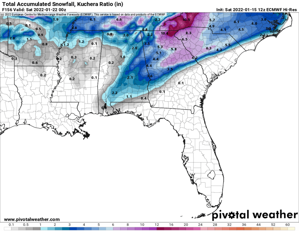
More southeast snow before any snow in northern IL via 12z Euro
-
Final here was 0.0