Jump to content

CAPE

Members
  • Posts

    30,947
  • Joined

  • Last visited

Everything posted by CAPE
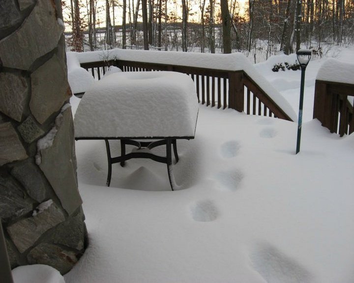
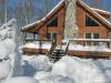
  1. I might lower my bar to an inch. I can totally see my yard being a bit too far SE for the good WAA stuff, and then get fringed by the coastal. I am sure lower DE will get in on some 1-2" per hr bands though.
  2. 1-2 has been my bar. Was nice to see a couple GFS runs with 6-8 in my yard, and the crappy CMC still looks good but it will correct late as always. This is just a tough pattern for a coastal to get going and gain enough latitude in time to get most of us into the CCB. Still could happen, but looking less likely.
  3. I am not much on using ensembles at this range but a quick glance at the 12z GEFS precip/snow mean is what you would expect. Supports the op.
  4. Yeah its pretty common and super contagious. I had it last year when I got back from chasing the coastal blizzard. That was awful. This time it may have been some other virus but had the same behavior. Difference is I don't seem to have the lingering run-down feeling I had last time. Odd to get similar bugs in consecutive years though. Haven't had an illness that made me puke in well over 10 years, and now back to back in Jan, lol. And of course you get it coming out of both ends which is always fun.
  5. Like I mentioned in the main thread, I am not paying much attention to anything other than the op runs of the GFS and Euro at this juncture. It would be nice if the lead WAA induced snow area remains intact enough to give much of the region an inch or 2. Not so sure on that though. Really need that coastal to get going and get into the CCB precip on the west side. That's where the potential is for significant snow for most of us. Tricky though with the suppressive mechanisms up north and the progressive nature of the pattern.
  6. Thats a perfect match of the winter to this point for my yard lol. Not sure I would have even looked at the NAM on my own at this range. At this point I am pretty laser focused on the EURO and GFS op runs.
  7. Just experienced 12 hours of the crud (Norovirus probably). Bad part was fast and furious but only lasted 6 hours. Surprised how decent I feel now. Off work, so I guess I will recuperate and model watch all day.
  8. The 0z run gets some good CCB action going with the coastal esp for eastern areas.
  9. Thats what I saw, and Ji too I think. That lobe was behind the southern wave on previous runs, and now it comes down right on top. The hammer.
  10. Climo says it will lol. Your area is going to come out on top of slower lower in the snow dept most winters.
  11. He is in S DE right? That area sure has been on a bit of a hot streak the past couple winters.
  12. I would be more than happy with a straight up and simple 2-4" WAA event with no temp or p-type issues, but the idea of getting in on some CCB action with a (somewhat late) developing coastal is also intriguing. If it happens it probably would be most impactful for places like SBY up to ACY given the progressive flow.
  13. Quite a few members that stripe the MA coastal areas and even up through the immediate coast of NE. I don't think a low can actually run up the coast in the classic sense in this set up, but could enhance snowfall esp for E VA, DE/NJ and maybe LI as it heads ENE. There was a lot of upper level energy left behind on the 12z op run but didn't really do much at the surface, and other models have also hinted at sort of a 2 'phase' storm. Such a long duration continuous light snow event as is being advertised seems kinda unusual, so maybe there is something to the idea of a 1-2 type deal.
  14. I have a a hunch they wont jackpot this one. Call it short term atmospheric memory loss.
  15. I am ready for Richmond to return to "snow anus" status.
  16. Not necessarily related, but did you see Cranky's new discussion on Twitter? Its quite good.
  17. HM just got a "how much for Philly" reply on his latest twitter post, lol.
  18. It certainly bears some resemblance. The NS energy and associated confluence has always been a player for this event. One other feature that has been shifting over the last few runs of the GFS is the western ridge position/amplification. Less amplitude esp on the 6z run and the southern wave doesn't get as much dig in the lower MS Valley.
  19. Mount Holly's thoughts this morning on the storm potential. Seems about right given the set-up and current model trends. Saturday night into Sunday, aformentioned low looks to move northeast passing off the coast south of the forecast area. Forecast models have started to come in to better agreement but since this is still several days away confidence regarding this system is still only in the low to moderate range. Latest indications are that southern stream shortwave will tend to fracture apart as it gets pulled into confluent upper level flow over the northeast. The result would be a somewhat weaker low passing farther south than what the GFS and GEM were showing 24 hours ago. There will also be a surface high over Ontario/Quebec feeding cold, dry air into the system and this could also result in a sharp northern cut off in precip. The upshot is that there is still a potential for some accumulating snow to occur with the highest chances for precip being areas near and especially south of the I-95 corridor.
  20. There seems to be a general trend across guidance to a weaker, more diffuse system as it heads east. and this is likely (mostly) due to the confluence up north. It looks like the models are beginning to come to a general consensus though on a light or low end moderate event, something like 2-4", possibly some places seeing 5-6. I am good with that. Lets just hope the wave doesn't end up completely squashed/crushed south as it moves east in future runs. (I will toss the 6z GFS for now lol).
×
×
  • Create New...